Andrew Humphrey, CBM (@andrewhumphrey) 's Twitter Profile
Andrew Humphrey, CBM

@andrewhumphrey

Husband 😊 Father 😊 Chief Meteorologist ☀️ First and only TV broadcast meteorologist on Earth with a degree in meteorology from @MIT.

ID: 11254702

linkhttp://www.andrewhumphrey.com calendar_today17-12-2007 17:20:07

104,104K Tweet

9,9K Followers

10,10K Following

NASA (@nasa) 's Twitter Profile Photo

#Ax4, Axiom Space's next mission to the International Space Station, will send mission commander Peggy Whitson and astronauts from India, Poland, and Hungary to low Earth orbit for two weeks of science and outreach. Watch the launch live here with us on X. go.nasa.gov/4jCbbL9

#Ax4, <a href="/Axiom_Space/">Axiom Space</a>'s next mission to the <a href="/Space_Station/">International Space Station</a>, will send mission commander Peggy Whitson and astronauts from India, Poland, and Hungary to low Earth orbit for two weeks of science and outreach. Watch the launch live here with us on X. go.nasa.gov/4jCbbL9
NWS St. Louis (@nwsstlouis) 's Twitter Profile Photo

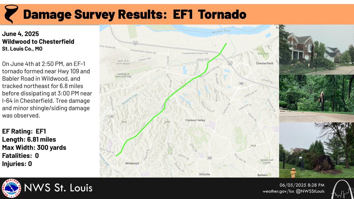
Damage survey crews confirmed that an EF-1 tornado moved from Wildwood to Chesterfield, MO between 2:50 and 3:00 PM yesterday, June 4th. Most of the damage was to trees, but some minor shingle and siding damage was also observed. #MOwx #STLwx

Damage survey crews confirmed that an EF-1 tornado moved from Wildwood to Chesterfield, MO between 2:50 and 3:00 PM yesterday, June 4th. Most of the damage was to trees, but some minor shingle and siding damage was also observed. #MOwx #STLwx
National Weather Service (@nws) 's Twitter Profile Photo

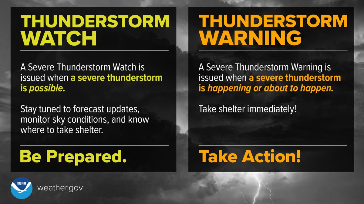
Another active severe weather day is expected today from New Mexico, east to Kentucky, so it's important to know the difference between a thunderstorm watch and warning. A Severe Thunderstorm WATCH means Be Prepared. A Severe Thunderstorm WARNING means Take Action!

Another active severe weather day is expected today from New Mexico, east to Kentucky, so it's important to know the difference between a thunderstorm watch and warning.
A Severe Thunderstorm WATCH means Be Prepared.
A Severe Thunderstorm WARNING means Take Action!
NASA Marshall (@nasa_marshall) 's Twitter Profile Photo

After completing testing at #NASAMarshall, NASA’s IMAP (Interstellar Mapping and Acceleration Probe) spacecraft recently arrived at the Astrotech Space Operations Facility near NASA's Kennedy Space Center where technicians are preparing it for launch! 🚀 READ MORE >> go.nasa.gov/3Zk2ldN
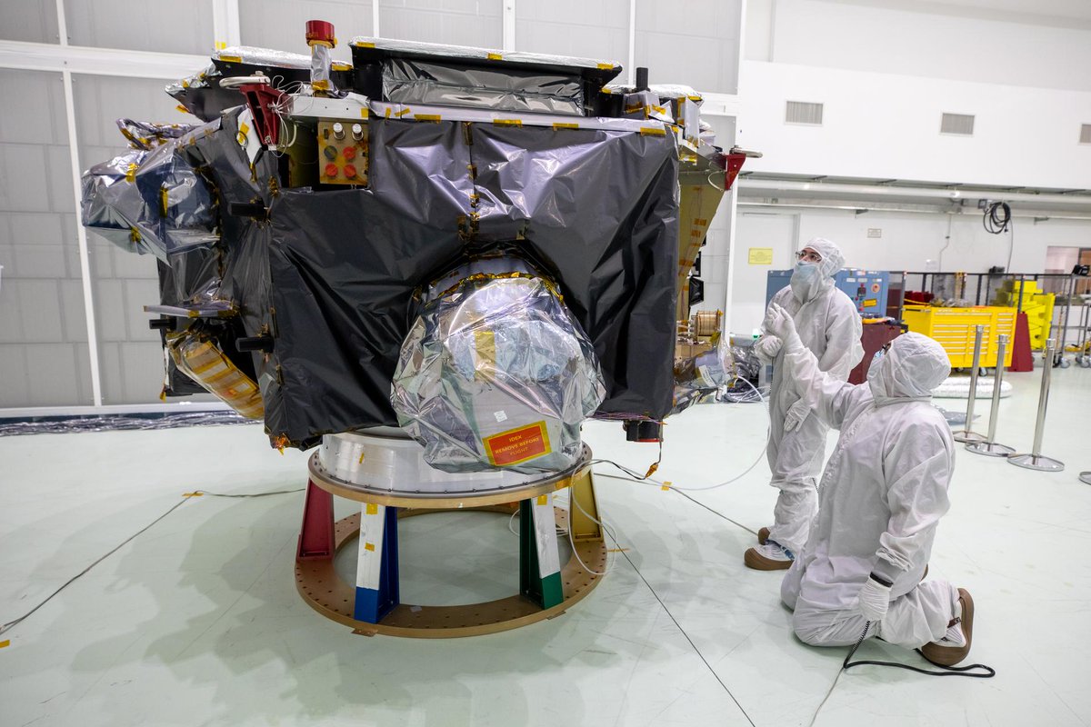
After completing testing at #NASAMarshall, NASA’s IMAP (Interstellar Mapping and Acceleration Probe) spacecraft recently arrived at the Astrotech Space Operations Facility near <a href="/NASAKennedy/">NASA's Kennedy Space Center</a> where technicians are preparing it for launch! 🚀 

READ MORE &gt;&gt; go.nasa.gov/3Zk2ldN
NWS Storm Prediction Center (@nwsspc) 's Twitter Profile Photo

A severe weather outbreak is possible across parts of the Southern Plains today. Destructive winds of 80 to 100 mph and giant hail up to 5 inches in diameter is possible Sunday afternoon/evening.

A severe weather outbreak is possible across parts of the Southern Plains today.  Destructive winds of 80 to 100 mph and giant hail up to 5 inches in diameter is possible Sunday afternoon/evening.
NWS Memphis (@nwsmemphis) 's Twitter Profile Photo

Severe thunderstorms may return again late tonight into Monday. Damaging winds and large hail are the main threats. #tnwx #arwx #mowx #mswx #midsouthwx

Severe thunderstorms may return again late tonight into Monday. Damaging winds and large hail are the main threats. #tnwx #arwx #mowx #mswx #midsouthwx
NWS Storm Prediction Center (@nwsspc) 's Twitter Profile Photo

7:09am CDT #SPC Day1 Outlook Moderate Risk: this afternoon and evening from the eastern Texas Panhandle into southern Oklahoma and northwest/north-central Texas spc.noaa.gov/products/outlo…

7:09am CDT #SPC Day1 Outlook Moderate Risk: this afternoon and evening from the eastern Texas Panhandle into southern Oklahoma and northwest/north-central Texas spc.noaa.gov/products/outlo…
NWS Memphis (@nwsmemphis) 's Twitter Profile Photo

📢 Did you receive damage from yesterday's storms? Be sure to let us know! Photos are great with an approximate location and time that the damage occurred (since we had two rounds yesterday) We appreciate your help!

📢 Did you receive damage from yesterday's storms? Be sure to let us know! Photos are great with an approximate location and time that the damage occurred (since we had two rounds yesterday)

We appreciate your help!
Weather Monitor (@weathermonitors) 's Twitter Profile Photo

A strong M6.5 earthquake struck Paratebueno, Cundinamarca, Colombia at 8:08 a.m. (shallow depth). 📍 Damage reported to homes and along the Villavicencio–Yopal highway. ⏱️ A M4.5 aftershock followed at 8:37 a.m.

Volcaholic 🌋 (@volcaholic1) 's Twitter Profile Photo

Due to today’s magnitude 6.3 earthquake in Colombia, damage has been reported to the road network between Villavicencio and Yopal. Authorities are warning of possible subsidence and cracks that could disrupt traffic.

NOAA (@noaa) 's Twitter Profile Photo

Just in: U.S. just saw it's 2nd-warmest #spring on record. Find summary and stats + map images from our report at: ncei.noaa.gov/news/national-… NOAA NCEI

Just in: U.S. just saw it's 2nd-warmest #spring on record.

Find summary and stats + map images from our report at:
ncei.noaa.gov/news/national-…

<a href="/NOAANCEI/">NOAA NCEI</a>
NOAA National Severe Storms Laboratory (@noaanssl) 's Twitter Profile Photo

A new tool is helping us better understand how hail forms and falls 🧊☁️ — aiming for improved forecasts to protect people, homes, and property 🏠⚠️ 🎥 Full video: youtube.com/watch?v=kFOhAT… PS:👀 with an assist from 🥎Oklahoma Softball + ⚾Oklahoma Baseball! NOAA NOAA Research

Dr. Gene Rench (@majorflood42) 's Twitter Profile Photo

Rain upstream of Memphis plus recent precipitation imply there is going to be a crest above 19' next Monday. Easing down to maybe 7' follows before mid-June.Take courage and share the Gospel of Jesus Christ. Utmost importance to God✝️🛐😇 #midsouthwx #tnwx #arwx #mswx #mowx

Rain upstream of Memphis plus recent precipitation imply there is going to be a crest above 19' next Monday. Easing down to maybe 7' follows before mid-June.Take courage and share the Gospel of Jesus Christ. Utmost importance to God✝️🛐😇 #midsouthwx #tnwx #arwx #mswx #mowx
NOAA Satellites (@noaasatellites) 's Twitter Profile Photo

It's been a stormy week! 🌩️ This extended satellite imagery loop via NOAA's #GOESEast 🛰️ shows the outbreak of severe thunderstorms that raced across the southern Plains Sunday afternoon through early Monday. The storms brought damaging winds, large #hail, and several reports of