Andrew Renninger
@andrewrenninger
social + spatial science | PhD @CASAUCL | analyst and researcher @Penn
ID: 301593228
19-05-2011 18:40:44
169 Tweet
228 Followers
258 Following

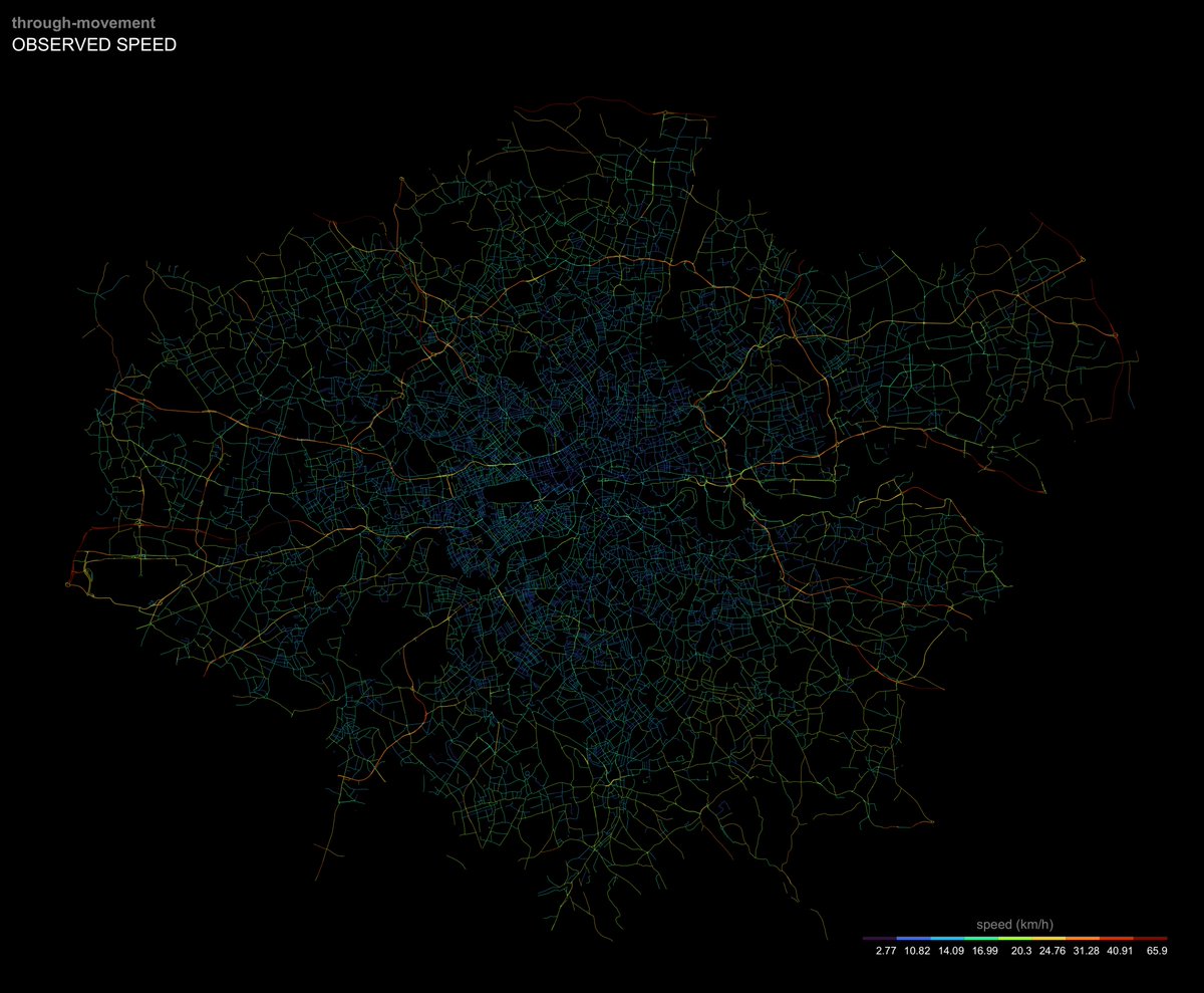
#30DayMapChallenge 19 | Urban Travel speeds in Greater London (movement data from Uber Open Source, with some #rstats and #rspatial to clean it up)

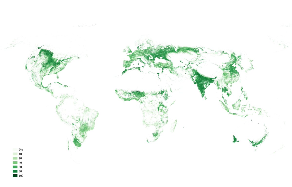
#30DayMapChallenge 20 | Rural Croplands across the globe, measured by intensity within square kilometer grid cells—37% of total land (made in #QGIS with data from IIASA Geo-Wiki's application geo-wiki.org)

Stumbled into #30DayMapChallenge 25 | Climate during some other work Mean daytime temperature for the United States—and visible BosWash urban heat island (with #EarthEngine and some help from this Justin Braaten tutorial developers.google.com/earth-engine/t…)


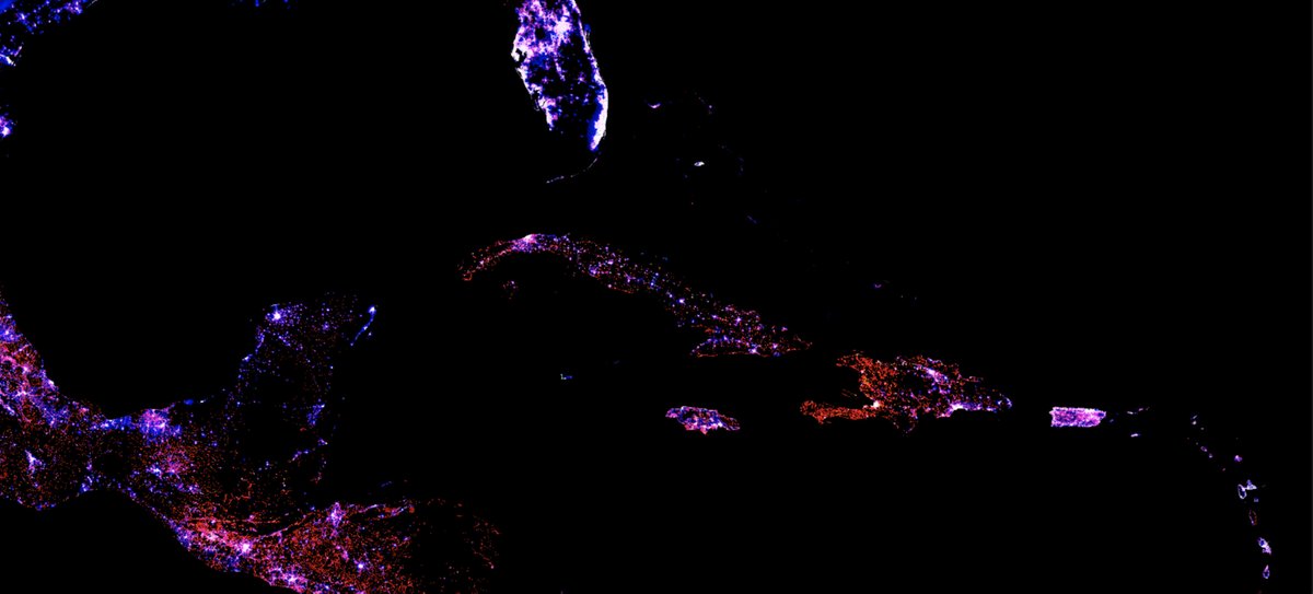
A while ago, I saw a tweet from Francisco Rowe ✌️ (since lost) on lights, population and buildings to capture development. Whatever happened to the project? Had time to replicate (I think) with an interactive #EarthEngine (#GEE) map—and it is fascinating. (See asrenninger.users.earthengine.app/view/dimension…)

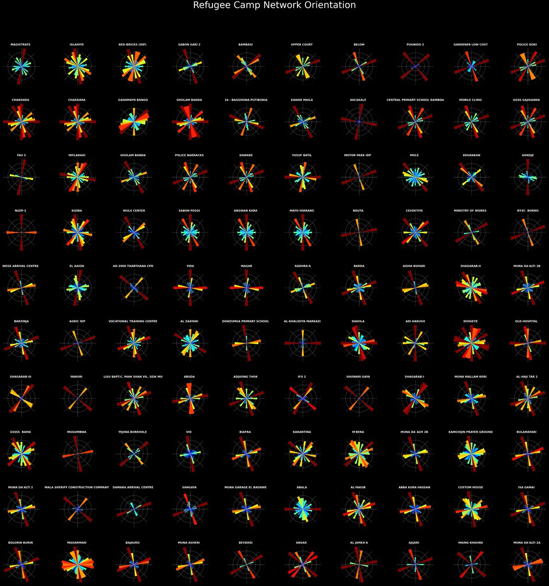
Hat off to Geoff Boeing for letting anyone reproduce his work—quite easily—with OSMnx; on a whim, looked at the entropy of each road network of all refugee camps on OpenStreetMap. Inspired by Richard Davies on Zaatari and Azraq in Extreme Economies (see geoffboeing.com/2016/11/osmnx-…)


Saturday morning project: Lloyd's algorithm assisted by #rstats and #rspatial. Thanks for the introduction Matt Dzugan; not quite getting to perfect regularity but working with a larger area. #generative

Absolutely loving the osmextract #rstats package; #rspatial keeps getting better. Great work from Robin Lovelace @[email protected] and Andrea Gilardi. For the uninitiated though (me an hour ago), hstore_get_value is the key to any good where clause—maybe include in the vignette?


Philadelphia buses during the morning commute (or what is left of it); accessibility made easy by the gtfs2gps package in #rstats thanks to Rafael H. M. Pereira 🚡 Urban Demographics and Instituto de Pesquisa Econômica Aplicada. The #rspatial ecosystem has a package for everything.

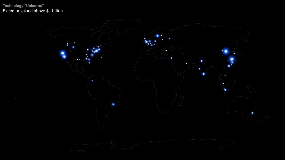
The geography of startups. With limited data, this firefly technique from Dr. Dominic Royé adds an interesting effect (dominicroye.github.io/en/2021/firefl…) Data scraped from wikipedia in #rstats #rspatial


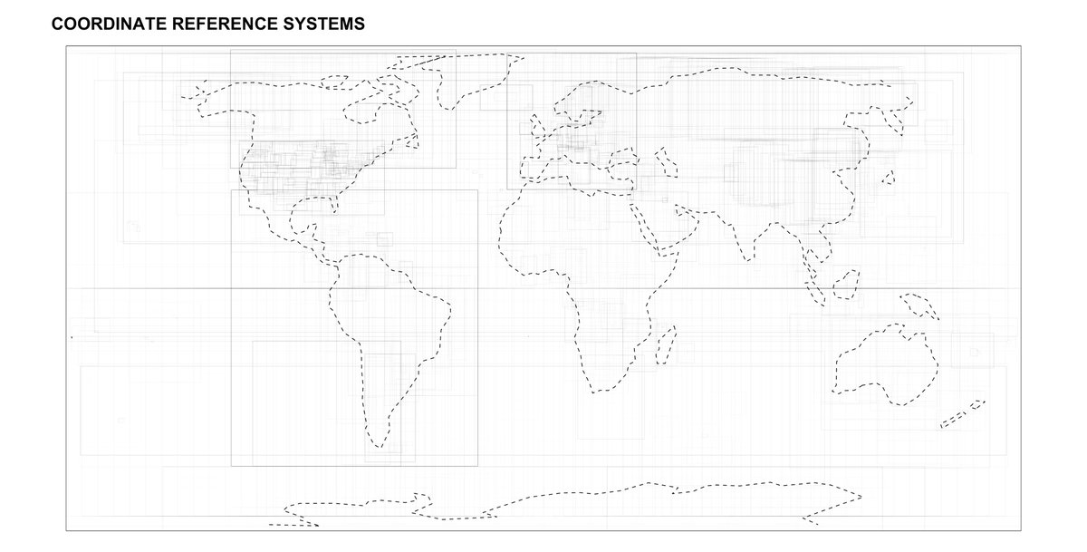
#30DayMapChallenge | Polygons All of the coordinate reference systems in Kyle Walker's excellent crssuggest #rstats package (projected in World Robinson, of course). #rspatial

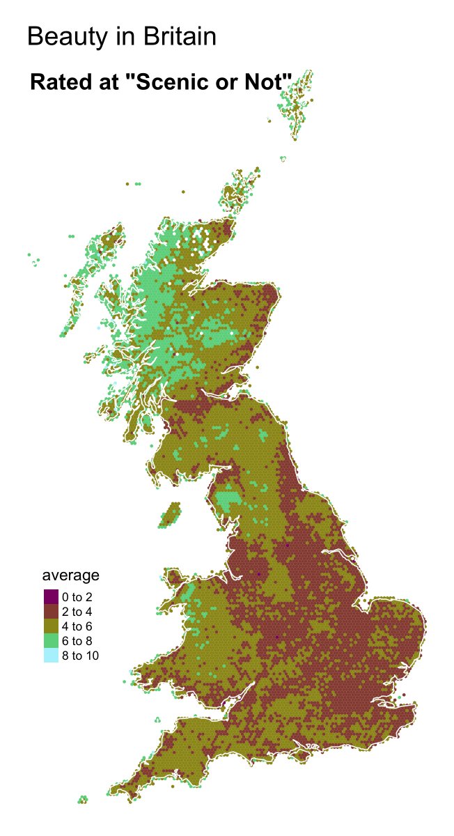
#30DayMapChallenge | Hexagons The most scenic areas in Britain according to Scenic or Not (scenicornot.datasciencelab.co.uk) and Data Science Lab. Easily done in #rstats and #rspatial with this code (github.com/asrenninger/ti…)

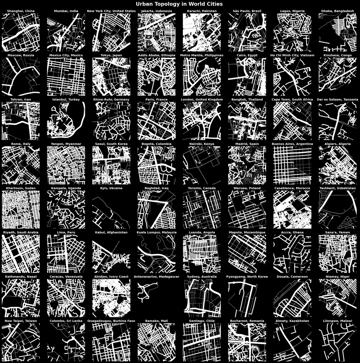
#30DayMapChallenge | OSM The downtown (according to Latitude Longitude) of the largest city in the largest countries, made with OSMnx and #Python.
