Aspia Space (@aspiaspace) 's Twitter Profile
Aspia Space

@aspiaspace

See More. Know More. Be Smarter.
aspiaspace.com

ID: 1372086127633559554

calendar_today17-03-2021 07:23:29

30 Tweet

112 Followers

19 Following

Center for Data Innovation (@datainnovation) 's Twitter Profile Photo

Using two types of satellites, Aspia Space uses AI to help farmers understand what their fields look like on cloudy days. The algorithm produces synthetic images of fields in all weather to assist with crop management. bbc.com/news/science-e…

Aspia Space (@aspiaspace) 's Twitter Profile Photo

Traffic queued on the M20 in Kent can be seen by Copernicus EU #Sentinel1 imagery. These views compare a snapshot from February and April, with the boosted backscatter along the motorway due to an increased volume of traffic. @BBCAmos #EarthObservation

Traffic queued on the M20 in Kent can be seen by <a href="/CopernicusEU/">Copernicus EU</a> #Sentinel1 imagery. These views compare a snapshot from February and April, with the boosted backscatter along the motorway due to an increased volume of traffic. @BBCAmos #EarthObservation
Aspia Space (@aspiaspace) 's Twitter Profile Photo

We are delighted to announce that Aspia Space has joined #NVIDIAInception, helping us scale up our ClearSky cloud-free satellite imaging service and develop more innovative downstream products at the interface of #AI and #EarthObservation. ow.ly/GV0g50JKjrn

We are delighted to announce that Aspia Space has joined #NVIDIAInception, helping us scale up our ClearSky cloud-free satellite imaging service and develop more innovative downstream products at the interface of #AI and #EarthObservation. 

ow.ly/GV0g50JKjrn
Aspia Space (@aspiaspace) 's Twitter Profile Photo

We are applying our ClearSky solution around the globe, processing trillions of pixels using NVIDIA GPUs. Here is a view of Iowa from earlier this month, based on ESA Earth Observation Sentinel data: (left) Sentinel-2, (right) ClearSky. #NVIDIAInception #PoweredByDL #EarthObservation #AI
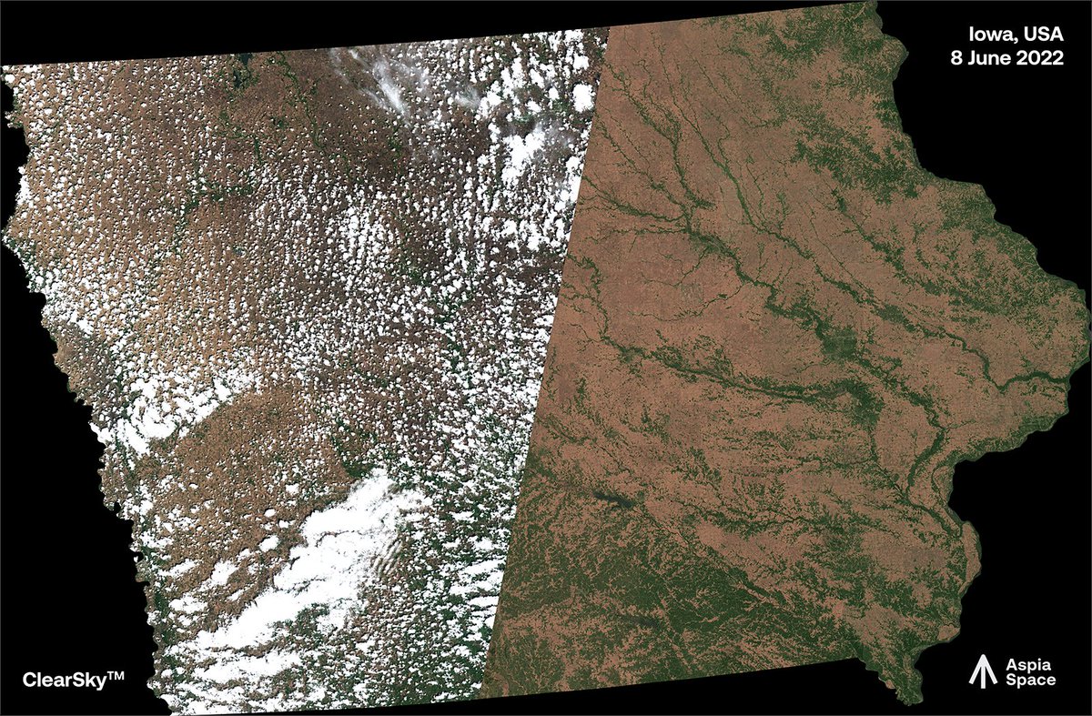
We are applying our ClearSky solution around the globe, processing trillions of pixels using <a href="/nvidia/">NVIDIA</a> GPUs. Here is a view of Iowa from earlier this month, based on <a href="/ESA_EO/">ESA Earth Observation</a> Sentinel data: (left) Sentinel-2, (right) ClearSky. #NVIDIAInception #PoweredByDL #EarthObservation #AI
Aspia Space (@aspiaspace) 's Twitter Profile Photo

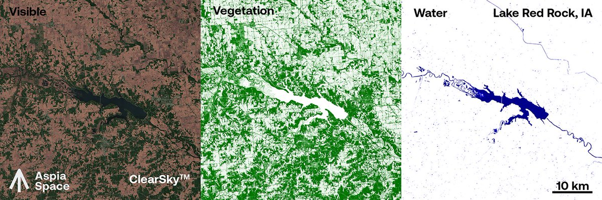
ClearSky predicts full spectrum (~400-2300nm) imagery. This allows us to generate products such as the Normalised Difference Vegetation or Water Index. In fact, you can analyse ClearSky imagery in exactly the same manner as 'direct' imagery. #NVIDIAInception #EarthObservation #AI

ClearSky predicts full spectrum (~400-2300nm) imagery. This allows us to generate products such as the Normalised Difference Vegetation or Water Index. In fact, you can analyse ClearSky imagery in exactly the same manner as 'direct' imagery. #NVIDIAInception #EarthObservation #AI
Aspia Space (@aspiaspace) 's Twitter Profile Photo

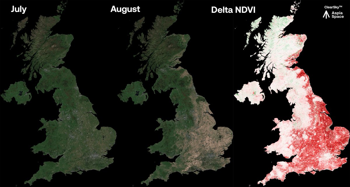
How can #AI help us monitor the impact of the UK #drought? Our ClearSky algorithm allows us to produce regular cloud-free hyperspectral #EO imagery. We can quantify and visualise the #heatwave's impact by mapping the change in the vegetation index, as shown here. @BBCAmos

How can #AI help us monitor the impact of the UK #drought? 

Our ClearSky algorithm allows us to produce regular cloud-free hyperspectral #EO imagery.
 
We can quantify and visualise the #heatwave's impact by mapping the change in the vegetation index, as shown here.

@BBCAmos
Jim Geach (@jgeach) 's Twitter Profile Photo

One of the motivations for Aspia Space's ClearSky technology that predicts visible satellite imagery in the presence of cloud, using Synthetic Aperture Radar!
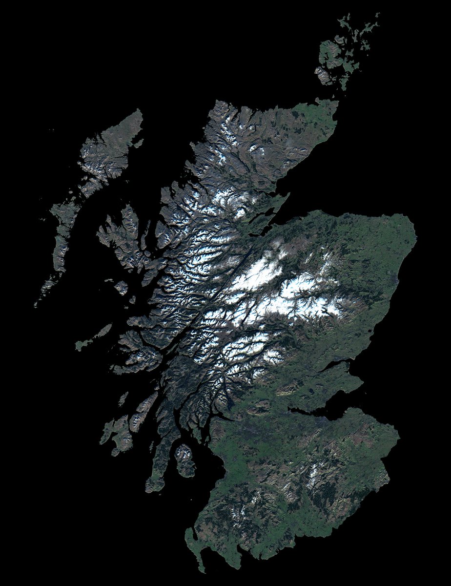
One of the motivations for <a href="/AspiaSpace/">Aspia Space</a>'s ClearSky technology that predicts visible satellite imagery in the presence of cloud, using Synthetic Aperture Radar!
Aspia Space (@aspiaspace) 's Twitter Profile Photo

Cloud-free Earth observation imaging can provide the next breakthrough in risk management. insurtechdigital.com/articles/earth… #space #agriculture #insurance #agritech

Aspia Space (@aspiaspace) 's Twitter Profile Photo

Introducing EarthPT: it’s like a #LLM, but for #EarthObservation data. We call it a Large Observation Model. linkedin.com/posts/aspia-sp…

Mike Smith (@smith42mike) 's Twitter Profile Photo

Congrats on the amazing work - FOSS foundation models FTW! I do have to point out that us at Aspia Space beat you to the punch with EarthPT 😉. EarthPT was the first and is currently the largest open source time series foundation model. Code + paper: github.com/aspiaspace/ear…