Briana Chronister, PhD, MS (@brichronister) 's Twitter Profile
Briana Chronister, PhD, MS

@brichronister

Environmental Epidemiology | @SDSU/@UCSanDiego PhD in Public Health | @NotreDame Double Domer🍀| T32 TADA-BSSR Alum

ID: 899988100096589824

linkhttps://linktr.ee/briana_chronister calendar_today22-08-2017 13:34:18

380 Tweet

146 Followers

441 Following

Briana Chronister, PhD, MS (@brichronister) 's Twitter Profile Photo

I feel like data cleaning and management is expected of everyone, but its not really taught in class. Looking forward to reviewing these materials!

NIEHS (@nih_niehs) 's Twitter Profile Photo

🤔 Considering the NIH EJ Scholars program? Check out the interest statements of Institutes, Centers, and Offices (ICOs) looking to host a scholar. These write-ups will give you an idea of what the ICOs are looking for. nih.gov/sites/default/…

🤔 Considering the NIH EJ Scholars program?

Check out the interest statements of Institutes, Centers, and Offices (ICOs) looking to host a scholar. These write-ups will give you an idea of what the ICOs are looking for. nih.gov/sites/default/…
Wayne Kepner, PhD, MPH (@wkepner) 's Twitter Profile Photo

Excited to showcase our idea next month! wWe aim to support individuals with SUD by helping them connect w/ others thru timely notifications based on personalized, context-sensitive triggers.Stanford Medicine Innovations for Substance Use Disorders Junghwan Park linkedin.com/posts/i4sud_i4…
Qiusheng Wu (@giswqs) 's Twitter Profile Photo

🚀 An update on the "Introduction to GIS Programming" course I'm teaching this semester! We wrapped up Python basics this week and will dive into #geospatial programming next week. 🎉 All course materials and video recordings are freely available online. Stay tuned for more

🚀 An update on the "Introduction to GIS Programming" course I'm teaching this semester! We wrapped up Python basics this week and will dive into #geospatial programming next week. 🎉

All course materials and video recordings are freely available online. Stay tuned for more
Qiusheng Wu (@giswqs) 's Twitter Profile Photo

🚀 Excited to share a sneak peek of the upcoming SamGeo release! 🌍✨ We can now segment remote sensing imagery using the Segment Anything Model 2 (SAM2). GitHub Pull Request: github.com/opengeos/segme… #geospatial #geoai #opensource

Briana Chronister, PhD, MS (@brichronister) 's Twitter Profile Photo

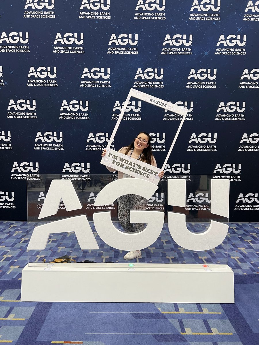
Presentation day at the #AGU24! Come by the biogeosciences section, poster 1369 to hear more about my work titled "Using Manifold Learning and Segment Anything to Identify small- and large-scale agriculture in an equatorial agricultural community."

Alhelí Calderón Villarreal, MD, PhD, MPH (@alhelicalderon) 's Twitter Profile Photo

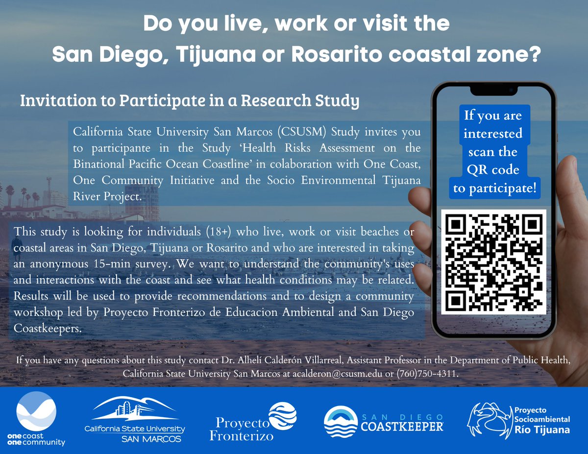
Do you live, work or visit the beaches or coastal area in San Diego, Tijuana or Rosarito? I invite you to participate in a research study to explore health risks associated with proximity and interactions with the Pacific Ocean coastline. It takes 15 min: t.ly/hJeKt

Do you live, work or visit the beaches or coastal area in San Diego, Tijuana or Rosarito? I invite you to participate in a research study to explore health risks associated with proximity and interactions with the Pacific Ocean coastline. It takes 15 min: t.ly/hJeKt
Children's Environmental Health Network (@cehn) 's Twitter Profile Photo

Good news for children's environmental health! The EPA is taking action to limit the use of chlorpyrifos, a pesticide linked to health concerns. Its use will now be restricted to 11 crops, with an overall reduction in application by 70%. l8r.it/8yVH

Briana Chronister, PhD, MS (@brichronister) 's Twitter Profile Photo

Last poster session of the week at AGU (American Geophysical Union)! Come to poster 2663 to hear how we used Spectral Mixture Analysis and UMAP to map agriculture, and then used home proximity measures to agriculture to see if distance was associated with pesticide exposure! #AGU24

Last poster session of the week at <a href="/theAGU/">AGU (American Geophysical Union)</a>! Come to poster 2663 to hear how we used Spectral Mixture  Analysis and UMAP to map agriculture, and then used home proximity measures to agriculture to see if distance was associated with pesticide exposure! #AGU24
Qiusheng Wu (@giswqs) 's Twitter Profile Photo

📢 I'm teaching a Geographic Software Design course this semester at the University of Tennessee! 🎉 All course materials will be freely available online, with new video lectures dropping three times a week. Join us to learn how to create open-source #Python packages for

📢 I'm teaching a Geographic Software Design course this semester at the University of Tennessee! 🎉 All course materials will be freely available online, with new video lectures dropping three times a week.

Join us to learn how to create open-source #Python packages for
Kyle Walker (@kyle_e_walker) 's Twitter Profile Photo

A PSA for US Census geodata users: while the TIGER/Line shapefiles are inaccessible, all Census geographies are still up via the TigerWeb API Endpoints are here: tigerweb.geo.census.gov/tigerwebmain/T… Use @JosiahParry's {arcgislayers} package to pull them into #rstats with minimal fuss

A PSA for US Census geodata users: while the TIGER/Line shapefiles are inaccessible, all Census geographies are still up via the TigerWeb API

Endpoints are here: tigerweb.geo.census.gov/tigerwebmain/T…

Use @JosiahParry's {arcgislayers} package to pull them into #rstats with minimal fuss
Qiusheng Wu (@giswqs) 's Twitter Profile Photo

🎉 The recording of our 90-minute workshop on SAMGeo is now available on YouTube!. A big thank you to Rohini Swaminathan and Maria Brovelli for hosting the session! 🌟 Workshop Title: Remote Sensing Image Segmentation with AI: Hands-On Workshop with the Segment Anything Model

🎉 The recording of our 90-minute workshop on SAMGeo is now available on YouTube!. A big thank you to Rohini Swaminathan and Maria Brovelli for hosting the session!

🌟 Workshop Title: Remote Sensing Image Segmentation with AI: Hands-On Workshop with the Segment Anything Model
Qiusheng Wu (@giswqs) 's Twitter Profile Photo

A free #GeoAI workshop at 9AM ET tomorrow, Feb. 18. Title: Modeling population dynamics with AI: A hands-on workshop with the Population Dynamics Foundation Model Register: aiforgood.itu.int/event/modeling… #geospatial #aiforgood #PDFM

A free #GeoAI workshop at 9AM ET tomorrow, Feb. 18.

Title: Modeling population dynamics with AI: A hands-on workshop with the Population Dynamics Foundation Model

Register: aiforgood.itu.int/event/modeling…

#geospatial #aiforgood #PDFM
Qiusheng Wu (@giswqs) 's Twitter Profile Photo

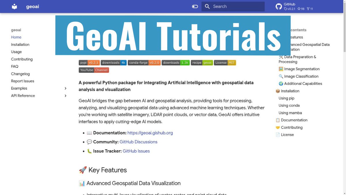
🚀 Exciting news! I'm launching a new #GeoAI tutorial series where I'll guide you through using the powerful GeoAI Python package for integrating AI with geospatial data analysis and visualization. 🌍✨ 🔗 Check out the first tutorial here: youtu.be/teqyY8GNYRU 🛠️ Explore the

🚀 Exciting news! I'm launching a new #GeoAI tutorial series where I'll guide you through using the powerful GeoAI Python package for integrating AI with geospatial data analysis and visualization. 🌍✨

🔗 Check out the first tutorial here: youtu.be/teqyY8GNYRU
🛠️ Explore the