Brooks Garner (@brooksweather) 's Twitter Profile
Brooks Garner

@brooksweather

Senior Meteorologist. Duel Certified ams & NWA Sealed 🌪️ “Anchors Under the Desk!" Viral tornado video, as the twister hit our station head-on. Husband & Dad

ID: 28857255

linkhttps://youtu.be/MM_BfNN0HX8?si=GSrIiVzN5_2Gph0k calendar_today04-04-2009 19:48:42

5,5K Tweet

10,10K Followers

2,2K Following

Brooks Garner (@brooksweather) 's Twitter Profile Photo

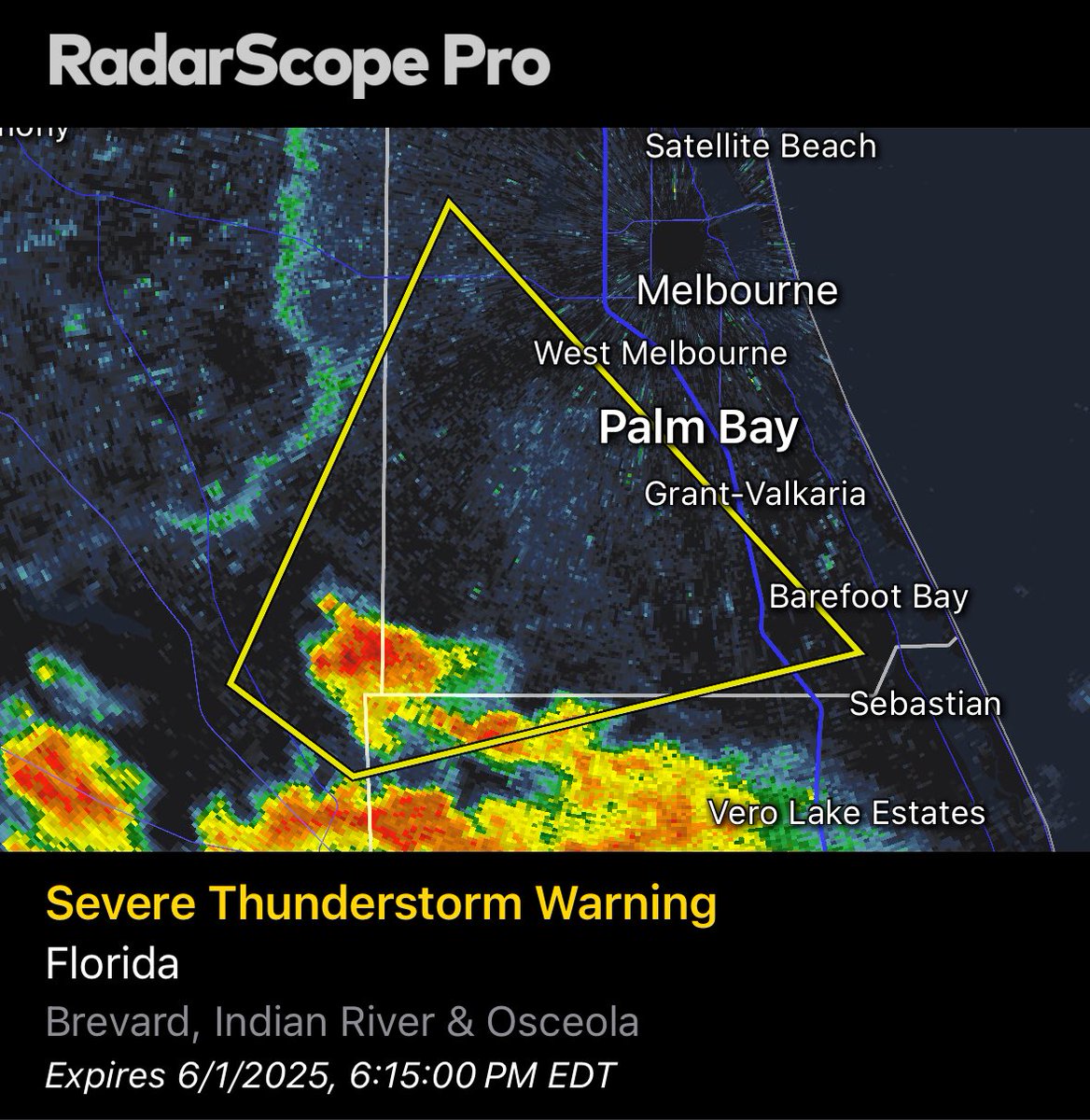
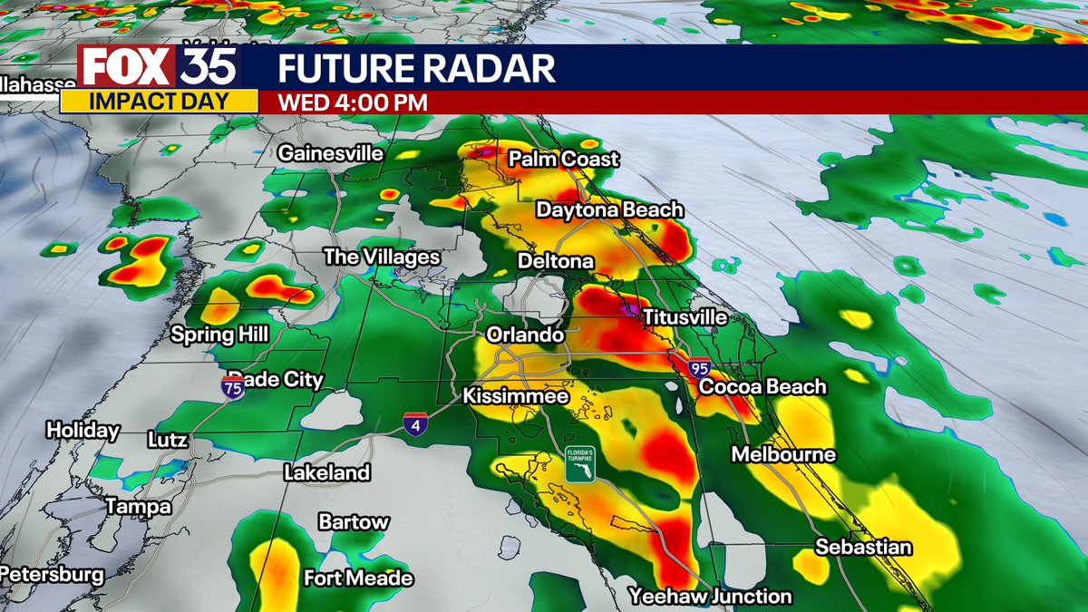
*Severe storm warning for southern Osceola and Brevard Counties Until 615 PM EDT. * At 524 PM EDT, it was located near Kenansville, moving northeast at 25 mph. HAZARD...60 mph wind gusts and quarter size hail. SOURCE...Radar indicated. IMPACT...Hail & wind damage possible

*Severe storm warning for southern Osceola and Brevard Counties Until 615 PM EDT.

* At 524 PM EDT, it was located near Kenansville, moving northeast at 25 mph.

 HAZARD...60 mph wind gusts and quarter size hail.

 SOURCE...Radar indicated.

  IMPACT...Hail & wind damage possible
Brooks Garner (@brooksweather) 's Twitter Profile Photo

Poor air quality.... A two-pronged impact with Canadian wildfire smoke from Manitoba (2,000 mi away) and dust from the Sahara (5,000 mi away) working in tandem. Plus, an approaching warm front returns PM storm chances. The dust dries up our numerous storm threat by the weekend.

Poor air quality....  A two-pronged impact with Canadian wildfire smoke from Manitoba (2,000 mi away) and dust from the Sahara (5,000 mi away) working in tandem. Plus, an approaching warm front returns PM storm chances. The dust dries up our numerous storm threat by the weekend.
Brooks Garner (@brooksweather) 's Twitter Profile Photo

Huge pyroclastic flow came down Mt. Etna in today’s Italy eruption. Hopefully the tourists and volcanologists on site got out. These are extremely deadly reaching up to 1,800°F.

Brooks Garner (@brooksweather) 's Twitter Profile Photo

These pyroclastic flow videos out of Mt. Etna Italy are mind blowing. Instant death if you find yourself in that descending cloud of 1,000°C ash and heat. Once they start if you’re in the path, there’s no outrunning it.

Brooks Garner (@brooksweather) 's Twitter Profile Photo

First 7-day tropical potential development zone appears in the Atlantic basin, forecast by the NHC. No threat to Florida, other than higher surf and tides if something did form, moving northeast and away… [6/2/2025 - 2pm]

First 7-day tropical potential development zone appears in the Atlantic basin, forecast by the NHC.  No threat to Florida, other than higher surf and tides if something did form, moving northeast and away…  [6/2/2025 - 2pm]
Brooks Garner (@brooksweather) 's Twitter Profile Photo

Much higher rain chance begins tomorrow (Tuesday) region-wide, as a rainy front draped across South Florida lifts north into Central Florida. Meanwhile, high above, an upper-low will form in the northeast Gulf, further enhancing regional lift to increase our rain chance and

Brooks Garner (@brooksweather) 's Twitter Profile Photo

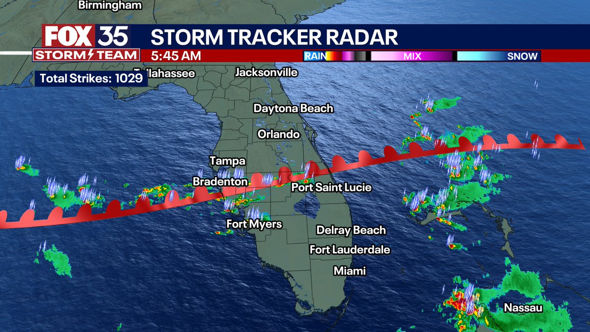
An upper level low in the northeast Gulf will force tropical air into Central Florida over the next 36 hours, resulting in numerous showers and a few storms. Tomorrow, there may be areas of torrential rain and ponding on the roads. I'm tracking it on FOX 35 Good Day Orlando.

Brooks Garner (@brooksweather) 's Twitter Profile Photo

Florida satellite loop is neat today! Sunny in Tampa, dreary in Orlando... Sharp cloud cut-off, sending temps hotter west of Orlando with a natural, 'boundary' of cooler vs hotter set up there, and which may help initiate new storm chances later today. Canadian wildfire smoke is

Brooks Garner (@brooksweather) 's Twitter Profile Photo

We've got deep, tropical moisture pushing into Central Florida today, resulting in numerous afternoon downpours and thunderstorms. Winds may gust over 45mph and rain could total over 1-3" in some areas with on-and-off torrents. I'm tracking it on Good Day Orlando, on FOX 35.

We've got deep, tropical moisture pushing into Central Florida today, resulting in numerous afternoon downpours and thunderstorms. Winds may gust over 45mph and rain could total over 1-3" in some areas with on-and-off torrents. I'm tracking it on Good Day Orlando, on FOX 35.
Brooks Garner (@brooksweather) 's Twitter Profile Photo

Some good news: The low threat for tropical development has passed, and you can probably thank the arrival of that Saharan Dust we've been tracking for the last two weeks. Its impacts are nothing to sneeze at, though the dust may have you sneezing a lot. [Posted 6/4/2025 at 10am]

Some good news: The low threat for tropical development has passed, and you can probably thank the arrival of that Saharan Dust we've been tracking for the last two weeks. Its impacts are nothing to sneeze at, though the dust may have you sneezing a lot. [Posted 6/4/2025 at 10am]
NHC_TAFB (@nhc_tafb) 's Twitter Profile Photo

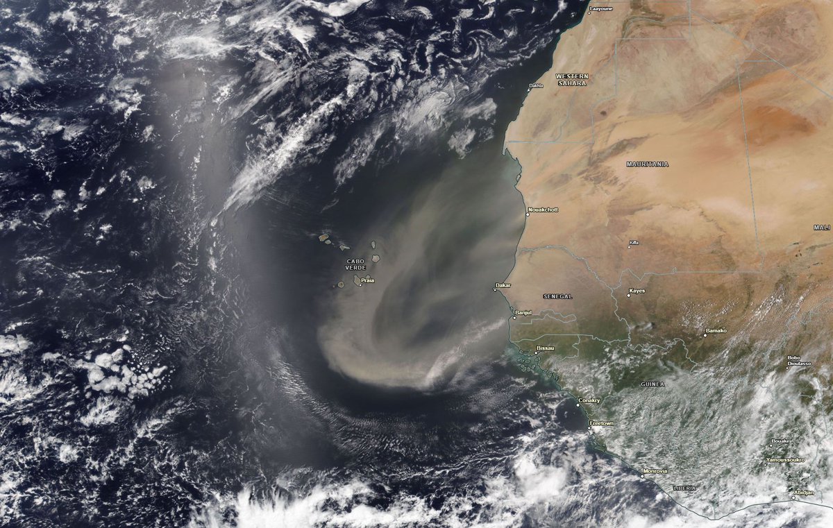
6/5 - Heads up! Satellite imagery depict a new plume of Saharan dust moving across the eastern Atlantic. This dry airmass will move westward over the next few days, suppressing the thunderstorm activity and reducing the visibility. #saharandust #weatheraware #NASA #Atlantic

6/5 - Heads up! Satellite imagery depict a new plume of Saharan dust moving across the eastern Atlantic. This dry airmass will move westward over the next few days, suppressing the thunderstorm activity and reducing the visibility. #saharandust #weatheraware #NASA #Atlantic
Brooks Garner (@brooksweather) 's Twitter Profile Photo

Saharan dust over our area today and tomorrow will drift away for improving conditions into early next week with better air quality. But, a new plume is being pushed off of the African continent and will drift across the Atlantic over the next few weeks. Rounds of dust are

Saharan dust over our area today and tomorrow will drift away for improving conditions into early next week with better air quality.

But, a new plume is being pushed off of the African continent and will drift across the Atlantic over the next few weeks.

Rounds of dust are