Cesium (@cesiumjs) 's Twitter Profile
Cesium

@cesiumjs

The Platform for 3D Geospatial.

Tile, visualize, contextualize, and analyze your 3D data. #3DTiles #WebGL

ID: 2187485455

linkhttps://cesium.com calendar_today11-11-2013 01:39:43

6,6K Tweet

10,10K Followers

8,8K Following

Cesium (@cesiumjs) 's Twitter Profile Photo

Join the Cesium team! We're hiring: - Application Engineer, Geospatial - Senior Application Engineer - Senior API Product Manager We value diversity and believe experience comes in many forms. Work on interesting and challenging problems with us: hubs.li/Q03qjZ8c0

Join the Cesium team! We're hiring:

- Application Engineer, Geospatial
- Senior Application Engineer
- Senior API Product Manager

We value diversity and believe experience comes in many forms. Work on interesting and challenging problems with us: hubs.li/Q03qjZ8c0
Cesium (@cesiumjs) 's Twitter Profile Photo

Congratulations to new #CesiumCertified Developer Vallaris Maps! The Cesium Certified Developer Program recognizes the technical expertise of developers who build on the Cesium platform. It's free + open to all. Learn more: hubs.li/Q03q_6HH0

Congratulations to new #CesiumCertified Developer Vallaris Maps!

The Cesium Certified Developer Program recognizes the technical expertise of developers who build on the Cesium platform. It's free + open to all.

Learn more: hubs.li/Q03q_6HH0
Cesium (@cesiumjs) 's Twitter Profile Photo

Learn how data powers open geospatial at #CesiumDevCon, June 23-25. Closing session focuses on future of data: Overture Maps Foundation open geospatial data initiatives, Geomatex Integrated Solutions drone + iTwin Capture at Pyramids of Giza, & Pete Kelsey's reality capture at Alcatraz hubs.li/Q03r1d_w0

Learn how data powers open geospatial at #CesiumDevCon, June 23-25. Closing session focuses on future of data: <a href="/OvertureMaps/">Overture Maps Foundation</a> open geospatial data initiatives, <a href="/geomatex/">Geomatex Integrated Solutions</a> drone + iTwin Capture at Pyramids of Giza, &amp; Pete Kelsey's reality capture at Alcatraz hubs.li/Q03r1d_w0
Cesium (@cesiumjs) 's Twitter Profile Photo

At #GEOINT2025, Project Geospatial's Adam Simmons caught up with Trent Tinker, director of federal business development, to talk about his background in geospatial, Cesium's history, and how we're advancing with Bentley Systems, Inc. Watch the interview: hubs.li/Q03rbZ1W0

At #GEOINT2025, Project Geospatial's Adam Simmons caught up with Trent Tinker, director of federal business development, to talk about his background in geospatial, Cesium's history, and how we're advancing with <a href="/BentleySystems/">Bentley Systems, Inc</a>.

Watch the interview: hubs.li/Q03rbZ1W0
Unreal Engine (@unrealengine) 's Twitter Profile Photo

Epic Games will be at the Cesium Developer Conference June 23-25! Will we see you there? 🫵 Join Sam Anderson's workshop on 3D geospatial content to learn the foundational skills you'll need to become a Cesium Certified Developer. But act quick, seats are limited for this

Cesium (@cesiumjs) 's Twitter Profile Photo

Congratulations to new #CesiumCertified Developer Brad Stricherz! The Cesium Certified Developer Program recognizes the technical expertise of developers who build on the Cesium platform. It's free + open to all. Learn more: hubs.li/Q03qvtSN0

Congratulations to new #CesiumCertified Developer Brad Stricherz!

The Cesium Certified Developer Program recognizes the technical expertise of developers who build on the Cesium platform. It's free + open to all.

Learn more: hubs.li/Q03qvtSN0
Cesium (@cesiumjs) 's Twitter Profile Photo

地震による建物被害をどう推定・可視化するか。大阪公立大学・金子健作博士の「MeSM」はAI×3D都市モデルで数十万棟の被害を推定し、CesiumJSで都市全体を描く。複数の防災データを重ね合わせて可視化する取り組みも進行中。詳細はこちら:hubs.li/Q03sb8mr0

地震による建物被害をどう推定・可視化するか。大阪公立大学・金子健作博士の「MeSM」はAI×3D都市モデルで数十万棟の被害を推定し、CesiumJSで都市全体を描く。複数の防災データを重ね合わせて可視化する取り組みも進行中。詳細はこちら:hubs.li/Q03sb8mr0
Cesium (@cesiumjs) 's Twitter Profile Photo

At United Nations #UNOpenSourceWeek, Tech Over is designed to spotlight the power of technology & multistakeholder cooperation, while deepening UN’s engagement with open-source community. Arun George is a 1st round judge on June 17. Find the team, all over the world: hubs.li/Q03skxT50

At <a href="/UN/">United Nations</a> #UNOpenSourceWeek, Tech Over is designed to spotlight the power of technology &amp; multistakeholder cooperation, while deepening UN’s engagement with open-source community. Arun George is a 1st round judge on June 17. Find the team, all over the world: hubs.li/Q03skxT50
Cesium (@cesiumjs) 's Twitter Profile Photo

.Bentley Systems, Inc Infraweek Latin America 2025—virtual! Digital twins, AI, & advanced software for water, energy, digital cities, transportation, & ESG. Session 1: Infrastructure–Digital Twins and Sustainability (TODAY) highlights Cesium. Join us: hubs.li/Q03srfWK0

.<a href="/BentleySystems/">Bentley Systems, Inc</a> Infraweek Latin America 2025—virtual! Digital twins, AI, &amp; advanced software for water, energy, digital cities, transportation, &amp; ESG. Session 1: Infrastructure–Digital Twins and Sustainability (TODAY) highlights Cesium. Join us: hubs.li/Q03srfWK0
Cesium (@cesiumjs) 's Twitter Profile Photo

#CesiumDevCon in 5 days! Connect with developers and integrators shaping the future of open geospatial. Join us in Philly for technically oriented, community-driven sessions; insights from leaders in 3D geospatial; and networking and receptions. Register: hubs.li/Q03sKzKP0

Cesium (@cesiumjs) 's Twitter Profile Photo

Congratulations to new #CesiumCertified Developer Map Mastery Consulting! The Cesium Certified Developer Program recognizes the technical expertise of developers who build on the Cesium platform. It's free + open to all. Learn more: hubs.li/Q03qvsFv0

Congratulations to new #CesiumCertified Developer Map Mastery Consulting!

The Cesium Certified Developer Program recognizes the technical expertise of developers who build on the Cesium platform. It's free + open to all.

Learn more: hubs.li/Q03qvsFv0
Cesium (@cesiumjs) 's Twitter Profile Photo

A geospatially accurate 3D Globe is now available in QGIS as part of the QGIS 3.44 stable release. This work is the result of a Cesium Ecosystem Grant supporting the partnership of Lutra Consulting Limited and North Road. Learn more and get started: hubs.li/Q03s-5vc0

Cesium (@cesiumjs) 's Twitter Profile Photo

To enable Hobu's users to visualize and interact with city- or country-scale point clouds and raster data, the company developed its browser-based Eptium viewer using CesiumJS. Learn how Hobu enables interactivity and understanding for a broad audience: hubs.li/Q03s-VD10

To enable Hobu's users to visualize and interact with city- or country-scale point clouds and raster data, the company developed its browser-based Eptium viewer using CesiumJS. Learn how Hobu enables interactivity and understanding for a broad audience: hubs.li/Q03s-VD10
Cesium (@cesiumjs) 's Twitter Profile Photo

Since Cesium joined Bentley Systems, Inc, we've taken the time to learn more about the technologies built by Bentley & opportunities to bring them to the community. As #CesiumDevCon gets underway, we're sharing our roadmap. Dig in & let us know what you think: hubs.ly/Q03t9lqn0

Since Cesium joined <a href="/BentleySystems/">Bentley Systems, Inc</a>, we've taken the time to learn more about the technologies built by Bentley &amp; opportunities to bring them to the community. As #CesiumDevCon gets underway, we're sharing our roadmap. Dig in &amp; let us know what you think: hubs.ly/Q03t9lqn0
Bert Temme (@berttemme) 's Twitter Profile Photo

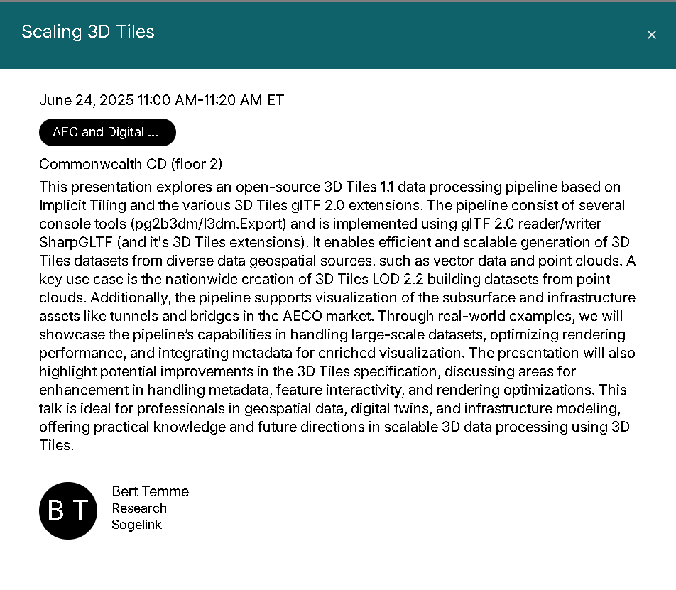
Tomorrow I'll give a presentation at Cesium Developer Conference Philadelphia about Scaling 3D Tiles (11.00H ET). Who do I see there? web.cvent.com/event/82ef71ed…

Tomorrow I'll give a presentation at <a href="/CesiumJS/">Cesium</a> Developer Conference Philadelphia about Scaling 3D Tiles (11.00H ET). Who do I see there? web.cvent.com/event/82ef71ed…
Cesium (@cesiumjs) 's Twitter Profile Photo

背背景整備に40時間→1時間! 日本工営がCesiumで港湾・地震・防災の3D空間を高速可視化。 Unreal Engine連携で説明や意思決定も直感的に。 現地に行けなくても“空間を体感”。非接触型で合意形成もスムーズに。詳細はこちら:hubs.li/Q03thzYL0

背背景整備に40時間→1時間!
日本工営がCesiumで港湾・地震・防災の3D空間を高速可視化。
Unreal Engine連携で説明や意思決定も直感的に。
現地に行けなくても“空間を体感”。非接触型で合意形成もスムーズに。詳細はこちら:hubs.li/Q03thzYL0
Cesium (@cesiumjs) 's Twitter Profile Photo

The iconic red PSFS letters went teal for #CesiumDevCon! We were proud to host the community in our hometown this week—thank you for the energy and great conversations.

The iconic red PSFS letters went teal for #CesiumDevCon!

We were proud to host the community in our hometown this week—thank you for the energy and great conversations.
Cesium (@cesiumjs) 's Twitter Profile Photo

.HNTB creates real-time interactive media to visualize and assess infrastructure project designs, from single highway interchanges to 30-mile road and rail corridors. Read about how HNTB uses Cesium to cut 1,000 hours of work to 200-300: hubs.li/Q03tVn3h0