Chris Jochem (@chrisjochem) 's Twitter Profile
Chris Jochem

@chrisjochem

Geographer with a computer. @WorldPopProject, #rstats

ID: 1146449702692564993

linkhttp://www.wcjochem.com calendar_today03-07-2019 16:04:43

23 Tweet

168 Followers

399 Following

Heather Chamberlain (@heatherch100) 's Twitter Profile Photo

Finishing up the last day at @efgs2019 with a session on Future #geospatial thinking. Chris Jochem from WorldPopProject @geogsouthampton presented on settlement classification from multi-scale spatial patterns of building footprints using a machine learning approach #efgs2019
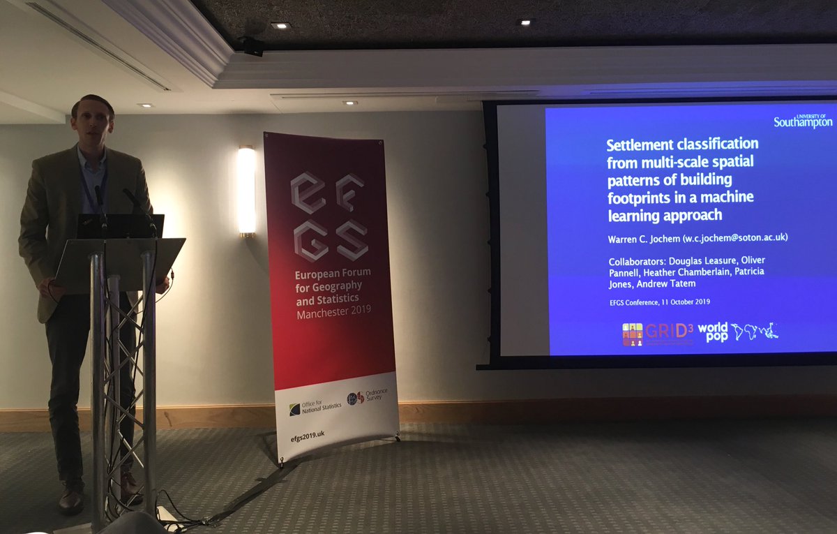
Finishing up the last day at @efgs2019 with a session on Future #geospatial thinking. <a href="/ChrisJochem/">Chris Jochem</a> from <a href="/WorldPopProject/">WorldPopProject</a> @geogsouthampton presented on settlement classification from multi-scale spatial patterns of building footprints using a machine learning approach #efgs2019
Chris Jochem (@chrisjochem) 's Twitter Profile Photo

At what time on New Year's had most of the world's people started the year 2020? A little trivia, and a fun use for WorldPopProject data. github.com/wcjochem/newye… Happy (belated) New Year to all!
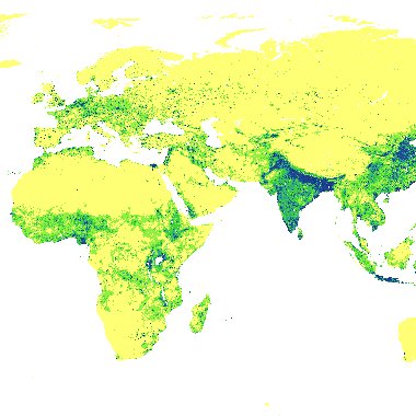
At what time on New Year's had most of the world's people started the year 2020? A little trivia, and a fun use for <a href="/WorldPopProject/">WorldPopProject</a> data.
github.com/wcjochem/newye…

Happy (belated) New Year to all!
GRID3 (@grid3global) 's Twitter Profile Photo

Learn more about how we map settlements. Our first webinar, Mapping Settlements, is out now: bit.ly/mapsettlements #datascience #datadriven

Heather Chamberlain (@heatherch100) 's Twitter Profile Photo

New WorldPopProject paper led by Chris Jochem - Classifying settlement types from multi-scale spatial patterns of building footprints, with @Need4GIS Andy Tatem Doug Leasure, Pat Jones @geogsouthampton GRID3 #openaccess #geospatial #urbananalytics journals.sagepub.com/doi/10.1177/23…
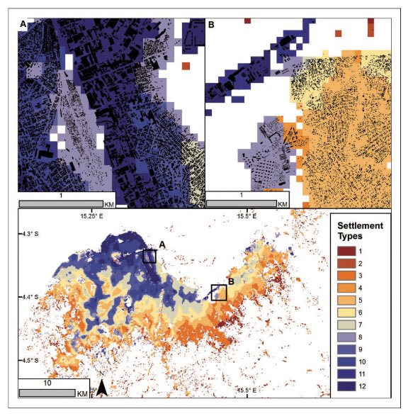
New <a href="/WorldPopProject/">WorldPopProject</a> paper led by <a href="/ChrisJochem/">Chris Jochem</a> - Classifying settlement types from multi-scale spatial patterns of building footprints, with @Need4GIS <a href="/AndyTatem/">Andy Tatem</a> Doug Leasure, Pat Jones @geogsouthampton <a href="/grid3global/">GRID3</a> #openaccess #geospatial #urbananalytics journals.sagepub.com/doi/10.1177/23…
WorldPopProject (@worldpopproject) 's Twitter Profile Photo

Explore our new Bayesian population estimate datasets produced as part of the GRID3 program through the woprVision app: apps.worldpop.org/woprVision/

Explore our new Bayesian population estimate datasets produced as part of the <a href="/grid3global/">GRID3</a> program through the woprVision app: apps.worldpop.org/woprVision/
WorldPopProject (@worldpopproject) 's Twitter Profile Photo

New WorldPop paper in PNASNews as part of GRID3 - National population mapping from sparse survey data: pnas.org/content/early/… - explore outputs at: apps.worldpop.org/woprVision/

New WorldPop paper in <a href="/PNASNews/">PNASNews</a> as part of <a href="/grid3global/">GRID3</a> - National population mapping from sparse survey data: pnas.org/content/early/… - explore outputs at: apps.worldpop.org/woprVision/
Chris Jochem (@chrisjochem) 's Twitter Profile Photo

Experimental #rstats 📦 {sfarrow} for reading/writing `sf` objects from/to Parquet files with {arrow}. Using consistent geo metadata to work with GeoPandas. Currently quite simple; feedback and ideas welcome #rspatial github.com/wcjochem/sfarr…

Experimental #rstats 📦 {sfarrow} for reading/writing `sf` objects from/to Parquet files with {arrow}. Using consistent geo metadata to work with <a href="/GeoPandas/">GeoPandas</a>. Currently quite simple; feedback and ideas welcome  #rspatial  

github.com/wcjochem/sfarr…
Chris Jochem (@chrisjochem) 's Twitter Profile Photo

My first #rstats 📦on CRAN! {sfarrow} Reading/writing spatial objects with coordinate reference system info from/to Parquet files and partitioned datasets #rspatial cran.r-project.org/package=sfarrow

Dani Arribas-Bel `@darribas@mapstodon.space` (@darribas) 's Twitter Profile Photo

Got excited and took it out for a spin, all looking great! Here's how you can read/write geospatial data between R and Python like it's the XXIst Century (also, in the same notebook thanks to the darribas.org/gds_env). Notebook at: gist.github.com/darribas/95b6c…

Got excited and took it out for a spin, all looking great! Here's how you can read/write geospatial data between R and Python like it's the XXIst Century (also, in the same notebook thanks to the darribas.org/gds_env). Notebook at:
gist.github.com/darribas/95b6c…
Jeremiah J Nieves (@dr_col_nieves) 's Twitter Profile Photo

New random forest informed population modelling package in R (CRAN.R-project.org/package=popRF ). Vignette/tutorial can be found (for now) at (dx.doi.org/10.13140/RG.2.…) GeoDataScience WorldPopProject #Population #rspatial

E&P B: Urban Analytics and City Science (@envplanb) 's Twitter Profile Photo

🥳The Breheny Prize for the most innovative E&P B: Urban Analytics and City Science article published in 2021 has been awarded to Chris Jochem , Douglas Leasure, Oliver Pannell, Heather Chamberlain , Patricia Jones, Andy Tatem from the WorldPopProject Congratulations to all👏Find out more: doi.org/10.1177/239980…