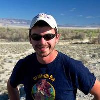
Danny Brothers (@dbrotherssc) 's Twitter Profile
Danny Brothers

@dbrotherssc

Coastal, Marine, and Lacustrine Geohazards, geophysics, reflection seismology. Colorado Buffaloes! Tweets my own, retweets & likes not endorsements.

ID: 4859269049

linkhttps://www.usgs.gov/staff-profiles/danny-brothers calendar_today29-01-2016 06:34:31

359 Tweet

471 Followers

592 Following
GeoGeorge (@geogeorgeology) 's Twitter Profile Photo

A user from Myanmar filmed what appears to be offset in a water channel caused by the earthquake. Looks like the fault surface was also exposed Credit: okarun011 on TikTok #MyanmarEarthquake

USGS Coastal Change (@usgscoastchange) 's Twitter Profile Photo

New study by USGS and partners: Exploring the dynamic interactions between the Southern #SanAndreasFault and a normal fault under the #SaltonSea ow.ly/XaXc50VuJJZ

New study by <a href="/USGS/">USGS</a> and partners: Exploring the dynamic interactions between the Southern #SanAndreasFault and a normal fault under the #SaltonSea ow.ly/XaXc50VuJJZ
USGS Coastal Change (@usgscoastchange) 's Twitter Profile Photo

Today, towering white objects floating off the #FloridaKeys are more likely to be cruise ships than anything else. But 30,000 years ago, giant icebergs drifted from Canada to as far south as FL, as revealed by seafloor mapping conducted by USGS and Woods Hole Oceanographic Institution (WHOI): ow.ly/LckA50Vxw10

USGS Coastal Change (@usgscoastchange) 's Twitter Profile Photo

Explore newly released 3D seismic data now available in the Gulf of America, part of the National Archive of Marine Seismic Surveys portal, a collaboration between USGS and Bureau of Ocean Energy Management: ow.ly/5Qy250VAb5X #USGS #BOEM #BSEE #Geoscience #Energy #GulfofAmerica #USEEZ

USGS (@usgs) 's Twitter Profile Photo

A new report estimates the Maverick Basin area near Texas’ Gulf Coast holds 11 trillion cubic feet of undiscovered natural gas, triple the total produced to date, and as much as the U.S. uses in 4 months. 👉ow.ly/5OqV50VCrfp  #UnleashingAmericanEnergy

A new report estimates the Maverick Basin area near Texas’ Gulf Coast holds 11 trillion cubic feet of undiscovered natural gas, triple the total produced to date, and as much as the U.S. uses in 4 months. 

👉ow.ly/5OqV50VCrfp  

#UnleashingAmericanEnergy
USGS (@usgs) 's Twitter Profile Photo

Minerals power modern life—and they’re not just on land. The U.S. has more ocean territory than land, and holds vast, untapped mineral resources. The USGS leads national efforts to map these mineral resources. Dive deeper 👉 ow.ly/Nt1N50VHTAh #energy #minerals #seafloor

USGS Coastal Change (@usgscoastchange) 's Twitter Profile Photo

Minerals power modern life—and they’re not just on land. The U.S. has more ocean territory than land, and holds vast, untapped mineral resources. The USGS leads national efforts to map these mineral resources. Dive deeper 👉 ow.ly/Nt1N50VHTAh #energy #minerals #seafloor

Danny Brothers (@dbrotherssc) 's Twitter Profile Photo

There’s a mountain of ongoing projects along Cascadia, looking at offshore evidence for past earthquakes, coastal subsidence from massive quakes, and earthquake shaking deposits in lakes. Stay tuned

Native Santa Cruz (@nativesantacruz) 's Twitter Profile Photo

As of 4:15pm today, the crane that went down during the partial collapse of the Santa Cruz Wharf at the end of December is out of the water! More video and photos will be coming

Alaska Earthquake Center (@akearthquake) 's Twitter Profile Photo

What’s Shaking Alaska?! Welcome to your weekly seismic update from across the state. Over the week of June 3–11, we recorded about 360 earthquakes. The largest was a magnitude 4.9 west of Adak on June 3. There were 2 felt events, one near Wasilla and one near Ester. Adak is no

What’s Shaking Alaska?! Welcome to your weekly seismic update from across the state. Over the week of June 3–11, we recorded about 360 earthquakes. The largest was a magnitude 4.9 west of Adak on June 3. There were 2 felt events, one near Wasilla and one near Ester. 
Adak is no
Danny Brothers (@dbrotherssc) 's Twitter Profile Photo

How do large Alaskan lakes respond to seismic shaking? We’re trying to answer this bc they contain geological evidence of past earthquakes We just wrapped up field ops in Skilak Lake- recovered seismic stations from around the shoreline and on the lake bottom

How do large Alaskan lakes respond to seismic shaking? We’re trying to answer this bc they contain geological evidence of past earthquakes 

We just wrapped up field ops in Skilak Lake- recovered seismic stations from around the shoreline and on the lake bottom
Alaska Earthquake Center (@akearthquake) 's Twitter Profile Photo

What’s Shaking Alaska?! Welcome to your weekly seismic update from across the state, brought to you by the Alaska Earthquake Center, where we monitor ground shaking 24-7. Over the past week, we recorded about 400 earthquakes. The largest earthquake was a magnitude 5.1 near Atka

What’s Shaking Alaska?! Welcome to your weekly seismic update from across the state, brought to you by the Alaska Earthquake Center, where we monitor ground shaking 24-7. Over the past week, we recorded about 400 earthquakes. The largest earthquake was a magnitude 5.1 near Atka
Harold Tobin (@harold_tobin) 's Twitter Profile Photo

It's a VERY large earthquake, possibly/probably among the 10 largest ever recorded. A clear subduction megathrust event. And another M>8.5 event with a notable foreshock (the recent M7.4 in same location), like Tohoku 2011. Tsunami warnings/watches should be taken seriously.