Digital Earth Africa (@dearthafrica) 's Twitter Profile
Digital Earth Africa

@dearthafrica

#DigitalEarthAfrica translates satellite data into easy to consume information for the entire African continent.

ID: 1100227476356120578

linkhttp://www.digitalearthafrica.org calendar_today26-02-2019 02:54:06

2,2K Tweet

7,7K Followers

259 Following

Helmsley Charitable Trust (@helmsleytrust) 's Twitter Profile Photo

What if we harnessed Earth observation data to enhance decision-making around environment and socio-economic challenges? Five years ago, that was the question Digital Earth Africa (DE Africa) set out to answer. Today, DE Africa is taking that data and using it as a building block for

Digital Earth Africa (@dearthafrica) 's Twitter Profile Photo

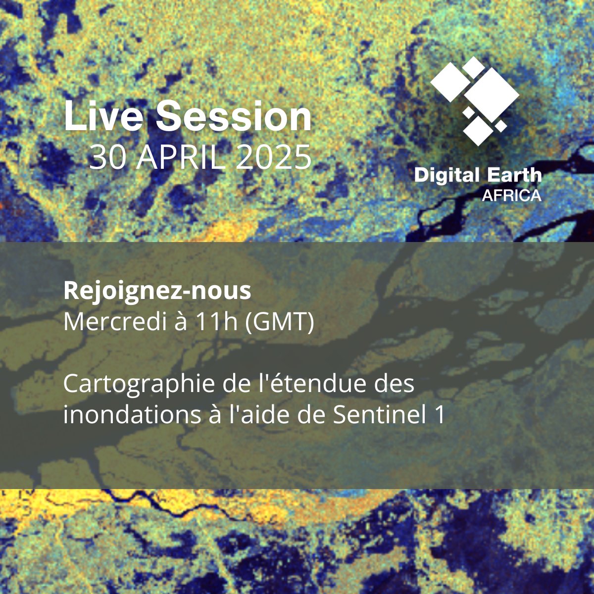
Rejoignez-nous ce mercredi pour une session EN DIRECT sur Cartographie de l'étendue des inondations à l'aide de Sentinel 1. 30 avril 2025, 11h GMT, bit.ly/4hb9JPg #sentinel-1 #EarthObservation #SustainableDevelopment #RemoteSensing #GeoDataForGood

Rejoignez-nous ce mercredi pour une session EN DIRECT sur Cartographie de l'étendue des inondations à l'aide de Sentinel 1. 30 avril 2025, 11h GMT, bit.ly/4hb9JPg

#sentinel-1 #EarthObservation #SustainableDevelopment #RemoteSensing #GeoDataForGood
Digital Earth Africa (@dearthafrica) 's Twitter Profile Photo

Please welcome Suwilanji Newa, our new Administrative Officer at @DE_Africa! With global experience in operations, governance, and donor-funded projects, she brings sharp skills & sector insight. Thrilled to have her on board! #DEAfrica #AfricaDevelopment #SpaceForDevelopment

Please welcome Suwilanji Newa, our new Administrative Officer at @DE_Africa! With global experience in operations, governance, and donor-funded projects, she brings sharp skills & sector insight. Thrilled to have her on board!
#DEAfrica  #AfricaDevelopment #SpaceForDevelopment
Digital Earth Africa (@dearthafrica) 's Twitter Profile Photo

Off the back of a funding extension from the Helmsley Charitable Trust, Dr Lisa Rebelo joined Star 91.9 FM to unpack DE Africa’s journey. DE Africa is driving real-world change with a focus on sustainability & African ownership. Listen in: ow.ly/Xqac50VKneh #EOData

Off the back of a funding extension from the Helmsley Charitable Trust, Dr Lisa Rebelo joined Star 91.9 FM to unpack DE Africa’s journey. DE Africa is driving real-world change with a focus on sustainability & African ownership.

Listen in: ow.ly/Xqac50VKneh
#EOData
Digital Earth Africa (@dearthafrica) 's Twitter Profile Photo

Dr. Lisa Rebelo, Ag MD, DE Africa, at the GEO Global Forum 2025. On May 5, she joins a panel on enhancing collaboration across GEO Flagships. On May 6, she presents on bridging global EO tools with local capacity. More info: earthobservations.org/about-us/event… #EarthObservation #DEAfrica

Dr. Lisa Rebelo, Ag MD, DE Africa, at the GEO Global Forum 2025. On May 5, she joins a panel on enhancing collaboration across GEO Flagships. On May 6, she presents on bridging global EO tools with local capacity. 

More info: earthobservations.org/about-us/event…
#EarthObservation #DEAfrica
Digital Earth Africa (@dearthafrica) 's Twitter Profile Photo

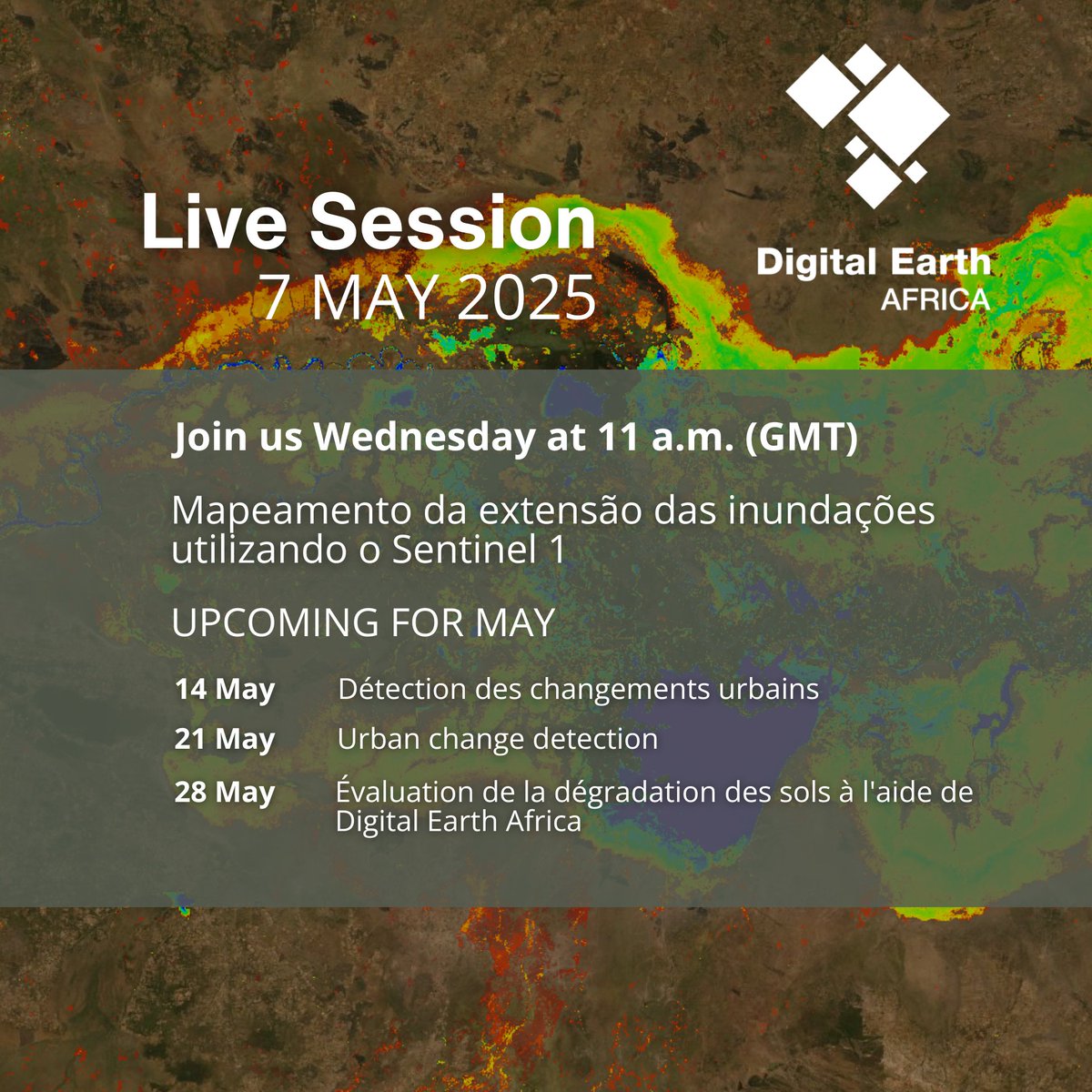
Join us LIVE this Wednesday, May 7, for a session (in Portuguese) on using Sentinel-1 SAR data to map floods & their impacts on livelihoods! Register here: bit.ly/4hb9JPg Missed our last one? Watch here: youtu.be/yXDmRW63rVw #FloodMapping #DigitalEarthAfrica

Join us LIVE this Wednesday, May 7, for a session (in Portuguese) on using Sentinel-1 SAR data to map floods & their impacts on livelihoods!

Register here: bit.ly/4hb9JPg
Missed our last one? Watch here: youtu.be/yXDmRW63rVw

#FloodMapping #DigitalEarthAfrica
Digital Earth Africa (@dearthafrica) 's Twitter Profile Photo

A new seagrass mapping project in Senegal is combining satellite data with local knowledge to support marine conservation and climate resilience. See how communities are leading the way in protecting vital coastal ecosystems. Read more: ow.ly/nUZM50VOhYF #SeagrassMapping

A new seagrass mapping project in Senegal is combining satellite data with local knowledge to support marine conservation and climate resilience. See how communities are leading the way in protecting vital coastal ecosystems.

Read more: ow.ly/nUZM50VOhYF

#SeagrassMapping
Digital Earth Africa (@dearthafrica) 's Twitter Profile Photo

How can African cities go greener & more equitable without blowing the budget? Urban actors across Africa joined a hands-on a webinar to explore open-access tools for mapping & monitoring urban forests More information: ow.ly/SwTJ50VPauT #UrbanForests #ClimateResilience

How can African cities go greener & more equitable without blowing the budget? Urban actors across Africa joined a hands-on  a webinar to explore open-access tools for mapping & monitoring urban forests

More information: ow.ly/SwTJ50VPauT
#UrbanForests #ClimateResilience
Digital Earth Africa (@dearthafrica) 's Twitter Profile Photo

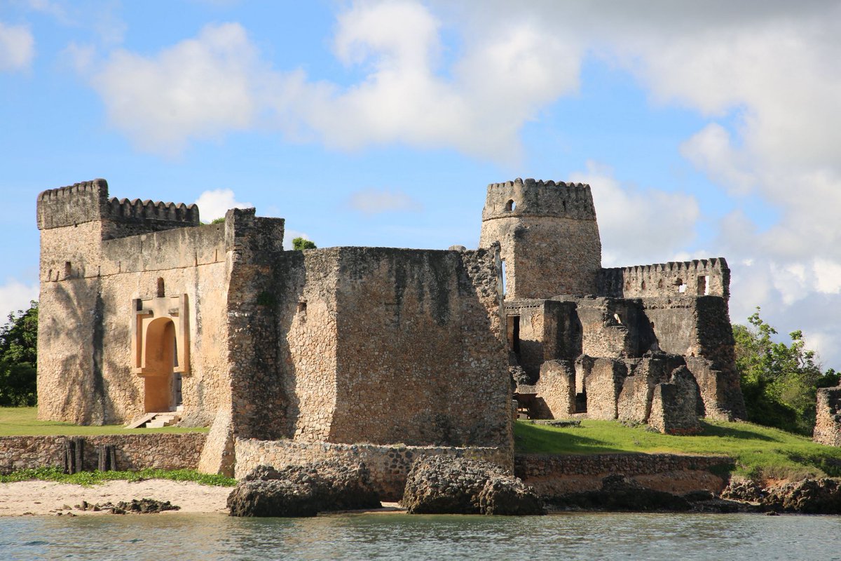
Dr Pamela Ochungo is using EO data from DEAfrica to protect Africa’s cultural heritage from climate threats. We'll be sharing more on Dr Ochungo's research so keep watching this space. Read more: ow.ly/ywXV50VQOUe #DEAfrica #EOdata #ClimateAction

Dr Pamela Ochungo is using EO data from DEAfrica to protect Africa’s cultural heritage from climate threats. We'll be sharing more on Dr Ochungo's research so keep watching this space.

Read more:  ow.ly/ywXV50VQOUe 

#DEAfrica #EOdata #ClimateAction
Digital Earth Africa (@dearthafrica) 's Twitter Profile Photo

Rejoignez-nous ce mercredi pour une session LIVE sur le suivi de la croissance urbaine avec Sentinel-1 & 2! L’Afrique s’urbanise vite. utilisons l’OT pour planifier des villes durables. Date: Mercredi, 11 AM GMT Register: bit.ly/4hb9JPg #Urbanization #EOdata

Rejoignez-nous ce mercredi pour une session LIVE sur le suivi de la croissance urbaine avec Sentinel-1 & 2! L’Afrique s’urbanise vite. utilisons l’OT pour planifier des villes durables.

Date: Mercredi, 11 AM GMT
Register: bit.ly/4hb9JPg

#Urbanization #EOdata
Digital Earth Africa (@dearthafrica) 's Twitter Profile Photo

The Digital Earth Africa 2024 Annual Report is now live and available in English & French! Explore our progress over the year, advancing Earth observation for Africa’s development. Download the report: digitalearthafrica.org/about-us/plann… #EarthObservation #GeospatialData #OpenData

The Digital Earth Africa 2024 Annual Report is now live and available in English & French!
Explore our progress over the year, advancing Earth observation for Africa’s development.

Download the report:  digitalearthafrica.org/about-us/plann…

#EarthObservation  #GeospatialData #OpenData
Digital Earth Africa (@dearthafrica) 's Twitter Profile Photo

Heritage sites on Africa’s coasts are vanishing. A new study uses DE Africa data to map erosion and preserve archaeological treasures in Kenya, Tanzania and Senegal. Read how #satellitedata is helping save the past: ow.ly/na1h50VT3tq #CulturalHeritage #EO #CoastalErosion

Heritage sites on Africa’s coasts are vanishing. A new study uses DE Africa data to map erosion and preserve archaeological treasures in Kenya, Tanzania and Senegal. 

Read how #satellitedata is helping save the past: ow.ly/na1h50VT3tq

#CulturalHeritage #EO #CoastalErosion
Digital Earth Africa (@dearthafrica) 's Twitter Profile Photo

Join us this Wednesday for a LIVE session on tracking urban growth using Sentinel-1 & 2! DE Africa will show how EO tools & urbanisation indices help monitor rapid city expansion & guide sustainable planning. Registration link: bit.ly/4hb9JPg #UrbanGrowth #EO

Join us this Wednesday for a LIVE session on tracking urban growth using Sentinel-1 & 2! DE Africa will show how EO tools & urbanisation indices help monitor rapid city expansion & guide sustainable planning.

Registration link: bit.ly/4hb9JPg

#UrbanGrowth #EO
Digital Earth Africa (@dearthafrica) 's Twitter Profile Photo

Crop type mapping training at AGRHYMET, Niger is underway! Using Cropland Mapping, Crop Health Analysis, and a crop type mapping tool, trainees are learning to accurately identify crop types, boosting crop monitoring and improving #foodsecurity across West Africa. #CropMapping

Crop type mapping training at AGRHYMET, Niger is underway! Using Cropland Mapping, Crop Health Analysis, and a crop type mapping tool, trainees are learning to accurately identify crop types, boosting crop monitoring and improving #foodsecurity across West Africa. 
#CropMapping
Digital Earth Africa (@dearthafrica) 's Twitter Profile Photo

DE Africa partners with Kenyatta University to train future leaders in EO for natural resource management. 24 students completed hands-on DE Africa training, gaining skills to monitor urban change. Read more: ow.ly/BHce50VWTf6 #Geospatial #CapacityBuilding

DE Africa partners with Kenyatta University to train future leaders in EO for natural resource management. 24 students completed hands-on DE Africa training, gaining skills to monitor urban change.
Read more: ow.ly/BHce50VWTf6

#Geospatial  #CapacityBuilding
Digital Earth Africa (@dearthafrica) 's Twitter Profile Photo

Joel Rhine developed the DEA Mosaic Builder to enable national-scale flood risk mapping with #Sentinel-1 data. By integrating Google Drive’s API, he bypassed storage limits, reducing processing time from days to hours. Learn more: digitalearthafrica.org/media-center/b… #Innovation

Joel Rhine developed the DEA Mosaic Builder to enable national-scale flood risk mapping with #Sentinel-1 data. By integrating Google Drive’s API, he bypassed storage limits, reducing processing time from days to hours.

Learn more: digitalearthafrica.org/media-center/b…

 #Innovation
Digital Earth Africa (@dearthafrica) 's Twitter Profile Photo

Rejoignez-nous EN DIRECT ce mercredi ! Découvrez comment évaluer la dégradation des sols avec Digital Earth Africa à l’aide d’exemples du Burkina Faso. 28 May | 11 AM GMT Register here: bit.ly/4hb9JPg Séance précédente: youtu.be/cCZpGBiHG2M #GeoDataForGood

Rejoignez-nous EN DIRECT ce mercredi !
Découvrez comment évaluer la dégradation des sols avec <a href="/DEarthAfrica/">Digital Earth Africa</a> à l’aide d’exemples du Burkina Faso.
28 May | 11 AM GMT

Register here: bit.ly/4hb9JPg 
Séance précédente:  youtu.be/cCZpGBiHG2M

#GeoDataForGood
Digital Earth Africa (@dearthafrica) 's Twitter Profile Photo

Esther Githae, a Geospatial Engineering student, is using EO data from DEarthAfrica to map urban growth in Ongata Rongai, Kenya turning local knowledge into spatial insight. Read more: digitalearthafrica.org/media-center/b… #DEAfrica #EOdata #UrbanPlanning #WomenInGIS #GeospatialInnovation

Esther Githae, a Geospatial Engineering student, is using EO data from DEarthAfrica to map urban growth in Ongata Rongai, Kenya turning local knowledge into spatial insight. 

Read more: digitalearthafrica.org/media-center/b…

#DEAfrica #EOdata #UrbanPlanning #WomenInGIS #GeospatialInnovation
Digital Earth Africa (@dearthafrica) 's Twitter Profile Photo

Egypt is using DEAfrica tools to monitor 2,000+ km of coastline as part of its 2050 Water Strategy. The DE Africa infrastructure is helping identify erosion risks, assess shoreline protection & boost water resilience. Read more: ow.ly/Vmgz50W0Bbb #GIS #WaterSecurity

Egypt is using DEAfrica tools to monitor 2,000+ km of coastline as part of its 2050 Water Strategy. The DE Africa infrastructure is helping identify erosion risks, assess shoreline protection &amp; boost water resilience.

Read more: ow.ly/Vmgz50W0Bbb

#GIS #WaterSecurity
Digital Earth Africa (@dearthafrica) 's Twitter Profile Photo

Join us on our LIVE session this Wednesday! Learn how to assess land degradation with DEAfrica, featuring examples from Burkina Faso. Date: 4 June | Time: 11 AM GMT Register here: bit.ly/4hb9JPg Previous session: youtu.be/vaudcp2qqPI #GeoDataForGood

Join us on our LIVE session this Wednesday!
Learn how to assess land degradation with DEAfrica, featuring examples from Burkina Faso.

Date: 4 June |  Time: 11 AM GMT

Register here: bit.ly/4hb9JPg
Previous session: youtu.be/vaudcp2qqPI

#GeoDataForGood