Adugna G. Mullissa
@dradugna
#Radar #RemoteSensing and #MachineLearning Scientist | Tweets are personal views
ID: 299670969
https://adugnag.github.io/ 16-05-2011 14:07:05
71 Tweet
154 Followers
127 Following


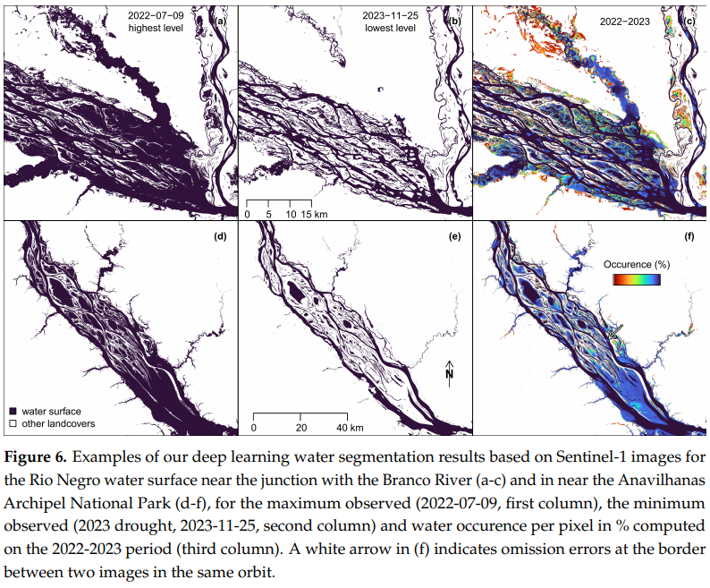
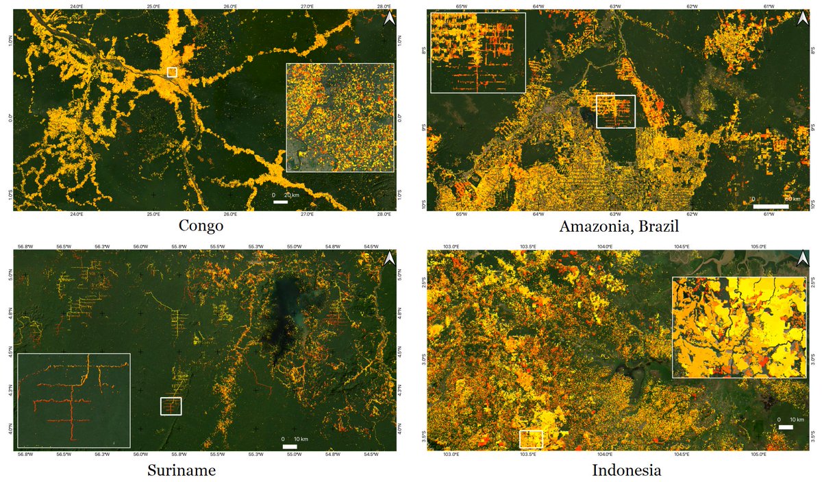
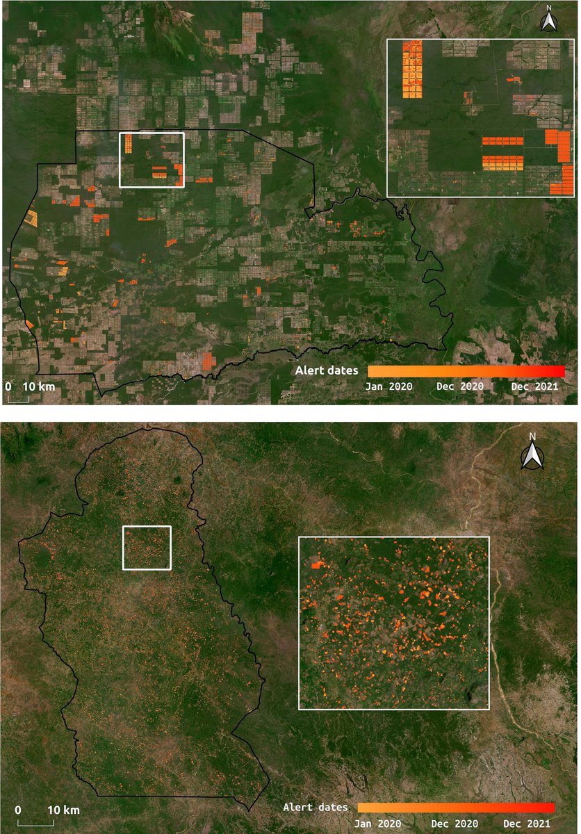
🌳🛰️If you are interested into #Forest disturbance mapping using #DeepLearning and #SAR data Sentinel-1, look at great work from my colleague and friend Adugna G. Mullissa in Remote Sensing of Environment. Good stuff ! Nice figure showing Paraguay and Mozambique. sciencedirect.com/science/articl…

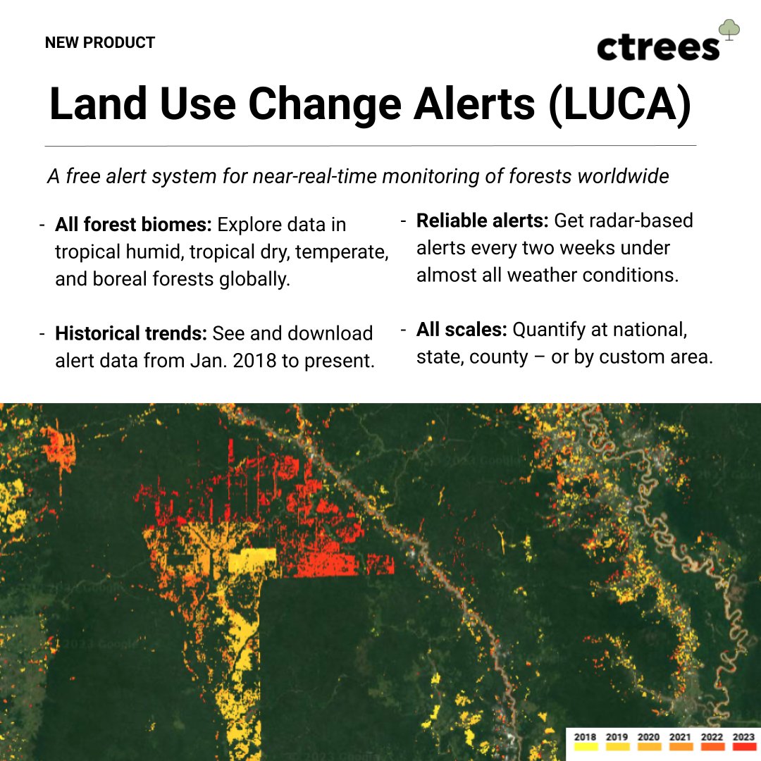
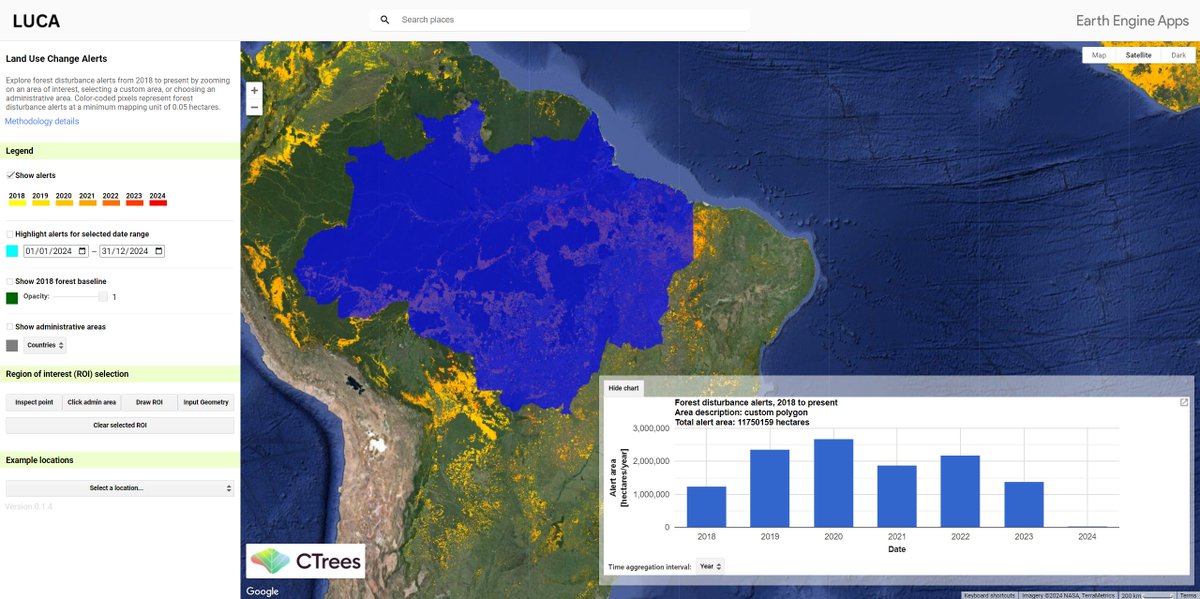
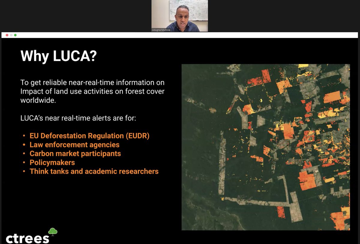
After the nice intro from @daniel_melling, we have Adugna G. Mullissa explaining waht is LUCA, and why is it important and necessary


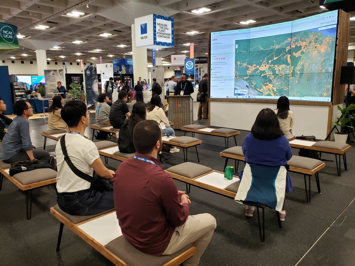
So great to showcase our data product at the #EarthEngine booth at #AGU23. Thanks Justin Braaten for the photo.

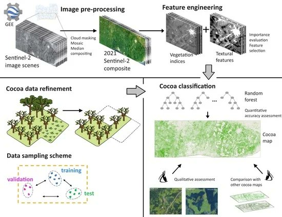
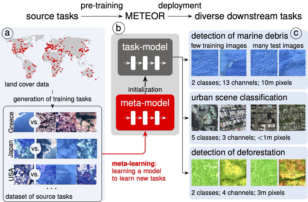
🚨📢 New nature Communications Earth & Environment paper 😀 Meta-learning to address diverse Earth observation problems across resolutions. nature.com/articles/s4324… It's joint work between EPFL and Wageningen U&R and collaborators Sherrie Wang (Massachusetts Institute of Technology (MIT)) Benjamin Kellenberger (Yale University) Ribana Roscher (Forschungszentrum Jülich | @[email protected]) devistuia


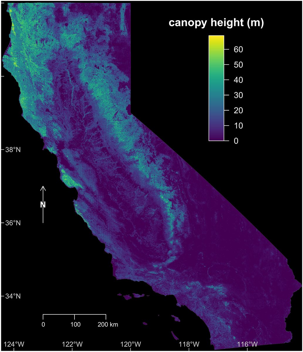
RELEASE: CTrees scientists led by Fabien Wagner have mapped the height of all trees in California by applying a deep learning model to very high resolution aerial imagery. The result is the most accurate map of the state's canopy height to date 🌐🌲ctrees.org/news/californi…


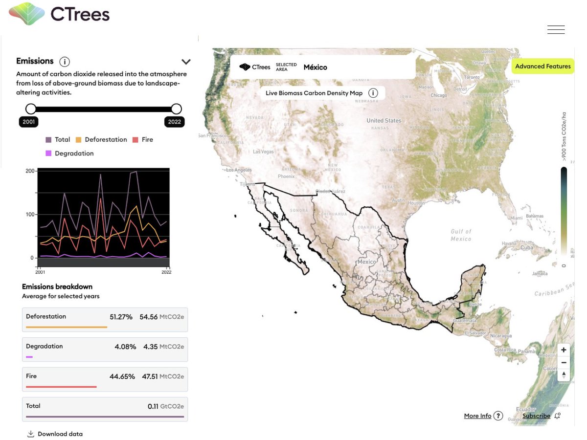
Check out our new REDD+AI platform ctrees.org/reddai that shows tropical forest degradation—from logging, fire, and roads—and tree cover loss in evergreen forests with unprecedented detail. This is v1, so be kind :) v2 coming soon CTrees Ricardo Dalagnol NICFI Satellite Data Program
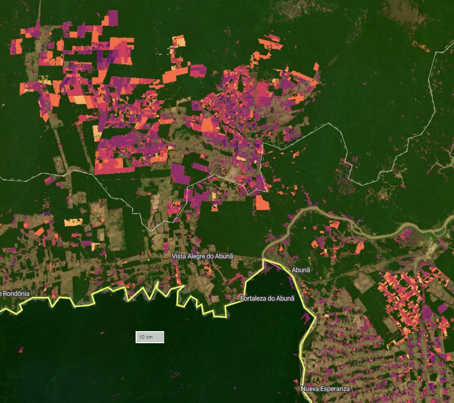

📢🚀Checkout this excellent tropical degradation data from Ricardo Dalagnol and Fabien Wagner. I can’t wait to see its impact on forest conservation efforts worldwide. CTrees


