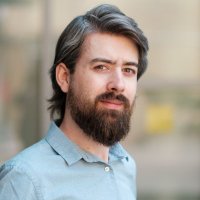
Eun-Kyeong Kim (@ek_geog) 's Twitter Profile
Eun-Kyeong Kim

@ek_geog

Spatial Data Science Lead & Research Associate @LISERinLUX; Mobility, Health, & Climate; Sensors, ML; worked @UZH_GEO; Ph.D. @GeoVISTA_PSU

ID: 2202491618

linkhttps://sites.google.com/view/ekgeog calendar_today19-11-2013 04:42:00

1,1K Tweet

797 Followers

769 Following
Qiusheng Wu (@giswqs) 's Twitter Profile Photo

How to create a #Python package and publish it on PyPI in less than 5 minutes? Video: youtu.be/EIwLZiTuYoA Demo: geosdemo.gishub.org #geospatial #geopython

How to create a #Python package and publish it on PyPI in less than 5 minutes?
Video: youtu.be/EIwLZiTuYoA 
Demo: geosdemo.gishub.org 

#geospatial #geopython
Jakub Nowosad (@jakub_nowosad) 's Twitter Profile Photo

🛰️ A new paper "scikit-eo: A Python package for Remote Sensing Data Analysis" on a tool for #LULC analysis with various machine learning and neural networks algorithms.🛰️ Article: buff.ly/4c34uhg Software: buff.ly/4bT244U #geopython #remotesensing #landcover

🛰️ A new paper "scikit-eo: A Python package for Remote Sensing Data Analysis" on a tool for #LULC analysis with various machine learning and neural networks algorithms.🛰️ 

Article: buff.ly/4c34uhg 
Software: buff.ly/4bT244U 

#geopython #remotesensing #landcover
Arif Masrur, PhD (@arif_masrur) 's Twitter Profile Photo

🔥 New study w/ Manzhu Yu & Alan Taylor “Capturing and interpreting wildfire spread dynamics: attention-based spatiotemporal models using ConvLSTM networks” published in Ecological Informatics: doi.org/10.1016/j.ecoi… #GeoAI #prediction #wildfire #deeplearning

IPCC (@ipcc_ch) 's Twitter Profile Photo

#IPCC #ClimateReport shows heatwaves in Europe will become more frequent, more intense & will last longer. By 2050, about half of the European population may be exposed to high or very high risk of heat stress during summer. ➡️ bit.ly/IICpt13

#IPCC #ClimateReport shows heatwaves in Europe will become more frequent, more intense & will last longer.

By 2050, about half of the European population may be exposed to high or very high risk of heat stress during summer. 

➡️ bit.ly/IICpt13
Dr Robbi Bishop-Taylor 🦋 (@satellitesci) 's Twitter Profile Photo

Here's a mind-blowing open data portal that I think should be far better known than it is: Geoscience Australia's Historical Aerial Photography archive, containing 1.2 million aerial photos from the 1920s on! 🛩 🗺 🤯 Yellow dots = scanned downloadable photos! digital.atlas.gov.au/apps/9a0ecbafe…

UBDC (@urbanbigdata) 's Twitter Profile Photo

UBDC and The Alan Turing Institute are hosting this year's Turing #UrbanAnalytics meeting at University of Glasgow from 11-13 November. There will be lightning talks, keynote presentations, panel discussions, and workshops on the theme of AI and digital twins. Full details: ow.ly/lzMn50T8NG5

UBDC and <a href="/turinginst/">The Alan Turing Institute</a> are hosting this year's Turing #UrbanAnalytics meeting at <a href="/UofGlasgow/">University of Glasgow</a> from 11-13 November. There will be lightning talks, keynote presentations, panel discussions, and workshops on the theme of AI and digital twins. Full details: ow.ly/lzMn50T8NG5
Grant McKenzie (@grantdmckenzie) 's Twitter Profile Photo

We are excited to have Sébastien Gambs give a keynote titled "Re-identification attacks on location data" during the Geoprivacy for Personalized Health workshop on September 13th. Send us an email if you'd like to attend. Eun-Kyeong Kim ptal-io.github.io/gph2024/#keyno…

Henrikki Tenkanen 🌐 htenkanen.bsky.social (@tenkahen) 's Twitter Profile Photo

Interested in High Performance Computing with spatial data? Next Monday 9th Sep at 13:00 (Finnish time) we organise a webinar focusing on training resources for GeoHPC using CSC supercomputing resources. 🤓 The registration is open here: forms.gle/Mw4k56oT2mCMTv… @geoportti

Interested in High Performance Computing with spatial data? Next Monday 9th Sep at 13:00 (Finnish time) we organise a webinar focusing on training resources for GeoHPC using <a href="/CSCfi/">CSC</a> supercomputing resources. 🤓 The registration is open here: forms.gle/Mw4k56oT2mCMTv… @geoportti
CaGIS (@cartographygis) 's Twitter Profile Photo

Yifan Zhang and colleagues present MapGPT: an autonomous framework for mapping by integrating large language model and cartographic tools. Check out the article doi.org/10.1080/152304… (free access) and a video showing the tool youtube.com/watch?v=LIDTn3… #GISchat

Yifan Zhang and colleagues present MapGPT: an autonomous framework for mapping by integrating large language model and cartographic tools. Check out the article doi.org/10.1080/152304… (free access) and a video showing the tool youtube.com/watch?v=LIDTn3… #GISchat
AniMove is on Bluesky @animove-course.bsky.social (@animove) 's Twitter Profile Photo

Some of you have been waiting for this moment.....all lecture recordings including remote sensing and downloads of this years #Animove are online now. 🥳 Happy Learning ! MPI-AB is on Bluesky @mpi-animalbehav.bsky.social Safi_Lab @safilabmpi animove.org/lecture-record…

Grant McKenzie (@grantdmckenzie) 's Twitter Profile Photo

The report from the 2024 "Workshop on #Geoprivacy for Personalized Health" I co-organized with Eun-Kyeong Kim has been published and is available at osf.io/v8g72. The 2nd workshop will take place in Luxembourg in late February. Details TBA.

The report from the 2024 "Workshop on #Geoprivacy for Personalized Health" I co-organized with <a href="/EK_geog/">Eun-Kyeong Kim</a> has been published and is available at osf.io/v8g72.  The 2nd workshop will take place in Luxembourg in late February. Details TBA.
Song Gao (@gissong) 's Twitter Profile Photo

It is my great honor and pleasure to be invited as a keynote speaker for the 2024 Korean Conference in Geospatial Information Science in conjunction with the industry annual event K-Geo-Festa! #GeoAI R&D has been rapidly growing in Korea through academia-industry collaboration!

It is my great honor and pleasure to be invited as a keynote speaker for the 2024 Korean Conference in Geospatial Information Science in conjunction with the industry annual event K-Geo-Festa! #GeoAI R&amp;D has been rapidly growing in Korea through academia-industry collaboration!
Grant McKenzie (@grantdmckenzie) 's Twitter Profile Photo

The call for participation in our 2nd Workshop on "Geoprivacy for Personalized Health" is online. It will be in Luxembourg this year, Feb 26 - Mar 1. Limited travel funding is available. Details at the link below. Eun-Kyeong Kim sites.google.com/view/ekgeog/ev…
Konstantin Klemmer (@kklmmr) 's Twitter Profile Photo

Off to #AAAI25! We're presenting #SatCLIP (joint work w/ Marc Rußwurm, Esther Rolf, Caleb Robinson & Lester Mackey) at the 12.30-2.30pm poster session on Friday, Feb 28! Let me know if you're around & want to chat #GeoAI!🛰️ Paper: arxiv.org/abs/2311.17179 Code: github.com/microsoft/satc…

Off to #AAAI25! We're presenting #SatCLIP (joint work w/ <a href="/MarcCoru/">Marc Rußwurm</a>, <a href="/rolf_comma_e/">Esther Rolf</a>, <a href="/calebrob6/">Caleb Robinson</a> &amp; <a href="/LesterMackey/">Lester Mackey</a>) at the 12.30-2.30pm poster session on Friday, Feb 28! Let me know if you're around &amp; want to chat #GeoAI!🛰️

Paper: arxiv.org/abs/2311.17179
Code: github.com/microsoft/satc…
Xihan Yao (@yaoxihan) 's Twitter Profile Photo

🎉 Two years after my graduation from Berkeley, my thesis is now published in Landscape and Urban Planning! We used LiDAR + microclimate simulation to reveal urban forest equity gaps in Portland, OR. 📄 Read: lnkd.in/gegZwn4W #UrbanForests #LiDAR #GIS #UrbanEquity

🎉 Two years after my graduation from Berkeley, my thesis is now published in Landscape and Urban Planning!
We used LiDAR + microclimate simulation to reveal urban forest equity gaps in Portland, OR.
📄 Read: lnkd.in/gegZwn4W
#UrbanForests #LiDAR #GIS #UrbanEquity