BetzyEO (@eobetzy) 's Twitter Profile
BetzyEO

@eobetzy

#EarthObservation scientist supporting #CapacityBuilding / int'l development. Tweets are my own; retweets ≠ endorsements.

ID: 1008034900488933376

calendar_today16-06-2018 17:13:43

8,8K Tweet

3,3K Followers

2,2K Following
🇧🇿 Belize GEO 🛰️ (@bzgeo) 's Twitter Profile Photo

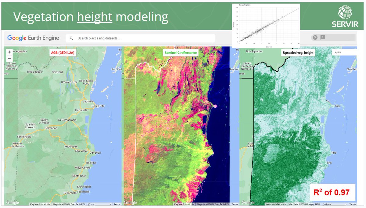
#ICYMI: It was a pleasure being able to lead a #geospatial studio activity last week at NC State Center for Geospatial Analytics focusing on the use of #EarthEngine for land cover change and veg. height estimation, leveraging resources from Robert Kennedy, GEDI, and @SpatialThoughts! 😉
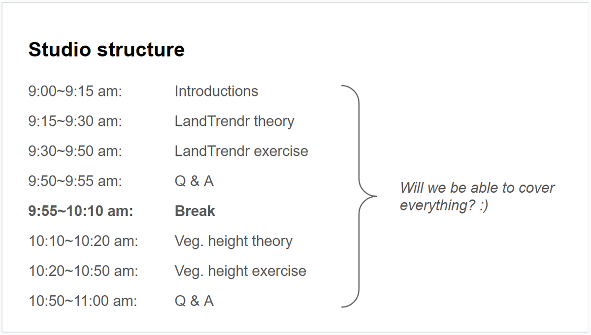
#ICYMI: It was a pleasure being able to lead a #geospatial studio activity last week at <a href="/NCSUgeospatial/">NC State Center for Geospatial Analytics</a> focusing on the use of #EarthEngine for land cover change and veg. height estimation, leveraging resources from <a href="/GeoTrendRob/">Robert Kennedy</a>, <a href="/GEDI_Knights/">GEDI</a>, and @SpatialThoughts! 😉
🇧🇿 Belize GEO 🛰️ (@bzgeo) 's Twitter Profile Photo

2/n: BTW, which resources from @SpatialThoughts and GEDI did we leverage for last week's studio activity at NC State Center for Geospatial Analytics? 🤔 We used a tutorial + code that Ujaval shared earlier this year (⬇️) re: how to upscale GEDI data. 🧐 x.com/spatialthought…

2/n: BTW, which resources from @SpatialThoughts and <a href="/GEDI_Knights/">GEDI</a> did we leverage for last week's studio activity at <a href="/NCSUgeospatial/">NC State Center for Geospatial Analytics</a>? 🤔

We used a tutorial + code that Ujaval shared earlier this year (⬇️) re: how to upscale GEDI data. 🧐
x.com/spatialthought…
IEEE Geoscience and Remote Sensing Society (@ieee_grss) 's Twitter Profile Photo

🌍✨ Looking for insights on AI strategy and scaling data science? Meet Dr. Manil Maskey (Manil Maskey, PhD), NASA's data expert and the trusted voice in community-driven data solutions. In our next episode of Down to Earth, Manil dives into the power of data quality, diversity, and

Remote Sensing MDPI (@remotesens_mdpi) 's Twitter Profile Photo

🌾🌽🌿 The #Classification Method Study of #Crops Remote Sensing with #DeepLearning, Machine Learning, and #GoogleEarthEngine ✍️ Jinxi Yao et al. 🔗 mdpi.com/2072-4292/14/1…

🌾🌽🌿 The #Classification Method Study of #Crops Remote Sensing with #DeepLearning, Machine Learning, and #GoogleEarthEngine

✍️ Jinxi Yao et al.
🔗 mdpi.com/2072-4292/14/1…
🇧🇿 Belize GEO 🛰️ (@bzgeo) 's Twitter Profile Photo

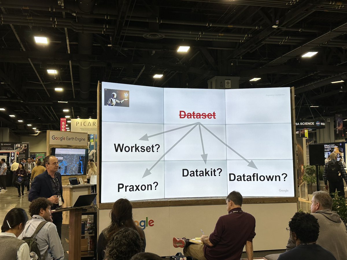
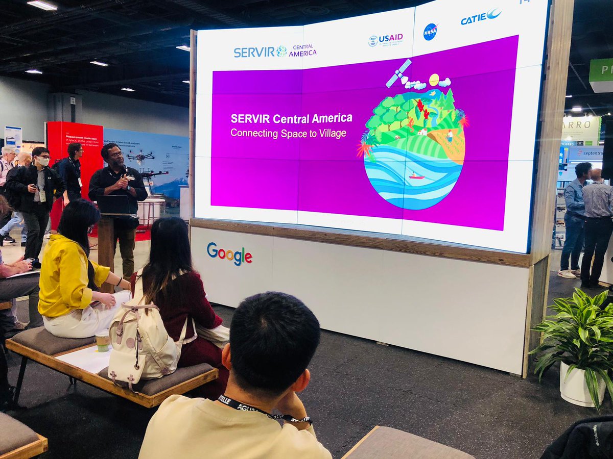
Are you at #AGU24? 🤔 If you're interested in hearing about how SERVIR Global / UAH Lab for Applied Science scientists are using #EarthEngine to bridge #LandCover monitoring and #OpenScience, come to the Google booth in the Exhibition Hall from 11:00-11:30 am today! 😉
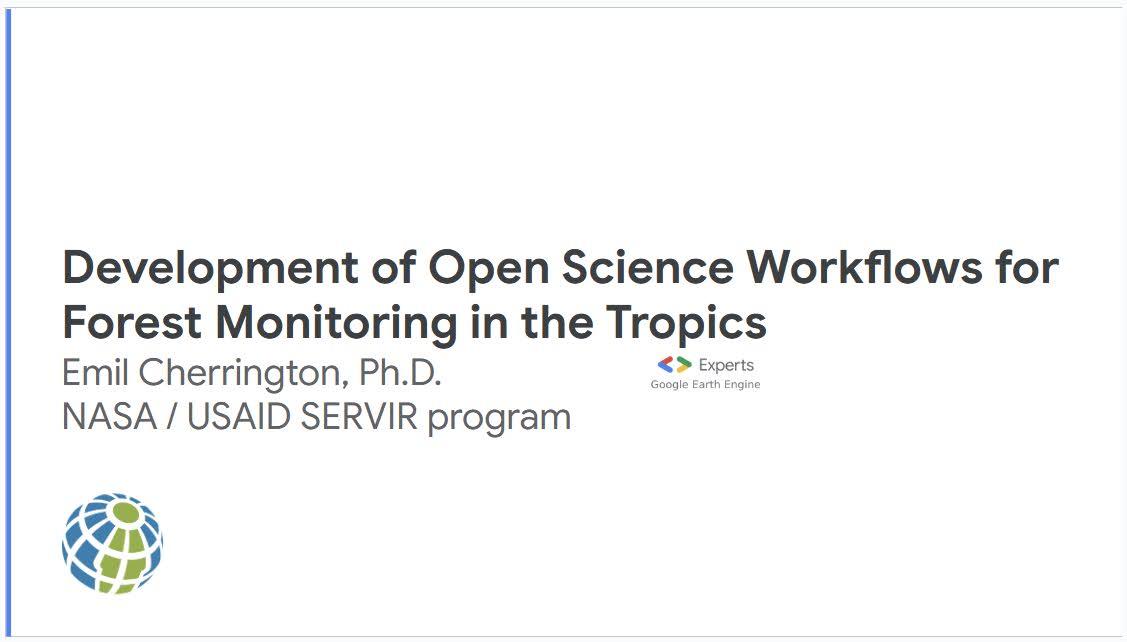

Are you at #AGU24? 🤔 If you're interested in hearing about how <a href="/SERVIRGlobal/">SERVIR Global</a> / <a href="/UAH_LAS/">UAH Lab for Applied Science</a> scientists are using #EarthEngine to bridge #LandCover monitoring and #OpenScience, come to the <a href="/Google/">Google</a> booth in the Exhibition Hall from 11:00-11:30 am today! 😉

Harvest (@harvestprogram) 's Twitter Profile Photo

Our second oral session at #AGU24 had some great presentations! We learned about new techniques for predicting crop yields at the scale of single fields; the use of SAR #EOdata for monitoring cropland flooding; and a lot more!

Our second oral session at #AGU24 had some great presentations! 

We learned about new techniques for predicting crop yields at the scale of single fields; the use of SAR #EOdata for monitoring cropland flooding; and a lot more!
NASAEarthdata (@nasaearthdata) 's Twitter Profile Photo

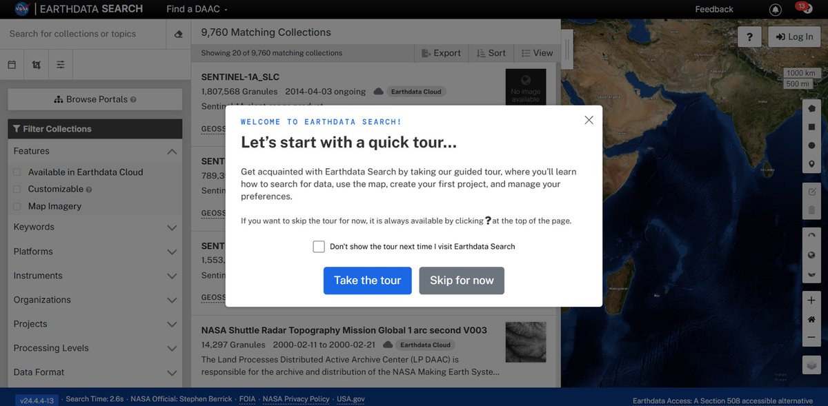
Using NASA Earthdata Search just got easier. A new guided tour has been added to Earthdata Search that shows you how to use Earthdata Search to search for data, use the map, create your first project, and manage your preferences. Get started at: search.earthdata.nasa.gov

Using NASA Earthdata Search just got easier. A new guided tour has been added to Earthdata Search that shows you how to use Earthdata Search to search for data, use the map, create your first project, and manage your preferences.  

Get started at: search.earthdata.nasa.gov
Harvest (@harvestprogram) 's Twitter Profile Photo

NASA Harvest had so many presenters in different sessions this week at #AGU24! We’re happy to share some of them with you over the next few days! Gedeon Muhawenayo is studying the impact of conflict on agricultural land in Sudan using machine learning & #EOData.

NASA Harvest had so many presenters in different sessions this week at #AGU24! We’re happy to share some of them with you over the next few days!

Gedeon Muhawenayo is studying the impact of conflict on agricultural land in Sudan using machine learning &amp; #EOData.
CATIE (@catieoficial) 's Twitter Profile Photo

🌎 Emil Cherrington, de NASA , presentó en AGU los avances en workflows de ciencia abierta para el monitoreo forestal. Destacó el trabajo con el Departamento Forestal de Belice y #SERVIRCA para crear un mapa nacional de cobertura terrestre. 🗺️ 👉 servir.catie.ac.cr USAID/El Salvador

🌎 Emil Cherrington, de <a href="/NASA/">NASA</a> , presentó en AGU los avances en workflows de ciencia abierta para el monitoreo forestal. Destacó el trabajo con el Departamento Forestal de Belice y #SERVIRCA para crear un mapa nacional de cobertura terrestre. 🗺️
👉 servir.catie.ac.cr
<a href="/USAIDES/">USAID/El Salvador</a>
🇧🇿 Belize GEO 🛰️ (@bzgeo) 's Twitter Profile Photo

#AGU24: This morning, it was great to see the Franz J Meyer present the outcomes of his ongoing SERVIR Global Applied Science Team project co-developed w/ @ICIMOD / SERVIR-HKH, on flood mapping using #SAR. 🧐 #GoldenAgeOfSAR

#AGU24: This morning, it was great to see the <a href="/SARevangelist/">Franz J Meyer</a> present the outcomes of his ongoing <a href="/SERVIRGlobal/">SERVIR Global</a> Applied Science Team project co-developed w/ @ICIMOD / SERVIR-HKH, on flood mapping using #SAR. 🧐 #GoldenAgeOfSAR
🇧🇿 Belize GEO 🛰️ (@bzgeo) 's Twitter Profile Photo

One of the last #AGU24 sessions I caught was "A Vision for What's Next: NASA’s Evolving Data, Software, and Science II," convened by Dr. Dr. Chelle Gentemann et al. In it, Dr. @steadyflux delivered a great talk on NASAEarthdata. 👏 It was great to be back at AGU in person! 😉
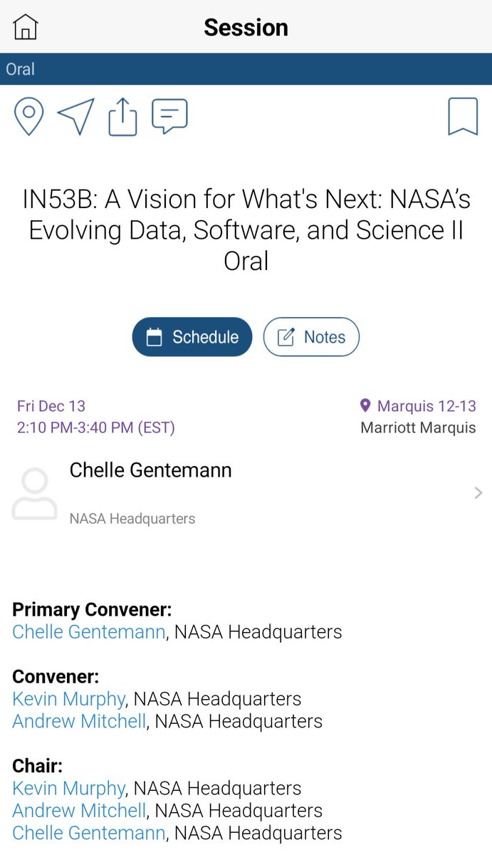
One of the last #AGU24 sessions I caught was "A Vision for What's Next: NASA’s Evolving Data, Software, and Science II," convened by Dr. <a href="/ChelleGentemann/">Dr. Chelle Gentemann</a> et al. In it, Dr. @steadyflux delivered a great talk on <a href="/NASAEarthData/">NASAEarthdata</a>. 👏 It was great to be back at AGU in person! 😉
CATIE (@catieoficial) 's Twitter Profile Photo

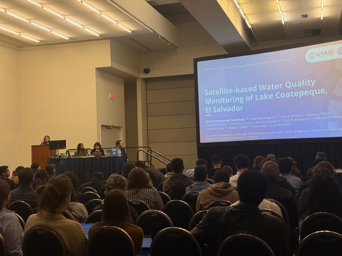
🌎📡 ¡Ciencia al servicio de la región! En #AGU24, BetzyEO de NASA presentó avances en monitoreo satelital de cuerpos de agua en #Centroamérica. 💧🛰️ Destacó el rol clave del hub SERVIR Centroamérica en CATIE, impulsando resiliencia con tecnología geoespacial. 🤝🌱 #SERVIRCA

🌎📡 ¡Ciencia al servicio de la región! En #AGU24, <a href="/EOBetzy/">BetzyEO</a> de <a href="/NASA/">NASA</a> presentó avances en monitoreo satelital de cuerpos de agua en #Centroamérica. 💧🛰️
Destacó el rol clave del hub SERVIR Centroamérica en CATIE, impulsando resiliencia con tecnología geoespacial. 🤝🌱 #SERVIRCA
Geo-spatial Information Science (@gsisoffice) 's Twitter Profile Photo

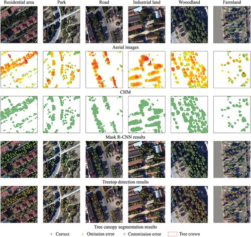
🛰️ Why this matters: Urban trees improve air quality, reduce heat, and enhance quality of life. But field surveys for tree counting are time-consuming and expensive. Our method combines deep learning and CHM data to map trees across various urban landscapes with >95% accuracy! 💡

🛰️ Why this matters:
Urban trees improve air quality, reduce heat, and enhance quality of life. But field surveys for tree counting are time-consuming and expensive.
Our method combines deep learning and CHM data to map trees across various urban landscapes with &gt;95% accuracy! 💡
NASA Landsat (@nasa_landsat) 's Twitter Profile Photo

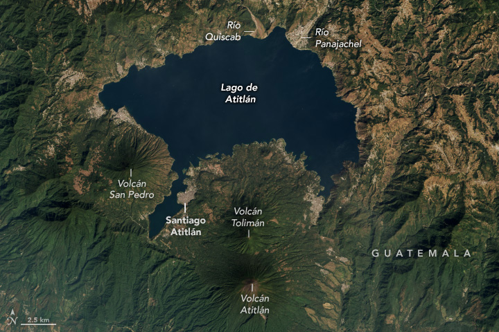
Between 158,000 and 40,000 years ago, a super-eruption dramatically reshaped the landscape of Guatemala, creating Lago de Atitlán. 🌋 #Landsat 8 data were draped over a digital elevation model from NASA’s SRTM to emphasize the area’s terrain. go.nasa.gov/400oNrR

Between 158,000 and 40,000 years ago, a super-eruption dramatically reshaped the landscape of Guatemala, creating Lago de Atitlán. 🌋

#Landsat 8 data were draped over a digital elevation model from NASA’s SRTM to emphasize the area’s terrain. go.nasa.gov/400oNrR
Geo-spatial Information Science (@gsisoffice) 's Twitter Profile Photo

🌆🔥 New Research Alert! How do #LandSurfaceTemperature (LST) & near-surface air temperature (TAIR) vary in an arid-to-semiarid urban region like Amman-Zarqa? 🤔 Our findings uncover key insights for #UrbanHeatIsland (UHI) research & sustainable urban planning! 🧵👇

🌆🔥 New Research Alert!
How do #LandSurfaceTemperature (LST) &amp; near-surface air temperature (TAIR) vary in an arid-to-semiarid urban region like Amman-Zarqa? 🤔
Our findings uncover key insights for #UrbanHeatIsland (UHI) research &amp; sustainable urban planning! 🧵👇
NASAEarthdata (@nasaearthdata) 's Twitter Profile Photo

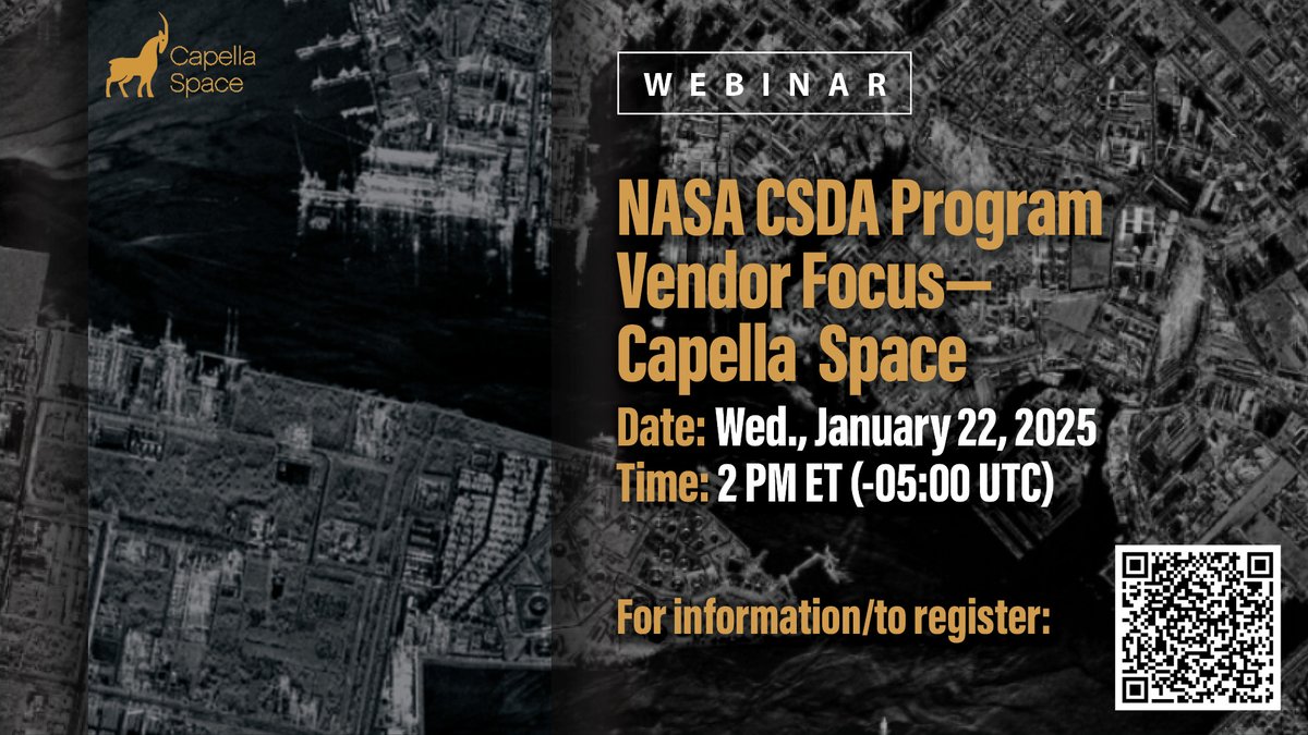
Join us on Wed., Jan. 22, 2025 to learn more about the NASA Commercial Satellite Data Acquisition (CSDA) program vendor Capella Space and how to discover, access, and work with their #SAR data products. For information/to register: go.nasa.gov/3PmrwqK

Join us on Wed., Jan. 22, 2025 to learn more about the NASA Commercial Satellite Data Acquisition (CSDA) program vendor Capella Space and how to discover, access, and work with their #SAR data products.

For information/to register: go.nasa.gov/3PmrwqK