Esri India (@esriindia) 's Twitter Profile
Esri India

@esriindia

Esri India offers end-to-end GIS based solutions including software products, application development, training, data conversion and technical support.

ID: 1023621674

linkhttps://www.esri.in/ calendar_today20-12-2012 06:02:10

5,5K Tweet

3,3K Followers

3,3K Following

Esri India (@esriindia) 's Twitter Profile Photo

Rohit Singh (Director, Esri R&D Center, New Delhi) takes the audience through advanced GeoAI and AI capabilities within ArcGIS systems, including several vision-learning models. #EsriIndiaDevSummit

Rohit Singh (Director, Esri R&D Center, New Delhi) takes the audience through advanced GeoAI and AI capabilities within ArcGIS systems, including several vision-learning models.

#EsriIndiaDevSummit
Esri India (@esriindia) 's Twitter Profile Photo

Sessions have begun after lunch, where the team takes the audience through ArcGIS Enterprise for Developers and ArcGIS location platform. #EsriIndiaDevSummit

Sessions have begun after lunch, where the team takes the audience through ArcGIS Enterprise for Developers and ArcGIS location platform.

#EsriIndiaDevSummit
Esri India (@esriindia) 's Twitter Profile Photo

Vijay Kumar (CTO, Esri India) opened Day 2 of the #EsriIndiaDevSummit with a preview of the day's agenda. Multiple sessions throughout the day will focus on showcasing advanced developer tools in ArcGIS, designed to power in-depth analysis and streamline data management.

Vijay Kumar (CTO, Esri India) opened Day 2 of the #EsriIndiaDevSummit with a preview of the day's agenda. Multiple sessions throughout the day will focus on showcasing advanced developer tools in ArcGIS, designed to power in-depth analysis and streamline data management.
Esri India (@esriindia) 's Twitter Profile Photo

Detailed sessions have now begun, with parallel tracks diving deep into advanced ArcGIS capabilities. In our first session, Esri India experts explore deep learning models in ArcGIS designed to enhance imagery interpretation and 3D data analysis. #EsriIndiaDevSummit

Detailed sessions have now begun, with parallel tracks diving deep into advanced ArcGIS capabilities.

In our first session, Esri India experts explore deep learning models in ArcGIS designed to enhance imagery interpretation and 3D data analysis. 

#EsriIndiaDevSummit
Esri India (@esriindia) 's Twitter Profile Photo

A separate session delves into powerful 3D data visualization and analysis capabilities available with ArcGIS Maps SDK for JavaScript. #EsriIndiaDevSummit

A separate session delves into powerful 3D data visualization and analysis capabilities available with ArcGIS Maps SDK for JavaScript.

#EsriIndiaDevSummit
Esri India (@esriindia) 's Twitter Profile Photo

The second session of the day focused on real-time data reporting using GeoEvent Server, highlighting key use cases such as personnel tracking, anomaly detection, and asset monitoring. #EsriIndiaDevSummit

The second session of the day focused on real-time data reporting using GeoEvent Server, highlighting key use cases such as personnel tracking, anomaly detection, and asset monitoring.

#EsriIndiaDevSummit
Esri India (@esriindia) 's Twitter Profile Photo

In the third session, Rohit Singh (Director, Esri R&D Center, New Delhi), along with Esri India experts, demonstrated how to integrate GeoAI models within ArcGIS and shared key optimization tips such as cell size & threshold values to improve output quality. #EsriIndiaDevSummit

In the third session, Rohit Singh (Director, Esri R&D Center, New Delhi), along with Esri India experts, demonstrated how to integrate GeoAI models within ArcGIS and shared key optimization tips such as cell size & threshold values to improve output quality.

#EsriIndiaDevSummit
Esri India (@esriindia) 's Twitter Profile Photo

In a parallel session, the focus was on ArcGIS Field Maps, showcasing how Arcade can be used to enhance situational awareness through advanced analysis, conditional visibility, and dynamic map visualizations. #EsriIndiaDevSummit

In a parallel session, the focus was on ArcGIS Field Maps, showcasing how Arcade can be used to enhance situational awareness through advanced analysis, conditional visibility, and dynamic map visualizations.

#EsriIndiaDevSummit
Esri India (@esriindia) 's Twitter Profile Photo

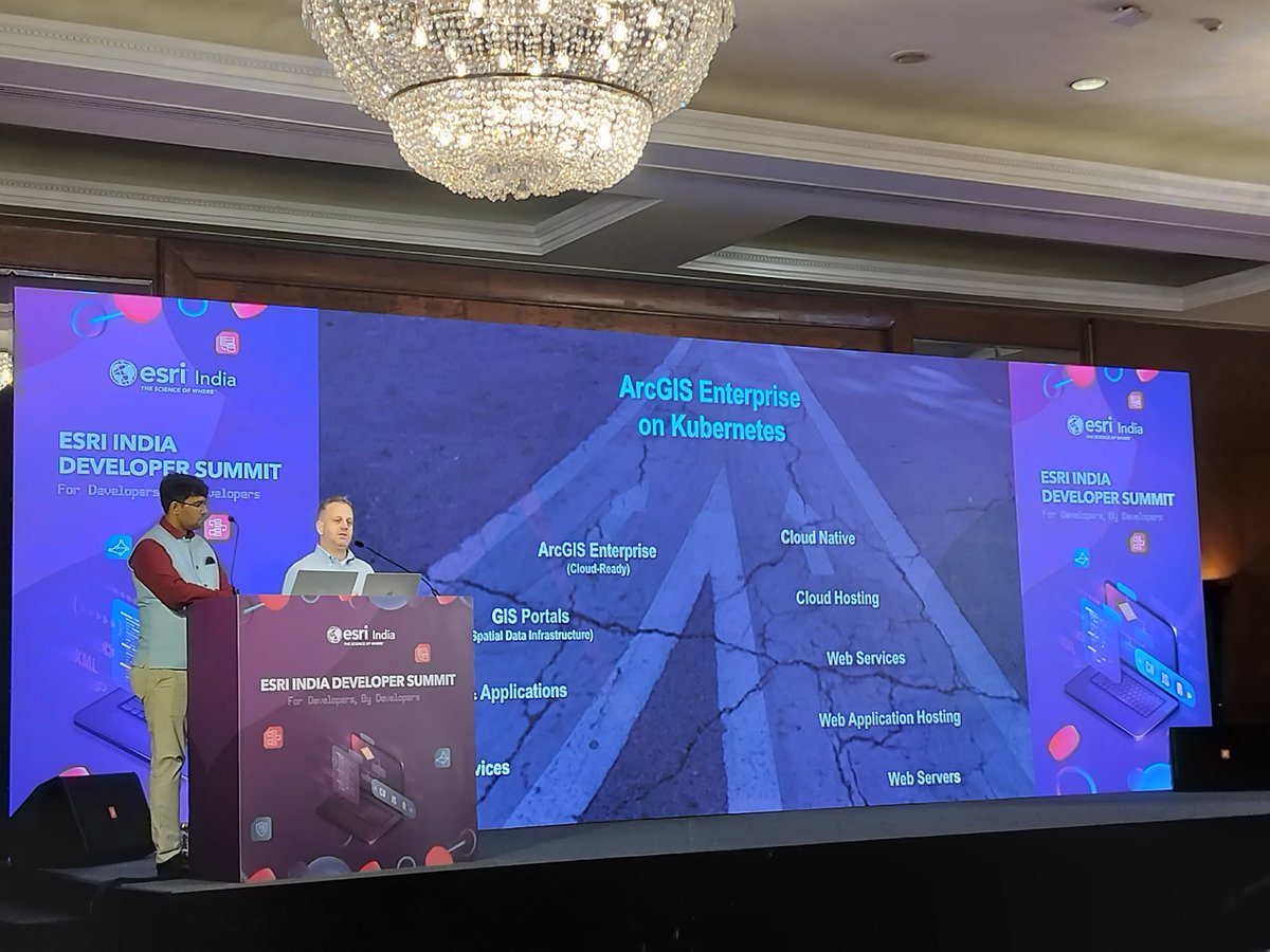
As the day progresses toward its final sessions, the team presents the cloud-native architecture of ArcGIS Enterprise for Kubernetes. The session highlighted how this setup enables rapid scalability, high availability, and simplified administration. #EsriIndiaDevSummit

As the day progresses toward its final sessions, the team presents the cloud-native architecture of ArcGIS Enterprise for Kubernetes. The session highlighted how this setup enables rapid scalability, high availability, and simplified administration.

#EsriIndiaDevSummit
Esri India (@esriindia) 's Twitter Profile Photo

In parallel, another session focused on the Utility Network using the ArcGIS Maps SDK for JavaScript, showcasing its capabilities for editing, visualizing, and tracing utility networks directly within a web browser. #EsriImdiaDevSummit

In parallel, another session focused on the Utility Network using the ArcGIS Maps SDK for JavaScript, showcasing its capabilities for editing, visualizing, and tracing utility networks directly within a web browser.

#EsriImdiaDevSummit