Tim Schmit (@goesguy) 's Twitter Profile
Tim Schmit

@goesguy

Satellite Research Meteorologist in Madison, WI. Likes GOES. Views posted here are my own. Photo: Fran Virum.

ID: 722499356969066496

linkhttp://cimss.ssec.wisc.edu/goes/goesdata.html calendar_today19-04-2016 18:57:24

12,12K Tweet

2,2K Followers

1,1K Following

AerosolWatch (@aerosolwatch) 's Twitter Profile Photo

The ABI sensor on NOAA Satellites GOES-East observed numerous smoke plumes, highlighted by the Aerosol Detection Product (ADP, lavender shading) from a mix of wildfires & prescribed fires (yellow dots, Fire Radiative Power) across the Southeast US yesterday afternoon 16 Apr.

UW-Madison CIMSS (@uwcimss) 's Twitter Profile Photo

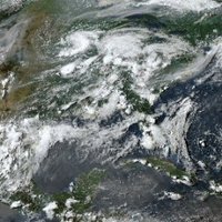
1-min #GOES19/#GOESEast Visible images with time-matched plots of SPC Storm Reports showed the thunderstorms that were prolific producers of tornadoes, large hail & damaging winds across eastern Nebraska & western Iowa on 17 April: cimss.ssec.wisc.edu/satellite-blog… #NEwx #IAwx NWS Omaha


NWS Milwaukee (@nwsmilwaukee) 's Twitter Profile Photo

Light rain continues near the WI-IL border through 4 PM. Additional scattered storms are possible after 5 PM over west-central and southwest WI. An isolated strong to severe storm can't be ruled out in this area. Main threats will be gusty winds and hail in any stronger storms.

Light rain continues near the WI-IL border through 4 PM. Additional scattered storms are possible after 5 PM over west-central and southwest WI. An isolated strong to severe storm can't be ruled out in this area. Main threats will be gusty winds and hail in any stronger storms.
UW-Madison CIMSS (@uwcimss) 's Twitter Profile Photo

A 2-day loop of NOAA Satellites #GOESEast Fire Temperature RGB showed that while the #JonesRoadWildfire was 50% contained as of yesterday, there was a brief flare-up that afternoon. #GOES19 sensed an IR temperature equal to the Band 7 detector saturation: cimss.ssec.wisc.edu/satellite-blog…

NWS Atlanta (@nwsatlanta) 's Twitter Profile Photo

Congratulations to these three meteorologists who worked their last shifts on April 30th. They have a combined 93 years of National Weather Service experience across nine different forecast offices! Thanks for your dedication and service! #gawx

Congratulations to these three meteorologists who worked their last shifts on April 30th. They have a combined 93 years of National Weather Service experience across nine different forecast offices! Thanks for your dedication and service! #gawx
Dr. Ryan French (@ryanjfrench) 's Twitter Profile Photo

The entirety of April 2025 in the Sun's atmosphere! Sunspot levels continue at the medium level, further validating that solar maximum has likely already passed (last year). Solar flare activity was average too, with the strongest event being an M5 level. #spaceweather #astronomy

American Meteorological Society (@ametsoc) 's Twitter Profile Photo

The National Climate Assessment's authors and support staff were dismissed this week. AMS and AGU (American Geophysical Union) are stepping up to continue the momentum of vital U.S. climate research and analysis with a new open-access publishing effort. Read more here: bit.ly/4m3zRi8

The National Climate Assessment's authors and support staff were dismissed this week. AMS and <a href="/theAGU/">AGU (American Geophysical Union)</a> are stepping up to continue the momentum of vital U.S. climate research and analysis with a new open-access publishing effort.

Read more here: bit.ly/4m3zRi8
UW-Madison CIMSS (@uwcimss) 's Twitter Profile Photo

A lightning strike at Lake Murray in South Carolina resulted in 20 injuries with 15 hospitalizations on 24 June - the LightningCast product provided some lead time before NOAA Satellites #GOESEast #GLM lightning detection. More on the CIMSS Satellite Blog: cimss.ssec.wisc.edu/satellite-blog…

NWS La Crosse (@nwslacrosse) 's Twitter Profile Photo

Getting an early start today with the severe weather. A severe weather watch will likely be needed in the coming hours as storms start to build into our area. More in depth details below ⬇️ spc.noaa.gov/products/md/md…

Getting an early start today with the severe weather. A severe weather watch will likely be needed in the coming hours as storms start to build into our area. More in depth details below ⬇️

spc.noaa.gov/products/md/md…
Diego Souza 📡🛰🌎 (@drodsouza) 's Twitter Profile Photo

🚀 ¡Inscripciones abiertas! Participa en el NOAA Satellites Hackathon 2025 🛰️ Una experiencia única para innovar, aprender y colaborar con expertos del mundo satelital. 📅 Octubre 2025 (virtual) 🔗 Regístrate aquí: noaasathack2025.sched.com #NOAASatHack #Hackathon #NOAA

🚀 ¡Inscripciones abiertas!

Participa en el NOAA Satellites Hackathon 2025 🛰️

Una experiencia única para innovar, aprender y colaborar con expertos del mundo satelital.

📅 Octubre 2025 (virtual)
🔗 Regístrate aquí: noaasathack2025.sched.com

#NOAASatHack #Hackathon #NOAA
Matthew Cappucci (@matthewcappucci) 's Twitter Profile Photo

BREAKING: A meteor just exploded over Atlanta and appears to have potentially left shards somewhere in South Carolina! The American Meteor Society has 128 formal reports pending of a fireball spotted around 12:24 PM Eastern time. It appears to have passed over Atlanta and

BREAKING: A meteor just exploded over Atlanta and appears to have potentially left shards somewhere in South Carolina!

The American Meteor Society has 128 formal reports pending of a fireball spotted around 12:24 PM Eastern time. It appears to have passed over Atlanta and
NWS Milwaukee (@nwsmilwaukee) 's Twitter Profile Photo

Scattered strong to severe storms are expected to develop this afternoon along a northward moving warm front, and over the lake breeze in southeast WI. Damaging winds, frequent lightning, and brief tornadoes are the main hazards. Stay weather aware! #wiwx

Scattered strong to severe storms are expected to develop this afternoon along a northward moving warm front, and over the lake breeze in southeast WI. Damaging winds, frequent lightning, and brief tornadoes are the main hazards. Stay weather aware! #wiwx
UW-Madison CIMSS (@uwcimss) 's Twitter Profile Photo

Scott Lindstrom has published his last CIMSS Blog post. A very happy Retirement to him! cimss.ssec.wisc.edu/satellite-blog…

Bill Line (@bill_line) 's Twitter Profile Photo

Severe thunderstorm over southeast Arizona yesterday (6/30) shown in GOES-West 1-min VIS/IR Sandwich Imagery. More satellite imagery from yesterday's southwest US thunderstorms: satelliteliaisonblog.wordpress.com/2025/07/01/sou…