Geological Survey IE (@geolsurvie) 's Twitter Profile
Geological Survey IE

@geolsurvie

Geological Survey Ireland - A division of @Dept_ECC. Groundwater:@GsiGroundwater INFOMAR:@followtheboats Tellus:@TellusGSI

ID: 778917509684756481

linkhttp://www.gsi.ie calendar_today22-09-2016 11:23:01

4,4K Tweet

4,4K Followers

1,1K Following

Geological Survey IE (@geolsurvie) 's Twitter Profile Photo

April's image for Geological Survey Ireland, @Dept_ECC is of An Branán Mór sea stack, Cliffs of Moher, Co Clare. It shows horizontal beds of Carboniferous mudstone, siltstone, & sandstone of the Central Clare Group. Photo by: James Grandfield.

April's image for Geological Survey Ireland, @Dept_ECC is of An Branán Mór sea stack, Cliffs of Moher, Co Clare.

It shows horizontal beds of Carboniferous mudstone, siltstone, & sandstone of the Central Clare Group.

Photo by: James Grandfield.
Ireland's Fossil Heritage (@irishfossils) 's Twitter Profile Photo

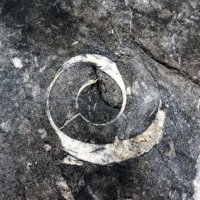
#TheGreatIrishFossilHunt is here! We need your help to find fossils in natural rocky outcrops and also in urban buildings and footpaths. Simply take a picture of any fossil you find send it to us! For more information, visit our website:ucc.ie/en/fossil-heri… Let the hunt begin!

#TheGreatIrishFossilHunt is here!
We need your help to find fossils in natural rocky outcrops and also in urban buildings and footpaths. Simply take a picture of any fossil you find send it to us! For more information, visit our website:ucc.ie/en/fossil-heri…
Let the hunt begin!
INFOMAR (@followtheboats) 's Twitter Profile Photo

Congrats to all involved in delivering the 2025 #INFOMAR #SeabedMapping MSc module co-created with Maynooth Geography . Students built ocean data skills to power Ireland’s #BlueEconomy! Read all about it 👉 infomar.ie/node/591 Dept. Environment, Climate and Communications Geological Survey IE Marine Institute

Congrats to all involved in delivering the 2025 #INFOMAR #SeabedMapping MSc module co-created with <a href="/Maynoothgeog/">Maynooth Geography</a>   . Students built ocean data skills to power Ireland’s #BlueEconomy!

Read all about it 👉 infomar.ie/node/591

<a href="/Dept_ECC/">Dept. Environment, Climate and Communications</a>    <a href="/GeolSurvIE/">Geological Survey IE</a>    <a href="/MarineInst/">Marine Institute</a>
Geological Survey IE (@geolsurvie) 's Twitter Profile Photo

April's County Geological Site for Geological Survey IE @Dept_ECC is is Murrens Esker, Co Meath & Co Westmeath. Murrens Esker formed by the deposition of sand and gravel by a subglacial river extending over 15km between counties Meath & Westmeath. More info: gsi.ie

April's County Geological Site for <a href="/GeolSurvIE/">Geological Survey IE</a> @Dept_ECC is is Murrens Esker, Co Meath &amp; Co Westmeath.

Murrens Esker formed by the deposition of sand and gravel by a subglacial river extending over 15km between counties Meath &amp; Westmeath.

More info: gsi.ie
Geological Survey IE (@geolsurvie) 's Twitter Profile Photo

Geological Survey Ireland, a division of Dept. Environment, Climate and Communications is pleased to announce the opening of the 2025 Graduate Geologists job competition. There are 6 positions, each of 11 months duration. More info: gsi.ie/en-ie/events-a…
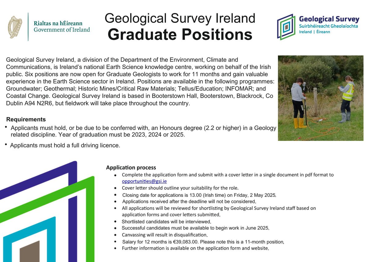
Geological Survey Ireland, a division of <a href="/Dept_ECC/">Dept. Environment, Climate and Communications</a> is pleased to announce the opening of the 2025 Graduate Geologists job competition. There are 6 positions, each of 11 months duration.

More info: gsi.ie/en-ie/events-a…
QuakeShake (@quakeshake_) 's Twitter Profile Photo

A Magnitude 6.2 earthquake occurred 21 km SE of Marmara Ereğlisi, Turkey 2025-04-23 09:49:10 (UTC time)🇹🇷. The epicentre is located approximately 40 kilometers southwest of Istanbul, in the Sea of Marmara. Several aftershocks followed the initial including one registering M5.3.

A Magnitude 6.2 earthquake occurred 21 km SE of Marmara Ereğlisi, Turkey 2025-04-23 09:49:10 (UTC time)🇹🇷. The epicentre is located approximately 40 kilometers southwest of Istanbul, in the Sea of Marmara. Several aftershocks followed the initial  including one registering M5.3.
Geological Survey IE (@geolsurvie) 's Twitter Profile Photo

📣 Only 1 week left to apply for the 2025 Graduate Geologist job competition at Geological Survey IE , @Dept_ECC There are 6 Graduate Geologist positions, each of 11 months duration. More info: gsi.ie

📣 Only 1 week left to apply for the 2025 Graduate Geologist job competition at <a href="/GeolSurvIE/">Geological Survey IE</a> , @Dept_ECC
There are 6 Graduate Geologist positions, each of 11 months duration.

More info: gsi.ie
INFOMAR (@followtheboats) 's Twitter Profile Photo

Have you tried out our Surveys, Reports, and Metadata Viewer? Explore previous or planned surveys, follow vessel track lines, view survey summaries or download full survey reports using the viewer. See it here > bit.ly/3hHdzSy Dept. Environment, Climate and Communications Geological Survey IE Marine Institute
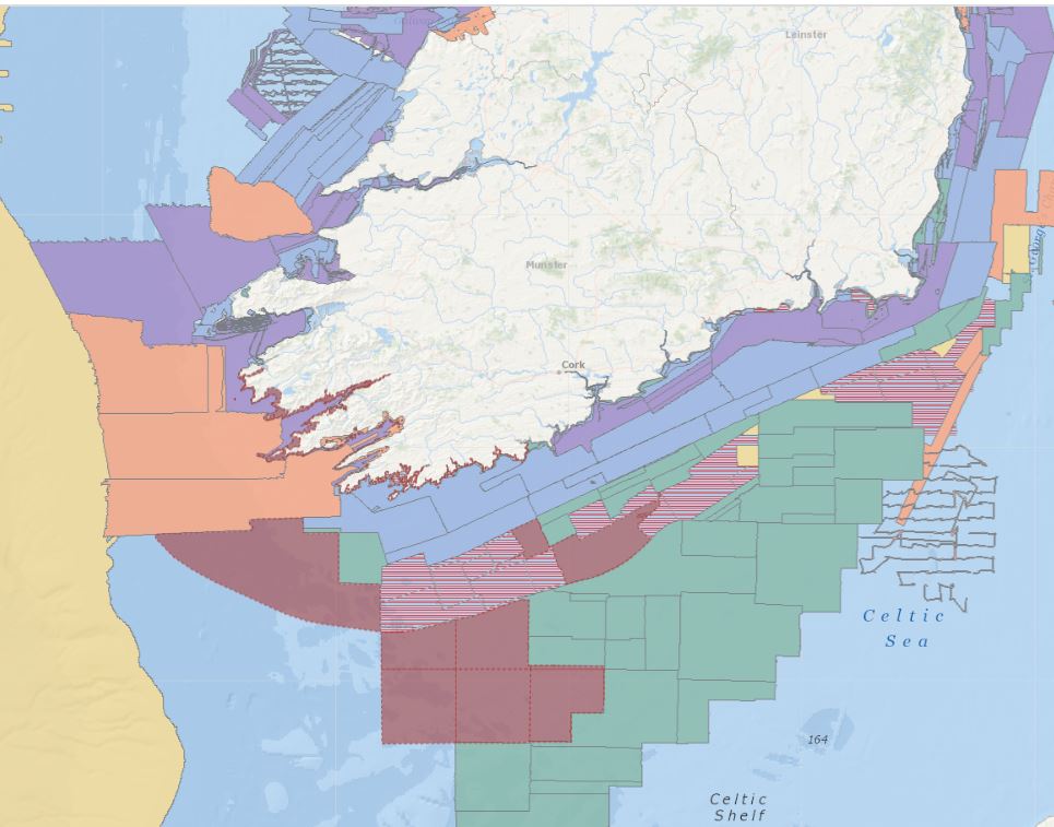
Have you tried out our Surveys, Reports, and Metadata Viewer?

Explore previous or planned surveys, follow vessel track lines, view survey summaries or download full survey reports using the viewer.

See it here &gt; bit.ly/3hHdzSy

<a href="/Dept_ECC/">Dept. Environment, Climate and Communications</a>  <a href="/GeolSurvIE/">Geological Survey IE</a> <a href="/MarineInst/">Marine Institute</a>
Dept. Environment, Climate and Communications (@dept_ecc) 's Twitter Profile Photo

In the last ten years Geological Survey IE has invested nearly €17 million in 226 research projects directly funding almost 160 researchers. This work has helped us to better understand Earth’s processes, climate change and natural hazards on our world. bit.ly/44Pbpe2
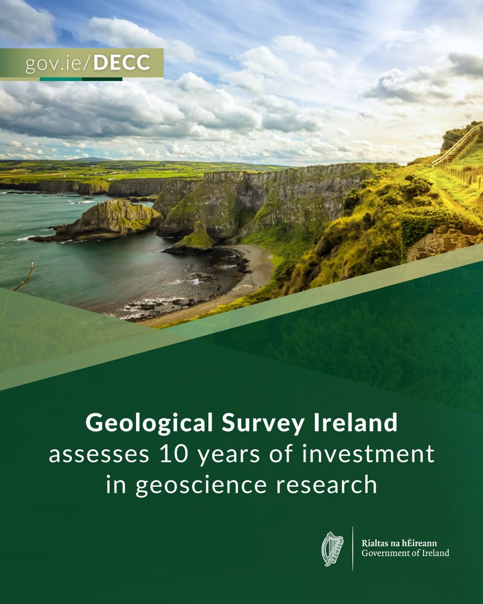
In the last ten years <a href="/GeolSurvIE/">Geological Survey IE</a> has invested nearly €17 million in 226 research projects directly funding almost 160 researchers. This work has helped us to better understand Earth’s processes, climate change and natural hazards on our world.

bit.ly/44Pbpe2
Geological Survey IE (@geolsurvie) 's Twitter Profile Photo

May’s image of the month for Geological Survey IE @Dept_ECC is of the Burren, Co Clare. Burren or boíreann in Irish means rock, rocky country, or karst. It is internationally known for its limestone pavement and associated flora and fauna. Photo by Pawel Zygmunt.

May’s image of the month for <a href="/GeolSurvIE/">Geological Survey IE</a> @Dept_ECC   is of the Burren, Co Clare.

Burren or boĂ­reann in Irish means rock, rocky country, or karst. It is internationally known for its limestone pavement and associated flora and fauna.

Photo by Pawel Zygmunt.
Geological Survey IE (@geolsurvie) 's Twitter Profile Photo

The Geotechnical Society of Ireland will hold its Spring Half Day Seminar on Tuesday, 13 May in Dublin. For more information and registration details see website. gsi.ie/en-ie/events-a…

Geological Survey IE (@geolsurvie) 's Twitter Profile Photo

The Geological Survey Ireland @Dept_ECC May County Geosite of the month is the Little Brosna-Shannon confluence, Co Offaly Offaly County Council and Co Tipperary Tipperary County Council. It’s a good example of an anastomosing channel - multiple, interconnecting channels. gsi.ie/en-ie/programm…

The Geological Survey Ireland @Dept_ECC May County Geosite of the month is the Little Brosna-Shannon confluence, Co Offaly <a href="/offalycoco/">Offaly County Council</a> and Co Tipperary <a href="/TipperaryCoCo/">Tipperary County Council</a>. It’s a good example of an anastomosing channel - multiple, interconnecting channels. 

gsi.ie/en-ie/programm…
DIAS Geophysics (@dias_geophysics) 's Twitter Profile Photo

⚠️ Earthquake Update! M1.5 #earthquake in the Irish Sea from 2025/05/22, recorded by stations of the Irish National Seismic Network (INSN) DIAS Geological Survey IE QuakeShake #DIASdiscovers

⚠️ Earthquake Update!

M1.5 #earthquake in the Irish Sea from 2025/05/22, recorded by stations of the Irish National Seismic Network (INSN)

<a href="/DIAS_Dublin/">DIAS</a>
<a href="/GeolSurvIE/">Geological Survey IE</a>
<a href="/quakeshake_/">QuakeShake</a> 

#DIASdiscovers
Geological Survey IE (@geolsurvie) 's Twitter Profile Photo

Geological Survey Ireland Department of Climate, Energy and the Environment image for June is Carrownrush, Co Sligo. Vertical Palaeogene Period dolerite dyke approximately 60 million years old, cutting through horizontal Carboniferous Period 300 million year old limestone beds. Photo by Rory Smith

Geological Survey Ireland <a href="/DeptCEE/">Department of Climate, Energy and the Environment</a> image for June is Carrownrush, Co Sligo. 
Vertical Palaeogene Period dolerite dyke approximately 60 million years old, cutting through horizontal Carboniferous Period 300 million year old limestone beds.
Photo by Rory Smith
Geological Survey IE (@geolsurvie) 's Twitter Profile Photo

Geological Survey Ireland Department of Climate, Energy and the Environment image for July is St John’s Point, Co Donegal. Lighthouse and Éire 70 sign on Carboniferous calcareous sandstone and sandy oolite of the Muckros Sandstone Formation. Photo by Aloke Tiwary

Geological Survey Ireland <a href="/DeptCEE/">Department of Climate, Energy and the Environment</a> image for July is St John’s Point, Co Donegal. Lighthouse and Éire 70 sign on Carboniferous calcareous sandstone and sandy oolite of the Muckros Sandstone Formation.
Photo by Aloke Tiwary
Geological Survey IE (@geolsurvie) 's Twitter Profile Photo

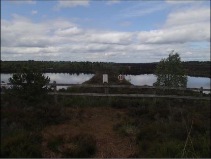
Geological Survey Ireland @Dept_ECC July County Geosite is Corlea Trackway, Co Longford. Underlain by Lower Carboniferous limestone bedrock, the oak plank trackway is set in Quaternary age peat. gsi.ie/en-ie/programm…

Geological Survey Ireland @Dept_ECC July County Geosite is Corlea Trackway, Co Longford. Underlain by Lower Carboniferous limestone bedrock, the oak plank trackway is set in Quaternary age peat. gsi.ie/en-ie/programm…