Meteorologist Grant Gilmore (@grantgilmorewx) 's Twitter Profile
Meteorologist Grant Gilmore

@grantgilmorewx

CBS Philadelphia On-Air Meteorologist | AMS Certified | Emmy Award Winning | UNC Asheville Grad | Michigan Faithful.

ID: 189232480

linkhttps://www.cbsnews.com/philadelphia/weather/ calendar_today10-09-2010 18:36:56

64,64K Tweet

8,8K Followers

1,1K Following

Meteorologist Grant Gilmore (@grantgilmorewx) 's Twitter Profile Photo

RADAR CHECK | Showers and thunderstorms have started to develop. While we don't have any severe weather yet, these storms are producing heavy rainfall with some lightning. Stay safe as more storms develop/strengthen through the afternoon.

Meteorologist Grant Gilmore (@grantgilmorewx) 's Twitter Profile Photo

TUESDAY STORMS UPDATE | The tornado-warned storm in Berks and Montgomery County Tuesday afternoon produced several reports of downed trees in the area. NWS Mount Holly plans to send a crew to survey the damage to determine if it was a tornado that caused the damage. #pawx
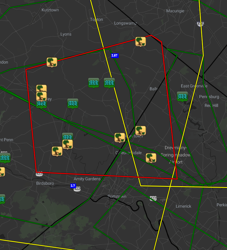
TUESDAY STORMS UPDATE | The tornado-warned storm in Berks and Montgomery County Tuesday afternoon produced several reports of downed trees in the area. <a href="/NWS_MountHolly/">NWS Mount Holly</a> plans to send a crew to survey the damage to determine if it was a tornado that caused the damage. #pawx
Meteorologist Grant Gilmore (@grantgilmorewx) 's Twitter Profile Photo

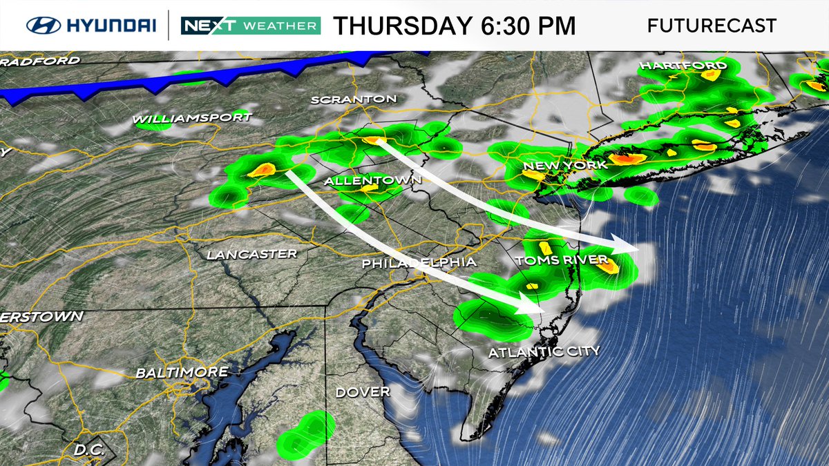
INCREASED STORM RISK THURSDAY | The chance for some late-day storms has increased for Thursday ahead of a cold front that'll usher in nicer weather for Independence Day. That said, some storms Thursday evening will have the potential to produce damaging winds and even some hail.

INCREASED STORM RISK THURSDAY | The chance for some late-day storms has increased for Thursday ahead of a cold front that'll usher in nicer weather for Independence Day. That said, some storms Thursday evening will have the potential to produce damaging winds and even some hail.
National Hurricane Center (@nhc_atlantic) 's Twitter Profile Photo

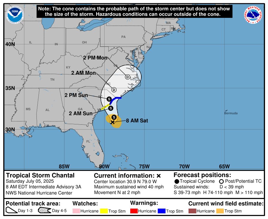
8 am EDT - A tropical or subtropical depression could form near the southeast U.S. this weekend or early next week. Heavy rainfall is possible across portions of the southeast U.S., particularly across the west-central Florida coast. Visit hurricanes.gov for more info.

8 am EDT - A tropical or subtropical depression could form near the southeast U.S. this weekend or early next week. Heavy rainfall is possible across portions of the southeast U.S., particularly across the west-central Florida coast. Visit hurricanes.gov for more info.
Meteorologist Grant Gilmore (@grantgilmorewx) 's Twitter Profile Photo

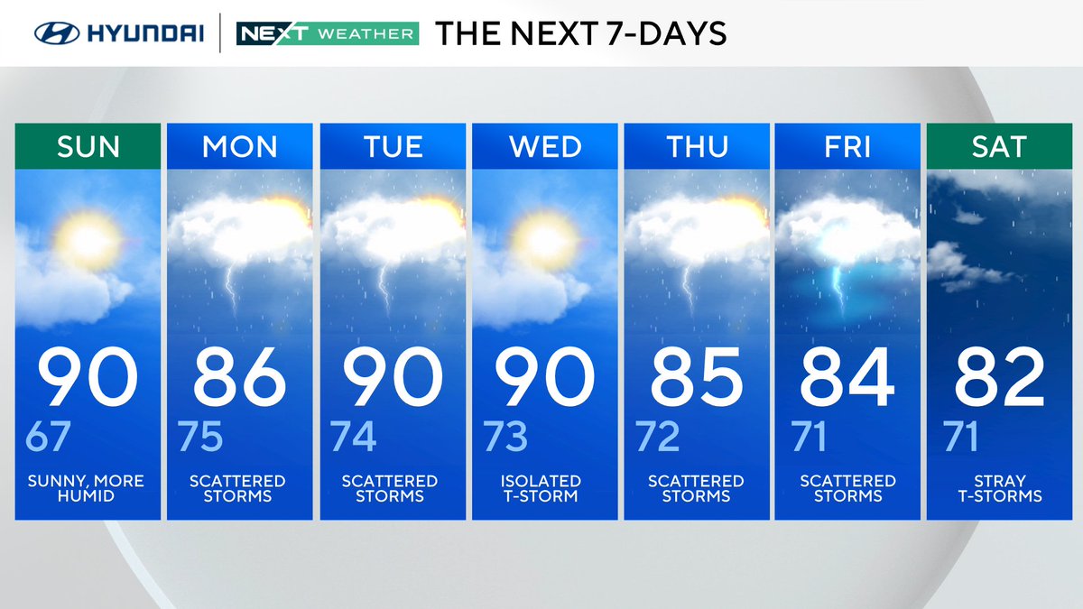
ONE LAST SUNNY DAY | As we wrap up the holiday weekend tomorrow we wrap up our dry stretch as well. The remnant low from #Chantal will kick off a rainy week ahead for much of the Philadelphia area.

ONE LAST SUNNY DAY | As we wrap up the holiday weekend tomorrow we wrap up our dry stretch as well. The remnant low from #Chantal will kick off a rainy week ahead for much of the Philadelphia area.
Meteorologist Grant Gilmore (@grantgilmorewx) 's Twitter Profile Photo

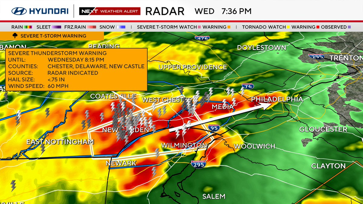
LINE OF SEVERE STORMS | Severe storms have lined up west of Philly and are tracking east toward Philadelphia. These storms will likely hold today to bring most of the region the threat or damaging winds and heavy/flooding rain. We'll be tracking all evening on CBS Philadelphia.

NWS Mount Holly (@nws_mountholly) 's Twitter Profile Photo

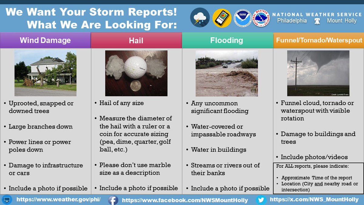
As storms continue to progress east this afternoon and evening, we will be looking for any reports of wind damage and flooding. Please reply to this post when it is safe to do so with the location and time of your report! Thanks! #NJwx #PAwx #MDwx #DEwx

As storms continue to progress east this afternoon and evening, we will be looking for any reports of wind damage and flooding. Please reply to this post when it is safe to do so with the location and time of your report! Thanks!

#NJwx #PAwx #MDwx #DEwx
Meteorologist Grant Gilmore (@grantgilmorewx) 's Twitter Profile Photo

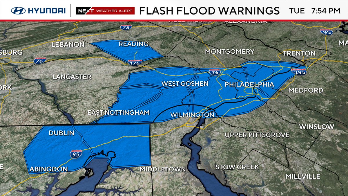
Severe storms continue to move through Delaware and New Jersey with Flash Flood Warnings in effect across the tri-state area. The worst of the weather will continue to push east and weaken, but stay safe as flash flood concerns continue into the overnight.

Severe storms continue to move through Delaware and New Jersey with Flash Flood Warnings in effect across the tri-state area. The worst of the weather will continue to push east and weaken, but stay safe as flash flood concerns continue into the overnight.
Meteorologist Grant Gilmore (@grantgilmorewx) 's Twitter Profile Photo

NEW WATCH | A Severe Thunderstorm Watch has been issued for the entire CBS Philadelphia area until midnight tonight. Damaging winds and heavy rain will be the primary concerns with these storms as they move into the area tonight.
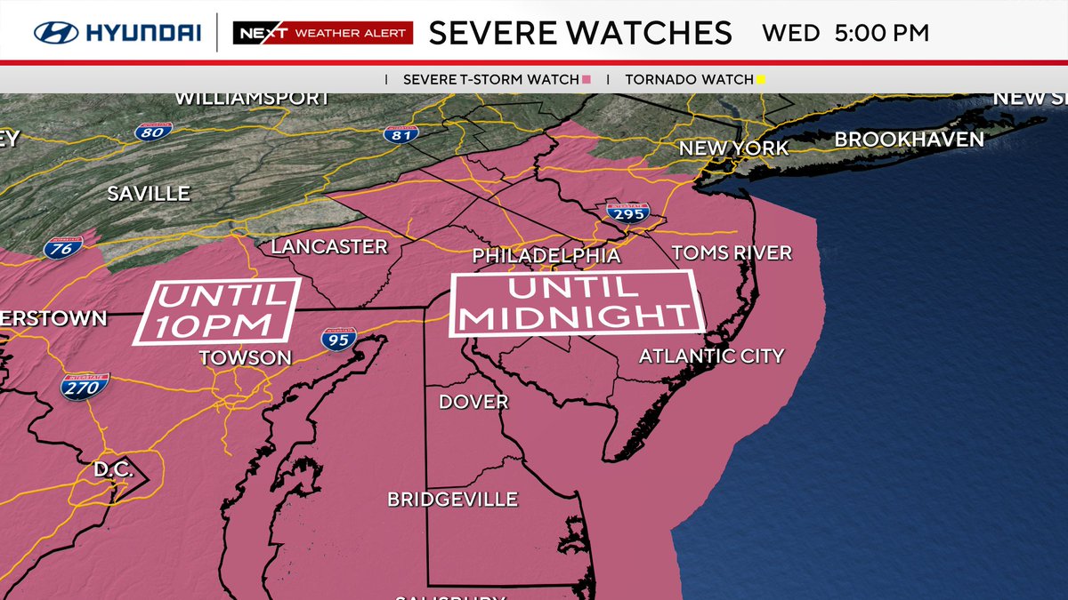
NEW WATCH | A Severe Thunderstorm Watch has been issued for the entire <a href="/CBSPhiladelphia/">CBS Philadelphia</a> area until midnight tonight. Damaging winds and heavy rain will be the primary concerns with these storms as they move into the area tonight.
Meteorologist Grant Gilmore (@grantgilmorewx) 's Twitter Profile Photo

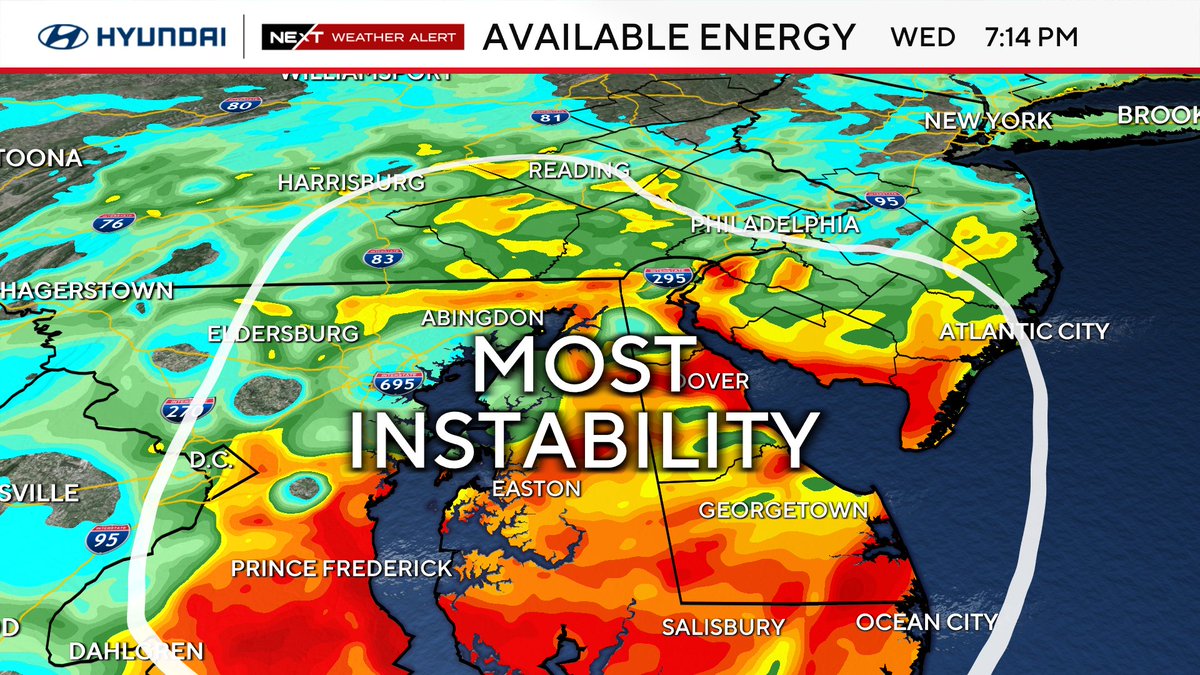
Severe storms with damaging winds and heavy rain continue to push toward Philadelphia, but the most favorable conditions for intense storms remains to our south. At this point there are no Severe Thunderstorm Warnings in the region, but one Flash Flood Warning in Chester Co.

Severe storms with damaging winds and heavy rain continue to push toward Philadelphia, but the most favorable conditions for intense storms remains to our south. At this point there are no Severe Thunderstorm Warnings in the region, but one Flash Flood Warning in Chester Co.
Meteorologist Grant Gilmore (@grantgilmorewx) 's Twitter Profile Photo

Heavy rain out ahead of a severe thunderstorm is starting to move into Philadelphia. Flash flooding will be the initial concern as this area of tropical rain moves into the urban corridor. Be careful on the roads as the sun sets and visibility decreases.

Heavy rain out ahead of a severe thunderstorm is starting to move into Philadelphia. Flash flooding will be the initial concern as this area of tropical rain moves into the urban corridor. Be careful on the roads as the sun sets and visibility decreases.
Meteorologist Grant Gilmore (@grantgilmorewx) 's Twitter Profile Photo

Flooding beginning to strand cars in Delaware County. Flooding will continue to be a concern across the urban corridor over the next several hours. CBS Philadelphia

Meteorologist Grant Gilmore (@grantgilmorewx) 's Twitter Profile Photo

An area of very heavy rainfall, frequent lightning and an embedded tornado threat is moving out of Delaware toward South Jersey the Jersey Shore. Heads up if you are in the path of this storm. Here are some ETA's as it moves into New Jersey.

An area of very heavy rainfall, frequent lightning and an embedded tornado threat is moving out of Delaware toward South Jersey the Jersey Shore. Heads up if you are in the path of this storm. Here are some ETA's as it moves into New Jersey.
Meteorologist Grant Gilmore (@grantgilmorewx) 's Twitter Profile Photo

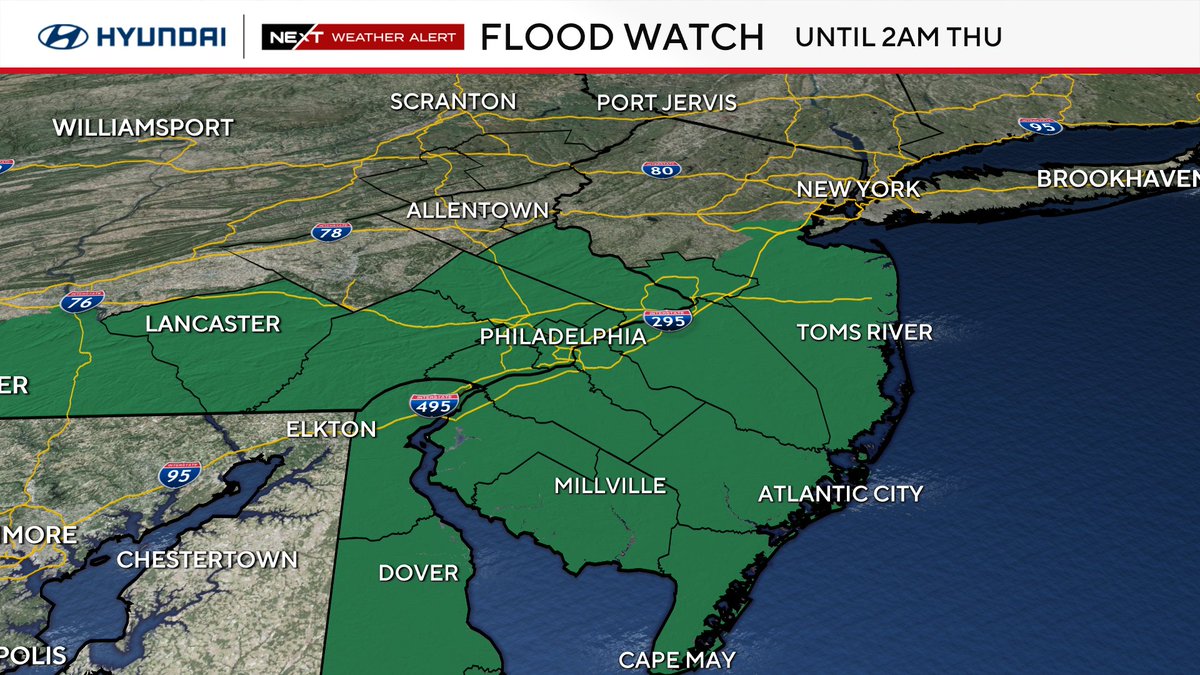
The Severe T-storm Watch has been cancelled for PA, DE and some of our NJ counties The rest of the area will remain in the Severe T-storm Watch until midnight. The Flood Watch has been cancelled for the Lehigh Valley, but remains in effect for the rest of the area until 2a.

The Severe T-storm Watch has been cancelled for PA, DE and some of our NJ counties  The rest of the area will remain in the Severe T-storm Watch until midnight.

The Flood Watch has been cancelled for the Lehigh Valley, but remains in effect for the rest of the area until 2a.