Joe Knight (@joeknightumn) 's Twitter Profile
Joe Knight

@joeknightumn

Professor of Remote Sensing at the University of Minnesota

ID: 1355860381

linkhttp://rs.umn.edu calendar_today16-04-2013 02:25:58

52 Tweet

102 Followers

27 Following

Joe Knight (@joeknightumn) 's Twitter Profile Photo

Tenure track faculty position in remote sensing now open at the University of Minnesota: hr.myu.umn.edu/jobs/ext/328226 Distribute widely, please.

Joe Knight (@joeknightumn) 's Twitter Profile Photo

Congrats to RSGAL Master’s student Peter Stangl for defending his thesis research on flood mapping using geospatial data!

UMN SFEC (@mnforested) 's Twitter Profile Photo

We're hosting a workshop on Lidar and Object-based Classification for Forest Management in a few weeks: sfec.cfans.umn.edu/2019-workshop-…

Mike Wulder (@mikewulder) 's Twitter Profile Photo

Agree! 💯 Myths begone! This paper is definitely a must read for anyone using #lidar for #forests or more generally. Important that all this history was captured.

UMNUAS (@umnuas) 's Twitter Profile Photo

Working with the MN DNR, we recently conducted a UAS data acquisition flight over the lower reaches of the Split Rock River in Split Rock Lighthouse SP. instagram.com/p/B1E--sNHkDA/…

Mike Wulder (@mikewulder) 's Twitter Profile Photo

Just when you think you are up-to-date on #remotesensing technology for #forestry. 🤦‍♂️ @JakobIglhaut etal. Structure from Motion Photogrammetry in Forestry: A #Review. Theory to application. 3D point clouds offering results comparable to #lidar #OpenAccess: link.springer.com/article/10.100…

Just when you think you are up-to-date on #remotesensing technology for #forestry. 🤦‍♂️
@JakobIglhaut etal. Structure from Motion Photogrammetry in Forestry: A #Review. Theory to application. 3D point clouds offering results comparable to #lidar
#OpenAccess: link.springer.com/article/10.100…
UMNUAS (@umnuas) 's Twitter Profile Photo

In the Remote Sensing Lab, we work with a variety of instruments and sensing modalities. We recently used TLS to scan two White Oak trees in Grams Regional Park, Zimmerman, MN for the UFore Lab in order to derive… instagram.com/p/B43MIbFgaPi/…

UMN Forest Resources (@umnforestres) 's Twitter Profile Photo

9-month, full-time, tenure-track assistant professor position specializing in Urban and Community Forestry hr.myu.umn.edu/jobs/ext/35115… ---------- Department Head with Faculty Rank for the department of Forest Resources. hr.myu.umn.edu/jobs/ext/35037…

9-month, full-time, tenure-track assistant professor position specializing in Urban and Community Forestry 
hr.myu.umn.edu/jobs/ext/35115…
----------
Department Head with Faculty Rank for the department of Forest Resources.
hr.myu.umn.edu/jobs/ext/35037…
Forrest Fleischman (@forrestfleisch1) 's Twitter Profile Photo

We have 2 openings for faculty positions in forestry at Minnesota: Department head and urban forestry. We expect to advertise a 3rd position ("bioeconomy") later this fall. drive.google.com/file/d/1HmKx7g… and docs.google.com/document/d/1C9…

USGS Landsat (@usgslandsat) 's Twitter Profile Photo

Landsat 9 acquired this image of #HurricaneIan as the eye of the storm passed north of Cuba yesterday. The image, which is ~ 185 km wide (115 mi.), has the island boundary overlaid on it. Over 50,000 people were evacuated from the western province & the entire island lost power.

Landsat 9 acquired this image of #HurricaneIan as the eye of the storm passed north of Cuba yesterday. The image, which is ~ 185 km wide (115 mi.), has the island boundary overlaid on it. Over 50,000 people were evacuated from the western province & the entire island lost power.
UMNUAS (@umnuas) 's Twitter Profile Photo

Map the whole TC campus? That was the challenge University Services had for us! #drones #remotesensing #dronesforgood #umn #ebee #sensefly

Map the whole TC campus? That was the challenge University Services had for us! #drones #remotesensing #dronesforgood #umn #ebee #sensefly
UMNUAS (@umnuas) 's Twitter Profile Photo

We use #drones, multispectral sensors, indices, and Google Earth Engine to track changes in vegetative health over time. #drones4ag #mapping

We use #drones, multispectral sensors, indices, and Google Earth Engine to track changes in vegetative health over time. #drones4ag #mapping
UMNUAS (@umnuas) 's Twitter Profile Photo

We recently demonstrated how sUAS might be used in the monitoring of conservation easements for Minnesota DNR. #drones4nrsm #conservation #mapping

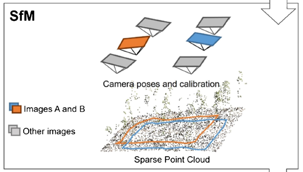
We recently demonstrated how sUAS might be used in the monitoring of conservation easements for <a href="/mndnr/">Minnesota DNR</a>. #drones4nrsm #conservation #mapping