Kartoza (@kartozageo) 's Twitter Profile
Kartoza

@kartozageo

Free and Open Source GIS (FOSSGIS) Service providers. leverage the power of the Free Software movement to solve geospatial problems.

ID: 829949071595016192

linkhttps://kartoza.com calendar_today10-02-2017 07:04:13

326 Tweet

1,1K Followers

131 Following

Kartoza (@kartozageo) 's Twitter Profile Photo

💡Curious about working with raster data in Python? ​ Our latest blog post dives into a step-by-step guide on how to update raster NoData values using Rasterio. ​ Read more here: kartoza.com/blog/python/tu… ​ #kartoza #python #GIS #blog #tutorial

💡Curious about working with raster data in Python?
​
Our latest blog post dives into a step-by-step guide on how to update raster NoData values using Rasterio. 
​
Read more here: kartoza.com/blog/python/tu…
​
#kartoza #python #GIS #blog #tutorial
Kartoza (@kartozageo) 's Twitter Profile Photo

🌍✨ Remember, it’s #QGISOpenDay today!🚀 Don’t miss these two awesome sessions: 📌QGIS 3.40 Review -⏰10:00 UTC 📌 GPS Data Analysis: A Matter of Space and Time -⏰4:00 UTC For all the links and session info, visit the Wiki 👉 github.com/qgis/QGIS/wiki… #GIS #OpenSource #QGIS

🌍✨ Remember, it’s #QGISOpenDay today!🚀

Don’t miss these two awesome sessions:
📌QGIS 3.40 Review -⏰10:00 UTC
📌 GPS Data Analysis: A Matter of Space and Time -⏰4:00 UTC

For all the links and session info, visit the Wiki 👉 github.com/qgis/QGIS/wiki…

 #GIS #OpenSource #QGIS
Kartoza (@kartozageo) 's Twitter Profile Photo

📡At the GISSA Western Cape meeting on December 3rd, two Kartoza team members, Michelle and Amy, delivered an engaging presentation on Agile Project Management for a Geospatial Consultancy. #kartoza #gis #GISSA

📡At the GISSA Western Cape meeting on December 3rd, two Kartoza team members, Michelle and Amy, delivered an engaging presentation on Agile Project Management for a Geospatial Consultancy.

#kartoza #gis #GISSA
Kartoza (@kartozageo) 's Twitter Profile Photo

Bridget Fleming in action at FOSS4G 2024 | https://fosstodon.org/@foss4g on Friday! Presenting the Geospatial Data Science Certificate for High School Students, demonstrating how FOSS4G tools and Project-Based Learning (PBL) techniques empower young learners to solve spatial challenges. #kartoza #SAGTA #opensource

Bridget Fleming in action at <a href="/foss4g/">FOSS4G 2024 | https://fosstodon.org/@foss4g</a> on Friday!
Presenting the Geospatial Data Science Certificate for High School Students, demonstrating how FOSS4G tools and Project-Based Learning (PBL) techniques empower young learners to solve spatial challenges. #kartoza #SAGTA #opensource
Kartoza (@kartozageo) 's Twitter Profile Photo

Rendering Points as a Heatmap in GeoServer📝 Learn how to transform a points layer into a Heatmap using GeoServer. Read the full blog article here: kartoza.com/blog/geoserver… #kartoza #geoserver #blogpost #heatmap #GIS

Rendering Points as a Heatmap in GeoServer📝

Learn how to transform a points layer into a Heatmap using GeoServer.

Read the full blog article here: kartoza.com/blog/geoserver…

#kartoza #geoserver #blogpost #heatmap #GIS
Kartoza (@kartozageo) 's Twitter Profile Photo

👩‍🔬As we celebrate Women and Girls in Science, let's continue to advocate for education, employment, and equal opportunities for them. Through greater inclusion, diversity and opportunity, we can build a stronger, more innovative society for all.🧪 #WomenInScience #GirlsInSTEM

👩‍🔬As we celebrate Women and Girls in Science, let's continue to advocate for education, employment, and equal opportunities for them. Through greater inclusion, diversity and opportunity, we can build a stronger, more innovative society for all.🧪

#WomenInScience #GirlsInSTEM
Kartoza (@kartozageo) 's Twitter Profile Photo

Join us for a free webinar exploring the latest advancements in open-source GIS technology! Date: Wednesday, 19 February 2025 Time: 12:00 PM ET (19:00 SAST) Register: docs.google.com/forms/d/e/1FAI… ​Zoom link: us06web.zoom.us/j/81417896016 ​ #kartoza #GIS #webinar #opensource

Join us for a free webinar exploring the latest advancements in open-source GIS technology!

Date: Wednesday, 19 February 2025
Time: 12:00 PM ET (19:00 SAST)
Register: docs.google.com/forms/d/e/1FAI…
​Zoom link: us06web.zoom.us/j/81417896016
​
#kartoza #GIS #webinar #opensource
Kartoza (@kartozageo) 's Twitter Profile Photo

📝 Introducing the new QGIS Plugins Website and QGIS Hub🚀 ​ Our latest blog article dives into the newly updated QGIS Plugins Website and the launch of the QGIS Hub! ​ Read more: kartoza.com/blog/qgis/intr… ​ #kartoza #QGIS #GIS #opensource #blog

📝 Introducing the new QGIS Plugins Website and QGIS Hub🚀
​
Our latest blog article dives into the newly updated QGIS Plugins Website and the launch of the QGIS Hub!
​
Read more: kartoza.com/blog/qgis/intr…
​
#kartoza #QGIS #GIS #opensource #blog
Kartoza (@kartozageo) 's Twitter Profile Photo

Did you miss our recent webinar?😟 No worries!🎉You can now watch the full recorded session on the Kartoza YouTube channel. Learn how you can Revolutionise your GIS with Kartoza! Watch on YouTube: youtu.be/jM3sgRBLljc?fe… #Kartoza #GIS #opensource #QGIS #MerginMaps #Webinar

Did you miss our recent webinar?😟

No worries!🎉You can now watch the full recorded session on the Kartoza YouTube channel. Learn how you can Revolutionise your GIS with Kartoza!

Watch on YouTube: youtu.be/jM3sgRBLljc?fe… 

#Kartoza #GIS #opensource #QGIS #MerginMaps #Webinar
Kartoza (@kartozageo) 's Twitter Profile Photo

📢 The next #QGIS Open Day is coming up! If you’d like to be a speaker at this virtual event, reach out to the Open Day coordinators with your topic. Sign up and share your expertise! 🌍✨ More info: github.com/qgis/QGIS/wiki… #GIS #opensource #openday

📢 The next #QGIS Open Day is coming up! If you’d like to be a speaker at this virtual event, reach out to the Open Day coordinators with your topic. Sign up and share your expertise! 🌍✨

More info: github.com/qgis/QGIS/wiki… 

#GIS #opensource #openday
Kartoza (@kartozageo) 's Twitter Profile Photo

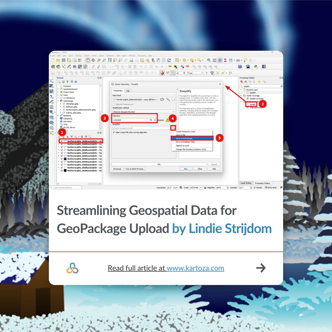
Unleash your inner artist with QGIS!🧑‍🚀🎨 ​ Ever wondered what a Bob Ross painting would look like recreated entirely in QGIS? ​ 👉 Read in full here: kartoza.com/blog/qgis/stre… ​ #QGIS #OpenSourceGIS #GISInternship #Kartoza #BobRossInQGIS #SpatialArt #GISProjects

Unleash your inner artist with QGIS!🧑‍🚀🎨
​
Ever wondered what a Bob Ross painting would look like recreated entirely in QGIS? 
​
👉 Read in full here: kartoza.com/blog/qgis/stre…
​
#QGIS #OpenSourceGIS #GISInternship #Kartoza #BobRossInQGIS #SpatialArt #GISProjects
Kartoza (@kartozageo) 's Twitter Profile Photo

This year marks the 55th anniversary of #EarthDay, let's commit to actions that promote renewable energy and environmental stewardship.🌍 ​ #EarthDay2025 ​#OurPowerOurPlanet #OpenSourceGIS​ #sustainability #kartoza

This year marks the 55th anniversary of #EarthDay, let's commit to actions that promote renewable energy and environmental stewardship.🌍
​
#EarthDay2025 ​#OurPowerOurPlanet #OpenSourceGIS​ #sustainability #kartoza
Kartoza (@kartozageo) 's Twitter Profile Photo

📈Elevate your GIS capabilities!✍️ ​ Equip yourself with the skills to design, manage, and analyse spatial data at scale—book your spot now. ​ Enrol today: kartoza.com/training/intro… ​ #kartoza #GIS #learngis #postgis #opensource

📈Elevate your GIS capabilities!✍️
​
Equip yourself with the skills to design, manage, and analyse spatial data at scale—book your spot now.
​
Enrol today: kartoza.com/training/intro…
​
#kartoza #GIS #learngis #postgis #opensource
Kartoza (@kartozageo) 's Twitter Profile Photo

🌍Discover the power of community mapping with OpenStreetMap! ​ Kartoza intern Hefni shares her experience learning to map buildings in her village using OSM tools. ​ Read more: kartoza.com/blog/gis/mappi… ​ #kartoza ​#intern ​ #blogpost #OpenStreetMap​ #GIS #CommunityMapping

🌍Discover the power of community mapping with OpenStreetMap! 
​
Kartoza intern Hefni shares her experience learning to map buildings in her village using OSM tools. 
​
Read more: kartoza.com/blog/gis/mappi…
​
#kartoza ​#intern ​ #blogpost #OpenStreetMap​ #GIS #CommunityMapping
Kartoza (@kartozageo) 's Twitter Profile Photo

📢Just published: New paper about #QGIS "The QGIS project: Spatial without compromise" by Anita Graser, Tim Sutton (Kartoza co-founder), Marco Bernasocchi 👏A must-read on QGIS's evolution and community! Read paper here: cell.com/patterns/fullt… #QGIS #OpenSourceGIS #kartoza

📢Just published: New paper about #QGIS

"The QGIS project: Spatial without compromise" by Anita Graser, Tim Sutton (Kartoza co-founder), Marco Bernasocchi

👏A must-read on QGIS's evolution and community!

Read paper here: cell.com/patterns/fullt…

#QGIS #OpenSourceGIS #kartoza
Kartoza (@kartozageo) 's Twitter Profile Photo

🌍Discover the power of GIS-one course at a time🚀 Online courses designed to help you upskill using tools like QGIS, PostGIS, and more. ​💻 Learn from anywhere. 👉 Explore our courses today: kartoza.com/training-cours… #kartoza #Opensource #GIS #PostGIS #QGIS #onlinetraining

🌍Discover the power of GIS-one course at a time🚀 Online courses designed to help you upskill using tools like QGIS, PostGIS, and more.

​💻 Learn from anywhere.
👉 Explore our courses today: kartoza.com/training-cours…

#kartoza #Opensource #GIS #PostGIS #QGIS #onlinetraining
Kartoza (@kartozageo) 's Twitter Profile Photo

🎉 Celebrating 11 years of industry excellence! 🎉 ​ Today, Kartoza celebrates 11 years of building and developing open-source geospatial solutions. For more info about Kartoza and our services, visit: kartoza.com ​ #Kartoza #OpenSource #GIS #SpatialForAll #ThankYou

🎉 Celebrating 11 years of industry excellence! 🎉
​
Today, Kartoza celebrates 11 years of building and developing open-source geospatial solutions. For more info about Kartoza and our services, visit: kartoza.com
​
#Kartoza #OpenSource #GIS #SpatialForAll #ThankYou
Kartoza (@kartozageo) 's Twitter Profile Photo

🗺️ New Map Alert! ​ The Namibia Topographic Map is now available on the SAGTA Map Downloader — plus two new projects: 📚 South Africa & 🌍 Global Map Projects ​ 🔗Visit the SAGTA Map Downloader: maps.sagta.org.za #Kartoza #GIS #MappingTools

🗺️ New Map Alert!
​
The Namibia Topographic Map is now available on the SAGTA Map Downloader — plus two new projects:
📚 South Africa &amp; 🌍 Global Map Projects
​
🔗Visit the SAGTA Map Downloader: maps.sagta.org.za

#Kartoza #GIS #MappingTools