KayleeBarbeeWX (@kayleebarbeewx) 's Twitter Profile
KayleeBarbeeWX

@kayleebarbeewx

@WRBLNews3 Weekend Meteorologist

ID: 1603258056426528770

calendar_today15-12-2022 05:18:18

3,3K Tweet

95 Followers

69 Following

KayleeBarbeeWX (@kayleebarbeewx) 's Twitter Profile Photo

Track along with us on the WRBL Radar App. Hit Future on the radar to track the latest storm. Enable notifications so you can hear the latest update or receive push notifications.

Cody Nickel (@cnickelwrbl) 's Twitter Profile Photo

Good Wednesday morning! Some leftover showers for areas towards the south; however, expect that to be gone by daybreak and likely replaced with areas of light fog. #wrblwx #gawx #alwx

Cody Nickel (@cnickelwrbl) 's Twitter Profile Photo

#Tsunami warnings fading after one of the largest earthquakes ever recorded. Here’s what to know Bob Jeswald - WRBL Meteorologist Kaylee Barbee Nicole Phillips #wrblwx #cawx #hiwx #wawx #orwx #akwx wrbl.com/news/national/…

Bob Jeswald - WRBL (@bjeswaldwrbl) 's Twitter Profile Photo

Evening thunderstorms at 7:30 PM ET that are strong with tremendous amount of lightning and gusty winds up to 40 mph. Watch for brief torrential rain, if you have to get out in these areas.

Cody Nickel (@cnickelwrbl) 's Twitter Profile Photo

Good Thursday morning! Waking up to warm and humid conditions with readings in the mid to low 70s. Mix of sun and clouds throughout the morning hours with highs in the 90s later this afternoon. #wrblwx #gawx #alwx

Cody Nickel (@cnickelwrbl) 's Twitter Profile Photo

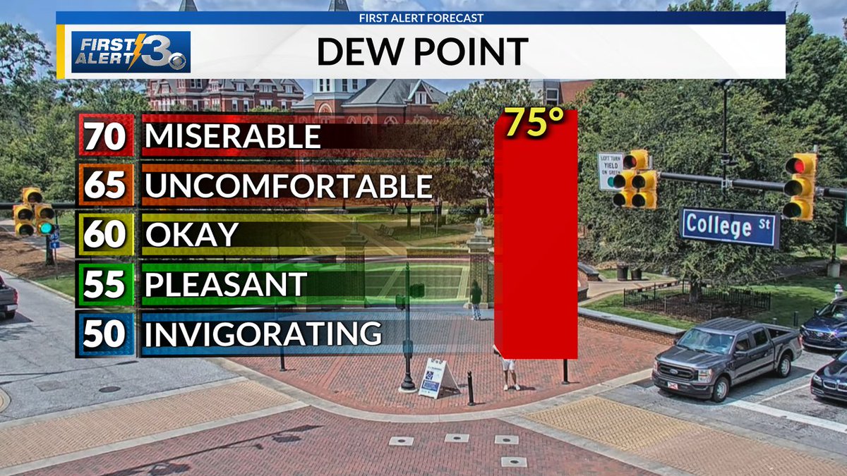
Dew point readings are off the chart this midday! Meaning it will still feel very hot with triple digit heat index values this afternoon. #wrblwx #gawx #alwx

Dew point readings are off the chart this midday! Meaning it will still feel very hot with triple digit heat index values this afternoon. #wrblwx #gawx #alwx
Bob Jeswald - WRBL (@bjeswaldwrbl) 's Twitter Profile Photo

10:30 PM ET: The showers and storms have cooled us down at this late hour. The First Alert Forecast calls for more across the region over the next several days. This is all driven from a summer cool front. And yes, it will be cooler in the forecast. #alwx #gawx

Cody Nickel (@cnickelwrbl) 's Twitter Profile Photo

Afternoon showers and storms right on cue as the cold front continues to inch closer from the north. #wrblwx #gawx #alwx

Cody Nickel (@cnickelwrbl) 's Twitter Profile Photo

QUITMAN: Get ready for some strong gusty winds up to 40 mph moving into Georgetown and across Quitman County. #wrblwx #gawx #alwx

Cody Nickel (@cnickelwrbl) 's Twitter Profile Photo

LEE & MACON: Strong gusty winds possible up to 40 mph moving in and likely impacting the communities of Loachapoka and Notasulga. #wrblwx #alwx

Cody Nickel (@cnickelwrbl) 's Twitter Profile Photo

CHAMBERS, LEE, HARRIS & TROUP: Strong storm over West Point, Valley and Lanett has potential to produce strong gusty winds up to 40 mph. Storm is slowly drifting east around 15 mph. #wrblwx #gawx #alwx

Bob Jeswald - WRBL (@bjeswaldwrbl) 's Twitter Profile Photo

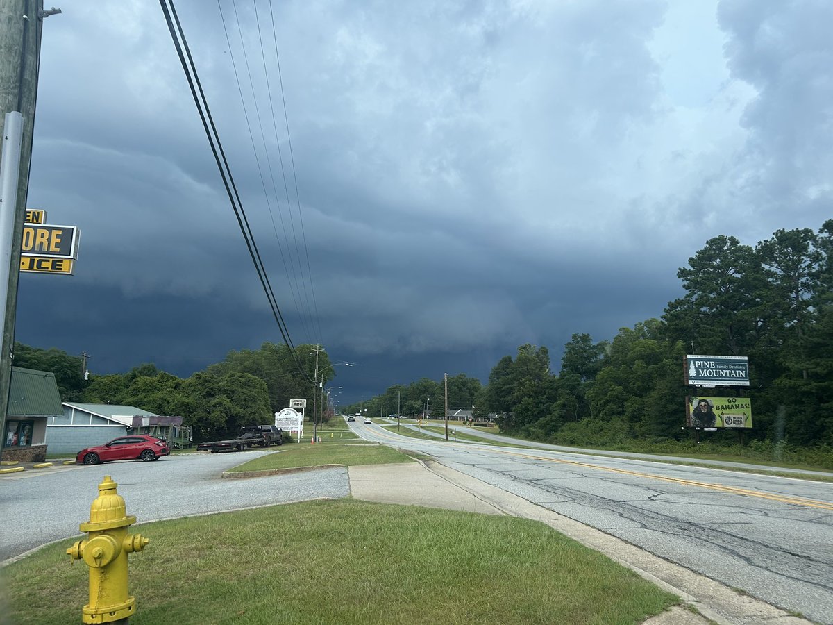
3:44PM ET These thunderstorms across Russell County are not at severe levels but the forcing along the cool front is adding small hail, strong winds, torrential rainfall, and plenty of cloud to ground lightning strikes across the region. #alwx #gawx #wrblweather

National Hurricane Center (@nhc_atlantic) 's Twitter Profile Photo

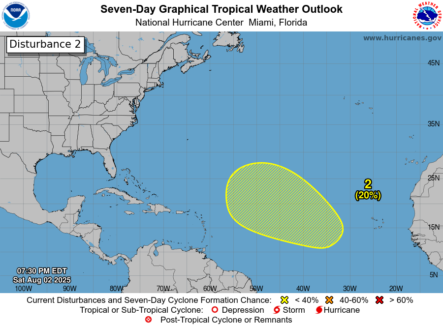
8 PM EDT Sat, Aug. 2: We're now monitoring 2 systems in the Atlantic, each with a low chance of becoming a tropical cyclone during the next 7 days: 1. A frontal low off the coast of NC could acquire some tropical or subtropical characteristics through Monday. 2. A tropical wave

8 PM EDT Sat, Aug. 2: We're now monitoring 2 systems in the Atlantic, each with a low chance of becoming a tropical cyclone during the next 7 days:

1. A frontal low off the coast of NC could acquire some tropical or subtropical characteristics through Monday.

2. A tropical wave
Nicole Phillips (@nicolephilli) 's Twitter Profile Photo

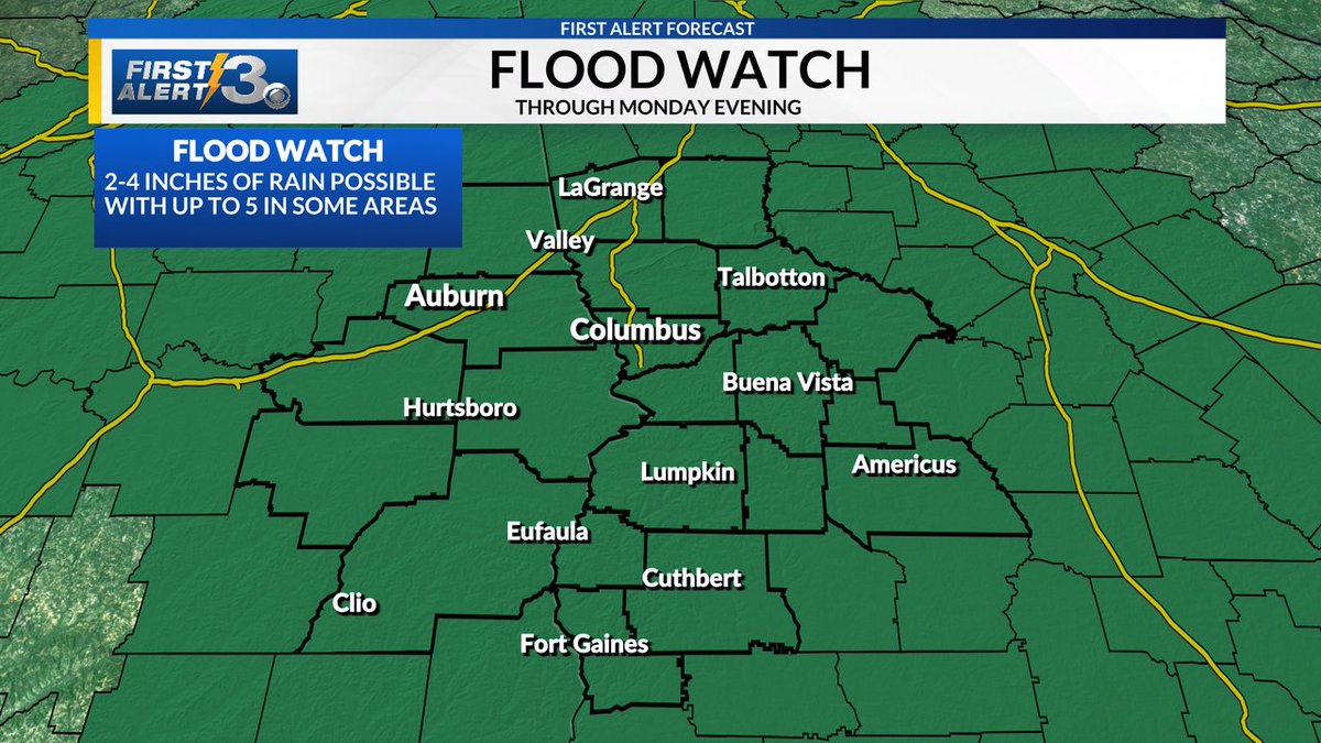
Flood Watch through Monday evening. Some areas have already received 1-3 inches of rain but an addition 2-4+ will be possible today through Monday

Flood Watch through Monday evening.

Some areas have already received 1-3 inches of rain but an addition 2-4+ will be possible today through Monday
KayleeBarbeeWX (@kayleebarbeewx) 's Twitter Profile Photo

8/3/25 FLASH FLOOD WARNING: A Flash Flood Warning has been issued for parts of Clay County until 10PM ET this evening. Areas impacted include Bluffton, Fort Gaines, Zetto, and Suttons Corner.

8/3/25 FLASH FLOOD WARNING: A Flash Flood Warning has been issued for parts of Clay County until 10PM ET this evening. Areas impacted include Bluffton, Fort Gaines, Zetto, and Suttons Corner.
KayleeBarbeeWX (@kayleebarbeewx) 's Twitter Profile Photo

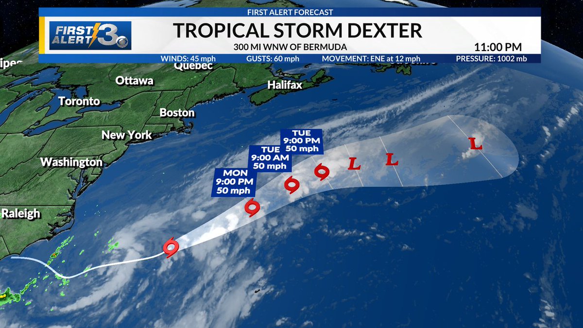
Tropical Storm #Dexter has formed in the Atlantic as of 11PM this evening. Dexter poses no threat to land and will continue to the northeast over the next few days. #Dexter #NHC #tropics

Tropical Storm #Dexter has formed in the Atlantic as of 11PM this evening. Dexter poses no threat to land and will continue to the northeast over the next few days.  #Dexter #NHC #tropics
Cody Nickel (@cnickelwrbl) 's Twitter Profile Photo

Good Monday morning! A cloudy, damp and cool start. Showers should increase in coverage as we go throughout the morning. #wrblwx #gawx #alwx

Cody Nickel (@cnickelwrbl) 's Twitter Profile Photo

CLAY & RANDOLPH: Watch out for areas of minor flooding. Heavy showers and a few rumbles of thunder continue to move into the area from the south. #wrblwx #gawx #alwx

Cody Nickel (@cnickelwrbl) 's Twitter Profile Photo

COMMUTE FORECAST: As the kiddos head back to school across Columbus this morning take it easy! Showers increase in coverage as we go throughout the morning and possibly a few rumbles of thunder possible later this evening. #wrblwx #gawx #alwx

COMMUTE FORECAST: As the kiddos head back to school across Columbus this morning take it easy! Showers increase in coverage as we go throughout the morning and possibly a few rumbles of thunder possible later this evening. #wrblwx #gawx #alwx