Kelly Foster (@kelly_wpmi) 's Twitter Profile
Kelly Foster

@kelly_wpmi

Morning News Anchor/AMS & NWA Sealed Meteorologist Local 15 WPMI-TV Mobile, AL-Pensacola/Ft. Walton Beach, FL

ID: 588282074

linkhttp://www.local15tv.com/weather calendar_today23-05-2012 13:21:06

11,11K Tweet

5,5K Followers

558 Following

Kelly Foster (@kelly_wpmi) 's Twitter Profile Photo

Pensacola Beach is packed out! The Blues will take to the sky in about half an hour! You can watch this camera at mynbc15.com/weather/cameras NBC 15 News
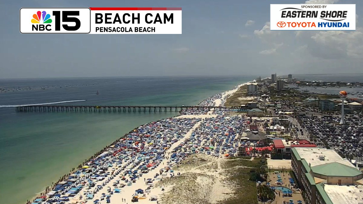
Pensacola Beach is packed out! The Blues will take to the sky in about half an hour! You can watch this camera at mynbc15.com/weather/cameras

<a href="/mynbc15/">NBC 15 News</a>
Kelly Foster (@kelly_wpmi) 's Twitter Profile Photo

A trough of low pressure in the Atlantic off the N FL coast is producing squally weather. It's set to move W across FL & into the NE Gulf by late Tue. Low formation chance next 7 days. Check back! NBC 15 News mynbc15.com/weather
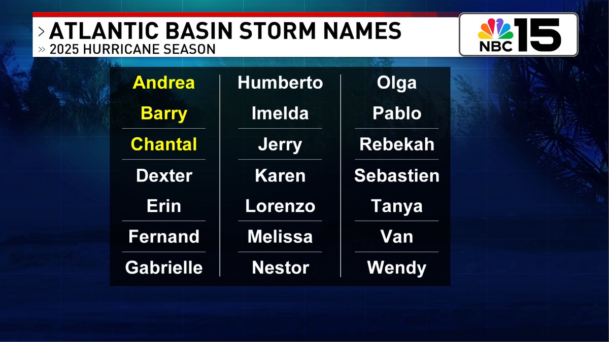
A trough of low pressure in the Atlantic off the N FL coast is producing squally weather.  It's set to move W across FL &amp; into the NE Gulf by late Tue. Low formation chance next 7 days. Check back! <a href="/mynbc15/">NBC 15 News</a> mynbc15.com/weather
Kelly Foster (@kelly_wpmi) 's Twitter Profile Photo

We kick off the workweek with typical summertime t-storms with a 30% chance wet weather finds you. Temps spike into the mid 90s during peak heating hours, & when we factor in the humidity, heat index values 🥵♨will surge 100-105+NBC 15 News mynbc15.com/weather
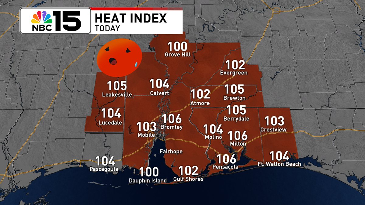
We kick off the workweek with typical summertime t-storms with a 30% chance wet weather finds you. Temps spike into the mid 90s during peak heating hours, &amp; when we factor in the humidity, heat index values 🥵♨will surge 100-105+<a href="/mynbc15/">NBC 15 News</a> mynbc15.com/weather
Kelly Foster (@kelly_wpmi) 's Twitter Profile Photo

A disturbance offshore of the Atlantic coast of N FL is forecast to move W into the NE Gulf late Tue. It has a low formation chance over the next 7 days. Regardless of development, it'll be a rainmaker for us mid to late week NBC 15 News mynbc15.com/weather

A disturbance offshore of the Atlantic coast of N FL is forecast to move W into the NE Gulf late Tue. It has a low formation chance over the next 7 days. Regardless of development, it'll be a rainmaker for us mid to late week <a href="/mynbc15/">NBC 15 News</a> mynbc15.com/weather
Kelly Foster (@kelly_wpmi) 's Twitter Profile Photo

Gorgeous start to the workweek 😎along our stretch of the Gulf Coast from Mobile to Fairhope, #Alabama & east to Pensacola, #Florida. Dress light & keep the water bottle close, it'll be a hot & steamy Monday NBC 15 News mynbc15.com/weather
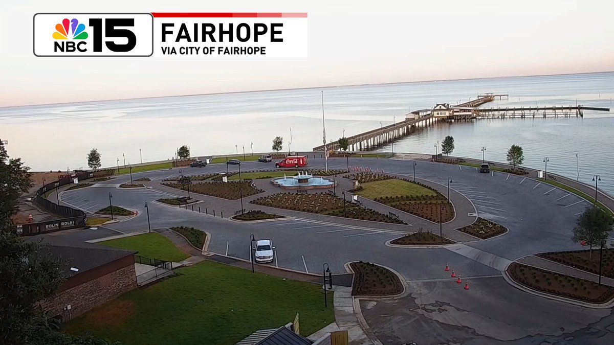
Gorgeous start to the workweek 😎along our stretch of the Gulf Coast from Mobile to Fairhope, #Alabama &amp; east to Pensacola, #Florida. Dress light &amp; keep the water bottle close, it'll be a hot &amp; steamy Monday <a href="/mynbc15/">NBC 15 News</a> mynbc15.com/weather
Kelly Foster (@kelly_wpmi) 's Twitter Profile Photo

We'll be keeping a close eye on the tropics this week. Currently a low chance Invest 93L develops as it moves west through the northern Gulf. Full breakdown tonight on NBC 15 News at 5, 6, & 10PM. mynbc15.com/weather
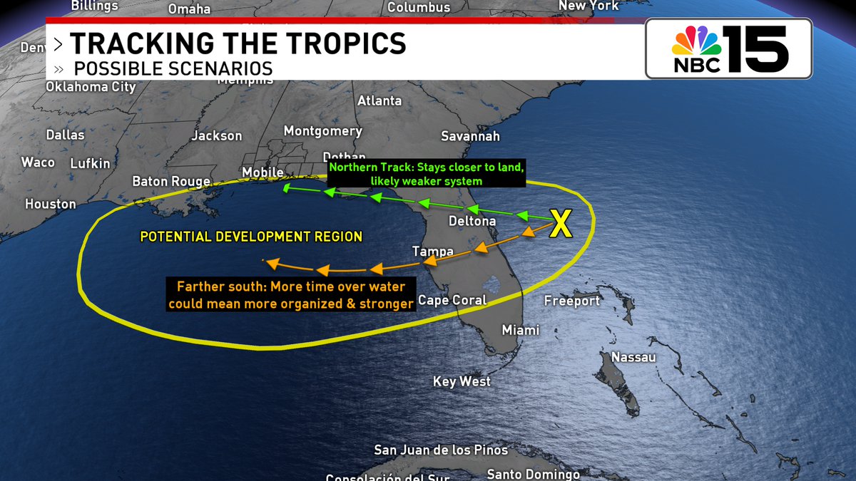
We'll be keeping a close eye on the tropics this week. Currently a low chance Invest 93L develops as it moves west through the northern Gulf. Full breakdown tonight on <a href="/mynbc15/">NBC 15 News</a> at 5, 6, &amp; 10PM. 

mynbc15.com/weather
Kelly Foster (@kelly_wpmi) 's Twitter Profile Photo

Regardless of any tropical development, a surge in tropical moisture could bring heavy rain & flooding concerns mid to late week. At the beach, the rip current risk will also likely rise with red flags possible by Thursday. NBC 15 News mynbc15.com/weather
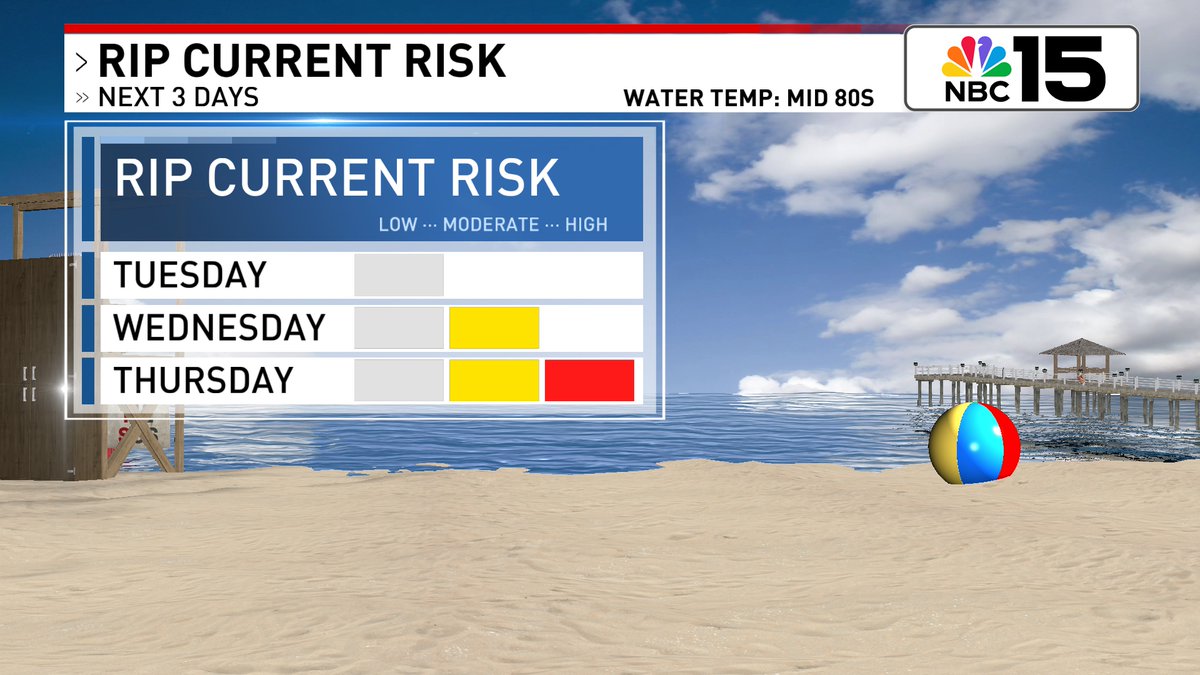
Regardless of any tropical development, a surge in tropical moisture could bring heavy rain &amp; flooding concerns mid to late week. At the beach, the rip current risk will also likely rise with red flags possible by Thursday. <a href="/mynbc15/">NBC 15 News</a>

mynbc15.com/weather
Kelly Foster (@kelly_wpmi) 's Twitter Profile Photo

Warm and mostly dry tonight before cranking the heat right back up tomorrow 🔥🥵. The best chance of wet weather tomorrow will be east of I-65. By the second half of the week rain chances will increase as tropical moisture surges across the northern Gulf Coast. NBC 15 News
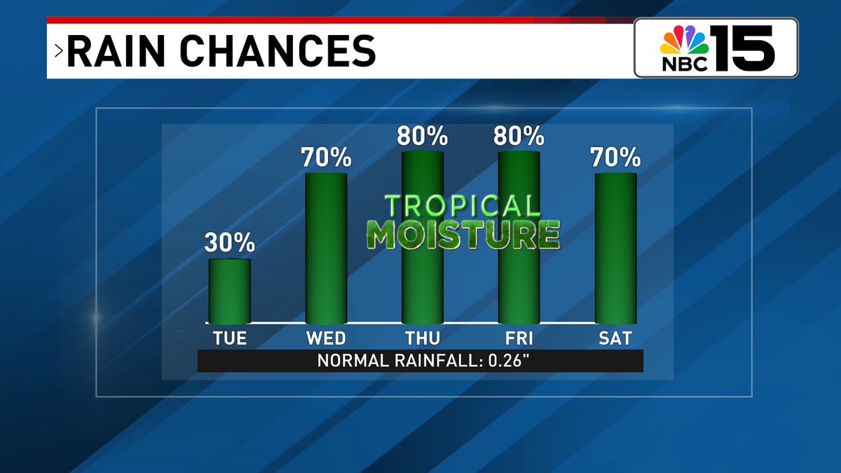
Warm and mostly dry tonight before cranking the heat right back up tomorrow 🔥🥵. The best chance of wet weather tomorrow will be east of I-65. By the second half of the week rain chances will increase as tropical moisture surges across the northern Gulf Coast. <a href="/mynbc15/">NBC 15 News</a>
Kelly Foster (@kelly_wpmi) 's Twitter Profile Photo

Now a medium (40%) chance Invest 93L develops as it moves west. It's expected to move across the Florida Peninsula tomorrow before moving into the northeastern Gulf by Wednesday. Watching closely. NBC 15 News mynbc15.com/weather
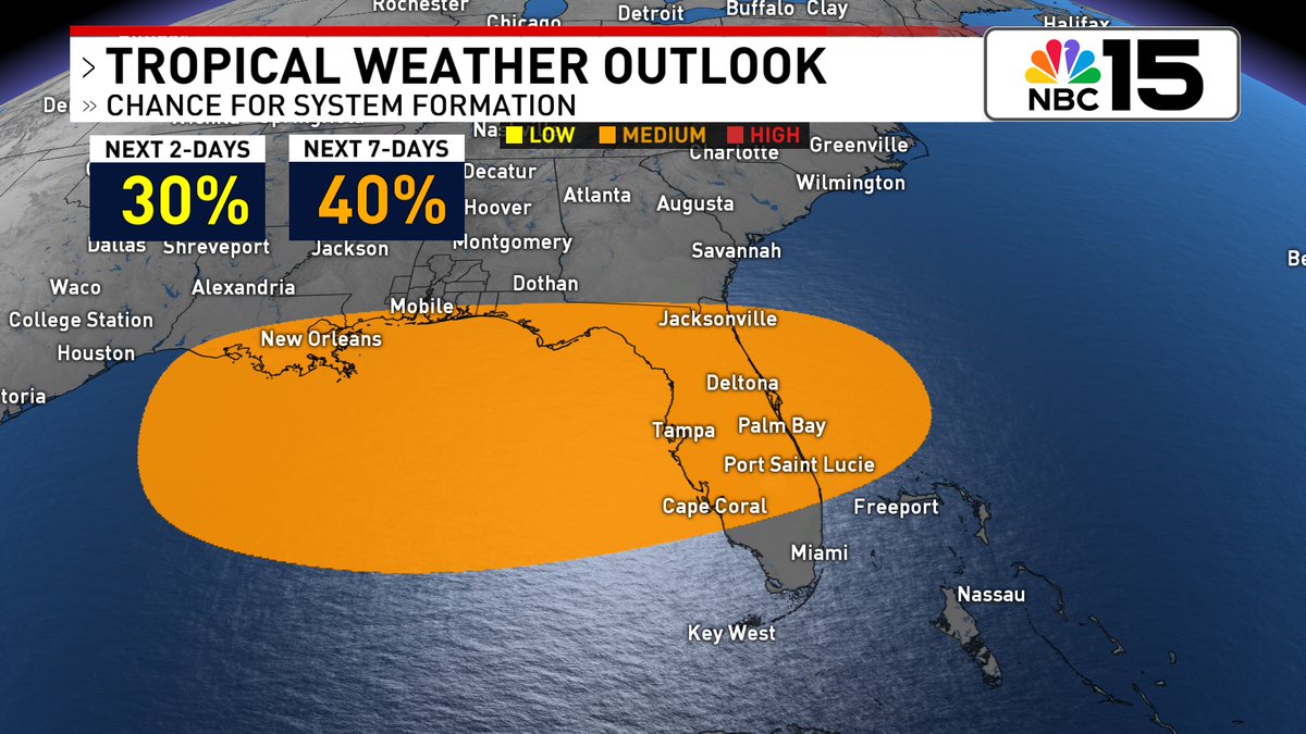
Now a medium (40%) chance Invest 93L develops as it moves west. It's expected to move across the Florida Peninsula tomorrow before moving into the northeastern Gulf by Wednesday. Watching closely. 

<a href="/mynbc15/">NBC 15 News</a> mynbc15.com/weather
Kelly Foster (@kelly_wpmi) 's Twitter Profile Photo

#Invest93L moves W across the FL Peninsula today & emerges into the warm waters of the Gulf on Wed. There will be a small window of opportunity for development. Right now medium formation chance. Next name up is #Dexter NBC 15 News mynbc15.com/weather
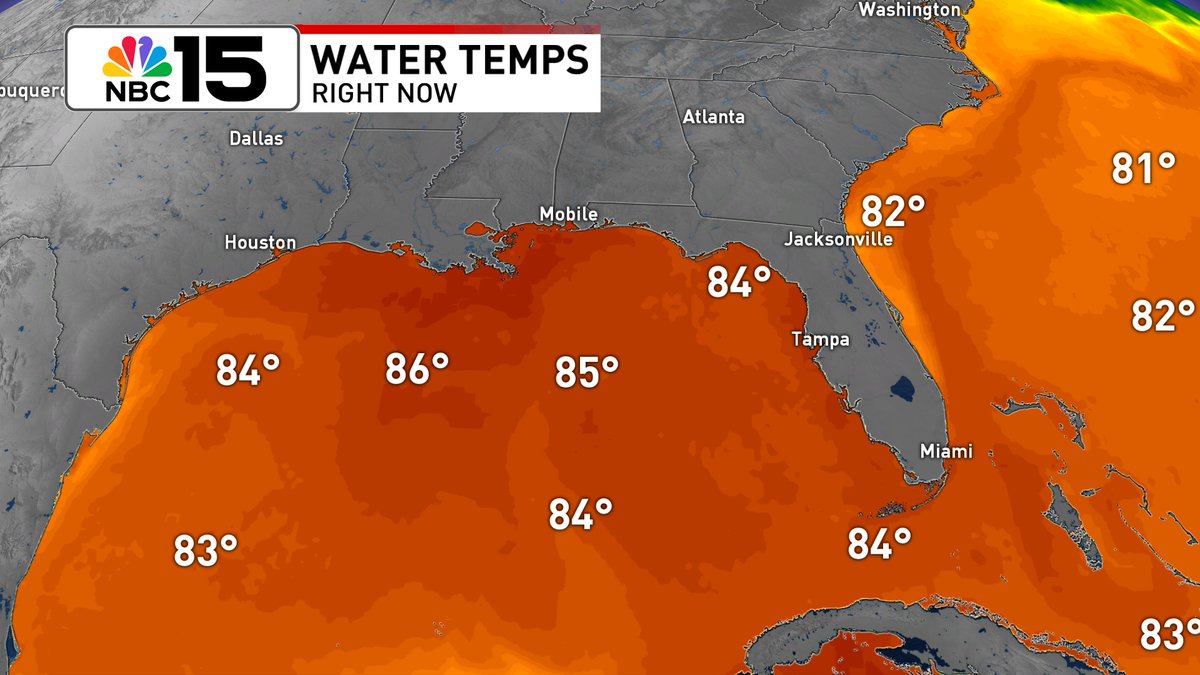
#Invest93L moves W across the FL Peninsula today &amp; emerges into the warm waters of the Gulf on Wed. There will be a small window of opportunity for development. Right now medium formation chance. Next name up is #Dexter <a href="/mynbc15/">NBC 15 News</a> mynbc15.com/weather
Kelly Foster (@kelly_wpmi) 's Twitter Profile Photo

Tracking Invest 93L: regardless of formation, heavy rainfall could produce localized flash flooding over parts of FL through mid-week. Tropical downpours may also cause flash flooding for the north-central Gulf Coast late week. #tropics NBC 15 News mynbc15.com/weather
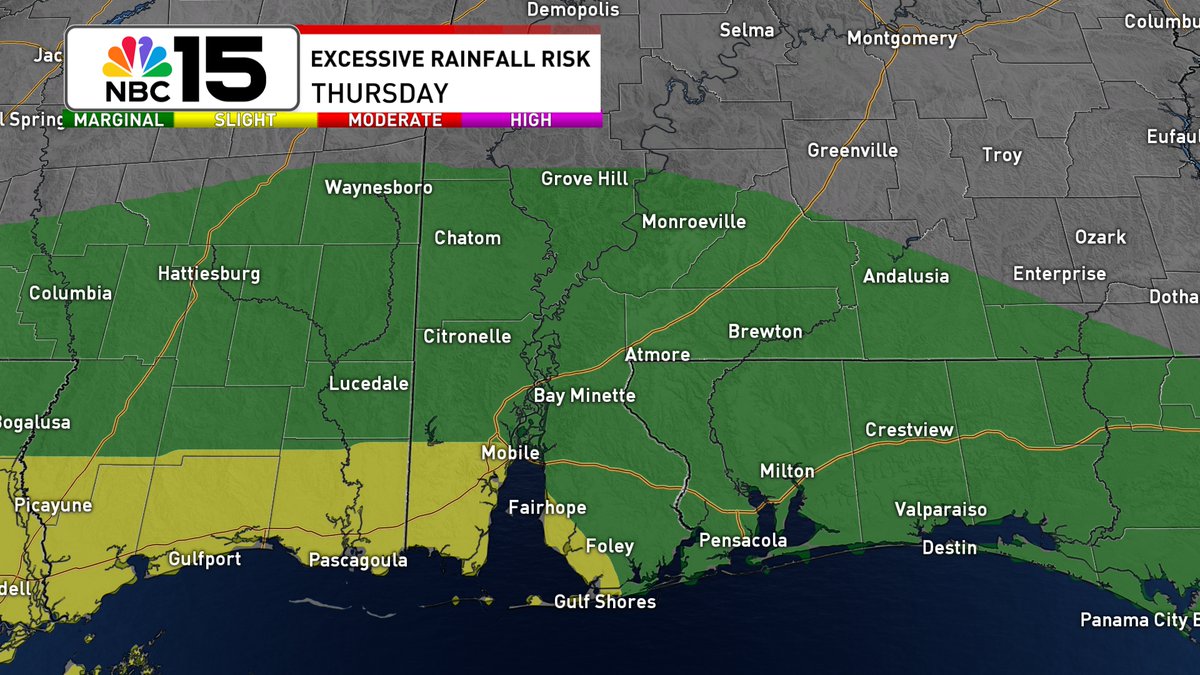
Tracking Invest 93L: regardless of formation, heavy rainfall could produce localized flash flooding over parts of FL through mid-week. Tropical downpours may also cause flash flooding for the north-central Gulf Coast late week. #tropics <a href="/mynbc15/">NBC 15 News</a> mynbc15.com/weather
Kelly Foster (@kelly_wpmi) 's Twitter Profile Photo

The heat 🥵♨🌡will rise as the day progresses! During peak heating hours, our temps will surge into the mid 90s with some areas north of I-10 nudging into the upper 90s! Add in the humidity & heat index values will soar in between 105-110 NBC 15 News mynbc15.com/weather
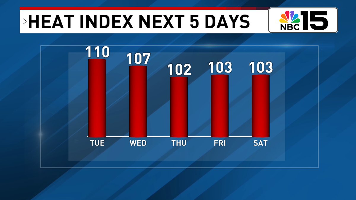
The heat 🥵♨🌡will rise as the day progresses! During peak heating hours, our temps will surge into the mid 90s with some areas north of I-10 nudging into the upper 90s! Add in the humidity &amp; heat index values will soar in between 105-110 <a href="/mynbc15/">NBC 15 News</a> mynbc15.com/weather
Kelly Foster (@kelly_wpmi) 's Twitter Profile Photo

Stay updated this week as an area of low pressure will move into the N Gulf on Wednesday. There is still a medium formation chance on Invest 93L. Mod risk of rip currents at our beaches mid-week then HIGH by Thu #tropics NBC 15 News mynbc15.com/weather
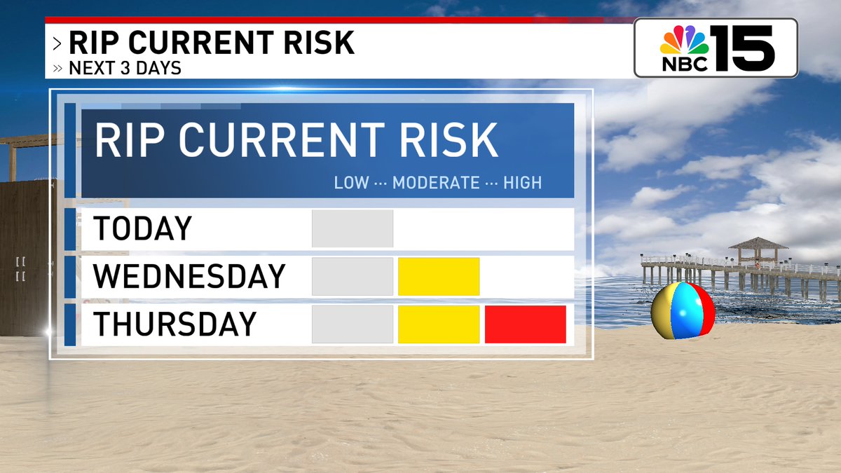
Stay updated this week as an area of low pressure will move into the N Gulf on Wednesday.  There is still a medium formation chance on Invest 93L. Mod risk of rip currents at our beaches mid-week then HIGH by Thu  #tropics <a href="/mynbc15/">NBC 15 News</a> mynbc15.com/weather
Kelly Foster (@kelly_wpmi) 's Twitter Profile Photo

Invest 93L has moved into northeast Florida. Still a medium development chance as it moves west. Latest run of models favoring a northern solution, but we could easily see changes. Continuing to watch closely. We'll have a full breakdown tonight on NBC 15 News at 5, 6, & 10PM.
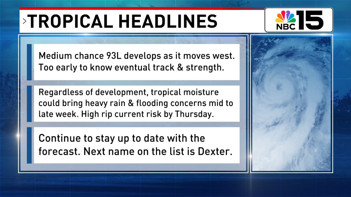
Invest 93L has moved into northeast Florida. Still a medium development chance as it moves west. Latest run of models favoring a northern solution, but we could easily see changes. Continuing to watch closely. We'll have a full breakdown tonight on <a href="/mynbc15/">NBC 15 News</a> at 5, 6, &amp; 10PM.
Kelly Foster (@kelly_wpmi) 's Twitter Profile Photo

Severe Thunderstorm Warning for southern Okaloosa County, including Fort Walton Beach, until 6:30PM. This storm is moving SW at 30 mph and is capable of 60 mph wind gusts and nickel size hail. NBC 15 News mynbc15.com/weather
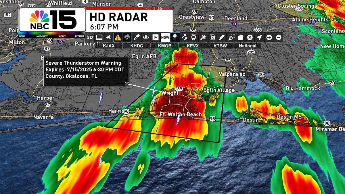
Severe Thunderstorm Warning for southern Okaloosa County, including Fort Walton Beach, until 6:30PM. This storm is moving SW at 30 mph and is capable of 60 mph wind gusts and nickel size hail. <a href="/mynbc15/">NBC 15 News</a>

mynbc15.com/weather
Kelly Foster (@kelly_wpmi) 's Twitter Profile Photo

Tomorrow bring more heat, but as tropical moisture increases, so will our rain chances. There will be a marginal risk of excessive rainfall that could lead to flash flooding for the southern 2/3rds of our area. NBC 15 News mynbc15.com/weather
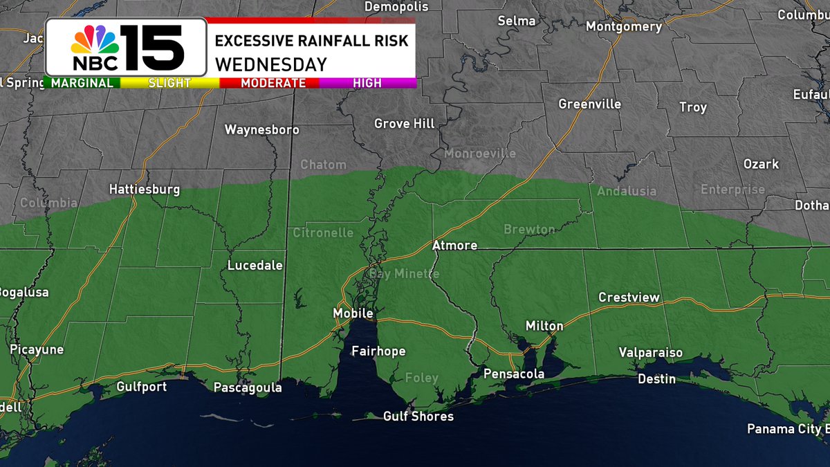
Tomorrow bring more heat, but as tropical moisture increases, so will our rain chances. There will be a marginal risk of excessive rainfall that could lead to flash flooding for the southern 2/3rds of our area. <a href="/mynbc15/">NBC 15 News</a>

mynbc15.com/weather
Kelly Foster (@kelly_wpmi) 's Twitter Profile Photo

NHC sticking with 40% development chance for the evening update. Watching to see how the disturbance moves across Florida. More details coming up tonight at 10PM on NBC 15 News. mynbc15.com/weather
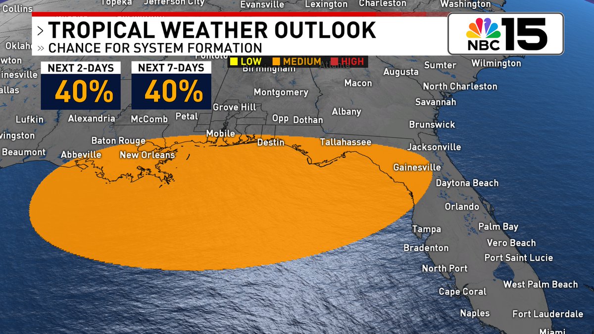
NHC sticking with 40% development chance for the evening update. Watching to see how the disturbance moves across Florida. More details coming up tonight at 10PM on <a href="/mynbc15/">NBC 15 News</a>.

mynbc15.com/weather
Kelly Foster (@kelly_wpmi) 's Twitter Profile Photo

Regardless if 93L develops or not, there will be a surge of tropical moisture that moves across the northern Gulf Coast leading to rounds of tropical downpours mid to late week with possible flooding concerns. At the beach, red flags are likely by Thursday. NBC 15 News
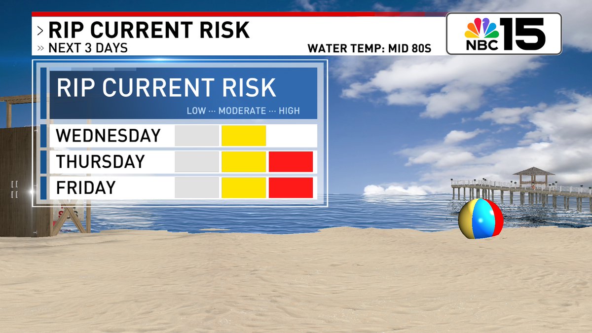
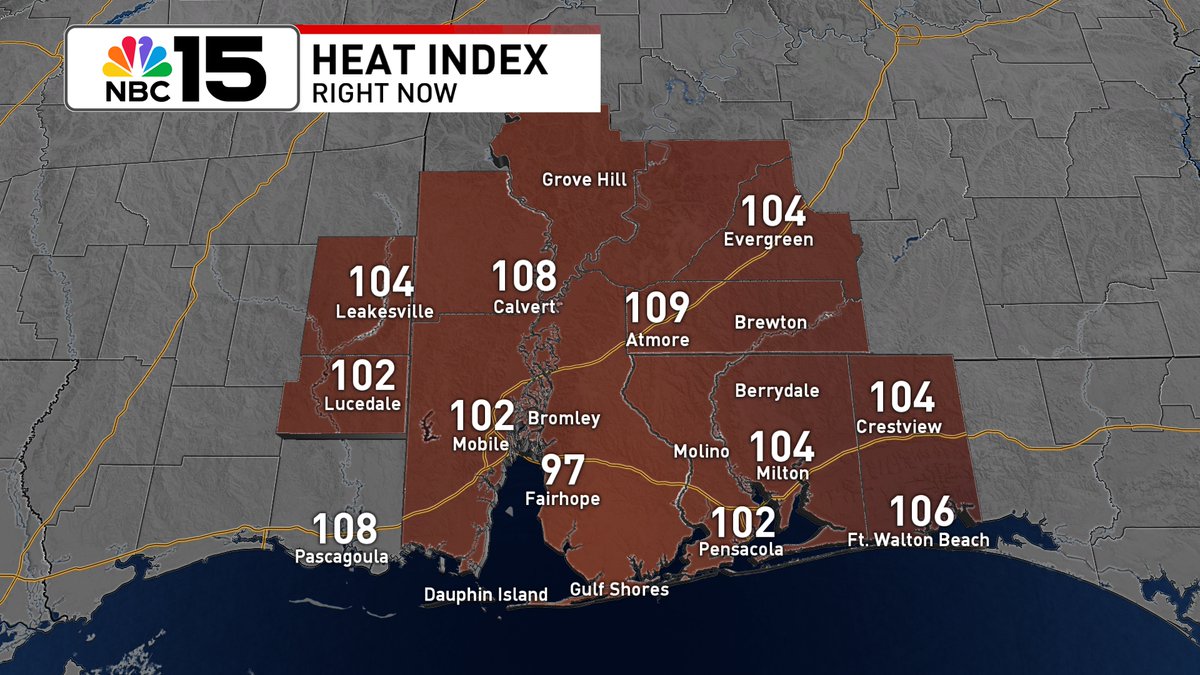
Regardless if 93L develops or not, there will be a surge of tropical moisture that moves across the northern Gulf Coast leading to rounds of tropical downpours mid to late week with possible flooding concerns. At the beach, red flags are likely by Thursday. <a href="/mynbc15/">NBC 15 News</a>