Dr. Debi Kilb (@kinect_with_sci) 's Twitter Profile
Dr. Debi Kilb

@kinect_with_sci

Seismologist, developing educational geoscience video games (Virtual & Augmented Reality, Kinect, Xbox & Unity)

ID: 413616446

linkhttp://siogames.ucsd.edu calendar_today16-11-2011 02:37:03

604 Tweet

455 Followers

978 Following

USGS Earthquakes (@usgs_quakes) 's Twitter Profile Photo

Watch this video to learn more about today’s San Francisco Bay Area earthquake with Dr. Annemarie Baltay. earthquake.usgs.gov/earthquakes/ev…

USGS Earthquakes (@usgs_quakes) 's Twitter Profile Photo

A magnitude 6.4 earthquake struck near Ferndale, CA at 2:34 this morning, Dec 20 2022. Shaking was damaging near epicenter and widely felt in NorCal. USGS ShakeAlert issued alerts to cell phones throughout the region. Smaller aftershocks should be expected in the coming days. 🧵

USGS ShakeAlert (@usgs_shakealert) 's Twitter Profile Photo

Good morning, southern California. Did you feel the magnitude 4.2 quake about 10 miles north of Borrego Springs, CA? The #ShakeAlert system was activated. More info at: earthquake.usgs.gov/earthquakes/ev… California Governor's Office of Emergency Services California Department of Conservation California Geological Survey

Good morning, southern California. Did you feel the magnitude 4.2 quake about 10 miles north of Borrego Springs, CA? The #ShakeAlert system was activated. More info at: earthquake.usgs.gov/earthquakes/ev…
<a href="/Cal_OES/">California Governor's Office of Emergency Services</a> <a href="/CalConservation/">California Department of Conservation</a> <a href="/CAGeoSurvey/">California Geological Survey</a>
USGS Earthquakes (@usgs_quakes) 's Twitter Profile Photo

Damaging M7.8 EQ hit southern Turkey near the Syrian border ~4am local time. PAGER is red for this event; extensive damage is probable. Our hearts go out to those affected. See Kandilli Rasathanesi for local info. earthquake.usgs.gov/earthquakes/ev…

Damaging M7.8 EQ hit southern Turkey near the Syrian border ~4am local time. PAGER is red for this event; extensive damage is probable. Our hearts go out to those affected. See <a href="/Kandilli_info/">Kandilli Rasathanesi</a> for local info. earthquake.usgs.gov/earthquakes/ev…
Allen Husker (@huskerallen) 's Twitter Profile Photo

Last night's earthquake swarm just south of the Salton Sea is in a zone where swarms often happen. They often start with a medium magnitude earthquake and are followed by many smaller earthquakes. academic.oup.com/gji/article-ab…

Dr. Judith Hubbard (@judithgeology) 's Twitter Profile Photo

The M4.8 earthquake that just struck New Jersey is the largest event in the catalog for this map area. Seeing huge numbers of felt reports! Typically, East Coast quakes are felt over wider areas than West Coast ones due to...

The M4.8 earthquake that just struck New Jersey is the largest event in the catalog for this map area.

Seeing huge numbers of felt reports! Typically, East Coast quakes are felt over wider areas than West Coast ones due to...
USGS ShakeAlert (@usgs_shakealert) 's Twitter Profile Photo

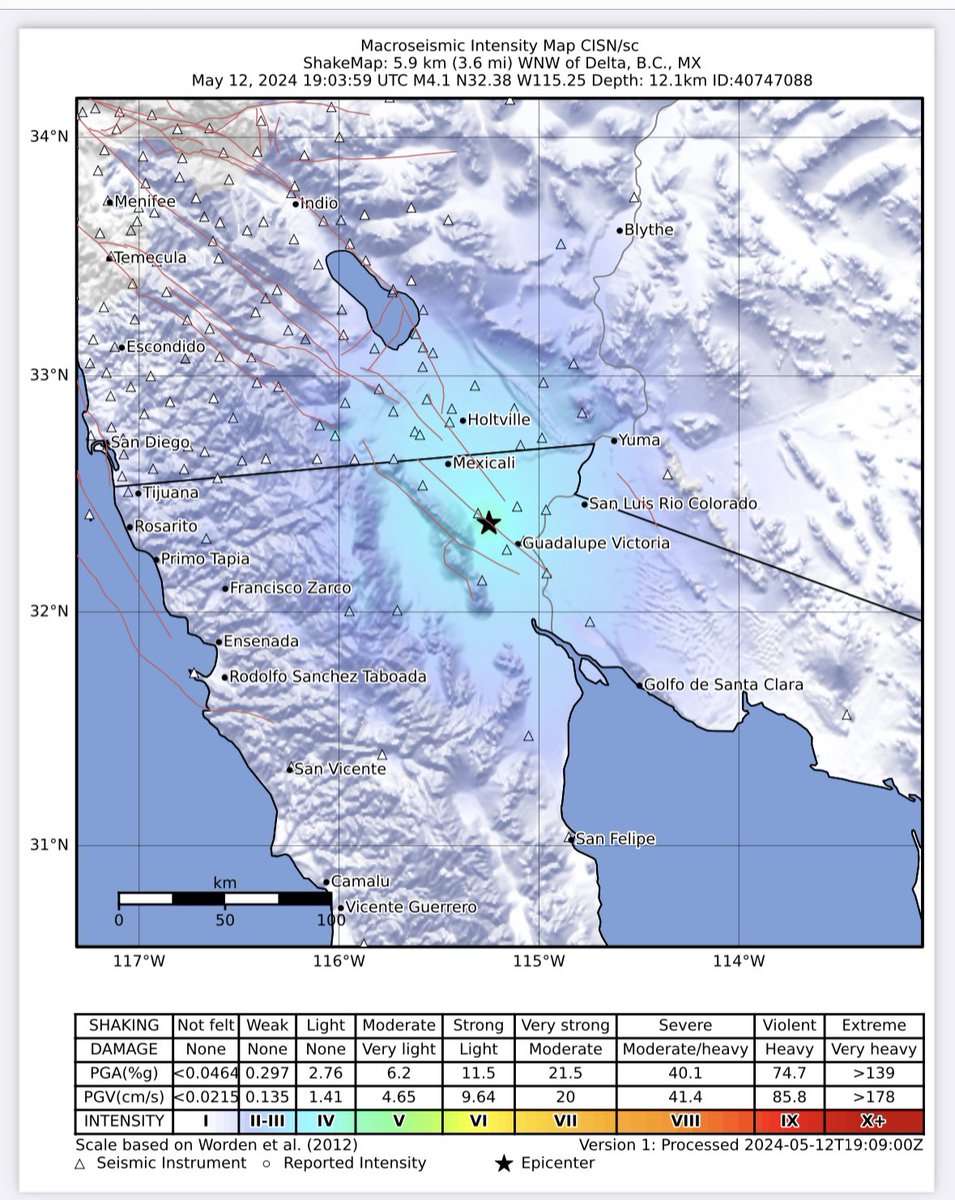
Hi again SouthernCA - your #ShakeAlert #EEW system has been very busy today with several activations. There was a second quake (magnitude 4.6) about 4 mi northwest of Delta, Baja California Mexico at 12:03 pm where alerts were delivered to phones. See: earthquake.usgs.gov/earthquakes/ev…

Hi again SouthernCA  - your #ShakeAlert #EEW system has been very busy today with several activations. There was a second quake (magnitude 4.6) about 4 mi northwest of Delta, Baja California Mexico at 12:03 pm where alerts were delivered to phones. See: earthquake.usgs.gov/earthquakes/ev…
USGS ShakeAlert (@usgs_shakealert) 's Twitter Profile Photo

Good morning again Southern CA! Did you feel the magnitude 4.6 quake about 6 miles north of Delta, Baja California Mexico at 4:58 am? The #ShakeAlert system was activated. See: earthquake.usgs.gov/earthquakes/ev… California Governor's Office of Emergency Services California Geological Survey USGS Earthquakes

Good morning again Southern CA! Did you feel the magnitude 4.6 quake about 6 miles north of Delta, Baja California Mexico at 4:58 am? The #ShakeAlert system was activated. See: earthquake.usgs.gov/earthquakes/ev… <a href="/Cal_OES/">California Governor's Office of Emergency Services</a> <a href="/CAGeoSurvey/">California Geological Survey</a> <a href="/USGS_Quakes/">USGS Earthquakes</a>
USGS ShakeAlert (@usgs_shakealert) 's Twitter Profile Photo

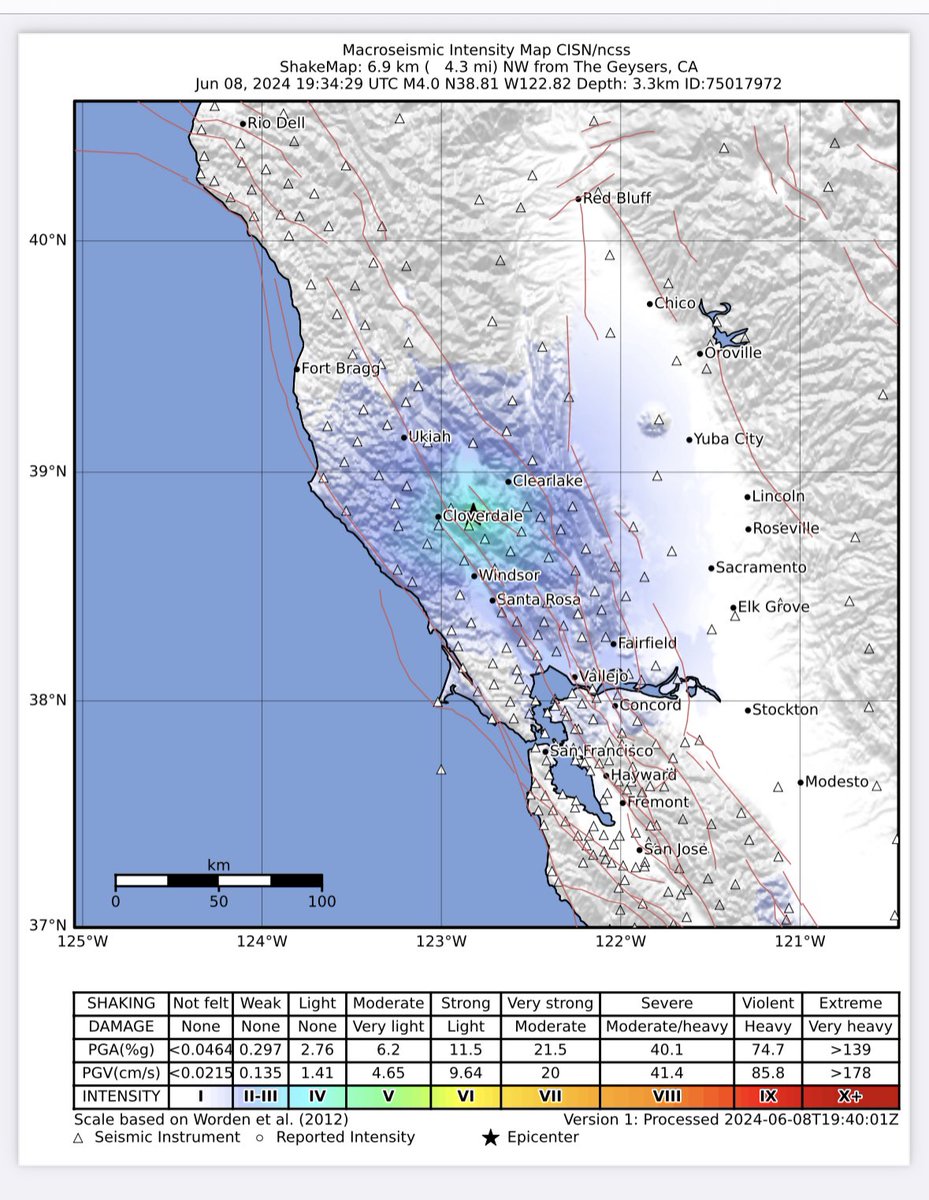
Good afternoon Northern, CA. Did you feel the magnitude 4.0 quake about 4.5 miles northwest of The Geysers at 12:34 pm? The #ShakeAlert system was activated. See: earthquake.usgs.gov/earthquakes/ev… California Governor's Office of Emergency Services California Geological Survey

Good afternoon Northern, CA. Did you feel the magnitude 4.0 quake about 4.5 miles northwest of The Geysers at 12:34 pm? The #ShakeAlert system was activated. See: earthquake.usgs.gov/earthquakes/ev… <a href="/Cal_OES/">California Governor's Office of Emergency Services</a> <a href="/CAGeoSurvey/">California Geological Survey</a>
USGS ShakeAlert (@usgs_shakealert) 's Twitter Profile Photo

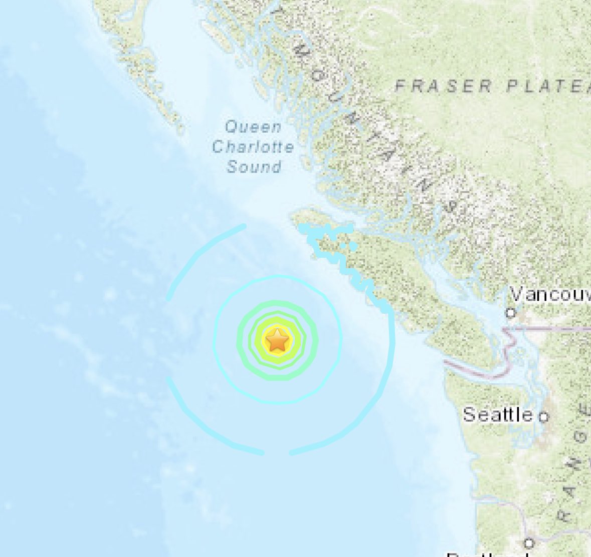
Good morning Washington state! Did you feel the magnitude 6.4 quake about 130 mi (209 km) southwest of Port McNeill, Canada at 8:08 am? The #ShakeAlert system was activated. See: earthquake.usgs.gov/earthquakes/ev… Washington ShakeOut PNSN WA Emergency Management Washington State Dept. of Natural Resources Natural Resources FEMA Region 10

Good morning Washington state! Did you feel the magnitude 6.4 quake about 130 mi (209 km) southwest of Port McNeill, Canada at 8:08 am? The #ShakeAlert system was activated. See:  earthquake.usgs.gov/earthquakes/ev… <a href="/waShakeOut/">Washington ShakeOut</a> <a href="/PNSN1/">PNSN</a> <a href="/waEMD/">WA Emergency Management</a> <a href="/waDNR/">Washington State Dept. of Natural Resources</a> <a href="/NRCan/">Natural Resources</a> <a href="/FEMARegion10/">FEMA Region 10</a>
USGS ShakeAlert (@usgs_shakealert) 's Twitter Profile Photo

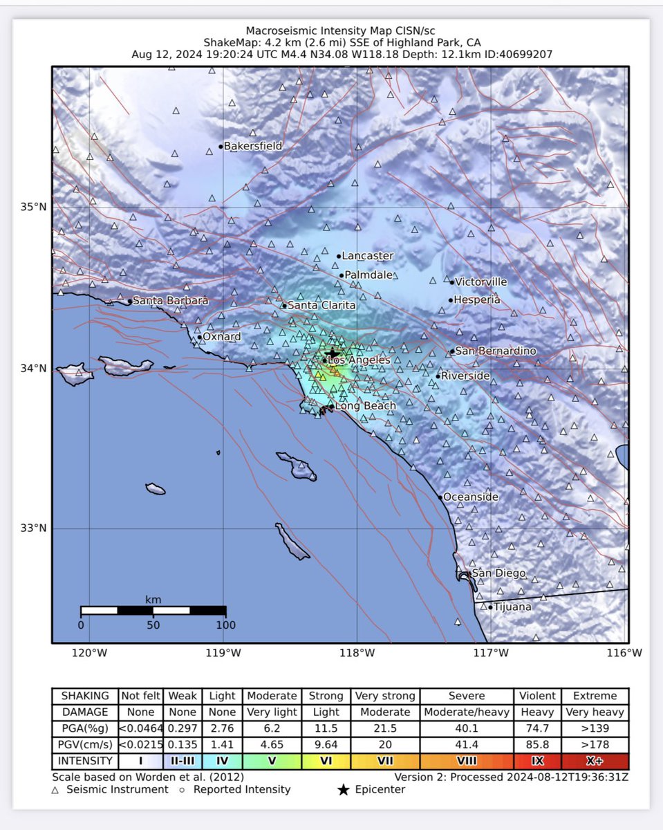
Good afternoon Southern California did you feel the magnitude 4.4 quake at 12:20 pm about 2.5 miles southeast of Highland Park. The #ShakeAlert system was activated. See: earthquake.usgs.gov/earthquakes/ev… California Geological Survey California Governor's Office of Emergency Services

Good afternoon Southern California did you feel the magnitude 4.4 quake at 12:20 pm about 2.5 miles southeast of Highland Park. The #ShakeAlert system was activated. See: earthquake.usgs.gov/earthquakes/ev… <a href="/CAGeoSurvey/">California Geological Survey</a> <a href="/Cal_OES/">California Governor's Office of Emergency Services</a>
USGS ShakeAlert (@usgs_shakealert) 's Twitter Profile Photo

Good morning Southern California! Did you feel the magnitude 3.9 quake about 3 miles southeast of Ontario at 10:34 am? The #ShakeAlert system was activated. See: earthquake.usgs.gov/earthquakes/ev… California Governor's Office of Emergency Services California Geological Survey USGS Earthquakes Listos California
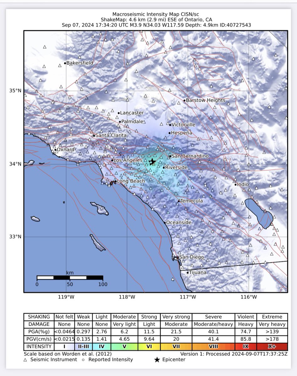
Good morning Southern California! Did you feel the magnitude 3.9 quake about 3 miles southeast of Ontario at 10:34 am? The #ShakeAlert system was activated. See: earthquake.usgs.gov/earthquakes/ev… <a href="/Cal_OES/">California Governor's Office of Emergency Services</a> <a href="/CAGeoSurvey/">California Geological Survey</a> <a href="/USGS_Quakes/">USGS Earthquakes</a> <a href="/ListosCA/">Listos California</a>
Dr. Eric J Fielding, PhD (@ericfielding) 's Twitter Profile Photo

#Mexico #Oaxaca #earthquake Caltech-JPL ARIA interferogram from modified Copernicus Sentinel-1 data acquired 2018/02/17 and 02/05 shows main fault slip on subduction megathrust beneath coast. USGS epicenter location biased NE as with previous events

#Mexico #Oaxaca #earthquake Caltech-JPL ARIA interferogram from modified Copernicus Sentinel-1 data acquired 2018/02/17 and 02/05 shows main fault slip on subduction megathrust beneath coast. USGS epicenter location biased NE as with previous events