LeicaGeosystems (@leicageosystems) 's Twitter Profile
LeicaGeosystems

@leicageosystems

Leica Geosystems products and services are trusted by professionals worldwide to help capture, analyse, and present spatial information. Part of @HexagonAB

ID: 82582147

linkhttp://leica-geosystems.com calendar_today15-10-2009 09:56:07

10,10K Tweet

16,16K Followers

702 Following

LeicaGeosystems (@leicageosystems) 's Twitter Profile Photo

Still setting up your total station manually? 🙄 There’s a smarter way. 👉🏼 The Auto Setup app in Leica Captivate uses control points and automation to get you aligned in minutes - fast, accurate and efficient. Explore all 46 Captivate apps -> hxgn.biz/3UYax0z

LeicaGeosystems (@leicageosystems) 's Twitter Profile Photo

Antonio Mendes, Mobile Mapping Solutions Manager at Leica Geosystems, and Ted Knaak, President of TopoDOT, will be at #INTERGEO2025, sharing insights into how pavement evaluation is being streamlined like never before. Thursday, October 9 | 10:40–11:00 📍 Main Stage

Antonio Mendes, Mobile Mapping Solutions Manager at Leica Geosystems, and Ted Knaak, President of TopoDOT, will be at #INTERGEO2025, sharing insights into how pavement evaluation is being streamlined like never before. 

Thursday, October 9 | 10:40–11:00 📍 Main Stage
LeicaGeosystems (@leicageosystems) 's Twitter Profile Photo

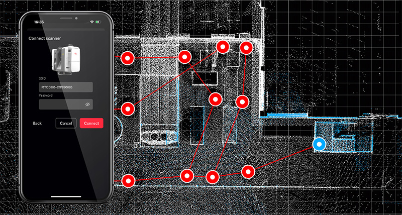
✨ Designed for the field, Cyclone FIELD 360 brings productivity to your workflow with intuitive tools and a future-proof design. Learn how it boosts productivity: hxgn.biz/3QScuJX #RealityCapture #CycloneFIELD360 #LaserScanning

✨ Designed for the field, Cyclone FIELD 360 brings productivity to your workflow with intuitive tools and a future-proof design. Learn how it boosts productivity: hxgn.biz/3QScuJX 

#RealityCapture #CycloneFIELD360 #LaserScanning
LeicaGeosystems (@leicageosystems) 's Twitter Profile Photo

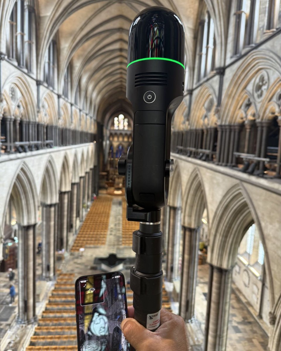
Recently, Marcus Rowe & Daniel Prewitt from Leica Geosystems digitally mapped Stonehenge & Salisbury Cathedral 🏛️ in just ONE day⏱️using BLK2GO & RTC360. We are proud to see our technology support heritage & public safety!

Recently, Marcus Rowe & Daniel Prewitt from Leica Geosystems digitally mapped Stonehenge & Salisbury Cathedral 🏛️ in just ONE day⏱️using BLK2GO & RTC360. We are proud to see our technology support heritage & public safety!
LeicaGeosystems (@leicageosystems) 's Twitter Profile Photo

GeoWork AG conducts regular surveys of the Aebi-Sillerenbühl chairlift mountain station using the Leica MS60 and CS20. Every survey turns data into confidence, letting skiers enjoy the Alps with peace of mind and every ride running smoothly. 🎿🏔️

GeoWork AG conducts regular surveys of the Aebi-Sillerenbühl chairlift mountain station using the Leica MS60 and CS20. Every survey turns data into confidence, letting skiers enjoy the Alps with peace of mind and every ride running smoothly. 🎿🏔️
LeicaGeosystems (@leicageosystems) 's Twitter Profile Photo

“Mobile mapping opened doors to infrastructure, rail, marine & renewables.” – Paul Jackson, Castle Surveys. ▪️ 80 km highway scanned in 1 day ▪️ No closures, no drones, no delays Read more: hxgn.biz/4mQy0wr #MobileMapping #SurveyLife #LeicaGeosystems #Geomatics
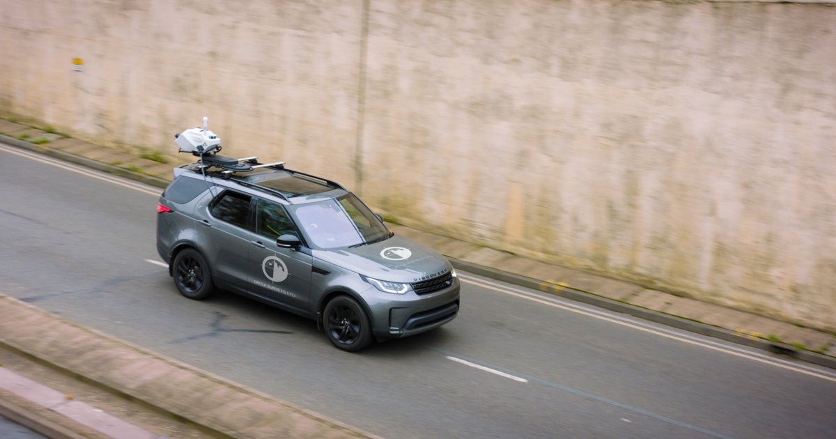
“Mobile mapping opened doors to infrastructure, rail, marine &amp; renewables.” – Paul Jackson, <a href="/CastleSurveys/">Castle Surveys</a>. 

▪️ 80 km highway scanned in 1 day
▪️ No closures, no drones, no delays

Read more: hxgn.biz/4mQy0wr

#MobileMapping #SurveyLife #LeicaGeosystems #Geomatics
LeicaGeosystems (@leicageosystems) 's Twitter Profile Photo

Operators know the terrain. OHS managers know the risks. Leica Xsight360 bridges both worlds, bringing real-time awareness to machines and teams. Turning every near miss into a safer tomorrow, this is Leica Xsight360: hxgn.biz/4nbzUby #SafetyFirst #HeavyConstruction

Operators know the terrain. OHS managers know the risks. Leica Xsight360 bridges both worlds, bringing real-time awareness to machines and teams. 

Turning every near miss into a safer tomorrow, this is Leica Xsight360: hxgn.biz/4nbzUby

#SafetyFirst #HeavyConstruction
LeicaGeosystems (@leicageosystems) 's Twitter Profile Photo

🏗️ Leica iCON trades is up for a Wichmann Innovation Award! 🏆 Leica iCON trades brings precision tech to construction, with tools like the vPen and vPole that are redefining what’s possible on site. Vote now: hxgn.biz/3K9RxtQ #WichmannAwards

🏗️ Leica iCON trades is up for a Wichmann Innovation Award! 🏆

Leica iCON trades brings precision tech to construction, with tools like the vPen and vPole that are redefining what’s possible on site.

Vote now: hxgn.biz/3K9RxtQ

#WichmannAwards
LeicaGeosystems (@leicageosystems) 's Twitter Profile Photo

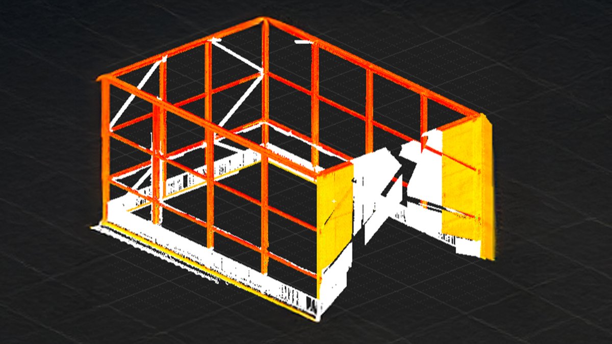
Transform your #RealityCapture workflow! You can now extract and geo-reference targets directly in the field! 📍✨ Learn how in our Expert Insight: 🔗 hxgn.biz/4oko6VL #RealityCapture #RTC360 #Surveying

Transform your #RealityCapture workflow! You can now extract and geo-reference targets directly in the field! 📍✨ Learn how in our Expert Insight:
🔗 hxgn.biz/4oko6VL 

#RealityCapture #RTC360 #Surveying
LeicaGeosystems (@leicageosystems) 's Twitter Profile Photo

One tool. Four powerful features: 📡 📐 Total station, GNSS,imaging, 3D scanning. Working as one, giving you complete clarity. Curious how? Get the e-book: hxgn.biz/4lwXzC5

One tool. Four powerful features: 📡 📐 Total station, GNSS,imaging, 3D scanning. Working as one, giving you complete clarity.
Curious how? Get the e-book: hxgn.biz/4lwXzC5
LeicaGeosystems (@leicageosystems) 's Twitter Profile Photo

What data sizes can Reality Cloud Studio work with? From a few megabytes to single files hundreds of gigabytes in size, Reality Cloud Studio can handle it all. #RealityCloudStudio #PointClouds #DigitalReality

LeicaGeosystems (@leicageosystems) 's Twitter Profile Photo

🚧 For MJL Group, construction tech is changing the game. With Leica 3D machine control and Leica ConX, they've unlocked next-level efficiency. Founder Matt Lugg calls it ''transformational". Read the full story: hxgn.biz/47jWudd #LeicaGeosystems #HeavyConstruction

🚧 For MJL Group, construction tech is changing the game. With Leica 3D machine control and Leica ConX, they've unlocked next-level efficiency. Founder Matt Lugg calls it ''transformational".

Read the full story: hxgn.biz/47jWudd

#LeicaGeosystems #HeavyConstruction
LeicaGeosystems (@leicageosystems) 's Twitter Profile Photo

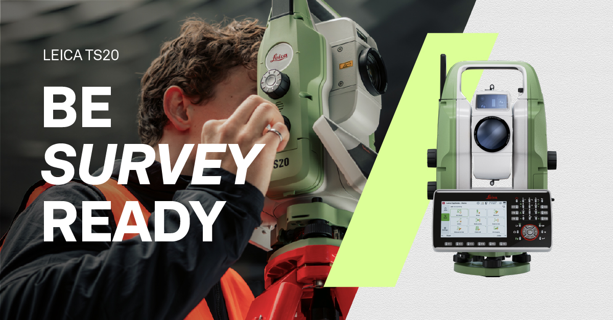
The Leica TS20: Built for surveyors, with surveyor feedback. Experience AI-powered automation, fast new EDM, IP66-level weather protection and more. #BeReady to work smarter with updated Leica Captivate & Infinity software: hxgn.biz/3JAi9Eb

The Leica TS20: Built for surveyors, with surveyor feedback. Experience AI-powered automation, fast new EDM, IP66-level weather protection and more. #BeReady to work smarter with updated Leica Captivate &amp; Infinity software: hxgn.biz/3JAi9Eb
LeicaGeosystems (@leicageosystems) 's Twitter Profile Photo

🎬 Behind the scenes at INTERGEO 2025! Take a look behind the curtain as our teams showcase the latest innovations, connect with industry professionals, and demonstrate how Leica Geosystems is shaping the future of geospatial technology. #INTERGEO2025 x.com/LeicaGeosystem…

LeicaGeosystems (@leicageosystems) 's Twitter Profile Photo

72 hours. That’s how long you have to fix uneven floors. Cyclone 3DR & Cyclone FIELD 360 help you stay on track with automated floor flatness analysis and ASTM-compliant reports. Learn more 🔗 hxgn.biz/46RinjX #RealityCapture #LaserScanning #3DR #FFFL

LeicaGeosystems (@leicageosystems) 's Twitter Profile Photo

On October 2nd, we launched the Leica TS20 robotic total station, and by October 7th, it was already in the spotlight at #INTERGEO2025 Couldn’t join? Visit our website to explore the Leica TS20 in detail and #BeReady for what is next 👉🏽 hxgn.biz/3JAi9Eb

LeicaGeosystems (@leicageosystems) 's Twitter Profile Photo

Leica TS20: Bygget til landmåling, med feedback fra landmålere. Oplev AI-baseret automatisering, hurtig og ny EDM, IP66-klasseficeret vejrbeskyttelse og meget mere >> hxgn.biz/3JAi9Eb

Leica TS20: Bygget til landmåling, med feedback fra landmålere. Oplev AI-baseret automatisering, hurtig og ny EDM, IP66-klasseficeret vejrbeskyttelse og meget mere &gt;&gt;  hxgn.biz/3JAi9Eb
LeicaGeosystems (@leicageosystems) 's Twitter Profile Photo

Den nye Leica TS20 robottotalstation = automatisering, som forebygger fejl + præcision, der varer ved. #BeReady til alle byggepladser og arbejdsopgaver 👉🏼 hxgn.biz/3JAi9Eb

LeicaGeosystems (@leicageosystems) 's Twitter Profile Photo

The new Leica TS20 robotic total station = automation that prevents mistakes + precision that lasts. #BeReady to face any site and job 👉🏼 hxgn.biz/3JAi9Eb