Nnadozie Onyeukwu. (@mandouze) 's Twitter Profile
Nnadozie Onyeukwu.

@mandouze

@EASA @AUVSI & @DroneAdda || Certified #UAVPilot || #Python #GeospatialAnalyst || M.Sc Geospatial Tech || Protocol @refugefamily #InspireAfrica ViewsMine. RT!=E

ID: 710053751977971712

linkhttps://europa.eu/europass/eportfolio/api/eprofile/shared-profile/2e196789-f261-4222-9b6f-5c64dc52c8 calendar_today16-03-2016 10:43:01

20,20K Tweet

2,2K Followers

2,2K Following
Department of Geographical Sciences (@umdgeography) 's Twitter Profile Photo

Join the 3rd International Quantitative Remote Sensing Summer School from July 10-17. Hosted virtually, it features global experts discussing the latest in remote sensing. Free to attend! #IntGeoCenter go.umd.edu/1p8h

Join the 3rd International Quantitative Remote Sensing Summer School from July 10-17. Hosted virtually, it features global experts discussing the latest in remote sensing. Free to attend! #IntGeoCenter
go.umd.edu/1p8h
Tao Wen 文涛 (@jaywt) 's Twitter Profile Photo

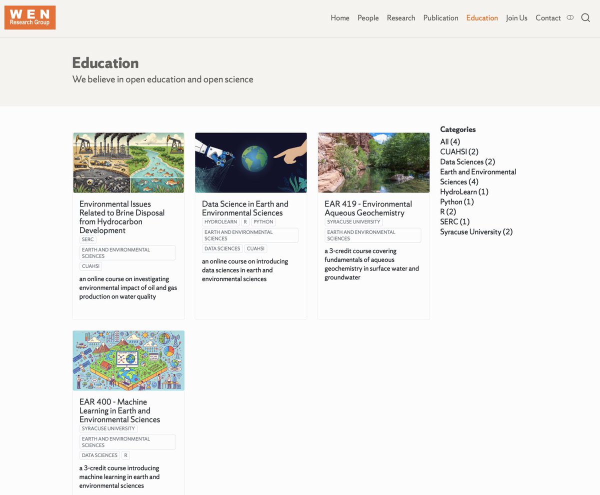
My team believes in open education. I am in the process of making all of the teaching materials of my courses (university curriculum and extracurricular) online and publicly accessible via my website at: jaywen.com/education.html Some are already there. More to come. Stay tuned!

My team believes in open education. I am in the process of making all of the teaching materials of my courses (university curriculum and extracurricular) online and publicly accessible via my website at: jaywen.com/education.html Some are already there. More to come. Stay tuned!
Behzad Ghanbarian (@b_ghanbarian) 's Twitter Profile Photo

I have two PhD positions available at UTA to start Spring or Fall 2025. Applicants should submit a cover letter and an updated CV to me via email [email protected]. Please use “PhD at UTA” on the subject line followed by the subject of interest. #research #UTA
Yohan (@yohaniddawela) 's Twitter Profile Photo

The most important geospatial concept? Spatial Autocorrelation. It can make the difference between spurious and accurate results. Here’s what you need to know about it:

The most important geospatial concept?

Spatial Autocorrelation.

It can make the difference between spurious and accurate results.

Here’s what you need to know about it:
State of the Map Nigeria (@sotmnigeria) 's Twitter Profile Photo

All is set for #SotMNigeria2024 conference hosting at Ile-Ife as the Local organizing Team led by Dr.Victor N. Sunday met the Management of AFRIGIST 🇳🇬🇨🇲🇧🇫🇧🇯🇲🇱 🇬🇭 🇳🇪 🇸🇳 to confirm available hosting facilities , major highlights of the conference 2024.stateofthemapnigeria.org

All is set for #SotMNigeria2024 conference hosting at Ile-Ife as the Local  organizing Team  led by Dr.Victor N. Sunday met  the Management of  <a href="/AFRIGIST_/">AFRIGIST 🇳🇬🇨🇲🇧🇫🇧🇯🇲🇱 🇬🇭 🇳🇪 🇸🇳</a>  to  confirm  available  hosting facilities , major highlights of the conference 2024.stateofthemapnigeria.org
Chi Chen (@chenchiiii) 's Twitter Profile Photo

I am recruiting Ph.D. students (Fall 2025) and Postdocs (now). We have multi-year NASA-funded projects and flexible funding to support your research: active/passive, optical/microwave remote sensing, vegetation & land modeling. Check my website: sites.google.com/site/chenchich…

Department of Geographical Sciences (@umdgeography) 's Twitter Profile Photo

Congratulations to PhD student Paromita basak 👏👏👏 As NASA #FINESST, she'll use her $150K grant to identify key areas in Southeast Asia that offer significant carbon storage and biodiversity benefits, w/ advisor Laura Duncanson +GEDI go.umd.edu/finesst-2024

Congratulations to PhD student <a href="/Paromitabasak1/">Paromita basak</a> 👏👏👏 

As <a href="/NASA/">NASA</a> #FINESST, she'll use her $150K grant to identify key areas in Southeast Asia that offer significant carbon storage and biodiversity benefits, w/ advisor <a href="/lauraduncanson/">Laura Duncanson</a> +<a href="/GEDI_Knights/">GEDI</a> 
go.umd.edu/finesst-2024
Geospatial Systems CDT (@geospatialcdt) 's Twitter Profile Photo

We are welcoming students, academics and industry colleagues to our 2024 CDT Annual Assembly. We've got a great couple of days ahead including talks form our final MRes cohort and posters highlighting student outputs over the past 12 months.

We are welcoming students, academics and industry colleagues to our 2024 CDT Annual Assembly.

We've got a great couple of days ahead including talks form our final MRes cohort and posters highlighting student outputs over the past 12 months.
Geospatial Systems CDT (@geospatialcdt) 's Twitter Profile Photo

We've started our first session of individual research presentations from our fifth (and final) cohort of students. Hearing presentations from a diverse range of Geospatial applications. You can find the topics, plus those of our other cohorts at geospatialcdt.ac.uk/phd-researcher…

We've started our first session of individual research presentations from our fifth (and final) cohort of students. 

Hearing presentations from a diverse range of Geospatial applications. You can find the topics, plus those of our other cohorts at geospatialcdt.ac.uk/phd-researcher…
CPGIS (@cpgis_media) 's Twitter Profile Photo

Research associate or fellow position in urban analytics available at the Geospatial Data Science Group, University of Glasgow bit.ly/3AMjCmf apply by 1 Oct 2024

Olumide S. Ogungbemi AMAPH (@olu_stephenlr) 's Twitter Profile Photo

BSc - University of Lagos, Nigeria. 🇳🇬, African Continent. 2nd in 🇳🇬. World rank 1,253 MS - Oregon State University, USA🇺🇸, North American Continent. World rank 140 PhD - ??🤔 All Glory to God.I got fully funded MS offer in Geography and Geospatial Science at Oregon State Uni.

BSc - University of Lagos, Nigeria. 🇳🇬, African Continent. 2nd in 🇳🇬.
World rank 1,253 

MS - Oregon State University, USA🇺🇸, North American Continent. World rank 140

PhD - ??🤔
All Glory to God.I got fully funded MS offer in Geography and Geospatial Science at Oregon State Uni.
Qiusheng Wu (@giswqs) 's Twitter Profile Photo

🚀 An update on the "Introduction to GIS Programming" course I'm teaching this semester! We wrapped up Python basics this week and will dive into #geospatial programming next week. 🎉 All course materials and video recordings are freely available online. Stay tuned for more

🚀 An update on the "Introduction to GIS Programming" course I'm teaching this semester! We wrapped up Python basics this week and will dive into #geospatial programming next week. 🎉

All course materials and video recordings are freely available online. Stay tuned for more
Pete Masters (@pedrito1414) 's Twitter Profile Photo

Mappers, we need help in #MaiduguriFlood response. With Nigeria Red Cross (Nigerian Red Cross Society HQ) & Humanitarian Mappers (Humanitarian Mappers) we are mapping areas where data is needed to help hundreds of thousands of flood-affected people! tasks.hotosm.org/projects/14735 Humanitarian OpenStreetMap Team Missing Maps YouthMappers

Gatien Falconnier (@gatien_falc) 's Twitter Profile Photo

We are looking for a PhD candidate to explore maize and sorghum comparative performances across sub-Saharan Africa, with the use of crop models: cirad.fr/content/downlo…

We are looking for a PhD candidate to explore maize and sorghum comparative performances across sub-Saharan Africa, with the use of crop models: 

cirad.fr/content/downlo…
OEA Consults (@consultsoea) 's Twitter Profile Photo

WE ARE HIRING!! Do you have a passion for managing impactful projects? OEA Consults is looking for a skilled Project Coordinator to drive our innovative solutions in planning and executing field data collection activities. 🚀 Ready to take your career to the next level? Read

WE ARE HIRING!! 

Do you have a passion for managing impactful projects? OEA Consults is looking for a skilled Project Coordinator to drive our innovative solutions in planning and executing field data collection activities. 🚀

Ready to take your career to the next level? Read
Qiusheng Wu (@giswqs) 's Twitter Profile Photo

Installing all commonly used #geospatial Python packages with a single command using the blazing fast uv package manager 🚀🔥 Video: youtu.be/nMyxL4n2nI0 geospatial: github.com/opengeos/geosp… uv: github.com/astral-sh/uv

Installing all commonly used #geospatial Python packages with a single command using the blazing fast uv package manager 🚀🔥

Video: youtu.be/nMyxL4n2nI0
geospatial: github.com/opengeos/geosp…
uv: github.com/astral-sh/uv
Deekay 🇳🇬📍🇸🇦 (@sdhikrullahi) 's Twitter Profile Photo

Please Nigeria's Drone Community check this article out, and I look forward to your comment. The NCAA and other African country's regulators can adopt this to make licensing possible. Thank you all as you. linkedin.com/pulse/guide-re…