Mark Dixon
@markdixontv
Chief Meteorologist at @WFSBnews... Forecasting & Broadcasting Weekday Evenings | Science Sunday, Host
ID: 322254150
http://www.wfsb.com/story/14896073/mark-dixon 22-06-2011 21:47:51
10,10K Tweet
8,8K Followers
873 Following


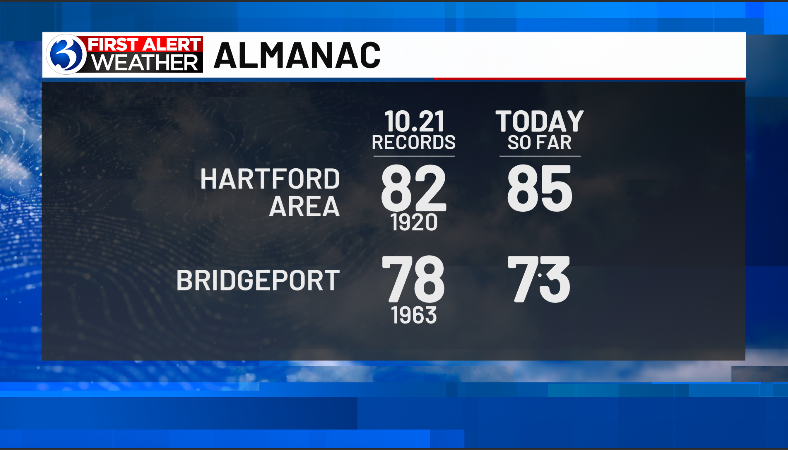
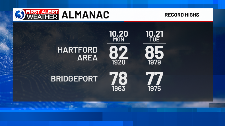
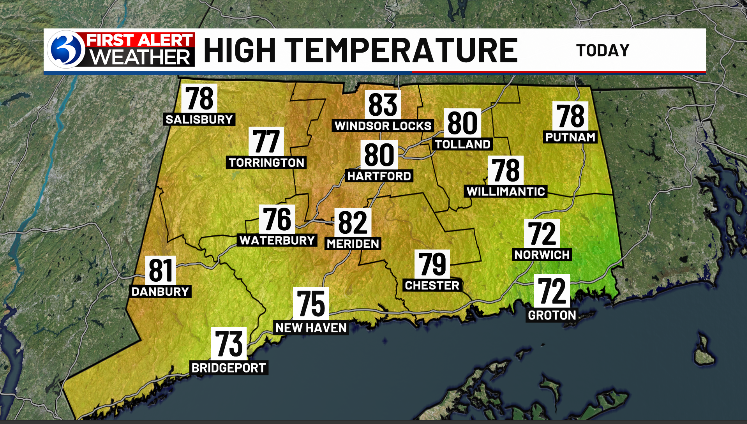
As of 3p Mon (10.21) the 104 year old record high for the Hartford Area has been surpassed by at least 3°! More on this unseasonably warm weather, also what will be an increasingly long stretch of dry weather... ahead on WFSB Channel 3

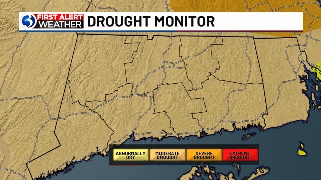
Today, sunset shifted to the 5p hour as we lose daylight heading toward winter... While we'll see plenty of sunshine in the days ahead, rainfall deficits increase. More on rain chances, also a transition to more October-like weather, ahead at 11p on WFSB Channel 3


The elevated risk for fire danger continues tomorrow, therefore it's another *First Alert Weather Day* ... deficits grow behind a cold front that ushers in even drier air on a gusty wind. More on this dry stretch & when it will feel October again, ahead on WFSB Channel 3


FIRST ALERT WEATHER DAY: The fire danger remains high today. The foliage, while near peak, is drying out in the breeze and adding fuel to brush fires already ongoing/sitting on the ground as tinder. While winds calm tonight, we stay dry... details on WFSB Channel 3 until 6:30 tonight


A warm front crosses tonight with some sprinkles, but it also brings a significant warm up! In the First Alert Forecast, we're talking record warmth on Halloween, prompting a First Alert Weather Day. Join us until 6:30 on WFSB Channel 3


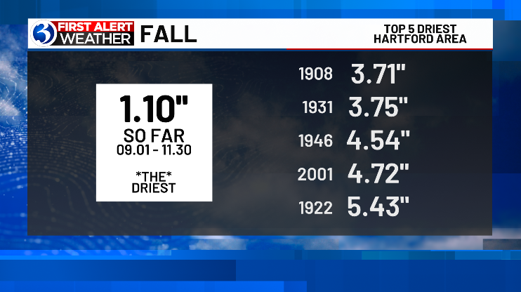
As of 11p (10.29), a whopping 0.06" of rain has been measured at Bradley Intl Airport. The total could come up a little more, but October '24 is still on track to go down in the books as the 3rd driest.


Much warmer today -- and even warmer tomorrow! A First Alert Weather Day as we forecast record warmth for Halloween. When temperatures fall to seasonable levels again until 6:30 on WFSB Channel 3


Thu (Halloween) 2p readings... 1° from the record, at Bradley Intl Airport 2° from the record at Bridgeport!


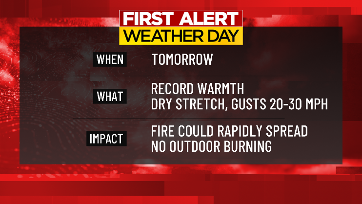
*First Alert Weather Day* While today is seasonable, another surge of warm air heads our way... temps peak Wednesday, at record levels. Also, with an increasing wind speed (gusts 30+ mph), there will be an amplified fire weather concern. More from 400-630p on WFSB Channel 3


Last night: the coldest of the season so far... Tonight: much milder as a warming trend commences! This one again peaks with temps hitting record levels... breaking down our First Alert Weather Day, how high temps go plus an increased fire risk, at 11p on WFSB Channel 3
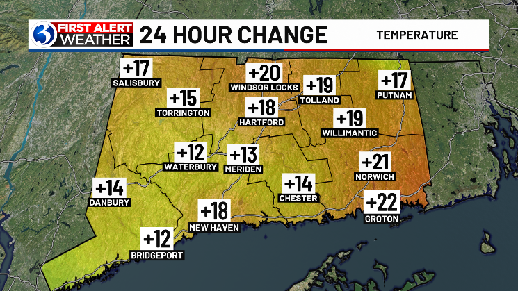

As of 3p (Tue, 11.05)... the record high for the Hartford Area has at least been tied! Tomorrow is a *First Alert Weather Day* given temps go even warmer (to record levels) with a gustier wind enhancing fire spread potential. Much more ahead, from 400-630p on WFSB Channel 3

Running well *above* the average high of 55, at *10pm* Tuesday... Our Wednesday is even warmer than today. The latest on record warmth, just how high temps will go tomorrow during our First Alert Weather Day, plus the latest on fire spread potential... at 11p on WFSB Channel 3
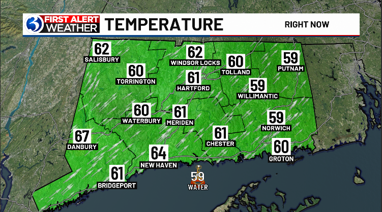

As expected, it was certainly an unseasonably warm day across CT! Not only were daily records broken... but for the Hartford Area, the 84° high set a monthly record, also for warmth this late into the year. Where we go from here, ahead on WFSB Channel 3


#shelfcloud drone pics Berlin CT Ashley Baylor Rachel Frank Ryan Hanrahan Mark Dixon Michele Powers



![NWS Boston (@nwsboston) on Twitter photo [#Record Warmth] New record highs were established Friday at #Boston #Hartford and #Worcester, tying the record high at #Providence. 😎 #MAwx #RIwx #CTwx [#Record Warmth] New record highs were established Friday at #Boston #Hartford and #Worcester, tying the record high at #Providence. 😎 #MAwx #RIwx #CTwx](https://pbs.twimg.com/media/GbUcOSVasAYBz_d.jpg)
