Mark Randall (@markrandall77) 's Twitter Profile
Mark Randall

@markrandall77

Australian lead in hydrometry. Image velocimetry & ADCP training.
Author on 4 national guidelines.

⚽️COYS 🎣🐟🍺🏕🛥🚀🪐 photography

ID: 1044946464

linkhttps://www.linkedin.com/comm/in/mark-randall-1786065b?midToken=AQHQbTsuav_1RQ&midSig=1GbJNpvDs8hpY1 calendar_today29-12-2012 14:03:39

124 Tweet

132 Followers

238 Following

NickEverard (@nick_everard) 's Twitter Profile Photo

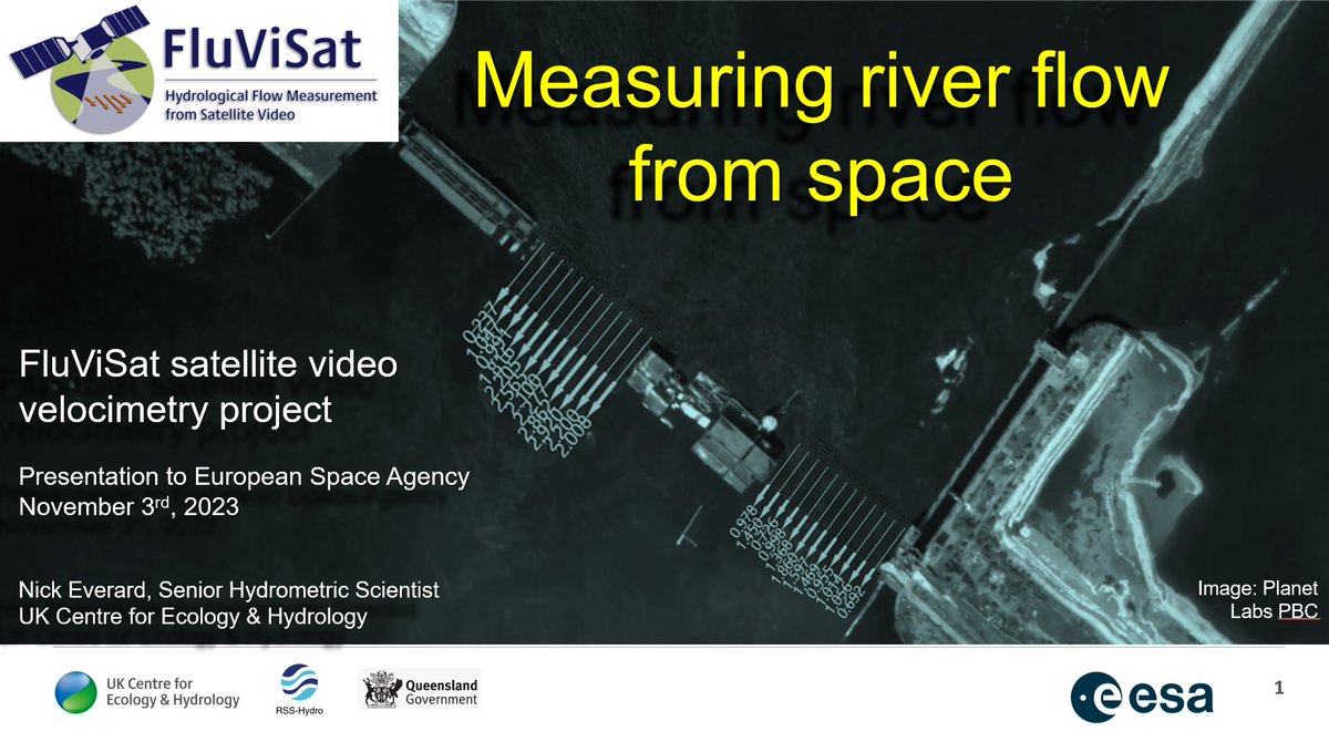
That went well! 55 slides in 35 minutes....! Oh, the project..? Brilliant - we can measure river flow, accurately, with video & still imagery from space. Now, come and talk to me at BHS 40th next Monday & #HydroSpace23 in Lisbon.

That went well! 55 slides in 35 minutes....!

Oh, the project..? 
Brilliant - we can measure river flow, accurately, with video & still imagery from space.

Now, come and talk to me at BHS 40th next Monday & #HydroSpace23 in Lisbon.
Bertrand Le Saux (@blesa_ux) 's Twitter Profile Photo

𝐂𝐚𝐧 𝐲𝐨𝐮 𝐦𝐞𝐚𝐬𝐮𝐫𝐞 𝐦𝐨𝐭𝐢𝐨𝐧 𝐟𝐫𝐨𝐦 𝐬𝐩𝐚𝐜𝐞? The European Space Agency ESA Earth Observation-funded #FluViSat project ended with positive answers: yes, not only with video from space, but also with sequences of still satellite images! eo4society.esa.int/projects/fluvi…

Bureau of Meteorology, Queensland (@bom_qld) 's Twitter Profile Photo

⚠️⛈️ A Severe Thunderstorm Warning has been issued for intense rainfall in the Cairns region, which may lead to dangerous and life-threatening flash flooding. Locations include Cairns, Yarrabah and Redlynch. 146mm has fallen in under 3 hours at Myola. ow.ly/YICO50QjsKM

⚠️⛈️ A Severe Thunderstorm Warning has been issued for intense rainfall in the Cairns region, which may lead to dangerous and life-threatening flash flooding. Locations include Cairns, Yarrabah and Redlynch. 146mm has fallen in under 3 hours at Myola. ow.ly/YICO50QjsKM
Mark Randall (@markrandall77) 's Twitter Profile Photo

Major flooding and an evacuation order out for parts of Cairns this morning. Rainfall intensities and totals are expected to continue for another 48 hours.

Bureau of Meteorology, Queensland (@bom_qld) 's Twitter Profile Photo

⚠️Major Flood Warning issued for the Barron River. Major flooding likely at Cairns Airport during Sunday afternoon & occurring at Kamerunga Bridge. Rainfall up to 513 mm was recorded over the Barron River catchment in the 24 hours to 9 am Sunday. Details: ow.ly/7qWu50Qjt2Z

⚠️Major Flood Warning issued for the Barron River. Major flooding likely at Cairns Airport during Sunday afternoon & occurring at Kamerunga Bridge. Rainfall up to 513 mm was recorded over the Barron River catchment in the 24 hours to 9 am Sunday. Details: ow.ly/7qWu50Qjt2Z
Bureau of Meteorology, Queensland (@bom_qld) 's Twitter Profile Photo

⚠️Major Flood Warning for the Barron River. Major flooding at Cairns Airport expected to exceed the 1977 flood this afternoon. Elevated river levels and moderate to major flooding is occurring downstream of Tinaroo Dam to Barron Falls. Details: ow.ly/MJPF50Qjthr

⚠️Major Flood Warning for the Barron River. Major flooding at Cairns Airport expected to exceed the 1977 flood this afternoon. Elevated river levels and moderate to major flooding is occurring downstream of Tinaroo Dam to Barron Falls. Details: ow.ly/MJPF50Qjthr
Cairns Post (@thecairnspost) 's Twitter Profile Photo

Much of the Far North is underwater tonight, as a result of the most severe flooding the region has experienced in almost 50 years. Low-lying homes have been inundated and another six to 12 hours of heavy rain is forecast for tonight. 📍EMERGENCY ALERTS: bit.ly/47Ys7qg

Paul Webster (@cassowary_man) 's Twitter Profile Photo

Hard to capture the volume of water on video but walking in I could feel the ground shaking amidst a deafening roar. An unprecedented 6ft of rain fell on the catchment over the past few days. #cairnsflood

Bureau of Meteorology, Queensland (@bom_qld) 's Twitter Profile Photo

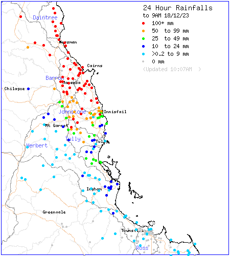
🌧️ A trough associated with ex-Tropical Cyclone Jasper produced more than 500 mm of rainfall at sites in the North Tropical Coast over the past 24 hours to 9am, in the Daintree, Mossman and Barron catchments. Subject to verification, some sites have recorded up to around 800 mm.

🌧️ A trough associated with ex-Tropical Cyclone Jasper produced more than 500 mm of rainfall at sites in the North Tropical Coast over the past 24 hours to 9am, in the Daintree, Mossman and Barron catchments. Subject to verification, some sites have recorded up to around 800 mm.
Bureau of Meteorology, Queensland (@bom_qld) 's Twitter Profile Photo

Widespread heavy rainfall occurred in parts of FNQ from 14-18th December 2023. Many areas from Tully to Cape Melville had 400-1000 mm with localised falls of 1200-1600 mm between Cairns & Cooktown. For maps of recent/past conditions: ow.ly/RH7v50QjzpX

Widespread heavy rainfall occurred in parts of FNQ from 14-18th December 2023. Many areas from Tully to Cape Melville had 400-1000 mm with localised falls of 1200-1600 mm between Cairns & Cooktown. For maps of recent/past conditions: ow.ly/RH7v50QjzpX
RFTTE (@rftte) 's Twitter Profile Photo

Chopper pilot Scott Blacket giving us a birds eye view of the King Creek area near Bedourie in the Channel Country of Central West QLD… the Georgina River in full flood!

Mark Randall (@markrandall77) 's Twitter Profile Photo

Great to be back in New Zealand. Testing out the new HydroSTIV portable tablet at the flow regatta. Looking forward to seeing the results compare.

Great to be back in New Zealand. Testing out the new HydroSTIV portable tablet at the flow regatta. Looking forward to seeing the results compare.