Merritt Harlan (@merritteharlan) 's Twitter Profile
Merritt Harlan

@merritteharlan

USGS Mendenhall Fellow studying remote sensing 🛰 of river discharge | and loves🥾 🎿 🛶 🏔🐶🤿🍦she/her

ID: 1178750981414232064

calendar_today30-09-2019 19:18:37

65 Tweet

204 Followers

222 Following

Merritt Harlan (@merritteharlan) 's Twitter Profile Photo

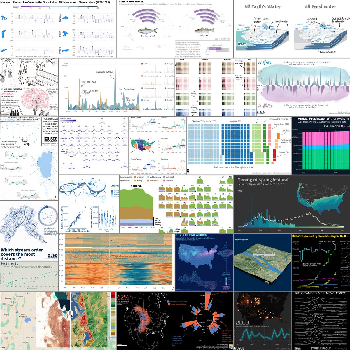
Had lots of fun making this viz for the #30DayChartChallenge and am so grateful for all the feedback and help from USGS Data Science ! Excited to keep working on streamflow estimation from satellites, especially with future SWOT data!

Michael F Meyer (@mishafredmeyer) 's Twitter Profile Photo

🚨New pre-print! 🚨 We present the National-scale, remotely sensed lake trophic state dataset #LTSUS with annual predicted lake trophic state for 55662 lakes 1984-2020. Data are available on @EDIgotData and ms is available on EarthArXiv eartharxiv.org/repository/vie…

USGS Store (@usgsstore) 's Twitter Profile Photo

It's #FreeMapMonday! Re-tweet and follow us for a chance to win the map Arches National Park, UT #USGSStore (U.S. residents only)

It's #FreeMapMonday! Re-tweet and follow us for a chance to win the map Arches National Park, UT #USGSStore (U.S. residents only)
USGS Data Science (@usgs_datasci) 's Twitter Profile Photo

We had so much fun sharing our #DataViz with you during April for the #30DayChartChallenge! 🎉 📊 Thank you to our contributors USGS and U.S. Fish and Wildlife Service! See this blog post for all of our contributions: waterdata.usgs.gov/blog/chart-cha…

We had so much fun sharing our #DataViz with you during April for the #30DayChartChallenge! 🎉 📊

Thank you to our contributors <a href="/USGS/">USGS</a> and <a href="/USFWS/">U.S. Fish and Wildlife Service</a>! 

See this blog post for all of our contributions:
waterdata.usgs.gov/blog/chart-cha…
Ryan Riggs (@riggs_rivers) 's Twitter Profile Photo

Happy to share that our paper on estimating lake and reservoir inflow and outflow discharge from the #SWOT_satellite is now available! I'm excited to apply the algorithm on live SWOT data. doi.org/10.1029/2023GL…

Happy to share that our paper on estimating lake and reservoir inflow and outflow discharge from the #SWOT_satellite is now available! I'm excited to apply the algorithm on live SWOT data.  doi.org/10.1029/2023GL…
Ryan Riggs (@riggs_rivers) 's Twitter Profile Photo

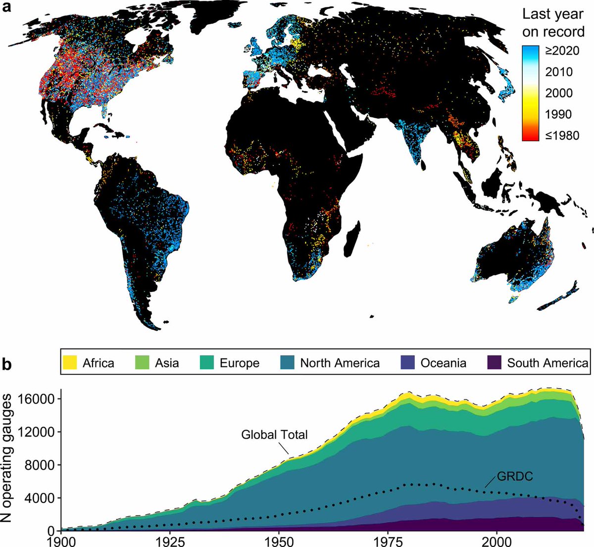
Where and when to river gauges go offline? In our new study, we compile the largest known dataset of river gauge data, analyze the temporal gaps of the compiled dataset, and fill in missing measurements with #Landsat and #Sentinel2 based estimates. iopscience.iop.org/article/10.108…

Where and when to river gauges go offline? In our new study, we compile the largest known dataset of river gauge data, analyze the temporal gaps of the compiled dataset, and fill in missing measurements with #Landsat and #Sentinel2 based estimates. iopscience.iop.org/article/10.108…
NASAEarthdata (@nasaearthdata) 's Twitter Profile Photo

New surface water extent and surface disturbance products from the Observational Products for End-Users from Remote Sensing Analysis (OPERA) project at NASA JPL are providing needed resources to federal agencies. Learn how: go.nasa.gov/43UkI96

New surface water extent and surface disturbance products from the Observational Products for End-Users from Remote Sensing Analysis (OPERA) project at <a href="/NASAJPL/">NASA JPL</a> are providing needed resources to federal agencies. 

Learn how: go.nasa.gov/43UkI96
Hacking Limnology (@hackinglimno) 's Twitter Profile Photo

Just over TWO weeks till #AEMONJ Hacking Limno + #DSOS23! With over 500 people registered from 50+ countries and 6 continents, it's bound to be a great week of #datascience #remotesensing #openscience #limnology #oceanography. REGISTRATION IS FREE AND OPEN TO ALL CAREER STAGES!

Inspiring Girls* Expeditions Europe (@ige_eu) 's Twitter Profile Photo

We are still looking for volunteers to carry equipment up to/down from our basecamp! Sign up via inspiringgirls.org/switzerland-ge…! You can't make it, but want to support the Gear Fairies? Spread the word and/or donate a contribution for the needed train tickets: pay.raisenow.io/tjfxr

Michael F Meyer (@mishafredmeyer) 's Twitter Profile Photo

Legit, Hacking Limnology #DSOS23 next week will likely be the best one yet. Still plenty of time to register!! aquaticdatasciopensci.github.io/registration/
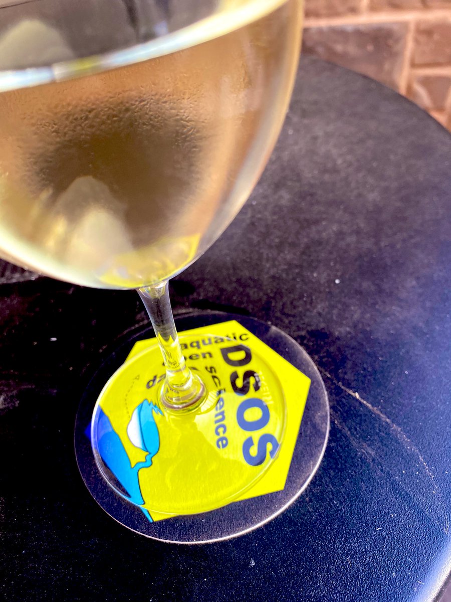

Legit, <a href="/HackingLimno/">Hacking Limnology</a> #DSOS23 next week will likely be the best one yet. Still plenty of time to register!! aquaticdatasciopensci.github.io/registration/
USGS Data Science (@usgs_datasci) 's Twitter Profile Photo

A new manuscript from USGS Water Resources is out in Scientific Data! The paper describes the Lake Trophic State – US dataset, which combines U.S. EPA Water and USGS Landsat data to predict trophic state for over 55,000 lakes 1984-2020. #rstats #limnology 1/n nature.com/articles/s4159…

USGS EROS (@usgs_eros) 's Twitter Profile Photo

Can Landsat help scientists study lakes? Yep, and there's a dataset for that! In our latest Eyes on Earth podcast, listen to USGS Geographer Michael Meyer talk about how Landsat helps validate the lake trophic state for thousands of lakes in the U.S.: ow.ly/fwox50QQ9PH