NASA_ABoVE
@nasa_above
This twitter account is no longer active. Please check out our website above.nasa.gov and follow @NASAEarth with the hashtag #NASA_ABoVE for updates.
ID: 1668640254
http://above.nasa.gov 13-08-2013 20:19:01
1,1K Tweet
1,1K Followers
96 Following

Gergana Daskalova National Geographic Society Isla Myers-Smith Jeff Kerby Natural Environment Research Council NASA_ABoVE U.S. National Science Foundation NSERC / CRSNG @RCN_Norway Vetenskapsrådet Villum Fonden URPP GCB iDiv Biodiversity Research The University of Sheffield @SheffieldAPS National Academies Gareth Phoenix @JarleBjerke @jakobjassmann Christian John Laia Andreu Hayles @SandyAngersB Pieter Beck @logan_berner Anne Bjorkman Anders Bryn CT Christiansen Sarah Elmendorf @BruceForbes4 Scott Goetz @mloranty LD Earth Observatory EU_ScienceHub UA Fairbanks SENCKENBERG Göteborgs universitet / University of Gothenburg NWO Nieuws Naturhist. museum NORCE Vrije Universiteit Amsterdam (inactief) University of Exeter INSTAAR 🏳️🌈 Lund University UiT | University of Tromsø UAA Environment and Natural Resources Institute at UAA UTEP Check out the other Arctic climate change research featured in Nature Climate Change and the upcoming ‘A Changing Arctic’ conference presented by @Framcentre, NatureClimate and Nature Reviews Earth & Environment 🌈 from 2-5 June, 2020 in Tromsø, Norway. nature.com/nclimate/


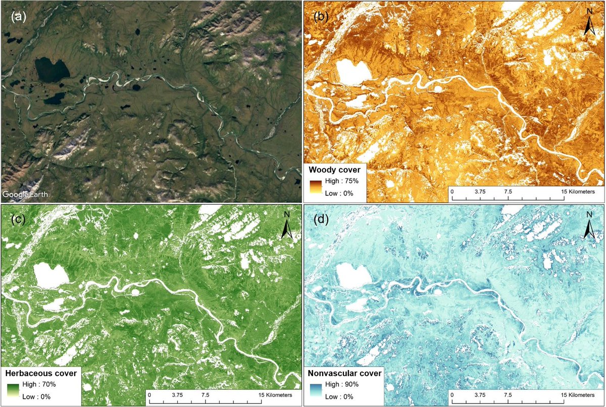
Maps of 3 major wildland #fire fuel types are available from the Arctic-Boreal Vulnerability Experiment NASA_ABoVE buff.ly/2Us0Xou The fuel components include woody (evergreen & deciduous shrubs), herbaceous (sedges & grasses), & nonvascular species (mosses & lichens).

Atmospheric gas concentrations collected during the #Arctic #Carbon Aircraft Profile (Arctic-CAP) campaigns are here: buff.ly/2u6Frv4 Gasses include #carbondioxide, methane, carbon monoxide, +more. Dataset is from the Arctic-Boreal Vulnerability Experiment NASA_ABoVE.
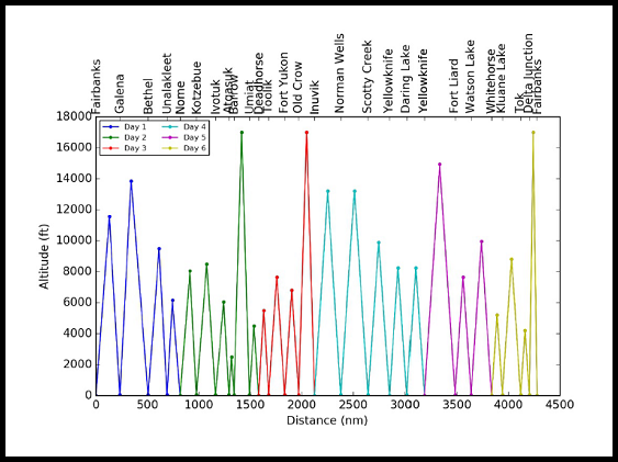

Environmental conditions during moose hunting season for 2000-2016 are available for rural Alaska. buff.ly/3bsyRj6 #Data include daily & annual air temp, river water level, & leaf drop dates. Research was sponsored by the Arctic-Boreal Vulnerability Experiment NASA_ABoVE
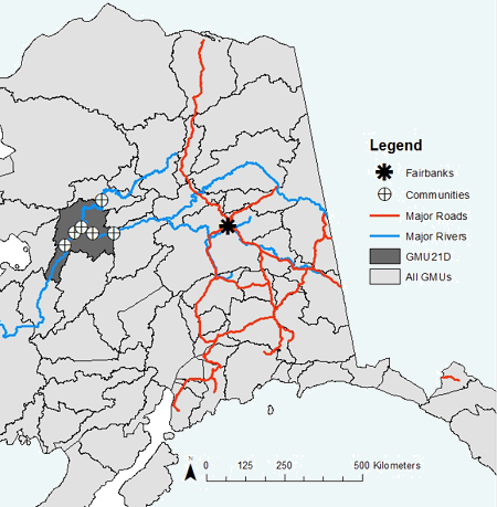


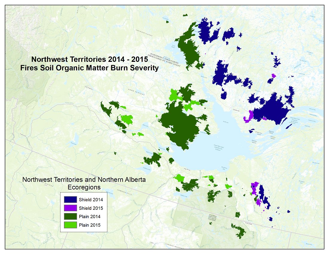
Maps of landscape surface burn severity from the 2014-2015 fires in the Northwest Territories & Northern Alberta, Canada, are now available from NASA_ABoVE buff.ly/38A7eCR Data were derived from #Landsat & linear regression models trained with field #data.

Keep up with new positions available with the Arctic-Boreal Vulnerability Experiment NASA_ABoVE buff.ly/2L0j7sL Interested in the #data they collect? Check out our archive: buff.ly/2sqnXoj #arctic #science

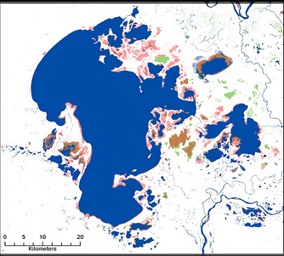
AirSWOT imagery from the 2017 Arctic-Boreal Vulnerability Experiment (NASA_ABoVE) was used to create water masks across parts of Canada and Alaska. buff.ly/2PmCWw1 The digital images were classified based on the Digital Camera System Normalized Difference Water Index.


#ICYMI: A map of the ecosystems surrounding Great Slave Lake, Canada, will contribute to #fire research in the #Arctic. Get this new dataset from the Arctic-Boreal Vulnerability Experiment NASA_ABoVE: buff.ly/2VhZS33 #Data correspond to the time period 1997-2011.

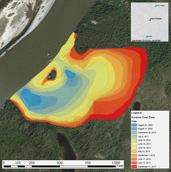
Get these #data from Arctic-Boreal Vulnerability Experiment NASA_ABoVE: A time series of Landsat-derived maps shows the expansion of a thaw slump on the East Fork Chandalar River in #Alaska from 2008-2017. buff.ly/2VBWpN2

#ICYMI: NASA_ABoVE dataset "ABoVE: Surface Water Extent, Boreal and Tundra Regions, North America, 1991-2011" buff.ly/2OT4N4h has been cited 4 times & downloaded >800 times! Data were derived from time series of #Landsat TM & ETM+
