NDAWN (@ndawnmesonet) 's Twitter Profile
NDAWN

@ndawnmesonet

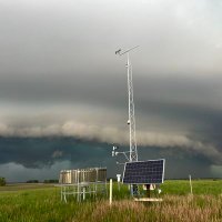
Home of the North Dakota Agricultural Weather Network and State Climate Office, the official weather and climate resource of ND with over 225 weather stations

ID: 2535534577

linkhttp://ndawn.info calendar_today30-05-2014 17:18:02

2,2K Tweet

2,2K Followers

80 Following

NDAWN (@ndawnmesonet) 's Twitter Profile Photo

Rain totals across North Dakota over the past 10 days ranged from 7.27" to 1.19", with an average of 3.5" statewide, recharging the soil moisture content. #ndwx #mnwx #mtwx

NDAWN (@ndawnmesonet) 's Twitter Profile Photo

May 25 at NDAWN: high of 76°F at Alvarado, Emerado, Hillsboro, Prosper // low of 33°F at Carson, New Hradec, Sanger, Williams #mnwx #ndwx

NDAWN (@ndawnmesonet) 's Twitter Profile Photo

May 26 at NDAWN: high of 80°F at Alvarado // low of 36°F at Carson, Fountain, Four Bears, Williams, Willow City #mnwx #ndwx

NDAWN (@ndawnmesonet) 's Twitter Profile Photo

May 27 at NDAWN: high of 80°F at Alvarado // low of 35°F at Four Bears // max precip of 0.44" at Denhoff #mnwx #ndwx

NDAWN (@ndawnmesonet) 's Twitter Profile Photo

May 30 at NDAWN: high of 86°F at Alvarado, Crystal, Humboldt // low of 39°F at Dry Fork, New Hradec // max precip of 0.33" at Center #mnwx #ndwx

NDAWN (@ndawnmesonet) 's Twitter Profile Photo

May 31 at NDAWN: high of 89°F at Humboldt // low of 40°F at Sunny Slope // max precip of 0.41" at Staples #mnwx #ndwx

NDAWN (@ndawnmesonet) 's Twitter Profile Photo

⏪️ May 2025 ↳ Temperature Extremes 🔴 101°F at Alvarado, Humboldt, Kennedy 🔵 25°F at Grenora, Poker Jim #ndwx #mnwx #mtwx

⏪️ May 2025
     ↳ Temperature Extremes

🔴 101°F at Alvarado, Humboldt, Kennedy
🔵 25°F at Grenora, Poker Jim 

#ndwx #mnwx #mtwx
NDAWN (@ndawnmesonet) 's Twitter Profile Photo

⏪️ May 2025 ↳ Precipitation Extremes 🟢 7.50" at Werner (+4.88" | 286% of normal) 🟤 0.80" at Williams (-2.31" | 26% of normal) #ndwx #mnwx #mtwx

⏪️ May 2025 
     ↳ Precipitation Extremes

🟢 7.50" at Werner (+4.88" | 286% of normal)
🟤 0.80" at Williams (-2.31" | 26% of normal)

#ndwx #mnwx #mtwx
NDAWN (@ndawnmesonet) 's Twitter Profile Photo

⏪️ May 2025 ↳ Average Air Temperature NDAWN averaged a daily air temperature of 56.6°F, which is 2.3°F above normal. #ndwx #mnwx #ndwx

⏪️ May 2025
     ↳ Average Air Temperature

NDAWN averaged a daily air temperature of 56.6°F, which is 2.3°F above normal.

#ndwx #mnwx #ndwx
NDAWN (@ndawnmesonet) 's Twitter Profile Photo

🌷 Spring 2025 🌷 ↳ Temperature Extremes 🔴 101°F at Alvarado, Humboldt, Kennedy 🔵 -11°F at Wales #ndwx #mnwx #mtwx

🌷 Spring 2025 🌷
     ↳ Temperature Extremes

🔴 101°F at Alvarado, Humboldt, Kennedy
🔵 -11°F at Wales

#ndwx #mnwx #mtwx
NDAWN (@ndawnmesonet) 's Twitter Profile Photo

🌷 Spring 2025 🌷 ↳ Precipitation Extremes 🟢 11.44" at Waseca (+1.42" | 114% of normal) 🟤 2.54" at Crystal (-2.24" | 53% of normal) Pretty Rock had the highest percent of normal precipitation with 216% (+5.62 | 10.48"). #ndwx #mnwx #mtwx

🌷 Spring 2025 🌷
     ↳ Precipitation Extremes

🟢 11.44" at Waseca (+1.42" | 114% of normal)
🟤 2.54" at Crystal (-2.24" | 53% of normal)

Pretty Rock had the highest percent of normal precipitation with 216% (+5.62 | 10.48").

#ndwx #mnwx #mtwx
NDAWN (@ndawnmesonet) 's Twitter Profile Photo

🌷 Spring 2025 🌷 ↳ Average Air Temperature NDAWN averaged a daily air temperature of 43.6°F, which is 2.8°F above normal. #ndwx #mnwx #ndwx

🌷 Spring 2025 🌷
     ↳ Average Air Temperature

NDAWN averaged a daily air temperature of 43.6°F, which is 2.8°F above normal.

#ndwx #mnwx #ndwx
NDAWN (@ndawnmesonet) 's Twitter Profile Photo

🌷 Spring 2025 🌷 ↳ Peak Wind Gusts • @ 10ft: 63 mph at Eldred • @ 33ft: 68 mph at Hettinger #ndwx #mnwx #mtwx

🌷 Spring 2025 🌷
     ↳ Peak Wind Gusts

• @ 10ft: 63 mph at Eldred
• @ 33ft: 68 mph at Hettinger

#ndwx #mnwx #mtwx
NDAWN (@ndawnmesonet) 's Twitter Profile Photo

June 2 at NDAWN: high of 94°F at Cottonwood, Delhi, Lamberton, Willmar // low of 42°F at Zeeland // 10ft peak wind of 54 mph at Westport // max precip of 1.10" at Murdock #mnwx #ndwx

NDAWN (@ndawnmesonet) 's Twitter Profile Photo

June 3 at NDAWN: high of 77°F at Gardner, Hillsboro, Mooreton, Wahpeton // low of 36°F at Dagmar // max precip of 1.31" at Waseca #mnwx #mtwx #ndwx

NDAWN (@ndawnmesonet) 's Twitter Profile Photo

June 4 at NDAWN: high of 78°F at fifteen stations // low of 34°F at Bottineau // 10ft peak wind of 51 mph at Ulen // max precip of 0.43" at Hirschville #mnwx #ndwx

NDAWN (@ndawnmesonet) 's Twitter Profile Photo

June 5 at NDAWN: high of 80°F at Becker // low of 33°F at Willow City // max precip of 0.39" at McKenzie #mnwx #ndwx