NOAA Satellites - Public Affairs
@noaasatellitepa
@NOAASatellitePA is managed by NESDIS Public Affairs. @NOAASatellites are the backbone of @NOAA's life-saving weather forecasts.
ID: 2460145735
http://www.nesdis.noaa.gov 23-04-2014 19:27:31
5,5K Tweet
32,32K Followers
4,4K Following
 's Twitter Profile Photo")
 on Twitter photo Just in: #April 2025 was a stormy, deadly month for the U.S.
--> Report summary with explanatory map images at: ncei.noaa.gov/news/national-…
via <a href=\"/NOAANCEI/\">NOAA NCEI</a> <a href=\"/NOAASatellites/\">NOAA Satellites</a>")
 on Twitter photo Just in: #April 2025 was 2nd warmest on record for the globe
Access our report highlights with captioned map images at: ncei.noaa.gov/news/global-cl…
via <a href=\"/NOAANCEI/\">NOAA NCEI</a> <a href=\"/NOAASatellites/\">NOAA Satellites</a>")
 's Twitter Profile Photo")
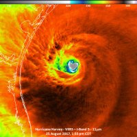
 on Twitter photo .<a href=\"/NOAA/\">NOAA</a> has announced its 2025 Atlantic Hurricane Season Outlook. See how NOAA's #satellites have you covered before, during and after a #hurricane threatens: bit.ly/439TnlG")
 on Twitter photo Just in: U.S. just saw it's 2nd-warmest #spring on record.
Find summary and stats + map images from our report at:
ncei.noaa.gov/news/national-…
<a href=\"/NOAANCEI/\">NOAA NCEI</a>")
 on Twitter photo Just in: #May 2025 was 2nd-warmest on record for the globe
Both poles saw below-average sea ice coverage.
--> Find more stats + download map images from our report at:
ncei.noaa.gov/access/monitor…
via <a href=\"/NOAANCEI/\">NOAA NCEI</a>")
 on Twitter photo Update:
The American Meteor Society (<a href=\"/amsmeteors/\">AMSMETEORS</a>) received hundreds of reports from Alabama, Florida, Georgia, North Carolina, South Carolina and Tennessee of a #fireball streaking across the sky Thursday afternoon. The Geostationary Lightning Mapper (#GLM) on <a href=\"/NOAA/\">NOAA</a>'s #GOES19")
 on Twitter photo Just in: Heat wave at month's end made #June 2025 7th-warmest June on record for U.S.
See this month's report with maps and images at:
ncei.noaa.gov/news/national-…
via <a href=\"/NOAANCEI/\">NOAA NCEI</a>")
 on Twitter photo Just in: #June 2025 was Earth’s 3rd-warmest June on record
Find our report with maps/images at:
ncei.noaa.gov/access/monitor…
via <a href=\"/NOAANCEI/\">NOAA NCEI</a>")