NWS Twin Cities (@nwstwincities) 's Twitter Profile
NWS Twin Cities

@nwstwincities

Official X account for the National Weather Service Twin Cities, Minnesota. Details: weather.gov/twincities

ID: 602065304

linkhttp://weather.gov/twincities calendar_today07-06-2012 17:50:50

52,52K Tweet

114,114K Followers

477 Following

NWS Twin Cities (@nwstwincities) 's Twitter Profile Photo

Multiple spotters reported a funnel cloud with this storm around 2:20pm. While it could reform, we do not expect it to produce a tornado. Gusty winds and small hail are also possible #mnwx

NWS Twin Cities (@nwstwincities) 's Twitter Profile Photo

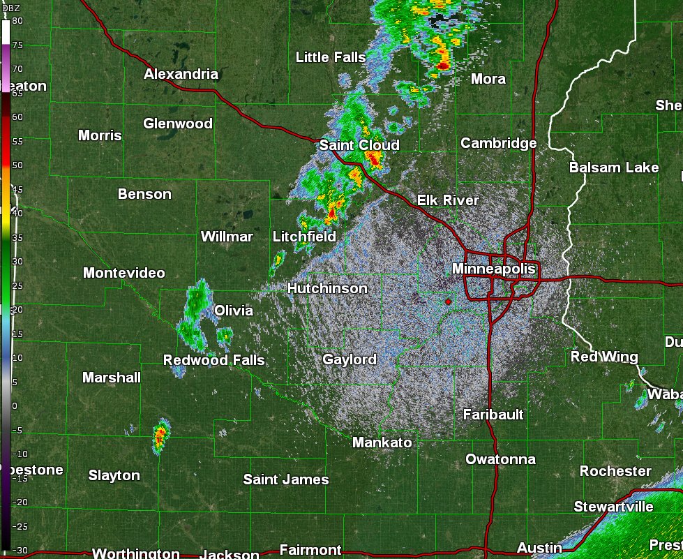
4:15PM Radar Update: Storms have trended down quite a bit, with only infrequent lightning at this time. Redevelop of storms will be possible along the front as it moves east this evening. #mnwx #wiwx

4:15PM Radar Update: Storms have trended down quite a bit, with only infrequent lightning at this time. Redevelop of storms will be possible along the front as it moves east this evening. #mnwx #wiwx
NWS Twin Cities (@nwstwincities) 's Twitter Profile Photo

There is a line of scattered storms moving into the Monticello area as of 4:40pm. At the speed the front has been moving, we'd expect these to move into the metro over the next 1-2 hours. If these weaken, there will be a greater chance for redevelopment later tonight (~8-10pm).

NWS Twin Cities (@nwstwincities) 's Twitter Profile Photo

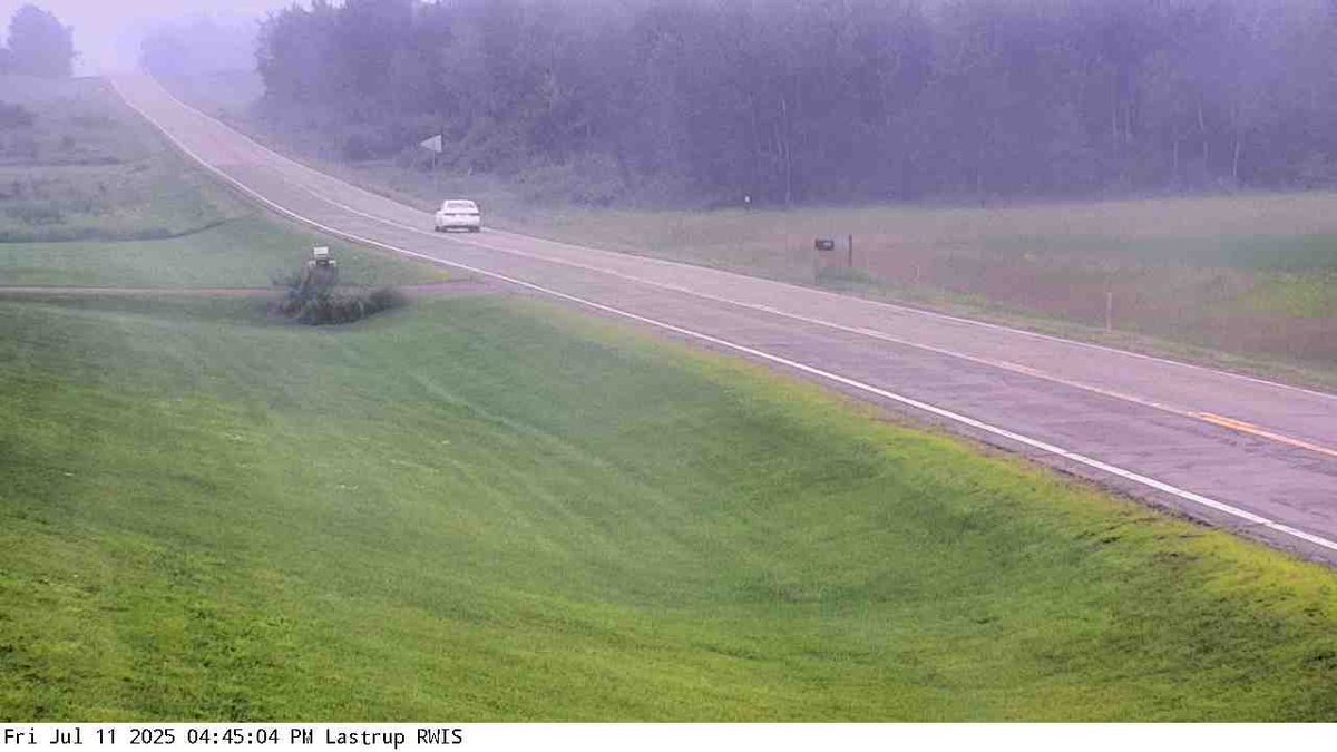
The Minnesota Department of Transportation camera in Lastrup just south of Brainerd... Note that Minnesota Pollution Control Agency has issued the Air Quality Alert through Monday covering multiple rounds of smoke. Not everyone will see this heavy of surface smoke, but it could be quite hazy at times this weekend. #mnwx #wiwx
The <a href="/MnDOT/">Minnesota Department of Transportation</a> camera in Lastrup just south of Brainerd... Note that <a href="/MnPCA/">Minnesota Pollution Control Agency</a> has issued the Air Quality Alert through Monday covering multiple rounds of smoke. Not everyone will see this heavy of surface smoke, but it could be quite hazy at times this weekend. #mnwx #wiwx
NWS Twin Cities (@nwstwincities) 's Twitter Profile Photo

Showers/storms have trended down this evening as the front moves from the west to east. Expect cooler and hazier conditions to start the weekend, before warming up by Monday ahead of our next chance for rain on Tuesday. #mnwx #wiwx

Showers/storms have trended down this evening as the front moves from the west to east. Expect cooler and hazier conditions to start the weekend, before warming up by Monday ahead of our next chance for rain on Tuesday. #mnwx #wiwx
NWS Twin Cities (@nwstwincities) 's Twitter Profile Photo

All clear! Rain has diminished and it appears more and more likely that we will stay dry through the rest of the night. Redevelopment of isolated weak showers are not out of the question for eastern MN and western WI. Should be little to no impact though #mnwx #wiwx

All clear! Rain has diminished and it appears more and more likely that we will stay dry through the rest of the night. Redevelopment of isolated weak showers are not out of the question for eastern MN and western WI. Should be little to no impact though #mnwx #wiwx
NWS Twin Cities (@nwstwincities) 's Twitter Profile Photo

Smoke from Canadian wildfires will cause poor air quality this weekend. Limit prolonged outdoor activities if possible, & keep windows closed. Visit airnow.gov for the latest air quality conditions where you live. #mnwx #wiwx

Smoke from Canadian wildfires will cause poor air quality this weekend. Limit prolonged outdoor activities if possible, &amp; keep windows closed.

Visit airnow.gov for the latest air quality conditions where you live.
#mnwx #wiwx
NWS Twin Cities (@nwstwincities) 's Twitter Profile Photo

Isolated thunderstorms are possible tomorrow evening, but the next chance for widespread showers and thunderstorms comes Tuesday afternoon through Wednesday. #mnwx #wiwx

Isolated thunderstorms are possible tomorrow evening, but the next chance for widespread showers and thunderstorms comes Tuesday afternoon through Wednesday.
#mnwx #wiwx
NWS Twin Cities (@nwstwincities) 's Twitter Profile Photo

Smoke persists tonight before partially clearing out tomorrow, with another round of smoke entering mainly eastern MN and western WI Monday. A cold front arrives Monday into Tuesday and pushes the smoke out, with showers and storms followed by cooler midweek temps. #mnwx #wiwx

Smoke persists tonight before partially clearing out tomorrow, with another round of smoke entering mainly eastern MN and western WI Monday. 

A cold front arrives Monday into Tuesday and pushes the smoke out, with showers and storms followed by cooler midweek temps. #mnwx #wiwx
NWS Twin Cities (@nwstwincities) 's Twitter Profile Photo

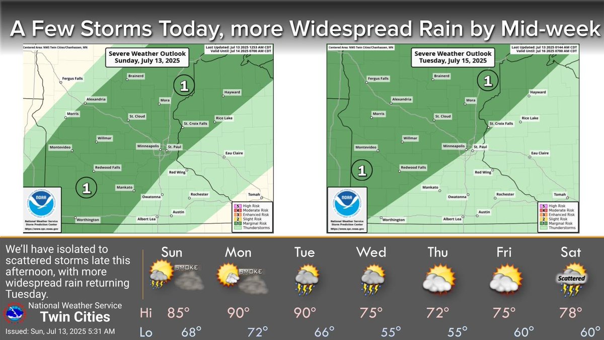
Bouts of Canadian wildfire smoke will continue through Monday. There will be a few storms late this afternoon and evening with more widespread showers and storms Tuesday afternoon through Wednesday night, followed by cooler weather to end the week. #mnwx #wiwx

Bouts of Canadian wildfire smoke will continue through Monday. There will be a few storms late this afternoon and evening with more widespread showers and storms Tuesday afternoon through Wednesday night, followed by cooler weather to end the week. #mnwx #wiwx
NWS Twin Cities (@nwstwincities) 's Twitter Profile Photo

Smoke returns tonight and persists until showers and storms return Tuesday into Wednesday. Heavy rain is possible as a warm front forms overnight Tuesday into Wednesday, favoring western to central Minnesota. #mnwx #wiwx

Smoke returns tonight and persists until showers and storms return Tuesday into Wednesday. 

Heavy rain is possible as a warm front forms overnight Tuesday into Wednesday, favoring western to central Minnesota. #mnwx #wiwx
NWS Twin Cities (@nwstwincities) 's Twitter Profile Photo

In coordination with MN Air Quality Index the air quality alert for our coverage area in Minnesota has been cancelled. The alert persists for northern Minnesota, so be sure to check your local conditions at airnow.gov or weather.gov

NWS Twin Cities (@nwstwincities) 's Twitter Profile Photo

Warm and humid today and Tuesday. Numerous thunderstorms are expected Tuesday evening into Wednesday. Locally heavy rainfall of 3-4" is possible in some spots, and the strongest storms Tuesday evening could contain hail and damaging winds.\n#mnwx #wiwx

Warm and humid today and Tuesday. Numerous thunderstorms are expected Tuesday evening into Wednesday. Locally heavy rainfall of 3-4"  is possible in some spots, and the strongest storms Tuesday evening could contain hail and damaging winds.\n#mnwx #wiwx
NWS Twin Cities (@nwstwincities) 's Twitter Profile Photo

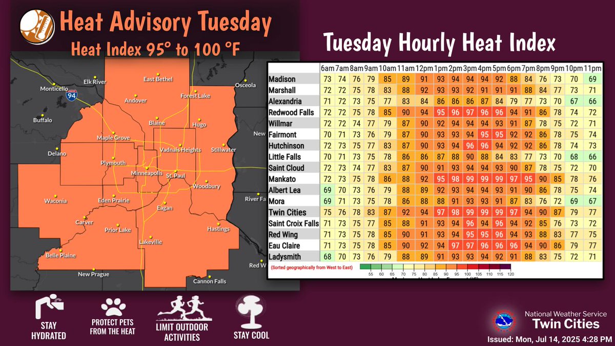
Tuesday will be hot and humid heat indices reaching the upper 90s. A cold front sweeps through late Tuesday creating a chance of severe storms across much of the area. Damaging Winds, Large Hail, and a tornado or two is possible. Cooler air arrives later this week. #mnwx #wiwx

Tuesday will be hot and humid heat indices reaching the upper 90s. A cold front sweeps through late Tuesday creating a chance of severe storms across much of the area. Damaging Winds, Large Hail, and a tornado or two is possible. Cooler air arrives later this week. #mnwx #wiwx