Benedicta Ohene (@ohenebhenedicta) 's Twitter Profile
Benedicta Ohene

@ohenebhenedicta

Certified UAV Pilot||Geography|Regional planning|YouthMapper|GIS and RS lover|Open Source|AWIGIS||music lover|OSM|Tech Enthusiast

ID: 2205912986

calendar_today21-11-2013 00:41:05

3,3K Tweet

653 Followers

820 Following

geotetanzania (@geotetanzania) 's Twitter Profile Photo

Pangolins need our maps, and time is ticking! ⏳ Join GeoTE & TRCO in Morogoro, Tanzania for GeoSpark 2025 and be part of the vital effort to map and protect these incredible animals. Your skills can save a species! #GeoSpark2025 #PangolinConservation #UrgentAction #GISforGood

Pangolins need our maps, and time is ticking! ⏳
Join GeoTE & TRCO in Morogoro, Tanzania for GeoSpark 2025 and be part of the vital effort to map and protect these incredible animals. Your skills can save a species! #GeoSpark2025 #PangolinConservation #UrgentAction #GISforGood
ROOTGIS (@rootgis09) 's Twitter Profile Photo

🎉 Our #BetterTomorrow program website is now LIVE! Built by our talented beneficiaries — youth & women trained in digital skills through the program 💻🌍 We’re empowering Tanzanian communities with tech, entrepreneurship & English skills. #DigitalLiteracy #Empowerment

🎉 Our #BetterTomorrow program website is now LIVE!
Built by our talented beneficiaries — youth & women trained in digital skills through the program 💻🌍
We’re empowering Tanzanian communities with tech, entrepreneurship & English skills. 
#DigitalLiteracy #Empowerment
Esri Training (@esritraining) 's Twitter Profile Photo

We are 💯 days away from this favorite MOOC opening 🤩!!! Save your spot to view the amazing videos + create beautiful maps🗺️: ow.ly/8YUo50VUWXa

We are 💯 days away from this favorite MOOC opening 🤩!!!

Save your spot to view the amazing videos + create beautiful maps🗺️: ow.ly/8YUo50VUWXa
Esri GIS Education (@gised) 's Twitter Profile Photo

Take a journey on how our brains process spatial information and get practical tips for storytelling with “Telling Stories with Maps”, written by Allen Carroll from ArcGIS StoryMaps 🗺️ Learn about this book: ow.ly/RtzN50VV20o


Take a journey on how our brains process spatial information and get practical tips for storytelling with “Telling Stories with Maps”, written by Allen Carroll from <a href="/ArcGISStoryMaps/">ArcGIS StoryMaps</a> 🗺️

Learn about this book: ow.ly/RtzN50VV20o

geotetanzania (@geotetanzania) 's Twitter Profile Photo

Morogoro, let's map the future together! 🗺️🤝 GeoTE is officially launching our collaborative geospatial hub in your city! We're excited to connect with local innovators and co-create solutions for Tanzania. #GeoTECommunity #MorogoroMaps #CollaborateTZ #GeospatialInnovation 🚀🇹🇿

YouthMappers (@youthmappers) 's Twitter Profile Photo

🧱 Map 3D buildings remotely with JOSM + Mapillary! Learn how to use street-level + satellite imagery to tag height, roof shape & more in @OpenStreetMap. 📹 Watch the full tutorial: tinyurl.com/3D-Remote #3DMapping #OpenStreetMap #YouthMappers #JOSM #Mapillary #OSM

YouthMappers (@youthmappers) 's Twitter Profile Photo

🗺️ Take it to the streets! Use FieldPapers to collect 3D building data like roof types & height — even offline. Perfect for low-connectivity areas. 📹 Watch the full tutorial: tinyurl.com/3D-FieldPapers #FieldMapping #OpenStreetMap #YouthMappers #3DMapping #FieldPapers #OSM

Calvin Menttor™ (@cmenttor) 's Twitter Profile Photo

⏳ Is your chapter/community yet to register for the 30 days #African #Mapathon? Get your gears ready to #map our world from 6th June to 6th July. It's going to be #fireworks like #Vitinha in the midfield 🔥🫵🏾 #psg #PsgInter

⏳ Is your chapter/community yet to register for the 30 days #African #Mapathon? Get your gears ready to #map our world from 6th June to 6th July. 

It's going to be #fireworks like  #Vitinha in the midfield 🔥🫵🏾

 #psg  #PsgInter
YouthMappers (@youthmappers) 's Twitter Profile Photo

Calling all YouthMappers across Africa! Apply now for the #SotMAfrica2025 Scholarship. 🗓️ Deadline: July 31 📍Tanzania 🔗 forms.gle/MBXC9YbLq6k9j6… Show how you're putting communities on the map! #OpenStreetMap #OSMAfrica #MappingForChange

Calling all <a href="/youthmappers/">YouthMappers</a> across Africa!
Apply now for the #SotMAfrica2025 Scholarship.
🗓️ Deadline: July 31
📍Tanzania
🔗 forms.gle/MBXC9YbLq6k9j6…
Show how you're putting communities on the map!

#OpenStreetMap #OSMAfrica #MappingForChange
geotetanzania (@geotetanzania) 's Twitter Profile Photo

Incredible to see our Open Mapping and GIS Manager representing us at the #DataToEndPoverty conference in Arusha! 📍 Grateful for spaces where data, evidence & local expertise come together to shape real solutions to extreme poverty. Keep it up👏💚

Geoffrey Kateregga (@kateregga1) 's Twitter Profile Photo

Join our Humanitarian OpenStreetMap Team #WorlRefugee Day webinar on Open Mapping for Conflict and Displacement With a panel discussion on how #OpenMapping supports displaced communities & strengthens humanitarian response in conflict zones 🗓️June 20th ⏰13:00 UTC 🔗Register: bit.ly/3FHYi4h
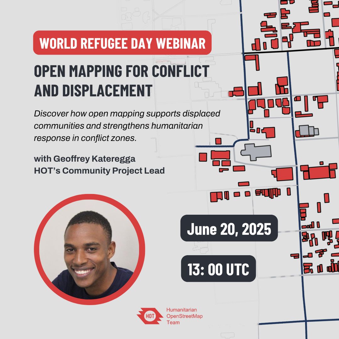
Join our <a href="/hotosm/">Humanitarian OpenStreetMap Team</a> #WorlRefugee Day webinar on Open Mapping for Conflict and Displacement

With a panel discussion on how #OpenMapping supports displaced communities &amp; strengthens humanitarian response in conflict zones

🗓️June 20th
⏰13:00 UTC
🔗Register: bit.ly/3FHYi4h
#Barcamp #CapeCoast (@bccapecoast) 's Twitter Profile Photo

Join #BarcampCapeCoast on June 28: #learning, #sharing, #networking & #mentoring. Register: bit.ly/bccapecoast202… #bccapecoast mentor: Deborah Bentum | Language & Culture Facilitator, CorpsAfrica | #InterculturalCommunication, #CommunityEngagement & #SecondLanguageAcquisition

Join #BarcampCapeCoast on June 28: #learning, #sharing, #networking &amp; #mentoring.
Register: bit.ly/bccapecoast202…

#bccapecoast mentor: Deborah Bentum | Language &amp; Culture Facilitator, <a href="/CorpsAfrica/">CorpsAfrica</a> | #InterculturalCommunication, #CommunityEngagement &amp; #SecondLanguageAcquisition
ArcGIS Pro (@arcgispro) 's Twitter Profile Photo

GIS Tutorial for ArcGIS Pro 3.4" is the book everyone needs to learn #ArcGISPro Taking you through fundamental skills & providing numerous exercises to practice new concepts, this book helps you develop your use of ArcGISPro. Learn more: ow.ly/B06N50WgZWC

GIS Tutorial for ArcGIS Pro 3.4" is the book everyone needs to learn #ArcGISPro  
Taking you through fundamental skills &amp; providing numerous exercises to practice new concepts, this book helps you develop your use of ArcGISPro. 
 Learn more: ow.ly/B06N50WgZWC
Pollicy (@pollicyorg) 's Twitter Profile Photo

📢Africa, it’s TIME! The biggest #data event is back! Save the date! October 30 -31, in Kampala, Uganda! More updates to come! #DFA25 #DataFestAfrica2025

📢Africa, it’s TIME! The biggest #data event is back!

Save the date!

October 30 -31, in Kampala, Uganda!

More updates to come!

#DFA25 #DataFestAfrica2025
YouthMappers (@youthmappers) 's Twitter Profile Photo

#TBT to the unforgettable 2023 YouthMappers leadership fellows summit held in Montego Bay, Jamaica🌴💡52 students from 25 countries gathered to shape the future of mapping. now, tag someone you know or met there! let`s have it.....😁

#TBT to the unforgettable 2023 <a href="/youthmappers/">YouthMappers</a> leadership fellows summit held in Montego Bay, Jamaica🌴💡52 students from 25 countries gathered to shape the future of mapping. 

now, tag someone you know or met there! 
let`s have it.....😁