OpenTopography
@opentopography
Open access to high-resolution, Earth science-oriented topography data, and related tools & resources. US NSF supported. #lidar
ID: 39327448
http://www.opentopography.org 11-05-2009 19:59:51
2,2K Tweet
10,10K Followers
592 Following

Happy to announce that U.S. National Science Foundation support for OpenTopography has been renewed for another four years! This is the 5th generation of funding for OT. Support comes from NSF EAR's Geoinformatics program & the National Discovery Cloud for Climate initiative. More: opentopography.org/news/opentopog…
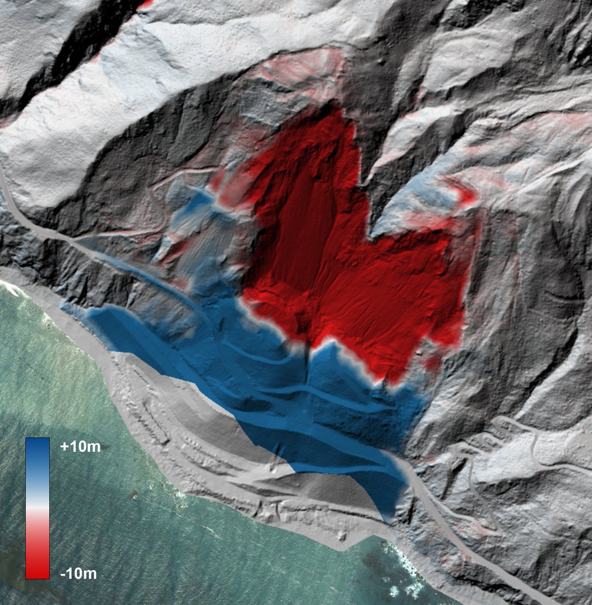

🎉Exciting updates to the Canterbury 2020-2023 dataset: OpenTopography doi.org/10.5069/G9Q23X… DEM on LDS data.linz.govt.nz/layer/111133. Here's the DSM showing Ohau Ski Field and the road up to it, east of Lake Ohau in the Canterbury Region. #Canterbury #Mapping #LiDAR #opendata 🗺️

Great news! Congratulations National Center for Airborne Laser Mapping.

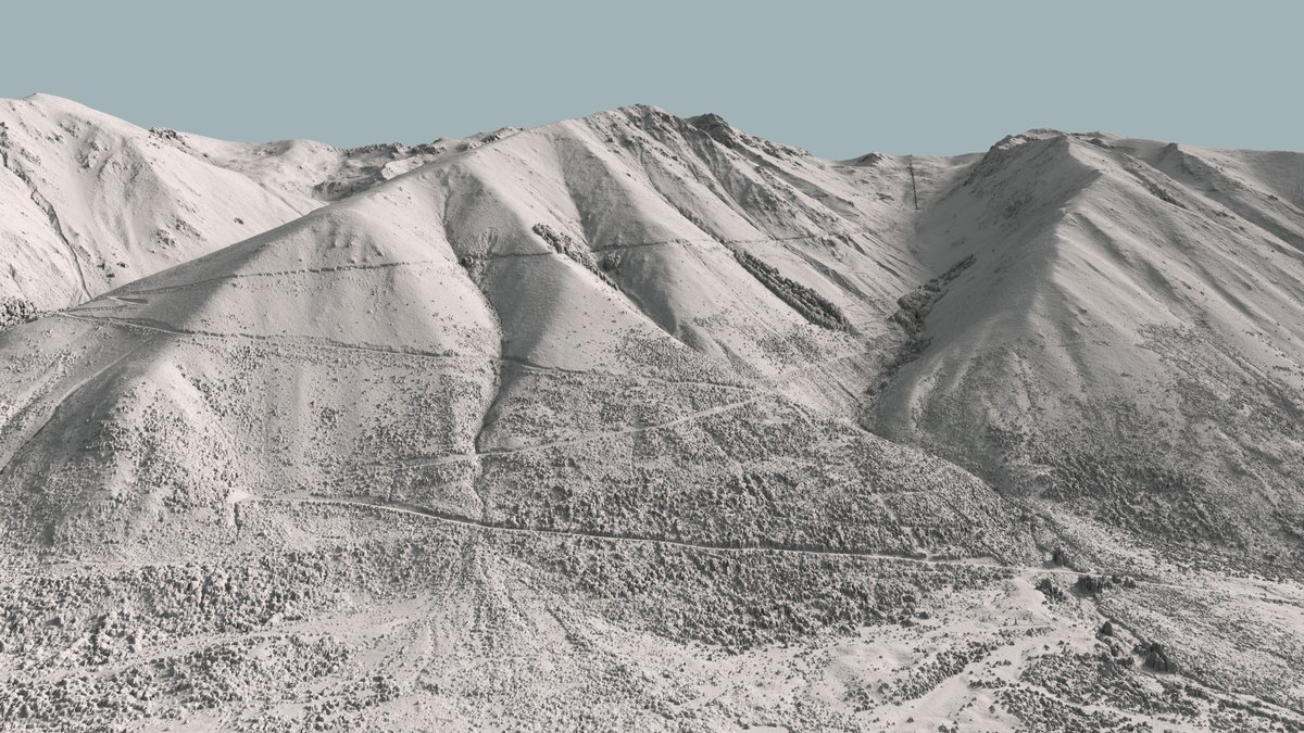
Featured Image: blending a DSM with aerial imagery, showing Baker Hut in Arthur’s Pass National Park. It also features Mt Murchison, White Glacier, and Marmaduke Dixon Glacier. Explore the latest #LiDAR updates at data.linz.govt.nz/layer/111133 & doi.org/10.5069/G9Q23X… OpenTopography


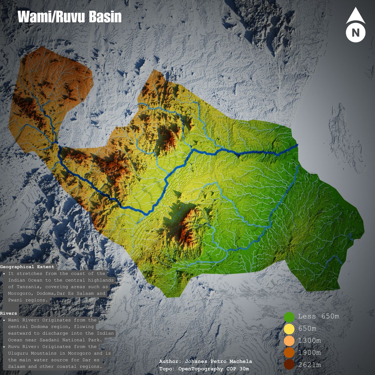
#omdtz Wami/Ruvu Basin Map, River watershed delineation generated from SRTM 30m from OpenTopography using QGIS #ClimateAction #WaterConservation #GIS #Mapping #Tanzania #GIS #QGIS #DataDriven #gischat Wizara ya Maji Tanzania



Are you interested in helping to guide OpenTopography? We're seeking members for our 3 Advisory Committees to represent users and ensure that the facility’s activities are aligned with the needs & initiatives of the scientific & educational communities: opentopography.org/news/new_ac_20…

#30DayMapChallenge · Day Thirteen · A new tool. Visualisations of segments of the Duchesne (left) and Sevier (right) rivers, inspired and made possible by @geo_coe (who wrote a wonderful set of tutorials in QGIS) and OpenTopography.


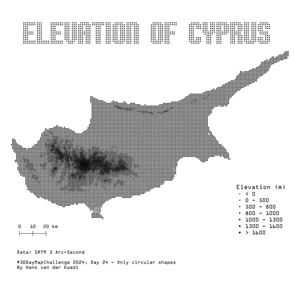
#30DayMapChallenge Day 24: Only circular shapes Elevation of #Cyprus in dot matrix style. Made with #QGIS using #OpenData SRTM 3 Arc-Second via OpenTopography DEM Downloader plugin.


Call for National Center for Airborne Laser Mapping seed project proposals is now open! Great opportunity for students to get free #lidar for research. New this year, faculty at MSI & 2YCs are also eligible. Data become open via OT. To date there are 254 NCALM datasets available on OT: ncalm.cive.uh.edu/seed-proposals
