Ricardo Dalagnol (@ricardodalagnol) 's Twitter Profile
Ricardo Dalagnol

@ricardodalagnol

Brazilian Remote sensing scientist who loves tropical forest ecology. Research Scientist at @CTrees_org. #RemoteSensing #REDD #DeepLearning #RStats

ID: 1219250021209726977

linkhttp://ricds.wordpress.com/ calendar_today20-01-2020 13:27:21

1,1K Tweet

2,2K Followers

546 Following

International Tree Mortality Network (@tree_mortality) 's Twitter Profile Photo

Interested in how the deadtrees.earth database can contribute towards mapping tree mortality globally? Come join us for the next ITMN seminar by Teja Kattenborn & Clemens Mosig on October 8th 16:00 CEST! Please register for the online seminar: t1p.de/cpwyg

Interested in how the deadtrees.earth database can contribute towards mapping tree mortality globally? 

Come join us for the next ITMN seminar by Teja Kattenborn & Clemens Mosig on October 8th 16:00 CEST! 

Please register for the online seminar: t1p.de/cpwyg
Fabien Wagner (@fabienwagner) 's Twitter Profile Photo

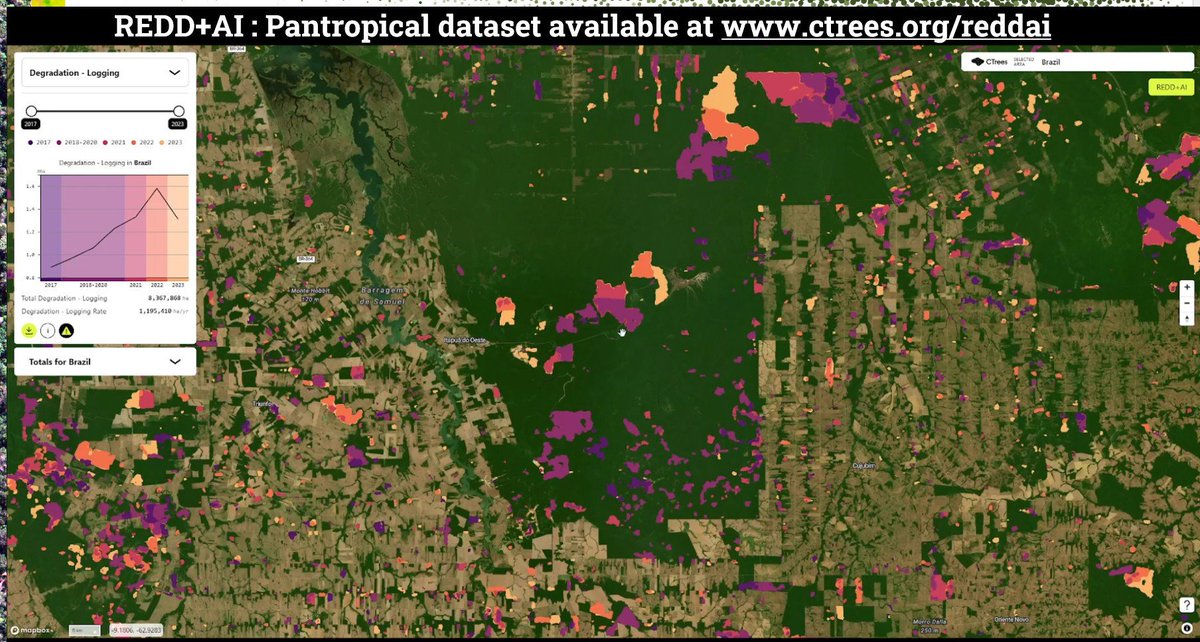
Check out our new REDD+AI platform ctrees.org/reddai that shows tropical forest degradation—from logging, fire, and roads—and tree cover loss in evergreen forests with unprecedented detail. This is v1, so be kind :) v2 coming soon CTrees Ricardo Dalagnol NICFI Satellite Data Program
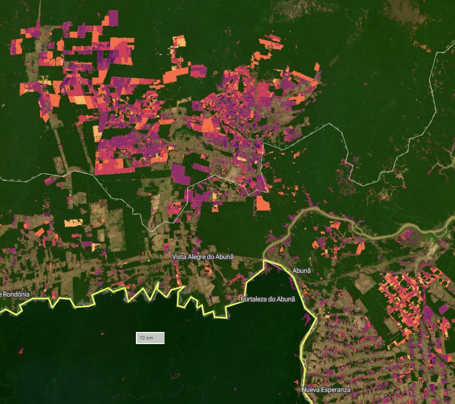
Check out our new REDD+AI platform ctrees.org/reddai that shows tropical forest degradation—from logging, fire, and roads—and tree cover loss in evergreen forests with unprecedented detail. This is v1, so be kind :) v2 coming soon
<a href="/CTrees_org/">CTrees</a> <a href="/RicardoDalagnol/">Ricardo Dalagnol</a> <a href="/NICFISatData/">NICFI Satellite Data Program</a>
Ricardo Dalagnol (@ricardodalagnol) 's Twitter Profile Photo

Replacing \ with / with one shortcut in R is easy See the image for the explanation. It is based on github.com/GegznaV/spAddi… package. There are more functionalities that i did not explore yet. #Rstudio #rstats tip 😀

Replacing \ with / with one shortcut in R is easy

See the image for the explanation. It is based on github.com/GegznaV/spAddi… package. There are more functionalities that i did not explore yet.

#Rstudio #rstats tip 😀
Ricardo Dalagnol (@ricardodalagnol) 's Twitter Profile Photo

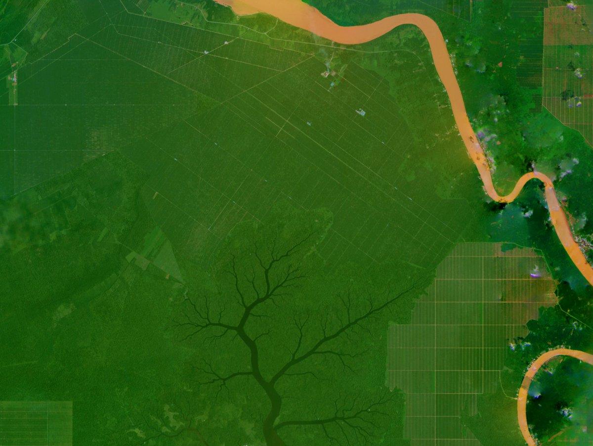
A river-tree and its branches protecting the remaining forest against the advance of deforestation and large scale palm oil in Malaysia #SatArt Image : Planet NICFI #NICFISatelliteDataProgram imagery, mosaic Oct 2020 at 111.71116,2.67147 (lon,lat). (Celebrating now 60 mosaics !)

A river-tree and its branches protecting the remaining forest against the advance of deforestation and large scale palm oil in Malaysia #SatArt

Image : Planet NICFI #NICFISatelliteDataProgram imagery, mosaic Oct 2020 at 111.71116,2.67147 (lon,lat). (Celebrating now 60 mosaics !)
Fabien Wagner (@fabienwagner) 's Twitter Profile Photo

🌿3-yr time-lapse of one of the Mother of Mothers trees of the Amazon rainforest 🌳🍃 likely one of the largest trees in the Amazon, with an astonishing crown diameter > 60 m and height > 50 m ! made with NICFI Satellite Data Program 🛰️images. CTrees #AmazonForest #TreeGiant #NatureWonder

Ricardo Dalagnol (@ricardodalagnol) 's Twitter Profile Photo

gdal_calc tip : when you are using multiple rasters for operations and they may have even the slightest difference in some parameters like extent, resolution, crs, origin, etc - the output parameters will be exactly the same as the -A raster. #gdalwisdom

Ricardo Dalagnol (@ricardodalagnol) 's Twitter Profile Photo

Next monday i will be giving one of the talks of the EEBIOMASS online workshop, it will be about my work on forest degradation in high resolution with deep learning, see the info below for free registration :

Ricardo Dalagnol (@ricardodalagnol) 's Twitter Profile Photo

I invite you for my talk on 'Mapping tropical forest degradation in high resolution with deep learning' at the EEBIOMASS virtual workshop Monday Dec 9. #CTrees Register : survey.academiccloud.de/index.php/2496… I will not be at AGU, but still I've got a talk to give at the same week! 😆

I invite you for my talk on 'Mapping tropical forest degradation in high resolution with deep learning' at the EEBIOMASS virtual workshop Monday Dec 9. #CTrees

Register : survey.academiccloud.de/index.php/2496…

I will not be at AGU, but still I've got a talk to give at the same week! 😆
Ricardo Dalagnol (@ricardodalagnol) 's Twitter Profile Photo

📢🛰️Sharing our new paper on Monitoring changes of forest height in California led by Dr. Favrichon 🔥 We assess the potential of mapping forest height using deep learning and 10-m satellite data and show how wildfire is the major driver of disturbance doi.org/10.3389/frsen.…

📢🛰️Sharing our new paper on Monitoring changes of forest height in California led by Dr. Favrichon

🔥 We assess the potential of mapping forest height using deep learning and 10-m satellite data and show how wildfire is the major driver of disturbance 

doi.org/10.3389/frsen.…
Ricardo Dalagnol (@ricardodalagnol) 's Twitter Profile Photo

📢🌳🛰️Sharing new paper "Towards a global understanding of tree mortality" from International Tree Mortality Network network. Shout out Cornelius/Adriane/Tom for leading. (From having fun with trees in the field to psychodelic-black-mirror-digital trees by the end 😅) Link : doi.org/10.1111/nph.20…
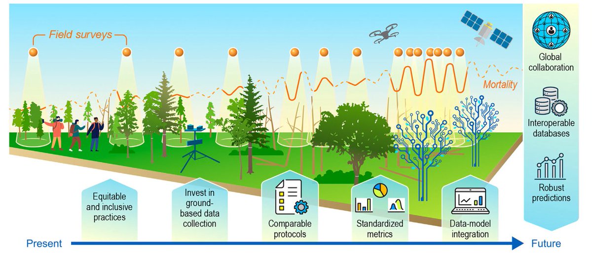
📢🌳🛰️Sharing new paper "Towards a global understanding of tree mortality" from <a href="/Tree_Mortality/">International Tree Mortality Network</a> network. Shout out Cornelius/Adriane/Tom for leading.
(From having fun with trees in the field to psychodelic-black-mirror-digital trees by the end 😅)

Link : doi.org/10.1111/nph.20…
Remote Sensing MDPI (@remotesens_mdpi) 's Twitter Profile Photo

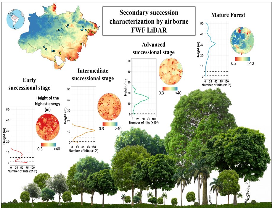
🌳🌳 Characterizing #Canopy Structure Variability in #Amazonian Secondary #Successions with Full-Waveform Airborne #LiDAR ✍️ Aline D. Jacon et al. 🔗 brnw.ch/21wQPHE

🌳🌳 Characterizing #Canopy Structure Variability in #Amazonian Secondary #Successions with Full-Waveform Airborne #LiDAR

✍️ Aline D. Jacon et al.
🔗 brnw.ch/21wQPHE
Ricardo Dalagnol (@ricardodalagnol) 's Twitter Profile Photo

Linear model was first invented < 1900s, we have new AI models being created every day, and if you are using some AI model that are 10yrs old (like I do: U-Net) you are nominally outdated in the AI world However, LM is very useful to this day, so does the much younger U-Net XD🤖

Ricardo Dalagnol (@ricardodalagnol) 's Twitter Profile Photo

🛰️🌳 CTrees New Amazon Canopy Height data at 5m spatial resolution based on #PlanetNICFI & #UNet led by Fabien Wagner is now in AWS Open Data ⏬Download & #CTrees by urself: ricds.github.io/ctrees-amazon-… 📥AWS: registry.opendata.aws/ctrees-amazon-… 📜Paper in review: arxiv.org/abs/2501.10600

🛰️🌳 <a href="/CTrees_org/">CTrees</a> New Amazon Canopy Height data at 5m spatial resolution based on #PlanetNICFI &amp; #UNet led by <a href="/FabienWagner/">Fabien Wagner</a> is now in AWS Open Data 

⏬Download &amp; #CTrees by urself: ricds.github.io/ctrees-amazon-…
📥AWS: registry.opendata.aws/ctrees-amazon-…
📜Paper in review: arxiv.org/abs/2501.10600