Ryan Breton (@ryanbretonwx) 's Twitter Profile
Ryan Breton

@ryanbretonwx

AMS Certified Meteorologist @NEWSCENTERmaine. Weeknights at 5 & 11 p.m. on WCSH6 & WLBZ2. Penn State alum. #WeAre

ID: 19307731

linkhttp://instagram.com/ryanbretonwx calendar_today21-01-2009 21:02:08

76,76K Tweet

10,10K Followers

1,1K Following

Ryan Breton (@ryanbretonwx) 's Twitter Profile Photo

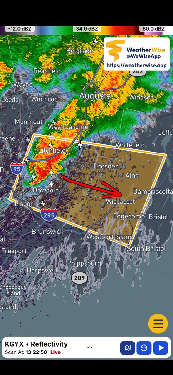
First Severe Thunderstorm Warning of the day for this storm moving from Bowdoin and Litchfield toward the Midcoast. 1” hail and wind gusts to 60 mph possible in spots.

First Severe Thunderstorm Warning of the day for this storm moving from Bowdoin and Litchfield toward the Midcoast. 1” hail and wind gusts to 60 mph possible in spots.
Ryan Breton (@ryanbretonwx) 's Twitter Profile Photo

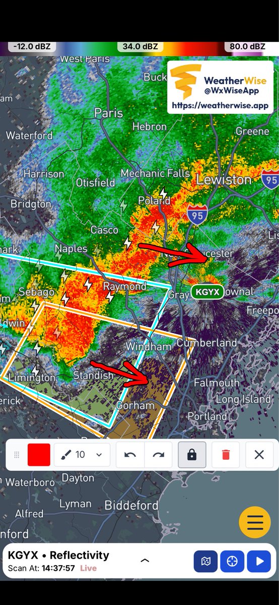
2:40p: Severe Thunderstorm Warning issued including Sebago Lake. The line of thunderstorms extends north to Lewiston. Most of this action will pass north of Portland in the next hour.

2:40p: Severe Thunderstorm Warning issued including Sebago Lake. The line of thunderstorms extends north to Lewiston. Most of this action will pass north of Portland in the next hour.
Ryan Breton (@ryanbretonwx) 's Twitter Profile Photo

2:53p: Severe Thunderstorm Warning extended to the coast and Casco Bay. Hail and 60 mph wind gusts are possible. Outside of the warning to the north, heavy rain and thunder.

2:53p: Severe Thunderstorm Warning extended to the coast and Casco Bay. Hail and 60 mph wind gusts are possible. Outside of the warning to the north, heavy rain and thunder.
CallanWX (@callanweather) 's Twitter Profile Photo

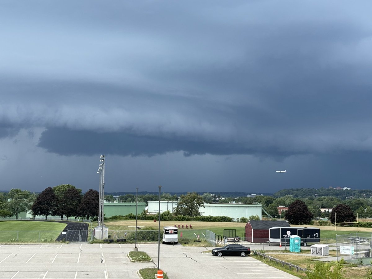
Heavy damage from a severe thunderstorm in Gorham, ME. Looks to me like a potential microburst or spin-up. Roofs taken off, cars damaged and very large trees down. NWS Gray Dana Osgood Tucker Antico

Heavy damage from a severe thunderstorm in Gorham, ME. Looks to me like a potential microburst or spin-up. Roofs taken off, cars damaged and very large trees down. <a href="/NWSGray/">NWS Gray</a> <a href="/danaosgoodwx/">Dana Osgood</a> <a href="/tuckerweather/">Tucker Antico</a>
Ryan Breton (@ryanbretonwx) 's Twitter Profile Photo

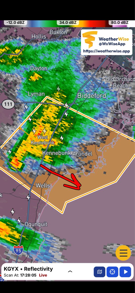
5:30p: Severe Thunderstorm Warning issued for the Kennebunks and Wells. Potential for hail and 60 mph gusts. It would not surprise me if this produces a waterspout once it gets out over the ocean.

5:30p: Severe Thunderstorm Warning issued for the Kennebunks and Wells. Potential for hail and 60 mph gusts. It would not surprise me if this produces a waterspout once it gets out over the ocean.
Rob Wright Images 🌻 (@robwrightimages) 's Twitter Profile Photo

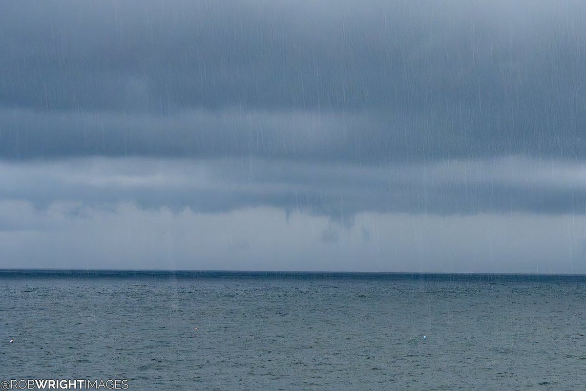
Possibly a small noodle funnel out over the ocean from the Kennebunk storm that had a hook on it and was severe-warned earlier this evening. Timestamp here is 6:00 PM. There was another one to the right but looked more like scud. -- Looking N from Sohier Park; York, Maine.

Possibly a small noodle funnel out over the ocean from the Kennebunk storm that had a hook on it and was severe-warned earlier this evening. Timestamp here is 6:00 PM. There was another one to the right but looked more like scud.
--
Looking N from Sohier Park; York, Maine.
Ryan Breton (@ryanbretonwx) 's Twitter Profile Photo

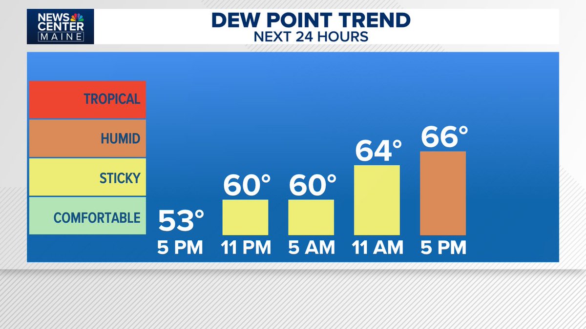
It's still comfortable now with dew points in the 50s, but it will be gradually turning more humid Thursday. The humidity peaks Friday ahead of a cold front.

It's still comfortable now with dew points in the 50s, but it will be gradually turning more humid Thursday. The humidity peaks Friday ahead of a cold front.