Sean Ash (@seanashwx) 's Twitter Profile
Sean Ash

@seanashwx

Meteorologist | #BlameSean | #Indy 🏠 | chocoholic | ❤️ B&G | father of 3 | husband | @WKU @WKUWeather Grad | Lifelong @UofL #WhoDey @Reds Fan

ID: 180822312

linkhttp://facebook.com/SeanAshfanpage calendar_today20-08-2010 15:40:22

100,100K Tweet

28,28K Followers

8,8K Following

Sean Ash (@seanashwx) 's Twitter Profile Photo

Storm cluster in southern Illinois intensifies on approach to Indiana. Reaches IL/IN border around 2 pm, Indy metro area around 4pm, Ohio line 6-7 pm. Additional storms will develop in advance of this complex too. Be Weather Aware and prepared to get indoors between now & 10pm

Sean Ash (@seanashwx) 's Twitter Profile Photo

A few downpours around the metro area. Highly humid air fuels 2”+ per hour rain rates again. Localized flooding possible.

Sean Ash (@seanashwx) 's Twitter Profile Photo

Storm coverage/intensity continues to increase. Clustering of storms west of I-65 building eastward with heavy rain, lightning, pockets of 50-60+ mph gusts between now & 9 pm. Continue to be Weather Aware and ready to get indoors if you hear the thunder and/or rain roaring.

Sean Ash (@seanashwx) 's Twitter Profile Photo

The lawn will be a mud pit at Deer Creek tonight for DMB. Get sheltered until this passes. May delay start some, but eventually gets east by 9pm.

Sean Ash (@seanashwx) 's Twitter Profile Photo

Heaviest over for metro area. Strongest cells near Marion, Hartford City, and east of North Vernon. Can’t rule out spotty showers, but atmosphere worked-over for now.

Debie Dotson (@debiecoltsgirl) 's Twitter Profile Photo

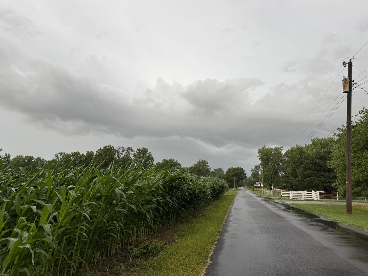
Sean Ash just under 2” of rain in about 45 minutes on the southwest side of Anderson near Lapel. Strong winds bent the cornfield across the road from us. This field was about 9-10’ tall. Hopefully it will recover.

<a href="/SeanAshWX/">Sean Ash</a> just under 2” of rain in about 45 minutes on the southwest side of Anderson near Lapel. Strong winds bent the cornfield across the road from us. This field was about 9-10’ tall. Hopefully it will recover.
Sean Ash (@seanashwx) 's Twitter Profile Photo

Plenty of sunny, hot, humid, rain-free radar hours today in central Indiana. But be Weather Aware again for scattered to locally numerous heavy storms bubbling up in heating of day. Fair game for cells on radar between noon and sunset. Some places get SOAKED & some stay dry.

Sean Ash (@seanashwx) 's Twitter Profile Photo

Alcaraz is human. Sinner gets his first Wimbledon. These two are locked-in. Should be quite a run if they stay healthy.

WTHR.com (@wthrcom) 's Twitter Profile Photo

WHAT A WIN! 🔥🏀 There were FIVE Fever players with double digit point totals as Indiana routed Paige Bueckers and the Dallas Wings 102-83. Kelsey Mitchell led the team in scoring with 20 points while Caitlin Clark posted a double-double. (📸:AP Photo/Doug McSchooler)

WHAT A WIN! 🔥🏀

There were FIVE Fever players with double digit point totals as Indiana routed Paige Bueckers and the Dallas Wings 102-83. Kelsey Mitchell led the team in scoring with 20 points while Caitlin Clark posted a double-double. 

(📸:AP Photo/Doug McSchooler)
Sean Ash (@seanashwx) 's Twitter Profile Photo

Heavy storm clusters build eastward and move across central/southern Indiana between now and 11 pm. Locally heavy rain (2”-3”+), some 60 mph gusts possible, and frequent lightning in stronger cells. Be ready to get indoors if you hear thunder.

Jennie Runevitch (@jenniewthr) 's Twitter Profile Photo

NEW: 35 more team members from Indiana Task Force 1 are being activated and deployed to the flood zone in Texas. They'll join the 49 Hoosier first responders already helping with search and recovery operations.

Sean Ash (@seanashwx) 's Twitter Profile Photo

This radar loop is just what the doctor ordered for the parched landscape. Rain rates vary from light to locally heavy with the potential of flash flooding growing south of I-70 to Ohio River.