Rachel Modestino TWN
@thatmetgirl
@weathernetwork Meteorologist by day, Dog mom by night
ID: 1376366426123014144
https://instabio.cc/thatmetgirl 29-03-2021 02:51:49
1,1K Tweet
2,2K Followers
520 Following

FRI PM - MON: Ice storm for Ontario, 10-20+ hours of freezing rain potential here. Highest impact risk in the east + cottage country, north GTA at times (esp. SAT) but boundary still changeable. #ONwx #ONStorm #ONIce The Weather Network

GTA FREEZING RAIN: Models trending colder Saturday evening to Sunday morning, opening the chance for 2-5mm in the GTA. significantly higher east and north of the city #ONwx #ONIce The Weather Network


Well over an entire day of freezing rain in eastern Ontario. 2-3+ cm of ice building up this weekend: MAJOR travel impacts & LONG DURATION power outages #ONwx #ONStorm #ONice The Weather Network

My face hurts The Weather Network #ONStorm #ONwx


3-4 PM severe thunderstorm prime time. Strong winds + hail biggest impacts. Tornadoes possible, but not a slam dunk. Watching eastern ON where the trigger is stronger #ONstorm #ONwx The Weather Network


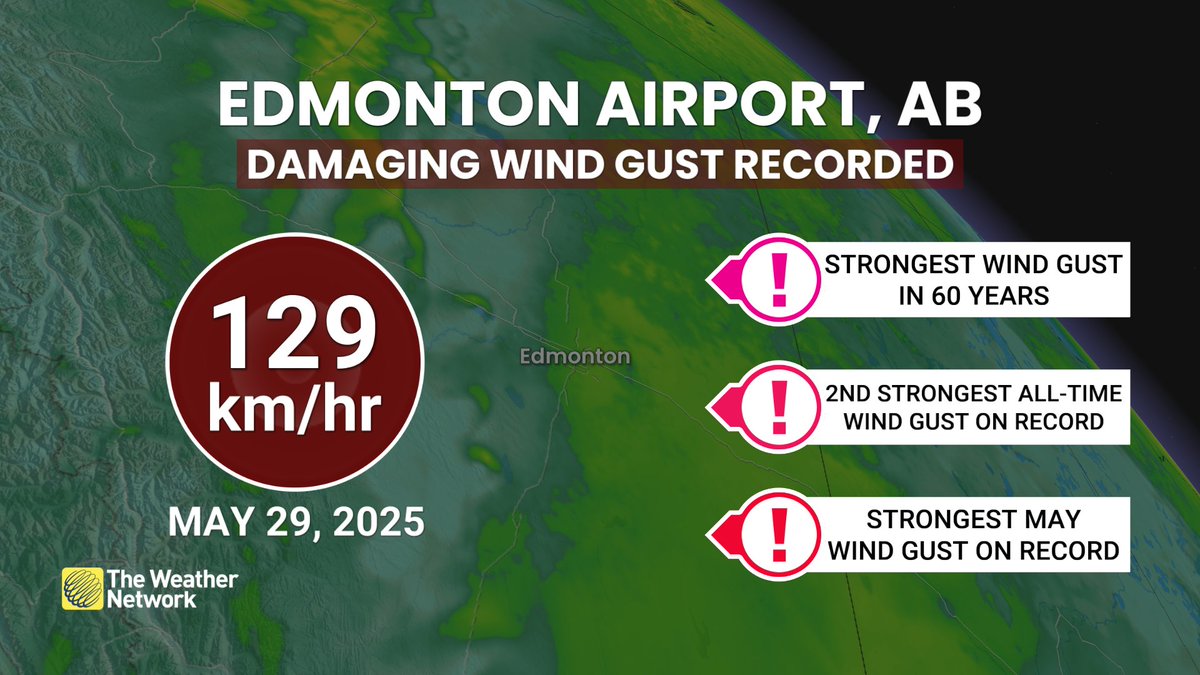
Strongest in May, and 2nd strongest all-time wind gust recorded at Edmonton's Airport this evening due to strong thunderstorm outflow winds. #ABstorm #ABwx The Weather Network


Nearly 1AM tornado warning issued. Multiple areas of strong rotation from Harrow to Chatham #Ontario . Particularly dangerous nocturnal situation here.. #ONstorm #ONWX The Weather Network


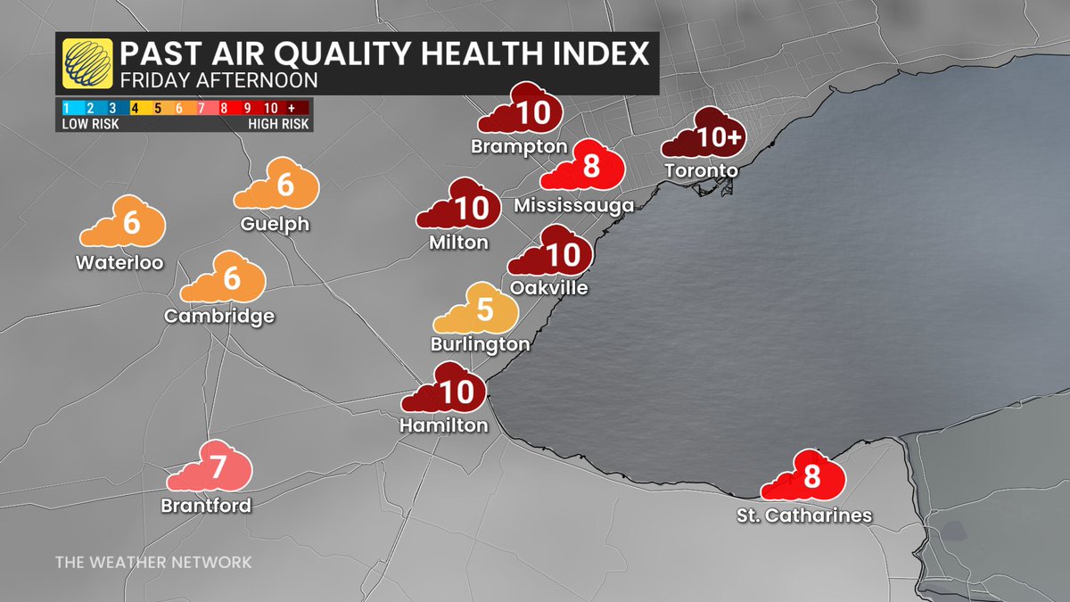
#AQHI of 10 or higher reached Friday afternoon from #Toronto to #Hamilton. Smoke's slowly moving but will likely still impact Saturday. #ONwx The Weather Network


High likelihood for severe storms today. Broken squall line triggered this evening over Lake Huron and GB. Risks for straight line winds (90-100 km/h) and possibly embedded tornadoes. #ONwx #ONStorm The Weather Network


#TropicalStorm #Erin has formed in the far east Atlantic! 5th named storm of the year could be the 1st major hurricane by the weekend as it passes north of the Antilles' Islands. Way too far out to know if/any impacts to the US/CA East coast. The Weather Network

#HurricaneErin is nearly 1400 km wide. Imagine driving from Windsor to Ottawa... and back. The Weather Network


Hurricane #Melissa is at the thresholds of what's meteorologically possible on Earth. 300km/h winds and 892mb will be the strongest landfalling hurricane on record for the Atlantic basin 😟 The Weather Network


Sable Island just recorded its strongest wind since Fiona 2022! Powerful #weatherbomb bearing down on #Newfoundland shortly #NLwx #NSwx The Weather Network Patrick Duplessis


