Tony Laubach
@tonylaubach
Storm Chaser and Meteorologist; Chasing weather for over two decades.
ID: 67057362
http://www.facebook.com/tonylaubach 19-08-2009 17:14:06
4,4K Tweet
6,6K Followers
148 Following
 's Twitter Profile Photo")
 on Twitter photo 🔥The 9th Round of Easy Loan, Earn $40 Reward is in progress❗️
⏰ Promotion Period: January 15th - Feburary 15th, 2025
👉 Register now and check more details at gate.io/campaigns/358")
While the obvious concern on a morning like this is icy roads and there are plenty of slick spots to contend with. My biggest issue has been trying to keep my windshield clean. It is so cold, that as soon as I start moving, I immediately am fighting ice accretion Frank Waugh, CBM KAKE 🐍 🐢=🌧️
 on Twitter photo While the obvious concern on a morning like this is icy roads and there are plenty of slick spots to contend with. My biggest issue has been trying to keep my windshield clean. It is so cold, that as soon as I start moving, I immediately am fighting ice accretion <a href=\"/FrankWaughKAKE/\">Frank Waugh, CBM KAKE 🐍 🐢=🌧️</a>")
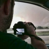
Massive wedge tornado west of Happy, Texas around 3:30pm CST NWS Amarillo Jay Prater, CBM KAKE
 on Twitter photo Massive wedge tornado west of Happy, Texas around 3:30pm CST <a href=\"/NWSAmarillo/\">NWS Amarillo</a> <a href=\"/JayPraterKAKE/\">Jay Prater, CBM KAKE</a>")
2.25" hail at Ft. Larned in Pawnee County, Kansas Jay Prater, CBM KAKE NWS Wichita NWS Dodge City
 on Twitter photo 2.25\" hail at Ft. Larned in Pawnee County, Kansas <a href=\"/JayPraterKAKE/\">Jay Prater, CBM KAKE</a> <a href=\"/NWSWichita/\">NWS Wichita</a> <a href=\"/NWSDodgeCity/\">NWS Dodge City</a>")
One of several landspout tornadoes west of Kit Carson, Colorado earlier this evening. NWS Goodland Jay Prater, CBM KAKE Brian Bledsoe 🐊
 on Twitter photo One of several landspout tornadoes west of Kit Carson, Colorado earlier this evening. <a href=\"/NWSGoodland/\">NWS Goodland</a> <a href=\"/JayPraterKAKE/\">Jay Prater, CBM KAKE</a> <a href=\"/BrianBledsoe/\">Brian Bledsoe 🐊</a>")
Stockton Hill Road 37N of Kingman, multiple water crossings filling up fast. NWS Las Vegas #azwx
 on Twitter photo Stockton Hill Road 37N of Kingman, multiple water crossings filling up fast. <a href=\"/NWSVegas/\">NWS Las Vegas</a> #azwx")
 on Twitter photo I'd have that champagne ready, Denver... #firstOfficialSnow #cowx #denverSnow")
 's Twitter Profile Photo")
 on Twitter photo #PokemonGOTourContest
Team FIRE; Bringin' the literal fire to melt away the cold of winter with Charizard, Rapidash, and Magmar.")
 's Twitter Profile Photo")
 on Twitter photo Trainers, we’re celebrating the Season of Alola and Stufful Community Day by awarding one lucky winner with a trip for two to Hawaii! 🏝️🥳
To enter, retweet this tweet and follow our Twitter account!")
The severe cell north of Kit Carson, CO at 4:30PM MDT. This dropped copious penny/nickel hail with some up-to 1.25" stones mixed in along CO-94 South of Boyero a bit earlier. NWS Pueblo NWS Boulder NWS Goodland Breaking Weather by AccuWeather AccuWeather
 on Twitter photo The severe cell north of Kit Carson, CO at 4:30PM MDT. This dropped copious penny/nickel hail with some up-to 1.25\" stones mixed in along CO-94 South of Boyero a bit earlier. <a href=\"/NWSPueblo/\">NWS Pueblo</a> <a href=\"/NWSBoulder/\">NWS Boulder</a> <a href=\"/NWSGoodland/\">NWS Goodland</a> <a href=\"/breakingweather/\">Breaking Weather by AccuWeather</a> <a href=\"/accuweather/\">AccuWeather</a>")
Love these low-expectation days when they way overperform! Beautiful storm and #lightning south of Mission, SD. This storm poked down a funnel and had some dust swirling underneath, but hard to tell whether the two features were connected. #sdwx NWS Rapid City AccuWeather
 on Twitter photo Love these low-expectation days when they way overperform! Beautiful storm and #lightning south of Mission, SD. This storm poked down a funnel and had some dust swirling underneath, but hard to tell whether the two features were connected. #sdwx <a href=\"/NWSRapidCity/\">NWS Rapid City</a> <a href=\"/accuweather/\">AccuWeather</a>")
 on Twitter photo Impromptu chase... left the house shortly after 4pm, got on the mess of severe/tornadic storms between Akron and Idalia in northeast Colorado. Handed the storms over to my KS buddies and enjoyed this view behind it all #cowx")
Hail post-storm on NE-71 approximately 10N of Scottsbluff. Measured lots of 1.25-1.75" that covered the ground and highway. Image taken at 5:40pm. NWS Cheyenne
 on Twitter photo Hail post-storm on NE-71 approximately 10N of Scottsbluff. Measured lots of 1.25-1.75\" that covered the ground and highway. Image taken at 5:40pm. <a href=\"/NWSCheyenne/\">NWS Cheyenne</a>")
Hail up to 1" on the east side of Strausburg, CO on CO-36 measured post-storm. NWS Boulder #cowx
 on Twitter photo Hail up to 1\" on the east side of Strausburg, CO on CO-36 measured post-storm. <a href=\"/NWSBoulder/\">NWS Boulder</a> #cowx")
Large tornado late Tuesday afternoon over Four Forks, Louisiana, looking north from Ketchie-Marshall east of Four Forks. NWS Shreveport
 on Twitter photo Large tornado late Tuesday afternoon over Four Forks, Louisiana, looking north from Ketchie-Marshall east of Four Forks. <a href=\"/NWSShreveport/\">NWS Shreveport</a>")
 on Twitter photo Allsups in Friona, TX a little water logged.. <a href=\"/NWSLubbock/\">NWS Lubbock</a>")
 on Twitter photo Tracked this incredible supercell out of the mountains northwest of Trnidad, Colorado all the way to Guymon in the Oklahoma Panhandle. This view looking west toward Boise City along US-412 early Sunday evening #cowx #nmwx #okwx")
11 South of Akron, Colorado around 430pm. Multiple tornadoes on this cell NWS Boulder
 on Twitter photo 11 South of Akron, Colorado around 430pm. Multiple tornadoes on this cell <a href=\"/NWSBoulder/\">NWS Boulder</a>")
 on Twitter photo Starting tomorrow and posting every Tuesday and Friday through the end of the year, a look back on my most prolific tornado chasing year of my life! Head over and follow me if you haven't already!
facebook.com/TonyLaubach")