USGS EROS (@usgs_eros) 's Twitter Profile
USGS EROS

@usgs_eros

USGS Earth Resources Observation and Science Center. The changing face of your planet: documented, studied & shared since 1973.

Questions: [email protected]

ID: 982298856057520128

linkhttp://usgs.gov/centers/eros calendar_today06-04-2018 16:47:52

4,4K Tweet

7,7K Followers

158 Following

USGS EROS (@usgs_eros) 's Twitter Profile Photo

When cyclones, fires, oil spills or floods threaten people, the International Charter sends satellite-based imagery to guide first responders. The USGS plays a key role in sharing data tailored to a country’s needs to help save lives. Read more here: ow.ly/wvk250W03IY

When cyclones, fires, oil spills or floods threaten people, the International Charter sends satellite-based imagery to guide first responders. The USGS plays a key role in sharing data tailored to a country’s needs to help save lives. Read more here:
ow.ly/wvk250W03IY
USGS EROS (@usgs_eros) 's Twitter Profile Photo

For some EROS scientists, fire is always on their mind. Some provide fuel information that helps fire managers plan, and some map the risk for large fires. Others map the perimeters and burn severity after fires. Learn more: ow.ly/bp7K50W0SKe #NationalWildfireAwarenessMonth

For some EROS scientists, fire is always on their mind. Some provide fuel information that helps fire managers plan, and some map the risk for large fires. Others map the perimeters and burn severity after fires. Learn more: ow.ly/bp7K50W0SKe #NationalWildfireAwarenessMonth
USGS Landsat (@usgslandsat) 's Twitter Profile Photo

#Landsat 9 captured imagery of an area in southern Switzerland that was devastated by a landslide on May 28th. These natural color panchromatic-sharpened images show the area on May 13th, and again on May 29th.

USGS EROS (@usgs_eros) 's Twitter Profile Photo

Are you signed up for the USGS Land Cover newsletter yet? You don’t want to miss the next issue coming out soon. It will preview the upcoming release of the Annual NLCD update with data from 2024! Sign up here: ow.ly/yQRz50W1EOS

Are you signed up for the USGS Land Cover newsletter yet? You don’t want to miss the next issue coming out soon. It will preview the upcoming release of the Annual NLCD update with data from 2024! Sign up here: ow.ly/yQRz50W1EOS
USGS Landsat (@usgslandsat) 's Twitter Profile Photo

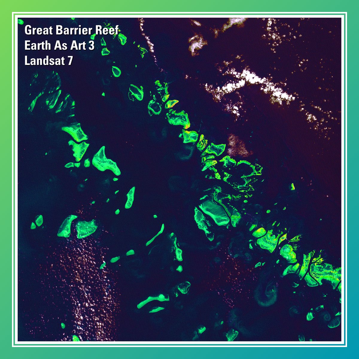
What might be mistaken for dinosaur bones being unearthed at a paleontological dig are some of the individual reefs that make up the #GreatBarrierReef. Download the image here: ow.ly/6xl250S4wG2. #EarthAsArt #WorldReefAwarenessDay

What might be mistaken for dinosaur bones being unearthed at a paleontological dig are some of the individual reefs that make up the #GreatBarrierReef. Download the image here: ow.ly/6xl250S4wG2.

#EarthAsArt #WorldReefAwarenessDay
USGS Landsat (@usgslandsat) 's Twitter Profile Photo

Geometric and radiometric calibration are the backbone of #Landsat's exceptional data quality. The USGS and NASA Landsat Cal/Val Team monitors the geometric and radiometric performance of the instruments to maintain the highest level. Learn more here: ow.ly/h9r250W2vTv.

Geometric and radiometric calibration are the backbone of #Landsat's exceptional data quality. The USGS and NASA Landsat  Cal/Val Team monitors the geometric and radiometric performance of the instruments to maintain the highest level. Learn more here: ow.ly/h9r250W2vTv.
USGS EROS (@usgs_eros) 's Twitter Profile Photo

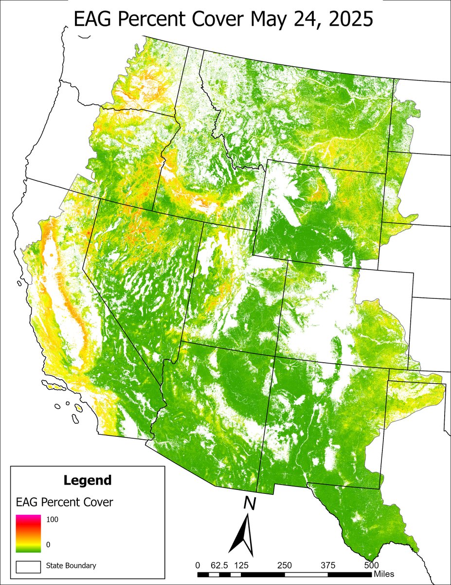
Week 7 of the 2025 Exotic Annual Grass (EAG) dataset is available, mapping the abundance of invasive grass species in western U.S. rangeland. Get the data: ow.ly/Tzo450W2NSt Eyes on Earth podcast about how EAG data helps sheep target cheatgrass: ow.ly/fna050W2NSs

Week 7 of the 2025 Exotic Annual Grass (EAG) dataset is available, mapping the abundance of invasive grass species in western U.S. rangeland. Get the data: ow.ly/Tzo450W2NSt 
Eyes on Earth podcast about how EAG data helps sheep target cheatgrass: ow.ly/fna050W2NSs
USGS Landsat (@usgslandsat) 's Twitter Profile Photo

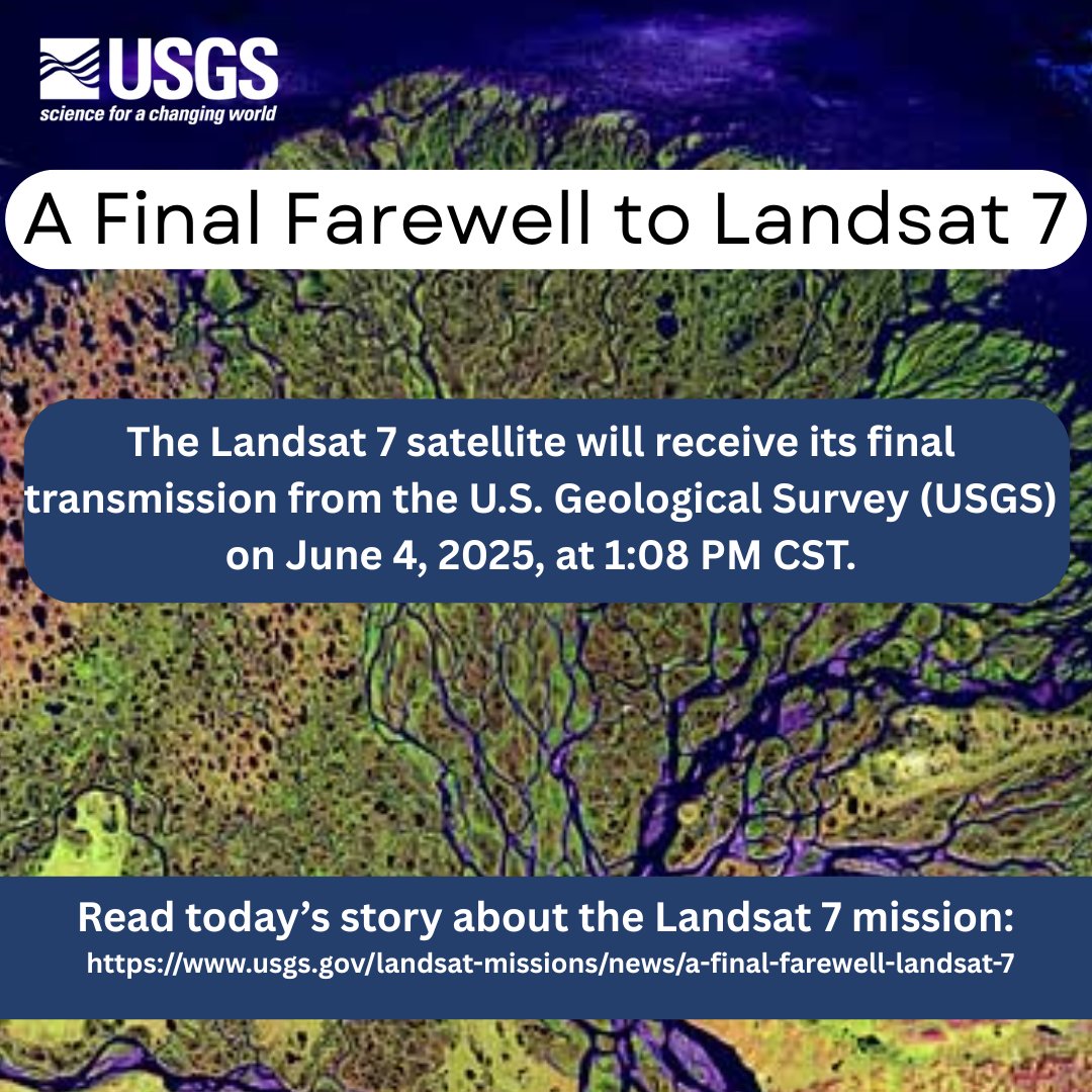
Remembering its 25 years of faithful Earth observation, the USGS and NASA announce the decommissioning of #Landsat 7 from active service June 4th. Read more here: ow.ly/WkTI50W4a0o.

Remembering its 25 years of faithful Earth observation, the USGS and NASA announce the decommissioning of #Landsat 7 from active service June 4th.

Read more here:  ow.ly/WkTI50W4a0o.
USGS EROS (@usgs_eros) 's Twitter Profile Photo

Annual NLCD makes looking at land change easy, even over nearly 4 decades. One cause of ag land change in the past 40 years is the USDA’s Conservation Reserve Program (CRP). Watch cropland and grassland alternate in this Montana animation. Learn more: ow.ly/BmGF50W4f8O

USGS (@usgs) 's Twitter Profile Photo

🌎🛰️After 25 years of Earth observation, the USGS bids farewell to #Landsat7 June 4. The legacy continues with Landsat 8 and 9, capturing planetary imagery to support farmers, city planners, and disaster recovery. 👉ow.ly/ZTf150W4mp3 #EarthObservation #NASA

🌎🛰️After 25 years of Earth observation, the USGS bids farewell to #Landsat7 June 4. The legacy continues with Landsat 8 and 9, capturing planetary imagery to support farmers, city planners, and disaster recovery. 

👉ow.ly/ZTf150W4mp3

#EarthObservation #NASA
USGS EROS (@usgs_eros) 's Twitter Profile Photo

It feels like we just debuted the reinvented Annual NLCD, but guess what?! This month, we’ll release an update with 2024 info. Watch for it June 25, 2025. Here’s an Annual NLCD example of forest fire and recovery in California. More about Annual NLCD: ow.ly/XVfI50W4T86

USGS (@usgs) 's Twitter Profile Photo

Across the US Department of the Interior, scientists are using satellites, drones, & other tech to monitor the planet and tackle big questions about land use, natural hazards, & more. The 2024 DOI Remote Sensing Activities Report highlights many of these innovative efforts: ow.ly/cql750W5cbL

USGS EROS (@usgs_eros) 's Twitter Profile Photo

USGS scientists collected field data in the Florida Keys as part of an effort to produce ocean depth measurements from satellite imagery. Sonar and Global Navigation Satellite System (GNSS) data will help evaluate accuracy of satellite measurements. Data: ow.ly/IwNi50W5q9u

USGS scientists collected field data in the Florida Keys as part of an effort to produce ocean depth measurements from satellite imagery. Sonar and Global Navigation Satellite System (GNSS) data will help evaluate accuracy of satellite measurements. Data: ow.ly/IwNi50W5q9u
USGS EROS (@usgs_eros) 's Twitter Profile Photo

#Landsat 8 collected new images of these Canada fires on June 5, 2025. Image A shows a wildfire near the Petitot River in northeastern British Columbia. The Saskatchewan fire in image B is burning east of Mari Lake. More than 200 fires are currently active across Canada.

USGS EROS (@usgs_eros) 's Twitter Profile Photo

Happy International Archives Day from the home of the largest civilian collection of images of the Earth’s land surface! The EROS film & digital archives include aerial & satellite imagery and more (declassified spy satellite scenes, too!). Learn more: ow.ly/EEuv50W5HT1

USGS EROS (@usgs_eros) 's Twitter Profile Photo

Remembering its quarter-century of faithful Earth observation, the USGS and NASA have announced the decommissioning of Landsat 7 from active service. Landsat 8 and Landsat 9 continue to collect images every day. Read more about Landsat 7: ow.ly/nz9k50W5CAQ

Remembering its quarter-century of faithful Earth observation, the USGS and NASA have announced the decommissioning of Landsat 7 from active service. Landsat 8 and Landsat 9 continue to collect images every day. Read more about Landsat 7: ow.ly/nz9k50W5CAQ
USGS EROS (@usgs_eros) 's Twitter Profile Photo

#OTD in 1980, #Landsat3 captured an image of Reflections from #Earth, a temporary art installation created by #TomVanSant, when flying over the #MojaveDesert. The giant human eye, consisting of 90 carefully positioned mirrors, was designed to be seen by #Landsat satellites.

#OTD in 1980, #Landsat3 captured an image of Reflections from #Earth, a temporary art installation created by #TomVanSant, when flying over the #MojaveDesert. The giant human eye, consisting of 90 carefully positioned mirrors, was designed to be seen by #Landsat satellites.
USGS EROS (@usgs_eros) 's Twitter Profile Photo

Come along as we visit a #Landsat validation test site on the latest Eyes on Earth podcast episode. We’ll learn about why validation is important to maintaining Landsat’s gold standard, as well as hazards of the test site (ticks are one!). Listen: ow.ly/CEnh50W8muN

USGS EROS (@usgs_eros) 's Twitter Profile Photo

The LP DAAC has released the Terra ASTER Version 4 product suite. This is the initial release of a reprocessing of the entire ASTER archive and includes data from early mission years 2000-2005. Future releases will continue chronologically. Details: ow.ly/ZMUQ50W7Y9L

The LP DAAC has released the Terra ASTER Version 4 product suite. This is the initial release of a reprocessing of the entire ASTER archive and includes data from early mission years 2000-2005. Future releases will continue chronologically. Details: ow.ly/ZMUQ50W7Y9L