Danny Mercer (@utahwxmetguy) 's Twitter Profile
Danny Mercer

@utahwxmetguy

Weather & climate enthusiast. Retired NOAA, National Weather Service Meteorologist. @UofUATMOS grad. Posts focus on weather in Utah & the Western U.S.

ID: 28829438

calendar_today04-04-2009 17:09:59

1,1K Tweet

407 Followers

294 Following

Alana Brophy (@alanabrophywx) 's Twitter Profile Photo

Winter Weather Advisories have expanded to include south-central Utah, Cache Valley, east Box Elder County, and the West Desert. Advisories will remain in effect through Friday with varying expiration times #utwx ABC4 News

Winter Weather Advisories have expanded to include south-central Utah, Cache Valley, east Box Elder County, and the West Desert. Advisories will remain in effect through Friday with varying expiration times #utwx
<a href="/abc4utah/">ABC4 News</a>
Danny Mercer (@utahwxmetguy) 's Twitter Profile Photo

The NWS Salt Lake City daily climate report indicates an official 14” of total snow this season. This is still below the 14.3” all-time record low snowfall set in 1933-1934. Will we beat it? Not much time left but the active pattern into next week favors YES- we shall see!

Alana Brophy (@alanabrophywx) 's Twitter Profile Photo

Stalling band of snow over Salt Lake County will result in the biggest valley snowfalls of the season! Travel impacts ahead for the AM commute & Utah DOT putting out travel advisories for road snow. Take it easy on the road & get ready for big totals! #utwx ABC4 News

Stalling band of snow over Salt Lake County will result in the biggest valley snowfalls of the season! Travel impacts ahead for the AM commute &amp; <a href="/UtahDOT/">Utah DOT</a> putting out travel advisories for road snow. Take it easy on the road &amp; get ready for big totals!
#utwx <a href="/abc4utah/">ABC4 News</a>
Danny Mercer (@utahwxmetguy) 's Twitter Profile Photo

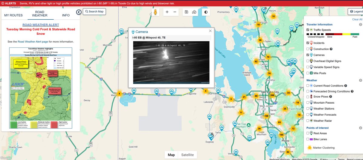
A strong cold front will move into the SL Valley within the hour. High winds and heavy snow causing travel difficulty (especially high-profile trucks) on I-80 over the W. Desert to Wendover. Snow will become heavy at times, with highest impacts in the SL Valley and benches.

A strong cold front will move into the SL Valley within the hour. High winds and heavy snow causing travel difficulty (especially high-profile trucks) on I-80 over the W. Desert to Wendover. Snow will become heavy at times, with highest impacts in the SL Valley and benches.
NASA (@nasa) 's Twitter Profile Photo

LIVE: #Crew9 and their SpaceX Dragon spacecraft are departing the International Space Station and starting their journey back to Earth. Undocking is scheduled for 1:05am ET (0505 UTC). x.com/i/broadcasts/1…

Danny Mercer (@utahwxmetguy) 's Twitter Profile Photo

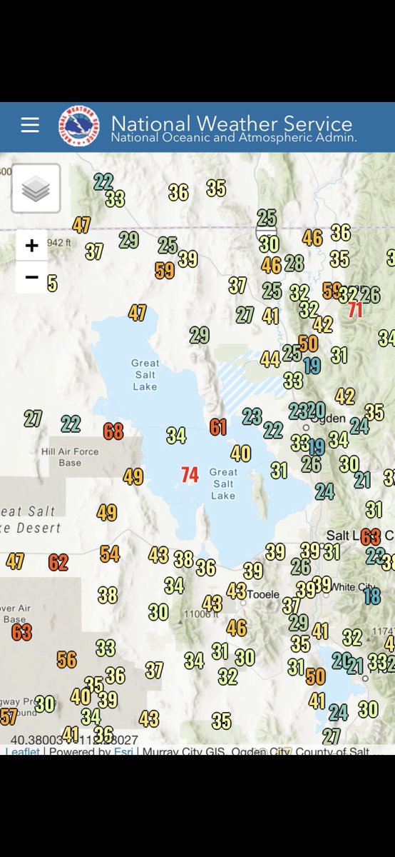
There is still lake effect potential through later tonight. Favored areas- Bountiful south into the SL Valley. Maybe some local minor accumulation, especially this evening. Be cautious of icy spots later. weather.gov/slc for updates. #utwx

Jonathan Pulley (@whidbeywxguy) 's Twitter Profile Photo

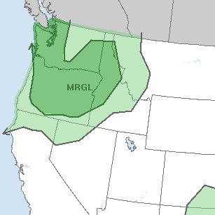
The marginal risk for severe thunderstorms has been expanded to include all of western Washington and parts of SW BC as well! The main threats at this time are strong to isolated damaging winds, large hail, and frequent lightning. I will have a full breakdown of the forecast

The marginal risk for severe thunderstorms has been expanded to include all of western Washington and parts of SW BC as well! The main threats at this time are strong to isolated damaging winds, large hail, and frequent lightning. I will have a full breakdown of the forecast
Danny Mercer (@utahwxmetguy) 's Twitter Profile Photo

Agreed! J. Powell will likely start QE to offset China’s dumping of U.S. bonds. Duration and amount of purchases target a goal to stabilize the bond market until tariffs are resolved. Not inflationary! Rates still high and consumer adverse to take on debt. Kelly Evans