WeatherReMarks (@weatherremarks) 's Twitter Profile
WeatherReMarks

@weatherremarks

Lifelong passion+fascination of weather. Providing insightful forecasts for the Northeast. Trained NWS SKYWARN spotter. facebook.com/WeatherReMarks

ID: 2496291281

linkhttp://www.weatherremarks.com calendar_today20-04-2014 03:54:10

8,8K Tweet

1,1K Followers

831 Following

WeatherReMarks (@weatherremarks) 's Twitter Profile Photo

Welcome to meteorological Summer on the summit of Mount Washington! Current conditions: 26°F: Temp 9°F: Wind chill 50mph wind gust 88mph (top 34hr gust) 2.8" OF SNOW! Jim Cantore James Spann #NHwx

Yuri Beletsky (@ybeletsky) 's Twitter Profile Photo

Just flew from Melbourne 🇦🇺 to Santiago 🇨🇱 on LATAM Chile flight LA804 and saw an incredible aurora from the plane ! 🤩 The sky was alive with soft splashes of light. This flight’s route feels truly special - passing so close to Antarctica, you can almost sense the vastness below.
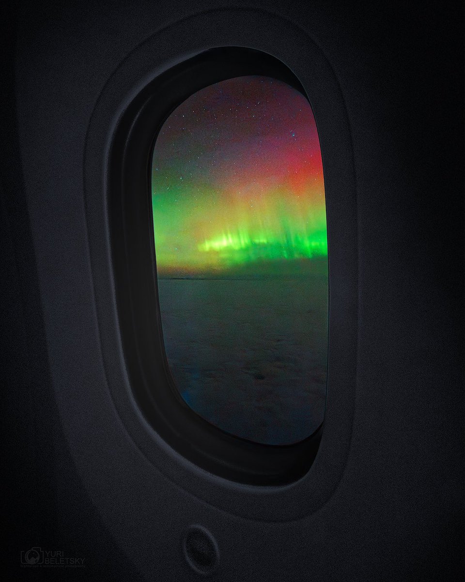
Just flew from Melbourne 🇦🇺 to Santiago 🇨🇱 on <a href="/LATAM_CHI/">LATAM Chile</a> flight LA804 and saw an incredible aurora from the plane ! 🤩 The sky was alive with soft splashes of light. This flight’s route feels truly special - passing so close to Antarctica, you can almost sense the vastness below.
Earthquakes (@newearthquake) 's Twitter Profile Photo

Preliminary: 5.6 earthquake, Crete, Greece. On 2025/06/03 11:26:31 UTC (3m ago, depth 10km). geofon.gfz-potsdam.de/eqinfo/event.p…

National Hurricane Center (@nhc_atlantic) 's Twitter Profile Photo

8 am EDT Tue Jun 3: A non-tropical area of low pressure is forecast to form along a frontal boundary in a couple days off the SE U.S. coast. The low could gradually acquire subtropical or tropical characteristics later this week if it remains offshore. Stay tuned to

8 am EDT Tue Jun 3: A non-tropical area of low pressure is forecast to form along a frontal boundary in a couple days off the SE U.S. coast. The low could gradually acquire subtropical or tropical characteristics later this week if it remains offshore. 

Stay tuned to
Mount Washington Observatory (MWOBS) (@mwobs) 's Twitter Profile Photo

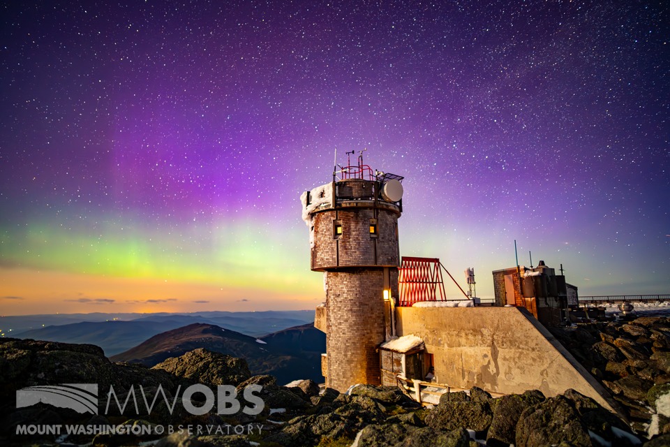
The northern lights put on another beautiful display at the summit last night, thanks to a strong geomagnetic storm and little to no clouds around the summit. With wind chills nearing 20 degrees, summit staff had to bundle up to watch the event around midnight.

The northern lights put on another beautiful display at the summit last night, thanks to a strong geomagnetic storm and little to no clouds around the summit. With wind chills nearing 20 degrees, summit staff had to bundle up to watch the event around midnight.
CIRA (@cira_csu) 's Twitter Profile Photo

Yesterday, Mount Etna erupted, spewing ash into the sky. The stratovolcano is located on the east coast of Sicily, Italy. High-resolution imagery captured by JPSS satellites.

Ryan Knapp (@wxknapper) 's Twitter Profile Photo

My timelapse of images from last night's #NorthernLights. While they were visible from dusk to dawn, to get to the good part quicker, this is from midnight & going until 230 EDT when fog rolled in & obscured my view. Fog was being lit up by the lights but unable to be seen. #NH

NWS Boston (@nwsboston) 's Twitter Profile Photo

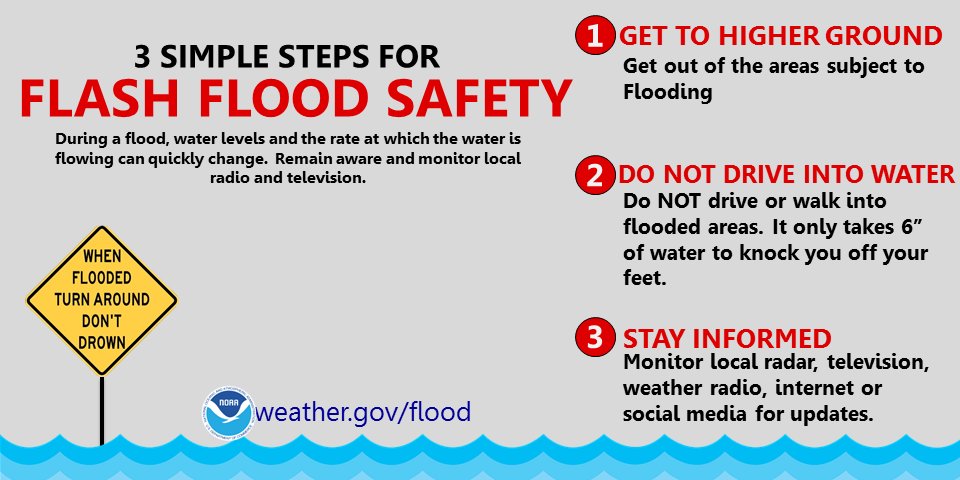
[Severe Weather/Localized Flash Flood Threat Today] Scattered severe t-storms with damaging wind gusts along with a localized flash flooding exist between noon and 10 pm this evening. The greatest risk is north of the CT/RI border where the activity will be most numerous.

[Severe Weather/Localized Flash Flood Threat Today] Scattered severe t-storms with damaging wind gusts along with a localized flash flooding exist between noon and 10 pm this evening. The greatest risk is north of the CT/RI border where the activity will be most numerous.
NWS Gray (@nwsgray) 's Twitter Profile Photo

Renewed risk of flash flooding today as heavy showers with embedded thunderstorms redevelop. Similar locations again see this rainfall, and flooding will onset quicker with saturated ground. Severe thunderstorms are not forecast today. #mewx #nhwx

Renewed risk of flash flooding today as heavy showers with embedded thunderstorms redevelop. Similar locations again see this rainfall, and flooding will onset quicker with saturated ground. Severe thunderstorms are not forecast today. #mewx #nhwx
Earthquakes (@newearthquake) 's Twitter Profile Photo

6.3 earthquake, 17 km NNE of Paratebueno, Colombia. Jun 8 13:08:06 UTC (17m ago, depth 10km). earthquake.usgs.gov/earthquakes/ev…

NWS Storm Prediction Center (@nwsspc) 's Twitter Profile Photo

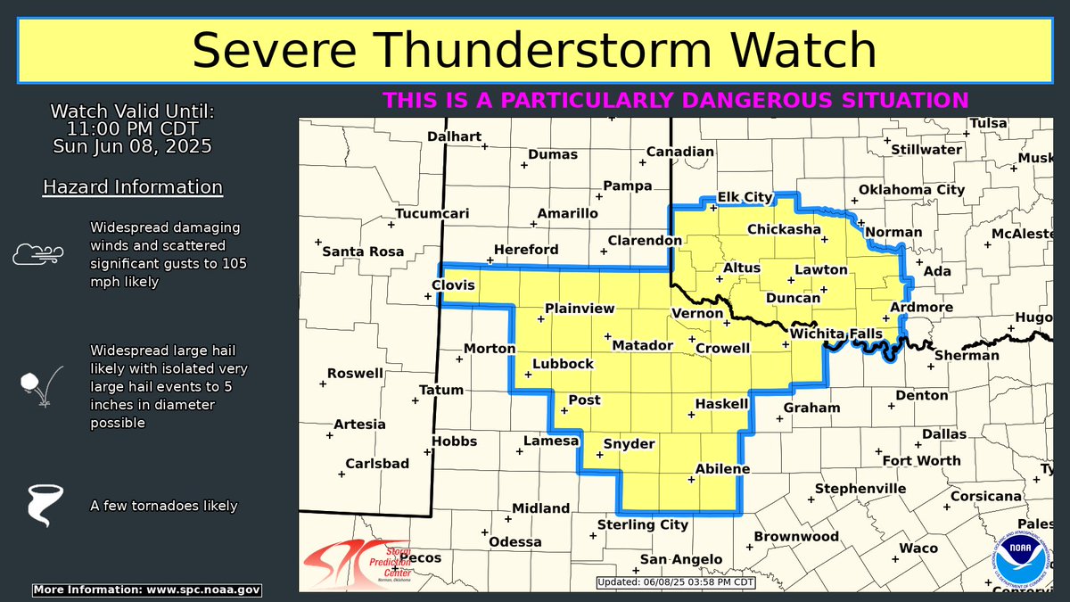
A PDS Severe Thunderstorm Watch is in effect until 11 PM CDT for parts of the Texas South Plains, western North Texas and southwest Oklahoma. Widespread severe winds and very large hail are possible. Stay weather aware this afternoon/evening.

A PDS Severe Thunderstorm Watch is in effect until 11 PM CDT for parts of the Texas South Plains, western North Texas and southwest Oklahoma. Widespread severe winds and very large hail are possible. Stay weather aware this afternoon/evening.
Thierry Goose (@thierrygoosebc) 's Twitter Profile Photo

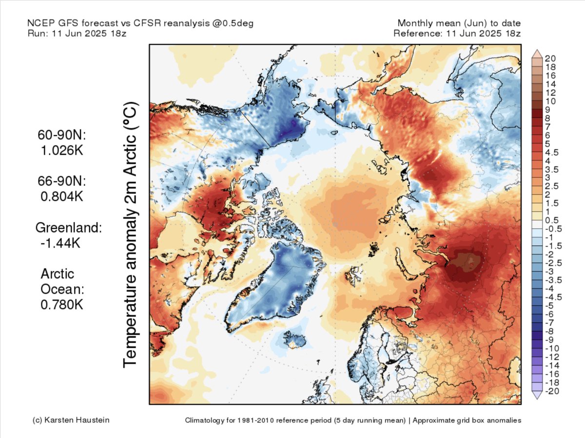
🥶 Very cool start of June in Alaska. 🇺🇸 June 1-10 Period Talkeetna ➡️ coolest since 1965 Deadhorse ➡️ coolest since records began in 1968 Anchorage ➡️ coolest since 1973 Bethel ➡️ coolest since 1977 Gulkana ➡️ coolest since 1986 Bettles, Fairbanks & Tanana ➡️ coolest since 2006

🥶 Very cool start of June in Alaska. 🇺🇸

June 1-10 Period
Talkeetna ➡️ coolest since 1965
Deadhorse ➡️ coolest since records began in 1968
Anchorage ➡️ coolest since 1973
Bethel ➡️ coolest since 1977
Gulkana ➡️ coolest since 1986
Bettles, Fairbanks &amp; Tanana ➡️ coolest since 2006