WeatherWorks (@weatherworks) 's Twitter Profile
WeatherWorks

@weatherworks

We're a private weather consulting firm, specializing in Customized Storm Alerts, Certified Snowfall Totals, & Past Weather Reports. We are YOUR Weather Experts

ID: 175426542

linkhttps://linktr.ee/weatherworks calendar_today06-08-2010 15:37:34

29,29K Tweet

3,3K Followers

350 Following

WeatherWorks (@weatherworks) 's Twitter Profile Photo

Tropical Storm Dexter continues to pose to risk to the US as it moves east. We're also watching two more disturbances which have a risk of development; one off the Southeast coast with a 40% chance of development in the next 7 days, per the NHC, though this likely remains out to

WeatherWorks (@weatherworks) 's Twitter Profile Photo

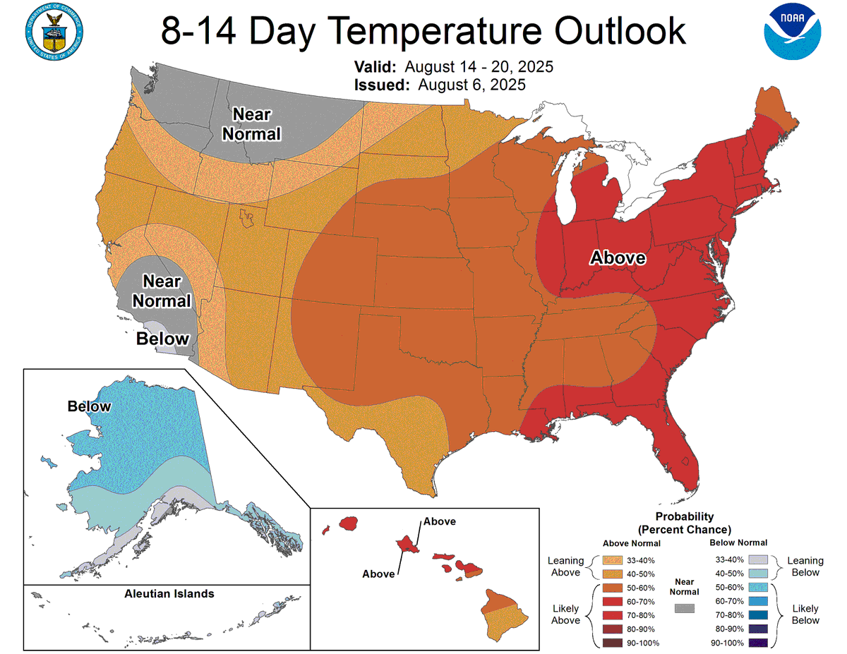
Summer isn't over yet across the eastern Seaboard. Big signal for above average temperatures again through the next two weeks.

Summer isn't over yet across the eastern Seaboard. Big signal for above average temperatures again through the next two weeks.
WeatherWorks (@weatherworks) 's Twitter Profile Photo

Tropical PSA: These are the last 6 runs of the GFS for August 22nd. Notice how wildly different every solution is? No consistency thanks to lots of moving parts in the upper atmosphere. Long range forecasting tells us the Atlantic is turning more active, but it can't pinpoint

WeatherWorks (@weatherworks) 's Twitter Profile Photo

Looks like a bit of roost rings popping up on radar this morning over the Delmarva and southern NJ. It's that time of year. The migratory birds are getting active for the changing seasons... #NJwx #DEwx

WeatherWorks (@weatherworks) 's Twitter Profile Photo

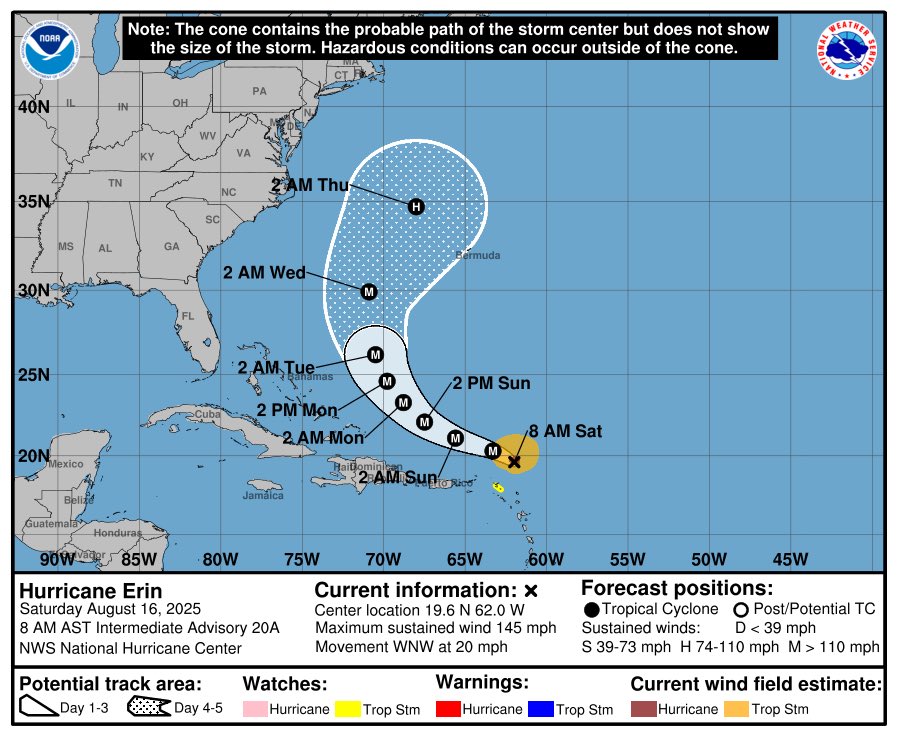
#Erin churning out in the Atlantic, getting into a better environment now. Should see it become a Hurricane either tomorrow or this weekend. Still many indications this takes the north turn. Less of a direct threat to the east coast, but watch for swells and rip currents next

WeatherWorks (@weatherworks) 's Twitter Profile Photo

Erin has become the first Hurricane of the 2025 Season, likely to become the first Major Hurricane as well. #Erin #Tropics #Hurricane

WeatherWorks (@weatherworks) 's Twitter Profile Photo

Hurricane #Erin tapped into some very warm waters and is going through rapid intensification. While a meager Category 1 yesterday, it has in the past several hours become a pretty strong Category 4 Major Hurricane: the first of the season. Thankfully, a fish storm at this point.

Hurricane #Erin tapped into some very warm waters and is going through rapid intensification. While a meager Category 1 yesterday, it has in the past several hours become a pretty strong Category 4 Major Hurricane: the first of the season. Thankfully, a fish storm at this point.
WeatherWorks (@weatherworks) 's Twitter Profile Photo

Hurricane Erin will be bringing a sleuth of coastal impacts from the Outer Banks to the Northeast through Thursday. Large waves and beach erosion, rip currents galore, and of course coastal flooding all on tap. #NJwx #DEwx #MDwx #VAwx #NCwx

WeatherWorks (@weatherworks) 's Twitter Profile Photo

It's already starting to get rough out on the islands in NC, and Hurricane #Erin is still hundreds of miles south still. It make's it's close approach Thursday AM. Mandatory evacuations are currently in effect for some of the barrier islands. #NCwx #hurricane #tropical

WeatherWorks (@weatherworks) 's Twitter Profile Photo

#Erin has exploded in size as it makes the northern turn. A "weaker" storm, but expected to bring pretty significant coastal flooding and large surf from OBX to the Jersey Shore tomorrow. #NJwx #NCwx #VAwx #DEwx

WeatherWorks (@weatherworks) 's Twitter Profile Photo

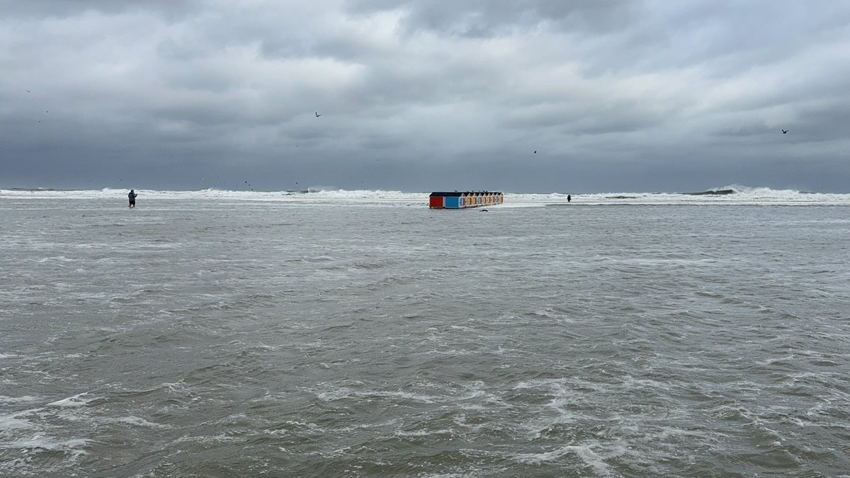
Erin moves "safely" out to sea. BUT, indirect impacts will occur. Outside of gusty winds and a choppy ocean, NE winds pile water at the coast late afternoon/evening, leading to significant coastal flooding over southern NJ and DE. Numerous flooded out areas are likely in the PM

WeatherWorks (@weatherworks) 's Twitter Profile Photo

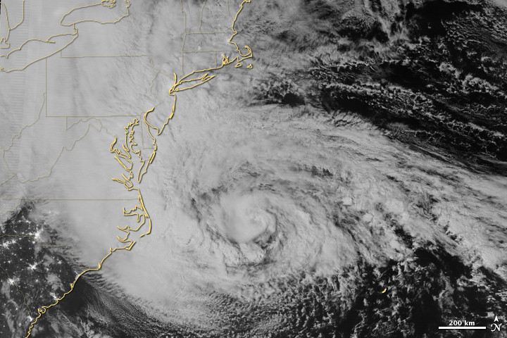
While not the same track or impacts at all, satellite similarities are quite eerie this AM. Current view of Hurricane #Erin left, and what Sandy looked like to the right. πŸ‘€ #NJwx #DEwx

While not the same track or impacts at all, satellite similarities are quite eerie this AM. Current view of Hurricane #Erin left, and what Sandy looked like to the right. πŸ‘€ #NJwx #DEwx