Zach Holder (@zachholderwx) 's Twitter Profile
Zach Holder

@zachholderwx

Chief Meteorologist for @WITN. Christian, chaser, hiker. Arkansas Native. Mississippi State Graduate. AR-MS-TX-AR-NC

ID: 272033545

linkhttps://www.witn.com calendar_today25-03-2011 17:44:04

26,26K Tweet

8,8K Followers

1,1K Following

Zach Holder (@zachholderwx) 's Twitter Profile Photo

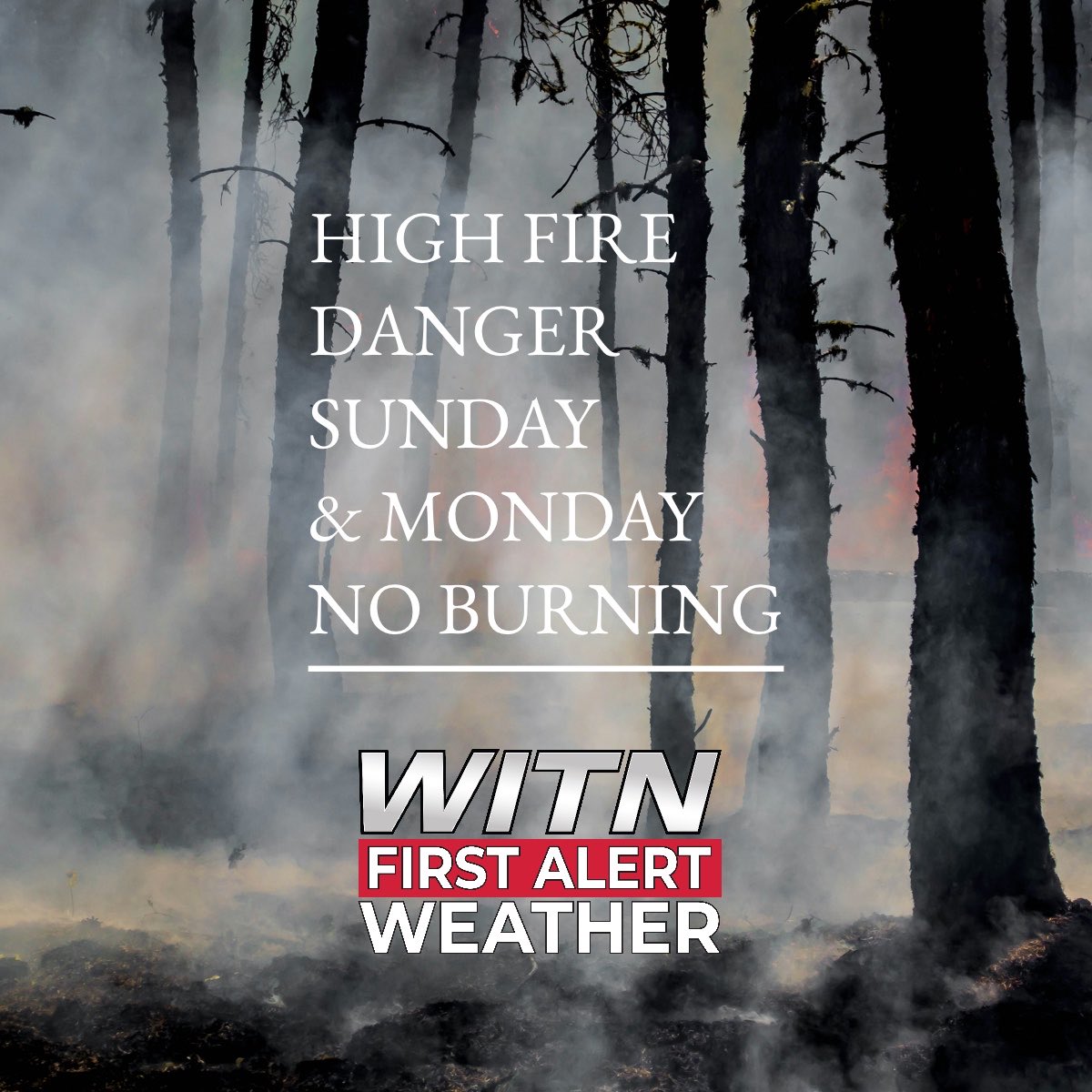
No burning through Monday. Today’s cold front will kick up the winds as really dry air arrives. The lowest humidity settles in on Monday with a breeze still around. Fires will spread quickly in these conditions despite recent rain. #ncwx

No burning through Monday. Today’s cold front will kick up the winds as really dry air arrives. The lowest humidity settles in on Monday with a breeze still around. Fires will spread quickly in these conditions despite recent rain. #ncwx
Zach Holder (@zachholderwx) 's Twitter Profile Photo

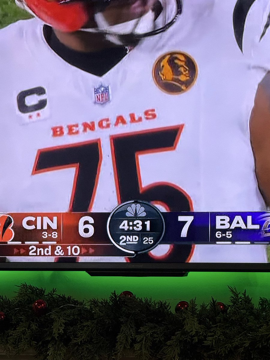
Oh no. I wonder if this is why the Arkansas football radio guys were in such a poor mood last night at the end of the game

Zach Holder (@zachholderwx) 's Twitter Profile Photo

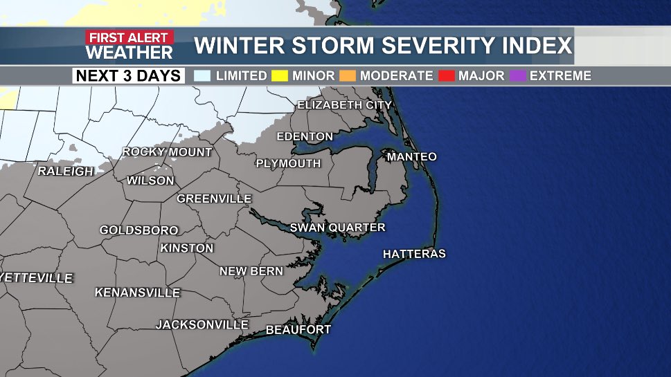
Never fails, quiet until I leave town. Just a little too early for a full blown winter storm. -Areas along and north of US 64 have the best chance of a few slick spots. -NO MILK OR BREAD NEEDED -Travel to parts of Virginia, the triangle, or the triad may be tougher #ncwx

Never fails, quiet until I leave town. Just a little too early for a full blown winter storm.
-Areas along and north of US 64 have the best chance of a few slick spots. 
-NO MILK OR BREAD NEEDED
-Travel to parts of Virginia, the triangle, or the triad may be tougher #ncwx
Zach Holder (@zachholderwx) 's Twitter Profile Photo

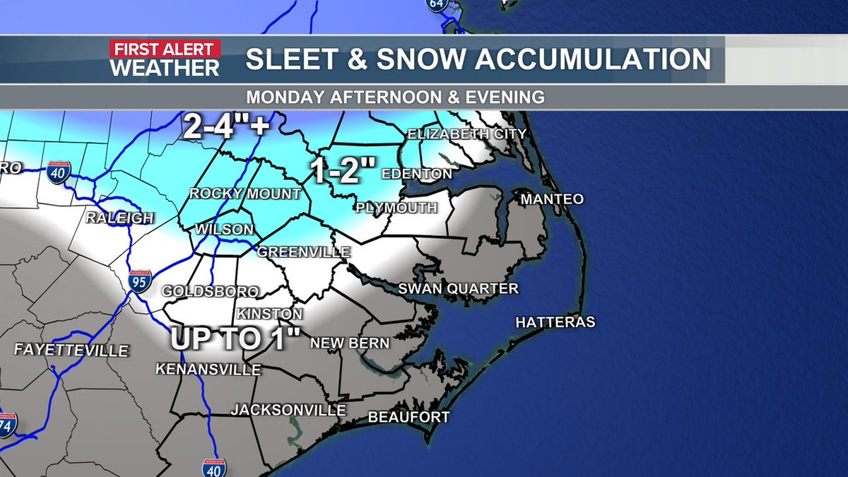
First snow map of the season! Quick and light. AM commute is fine, could be messy in some counties later. Snow sticks on elevated surfaces first, windy conditions may keep it from accumulating well. The best chance for road issues will be in heavy bursts and after sunset #ncwx

First snow map of the season! Quick and light. AM commute is fine, could be messy in some counties later. Snow sticks on elevated surfaces first, windy conditions may keep it from accumulating well. The best chance for road issues will be in heavy bursts and after sunset #ncwx
Zach Holder (@zachholderwx) 's Twitter Profile Photo

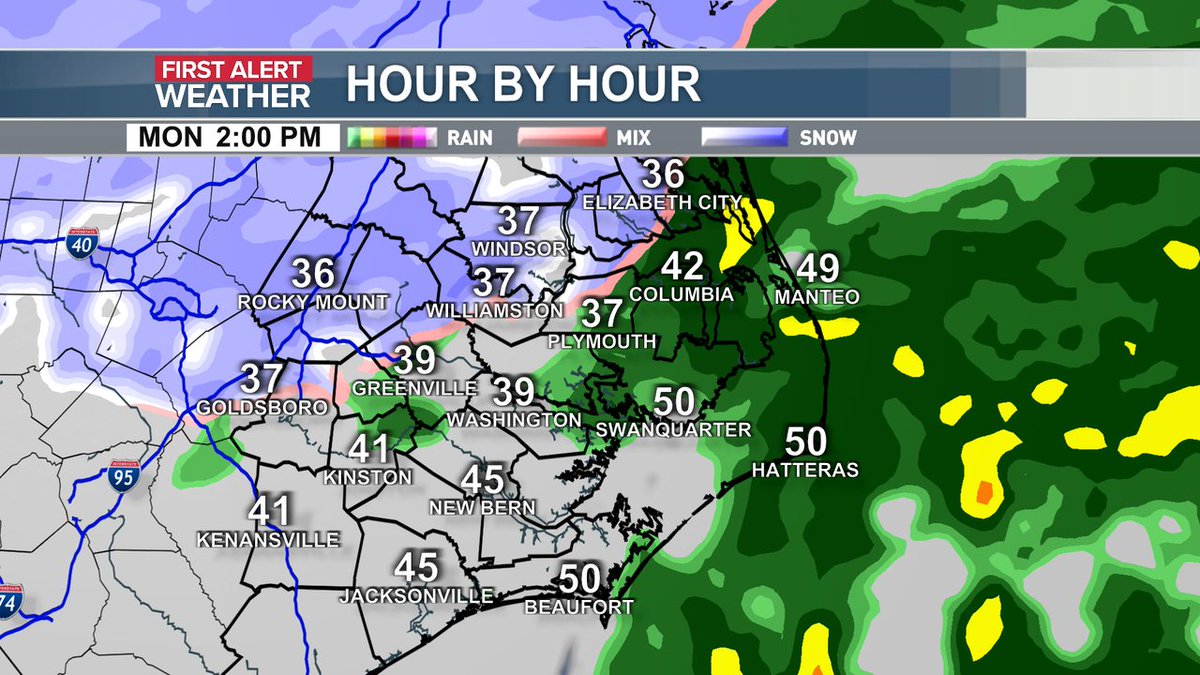
Getting a lot of timing questions so here's what radar could look like at 2 PM. Most are still fine but the transition from rain to snow has started for others. Even with above freezing temperatures, a heavy burst of snow can stick to elevated surfaces or bridges. #ncwx

Getting a lot of timing questions so here's what radar could look like at 2 PM. Most are still fine but the transition from rain to snow has started for others. Even with above freezing temperatures, a heavy burst of snow can stick to elevated surfaces or bridges.  #ncwx
Zach Holder (@zachholderwx) 's Twitter Profile Photo

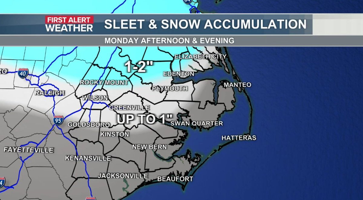
No big changes but a little more optimistic the change over happens quicker for parts of ENC. Dropped the up to 1" and 1-2" area a little more south. Virginia is the place to be. Along and south of US 70 could see flakes but it won't stick. #ncwx

No big changes but a little more optimistic the change over happens quicker for parts of ENC. Dropped the up to 1" and 1-2" area a little more south. Virginia is the place to be. Along and south of US 70 could see flakes but it won't stick.  #ncwx
Zach Holder (@zachholderwx) 's Twitter Profile Photo

Snow is falling across parts of ENC but is struggling to stick. Here's a look at where light accumulation is possible. #ncwx