afrimapr (@afrimapr) 's Twitter Profile
afrimapr

@afrimapr

R building blocks & training for mapping data in Africa. Funded by @wellcometrust, born 2020. #rstats #rspatial. Run by @southmapr & @aneldavdw

ID: 1235300640496250883

linkhttps://afrimapr.github.io/afrimapr.website/ calendar_today04-03-2020 20:28:19

596 Tweet

774 Followers

27 Following

GeoDataScience (@geodatascience) 's Twitter Profile Photo

🗺️ #30DayMapChallenge 🌍 Day 8: Africa Ákos Balog maps Chinese government projects across Africa while assessing political freedom levels using data from AidData and the Freedom in the World report. Are they building bridges or barriers?

🗺️ #30DayMapChallenge 🌍
Day 8: Africa
<a href="/AkosBalog1/">Ákos Balog</a> maps Chinese government projects across Africa while assessing political freedom levels using data from AidData and the Freedom in the World report. Are they building bridges or barriers?
Kyle Walker (@kyle_e_walker) 's Twitter Profile Photo

For Day 8 of #30DayMapChallenge, Africa, the percent of population using the Internet by county in Kenya from the 2019 Kenyan Census. Data come from the rKenyaCensus package by Shel 🇰🇪 🇮🇪; the map is adapted from Chapter 12 of my book: walker-data.com/census-r/worki… Find all of

For Day 8 of #30DayMapChallenge, Africa, the percent of population using the Internet by county in Kenya from the 2019 Kenyan Census.  

Data come from the rKenyaCensus package by <a href="/Shel_Kariuki/">Shel 🇰🇪 🇮🇪</a>; the map is adapted from Chapter 12 of my book: walker-data.com/census-r/worki…

Find all of
GeoDataScience (@geodatascience) 's Twitter Profile Photo

🗺️ #30DayMapChallenge 🌍 Day 13: Choropleth Gladys brings a bivariate map showing poverty and the number of Internally Displaced People (IDP) leaving at admin level 2 in Ethiopia (2018-19) Produced for the Displacement Tracking Matrix (DTM) Hackathon, with Ruth Neville, Maya and David Bareham

🗺️ #30DayMapChallenge 🌍
Day 13: Choropleth
<a href="/gekenyon/">Gladys</a> brings a bivariate map showing poverty and the number of Internally Displaced People (IDP) leaving at admin level 2 in Ethiopia (2018-19) 
Produced for the <a href="/DTM_IOM/">Displacement Tracking Matrix (DTM)</a> Hackathon, with <a href="/ruthneville20/">Ruth Neville</a>, <a href="/maya_m_w/">Maya</a> and David Bareham
OCHA Centre for Humanitarian Data (@humdata) 's Twitter Profile Photo

🚨 New #job! We're hiring a Data Engineer to develop #data pipelines and infrastructure to support our data science team & their work on anticipatory action. This position is home-based. ➡️ Apply by 26 November or spread the word! jobs.unops.org/pages/viewvaca…

GroupMappers (@groupmappers) 's Twitter Profile Photo

Celebrating GIS Day! Explore the malaria dashboard by #GroupMappers, #MORU Mapping Lama's #malaria situation - points represents communities, colours signify intensity. Now we can identify which village has the highest malaria cases! Thanks to year-long village data collection!

Celebrating GIS Day! 
Explore the malaria dashboard by #GroupMappers, #MORU
Mapping Lama's #malaria situation - points represents communities, colours signify intensity. Now we can identify which village has the highest malaria cases!

Thanks to year-long village data collection!
OCHA Centre for Humanitarian Data (@humdata) 's Twitter Profile Photo

After conflict escalated in #Sudan in April 2023, we worked with UN Humanitarian and Displacement Tracking Matrix (DTM) to develop scenarios for internal displacement. These have now been updated, including a worst-case scenario of 10 million displaced people by April 2024. Read more: centre.humdata.org/displacement-i…

After conflict escalated in #Sudan in April 2023, we worked with <a href="/UNOCHA/">UN Humanitarian</a> and <a href="/DTM_IOM/">Displacement Tracking Matrix (DTM)</a> to develop scenarios for internal displacement. These have now been updated, including a worst-case scenario of 10 million displaced people by April 2024.

Read more: centre.humdata.org/displacement-i…
OCHA Centre for Humanitarian Data (@humdata) 's Twitter Profile Photo

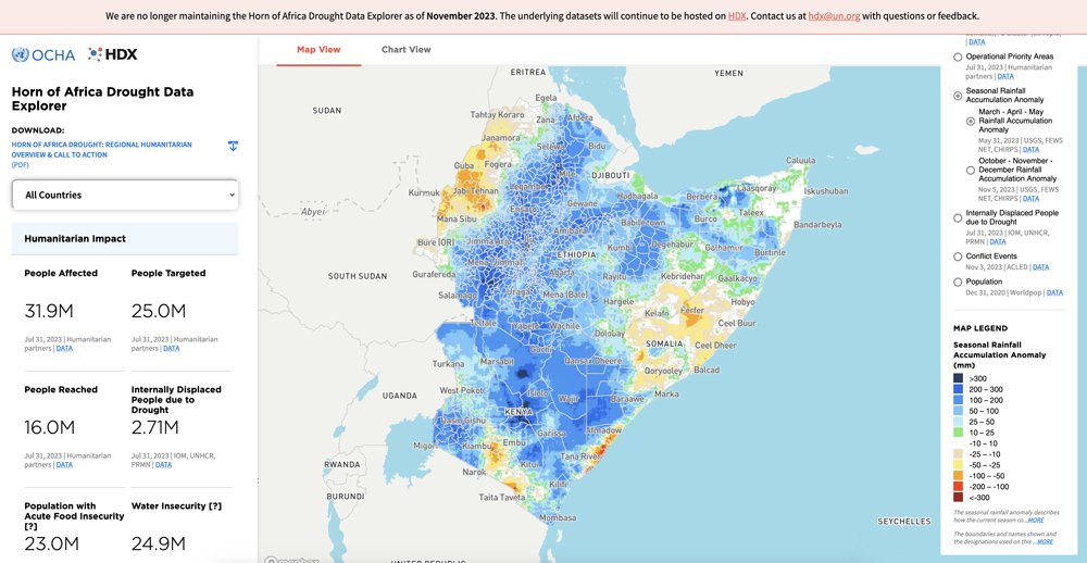
⚠️ We are discontinuing our Horn of Africa Drought Data Explorer however the underlying datasets will remain accessible on #HDX. Explore regional #data on acute food insecurity, seasonal rainfall accumulation, displacement due to drought and more here: data.humdata.org

⚠️ We are discontinuing our Horn of Africa Drought Data Explorer however the underlying datasets will remain accessible on #HDX.

Explore regional #data on acute food insecurity, seasonal rainfall accumulation, displacement due to drought and more here: data.humdata.org
Pete Macharia (@pete_m_m) 's Twitter Profile Photo

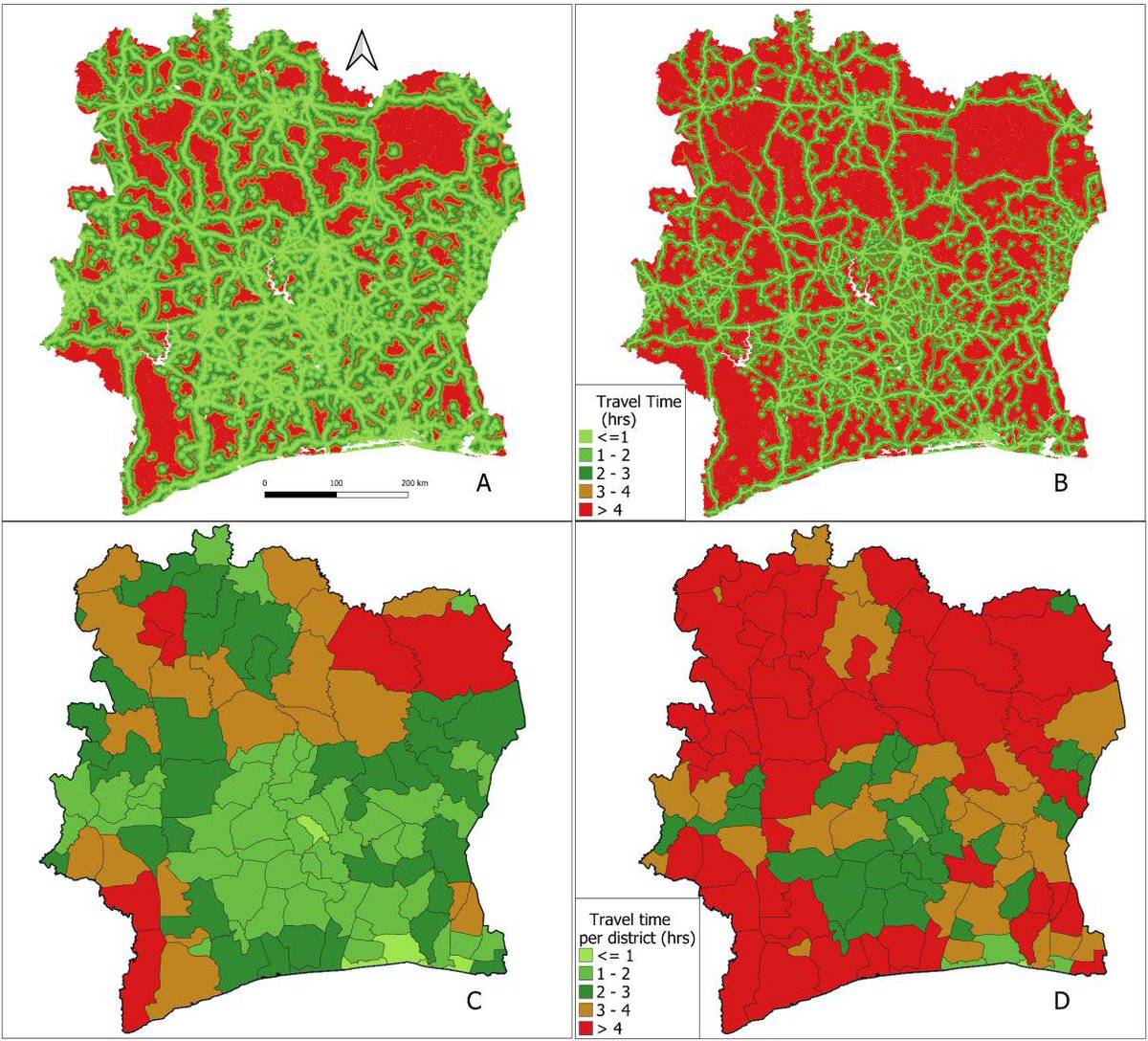
#Geographic accessibility to public healthcare facilities and #spatial clustering during the wet and dry seasons in #Coted'Ivoire led by Gaëlle T. Sehi. medRxiv at doi.org/10.1101/2023.1…

#Geographic accessibility to public healthcare facilities and #spatial clustering during the wet and dry seasons in #Coted'Ivoire led by <a href="/SehiGaellee/">Gaëlle T. Sehi</a>. 

<a href="/medrxivpreprint/">medRxiv</a> at doi.org/10.1101/2023.1…
Pete Macharia (@pete_m_m) 's Twitter Profile Photo

Three #PhD opportunities: Preparing Kenya's health system for extreme weather/ climate shocks. #Spatial , #Survey, #HealthEconomics Registered at University of Oxford & based KEMRI-Wellcome DPhil 1 – Assess vulnerability to extreme weather and the role of health and health services
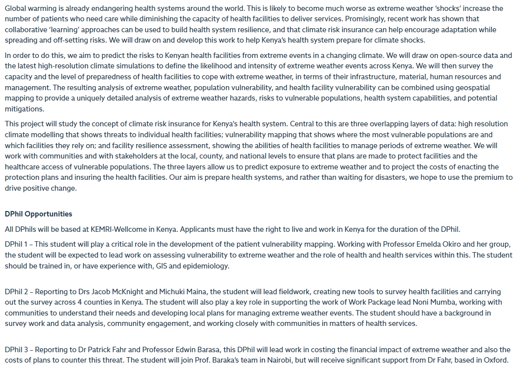
Three #PhD opportunities: Preparing Kenya's health system for extreme weather/ climate shocks. #Spatial , #Survey, #HealthEconomics 

Registered at <a href="/UniofOxford/">University of Oxford</a> &amp; based <a href="/KEMRI_Wellcome/">KEMRI-Wellcome</a> 

DPhil 1 – Assess vulnerability to extreme weather and the role of health and health services
OCHA Centre for Humanitarian Data (@humdata) 's Twitter Profile Photo

🛠️ API Upgrade! ADAM Disaster Alerts data on HDX now includes #flood, storm and earthquake alerts. Covering 130+ low and middle-income countries, ADAM issues alerts, aggregating risk and impact #data following sudden onset #humanitarian emergencies. Explore on #HDX: data.humdata.org/organization/a…

🛠️ API Upgrade! <a href="/WFP_ADAM/">ADAM Disaster Alerts</a> data on HDX now includes #flood, storm and earthquake alerts. Covering 130+ low and middle-income countries, ADAM issues alerts, aggregating risk and impact #data following sudden onset #humanitarian emergencies.

Explore on #HDX: data.humdata.org/organization/a…
OCHA Centre for Humanitarian Data (@humdata) 's Twitter Profile Photo

📢 New #job! We are hiring a #Data Manager to support the day-to-day maintenance of the HDX platform. This position is home-based. ➡️ Apply by 11 December or share with your networks! jobs.unops.org/pages/viewvaca…

SotM Africa 2025 (@sotmafrica) 's Twitter Profile Photo

📢Are we ready? #SotMAfrica2023 is finally here, an event bringing together OSM enthusiasts from Africa and beyond, our awaited moment to connect both in-person & online, to exchange insights, expertise and visions for the future 2023.stateofthemap.africa/programme Let's make it memorable

📢Are we ready?

#SotMAfrica2023 is finally here, an event bringing together OSM enthusiasts from Africa and beyond, our awaited moment to connect both in-person &amp; online, to exchange insights, expertise and visions for the future

2023.stateofthemap.africa/programme

Let's make it memorable
Innocent Maholi (@innocentmaholi) 's Twitter Profile Photo

Join me today on #SotMAfrica2023 as I speak about and moderate a panel discussion on how Africa can build more sustainable open mapping communities that bring positive changes to communities and support decision-making processes for governments and partners. OpenMap Development Tanzania SotM Africa 2025

Join me today on #SotMAfrica2023 as I speak about and moderate a panel discussion on how Africa can build more sustainable open mapping communities that bring positive changes to communities and support decision-making processes for governments and partners.

<a href="/OMDTZ/">OpenMap Development Tanzania</a> <a href="/sotmafrica/">SotM Africa 2025</a>
SotM Africa 2025 (@sotmafrica) 's Twitter Profile Photo

Watch the #SotMAfrica2023 sessions live on YouTube youtube.com/live/ELj9kFpCd… Don't miss out on these creative discussions, tap in now🥳

OpenStreetMap Ghana (@osmghana) 's Twitter Profile Photo

✨It's SotM Africa 2025 2023 conference 🎉 Day 1!! Let’s go 💃🏽 🎥Watch the sessions live at 🔗youtube.com/@sotmafrica/st… #SOTMAfrica2023


Geoffrey Kateregga (@kateregga1) 's Twitter Profile Photo

What is the current state of OSM in Africa! Dive into the current state, backed by comprehensive data analysis and survey results from vibrant #OpenStreetMap communities. Uncover the achievements, challenges, and dynamic contributions shaping OSM in Africa shorturl.at/jtyM9

Hemed (@725hemeed) 's Twitter Profile Photo

Haruna Passed out😴.... a bit apologies...since i'm awake..... Shapefile and Geotiffs in Africa are found in Natural Earth website...it has global data but you can clip for Africa....others are Grid3 and Rcmrd websites....if you're good in R programming Afrimapr package 📦 is good too

Hemed (@725hemeed) 's Twitter Profile Photo

Haruna YouTube's Milos Popovic channel is great place to start he has some cool tutorials....also afrimapr's GitHub is good for beginners like familiarity with packages and environment and familiarity cause it's Africa 😅....then you progress as time goes