Brian Tang (@btangywx) 's Twitter Profile
Brian Tang

@btangywx

Associate professor of atmospheric science @UAlbanyDAES. My research focuses on hurricanes and severe weather. Hockey player, skier, and hiker.

ID: 908152840832593920

linkhttp://www.atmos.albany.edu/facstaff/tang/ calendar_today14-09-2017 02:18:04

1,1K Tweet

3,3K Followers

478 Following

NOAA Space Weather Prediction Center (@nwsswpc) 's Twitter Profile Photo

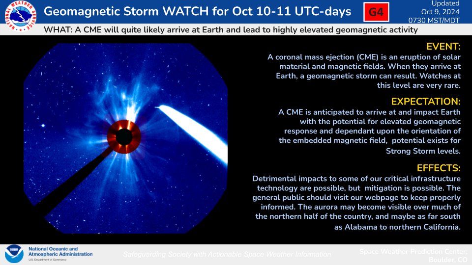
A fast CME erupted from the Sun the evening of 8 Oct and is likely to arrive at Earth on 10 Oct. This CME has been analyzed and there is potential to reach G4 levels upon arrival and throughout CME passage. Visit swpc.noaa.gov/news/g4-severe… for the full story.

A fast CME erupted from the Sun the evening of 8 Oct  and is likely to arrive at Earth on 10 Oct. This CME has been analyzed and there is potential to reach G4 levels upon arrival and throughout CME passage. Visit swpc.noaa.gov/news/g4-severe… for the full story.
Brooks Garner (@brooksweather) 's Twitter Profile Photo

10:10 am 10/9 - Confirmed tornado in Broward County after crossing I-75 in Palm Beach County. This is associated with Hurricane #Milton. We will see a tornado threat developing this afternoon.

Brian Tang (@btangywx) 's Twitter Profile Photo

The difference between Milton's wind field is apparent between last night's NOAA reconnaissance mission & this morning's mission. Note the significant expansion of hurricane-force winds on the E side of the storm. Despite Milton weakening, its larger size will keep surge high.

The difference between Milton's wind field is apparent between last night's NOAA reconnaissance mission & this morning's mission. Note the significant expansion of hurricane-force winds on the E side of the storm. Despite Milton weakening, its larger size will keep surge high.
NWS Miami (@nwsmiami) 's Twitter Profile Photo

10/9 at 3pm: Here is a view of all of the *Tornado Warnings* issued by NWS Tampa Bay, NWS Miami, and NWS Melbourne thus far. As of 3pm, 53 total tornado warnings have been issued today... 41 issued by NWS Miami Please remain aware for current and future tornado warnings!

10/9 at 3pm: Here is a view of all of the *Tornado Warnings* issued by NWS Tampa Bay, NWS Miami, and NWS Melbourne thus far.

As of 3pm, 53 total tornado warnings have been issued today...

41 issued by NWS Miami

Please remain aware for current and future tornado warnings!
Andy Hazelton (@andyhazelton) 's Twitter Profile Photo

Hurricane models have advertised an area of strong winds developing on the backside of #Milton (likely due to interaction with the jet) and I think we might be seeing evidence of that on the Tampa radar now. Watch to see if this picks up in recon and radar data this evening.

Hurricane models have advertised an area of strong winds developing on the backside of #Milton (likely due to interaction with the jet) and I think we might be seeing evidence of that on the Tampa radar now. Watch to see if this picks up in recon and radar data this evening.
Jake P. Mulholland, Ph.D. (@jakemulholland1) 's Twitter Profile Photo

Low-level rotational tracks via MRMS for the long-track supercells and tornadoes over the last 24-hours associated with Hurricane #Milton across Florida. #flwx

Low-level rotational tracks via MRMS for the long-track supercells and tornadoes over the last 24-hours associated with Hurricane #Milton across Florida. #flwx
Michael Fischer (@mikefischerwx) 's Twitter Profile Photo

I am happy to announce that I am actively looking for two PhD students to join my research group starting Fall 2025 at University of Miami Rosenstiel School! These positions are fully funded. Please see the slide for more info and feel free to reach out with any questions via email or DM here.

I am happy to announce that I am actively looking for two PhD students to join my research group starting Fall 2025 at <a href="/MiamiRosenstiel/">University of Miami Rosenstiel School</a>! These positions are fully funded. Please see the slide for more info and feel free to reach out with any questions via email or DM here.
Matthew Brown (@rhapsodyinbrown) 's Twitter Profile Photo

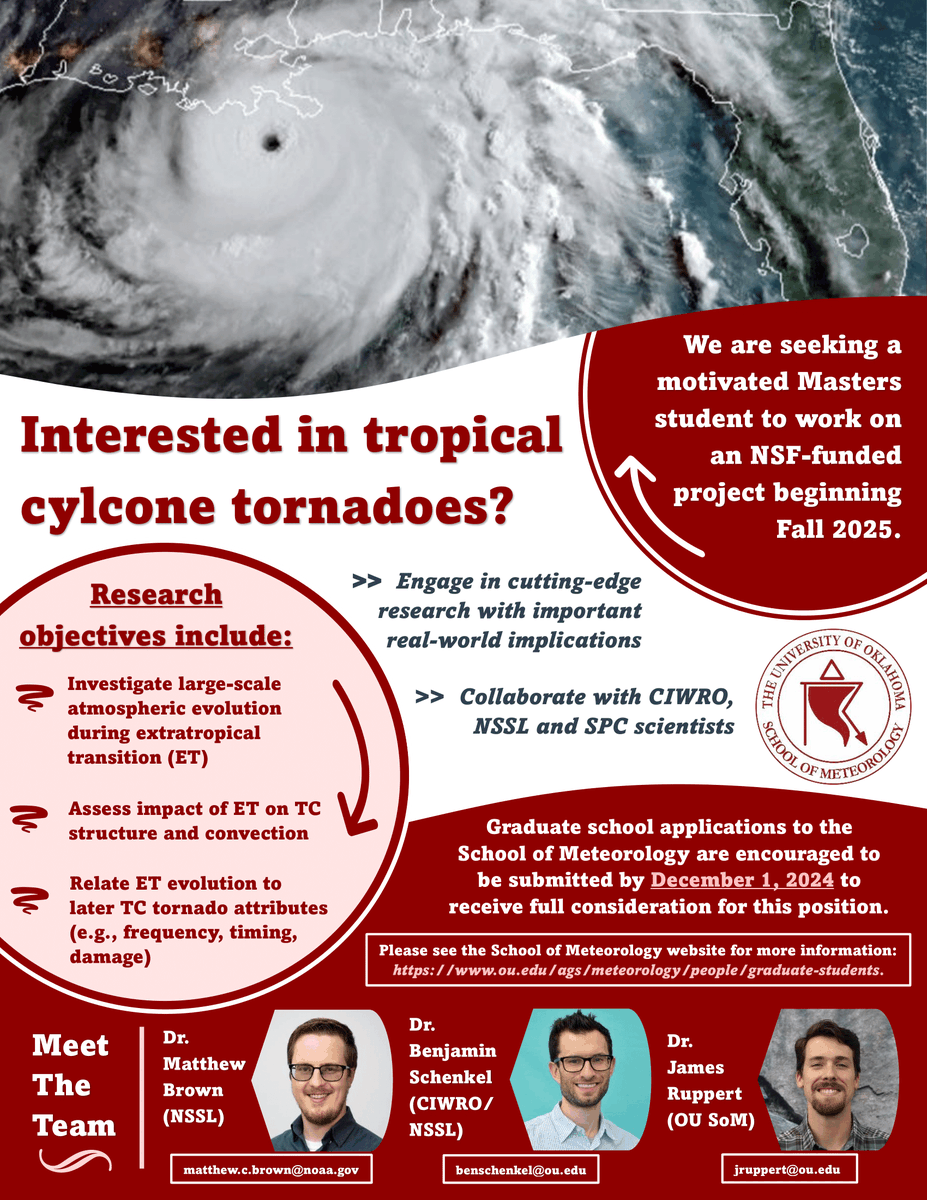
Still working on grad school applications (or know someone who should be?) Apply to OU to work w/ a supportive cohort - myself included - on an NSF-funded grant exploring connections between extratropical transition and TC tornadoes! More details below: jruppert.oucreate.com/wp-content/upl…

Still working on grad school applications (or know someone who should be?) Apply to OU to work w/ a supportive cohort - myself included - on an NSF-funded grant exploring connections between extratropical transition and TC tornadoes! More details below: jruppert.oucreate.com/wp-content/upl…
Xiaomin Chen (@xiaominchen7) 's Twitter Profile Photo

🌀Our TCBL lab🌀is admitting a M.S. (or Ph.D.) student to study boundary layer winds and tornadoes of landfalling hurricanes in Fall 2025. Students with a strong passion for hurricane science and a strong background of programming/physics are particularly encouraged to apply.

🌀Our TCBL lab🌀is admitting a M.S. (or Ph.D.) student to study boundary layer winds and tornadoes of landfalling hurricanes in Fall 2025. Students with a strong passion for hurricane science and a strong background of programming/physics are particularly encouraged to apply.
Nahel Belgherze (@wxnb_) 's Twitter Profile Photo

New drone shot from Pacific Palisades shows entire blocks of homes literally burned to the ground. The Palisades Fire alone could become the "costliest" fire in U.S. history. Courtesy of Kit Karzen

New drone shot from Pacific Palisades shows entire blocks of homes literally burned to the ground. The Palisades Fire alone could become the "costliest" fire in U.S. history. 

Courtesy of <a href="/KitKarzen/">Kit Karzen</a>
Brian Tang (@btangywx) 's Twitter Profile Photo

Dr. Justin Minder and I are seeking a postdoc to perform research on the characteristics and predictability of rainfall events over the Catskill mountains that impact the NYC water supply. See atmos.albany.edu/facstaff/tang/… for more info. Application deadline is May 9, 2025.