Chinmay Deval (@chinmay_deval) 's Twitter Profile
Chinmay Deval

@chinmay_deval

Water Security Lead @SERVIRGlobal - NASA🌏| Research Scientist @UAH_LAS💧| EO & GeoTech for environmental decision making 🛰️ | 🔄≠👍 | Views & opinions my own.

ID: 3281440274

linkhttps://chinmaydeval.com calendar_today16-07-2015 09:09:22

472 Tweet

333 Followers

1,1K Following

ESA Earth Observation (@esa_eo) 's Twitter Profile Photo

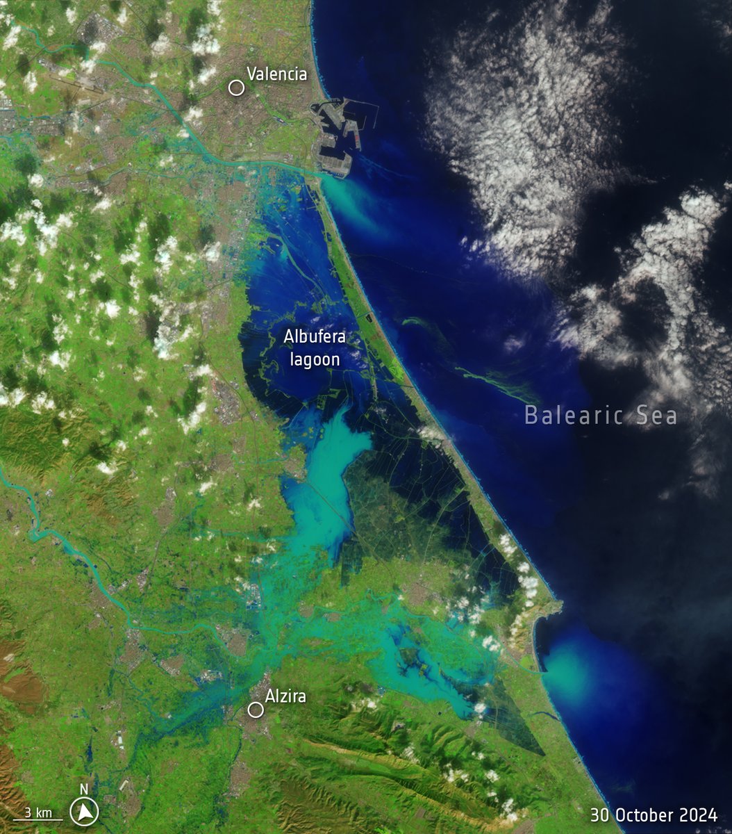
Spain is suffering its worst flood in decades after torrential rains struck the eastern province of Valencia. The death toll is climbing and people remain missing. 📸These images from Landsat-8 satellite illustrate the scale of the disaster, with images from October 8 and

Spain is suffering its worst flood in decades after torrential rains struck the eastern province of Valencia. The death toll is climbing and people remain missing.

📸These images from Landsat-8 satellite  illustrate the scale of the disaster, with images from October 8 and
AerosolWatch (@aerosolwatch) 's Twitter Profile Photo

Today 31 Oct is 1st day of #Diwali! Celebrations can exacerbate wintertime #haze in #SouthAsia. Joint Polar Satellite System (JPSS) #VIIRS aerosol optical depth shows widespread thick haze (dark red) but conditions along much of #IndoGangeticPlain clearer than recent years. Pawan Gupta Falguni Patadia
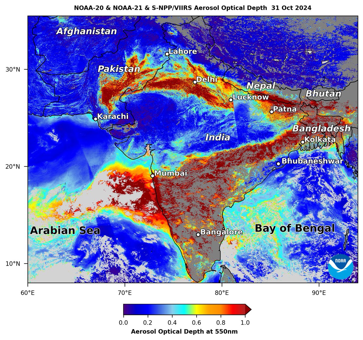
Today 31 Oct is 1st day of #Diwali! Celebrations can exacerbate wintertime #haze in #SouthAsia. <a href="/JPSSProgram/">Joint Polar Satellite System (JPSS)</a> #VIIRS aerosol optical depth shows widespread thick haze (dark red) but conditions along much of #IndoGangeticPlain clearer than recent years. <a href="/pawanpgupta/">Pawan Gupta</a> <a href="/falgunipatadia/">Falguni Patadia</a>
NASA Earth (@nasaearth) 's Twitter Profile Photo

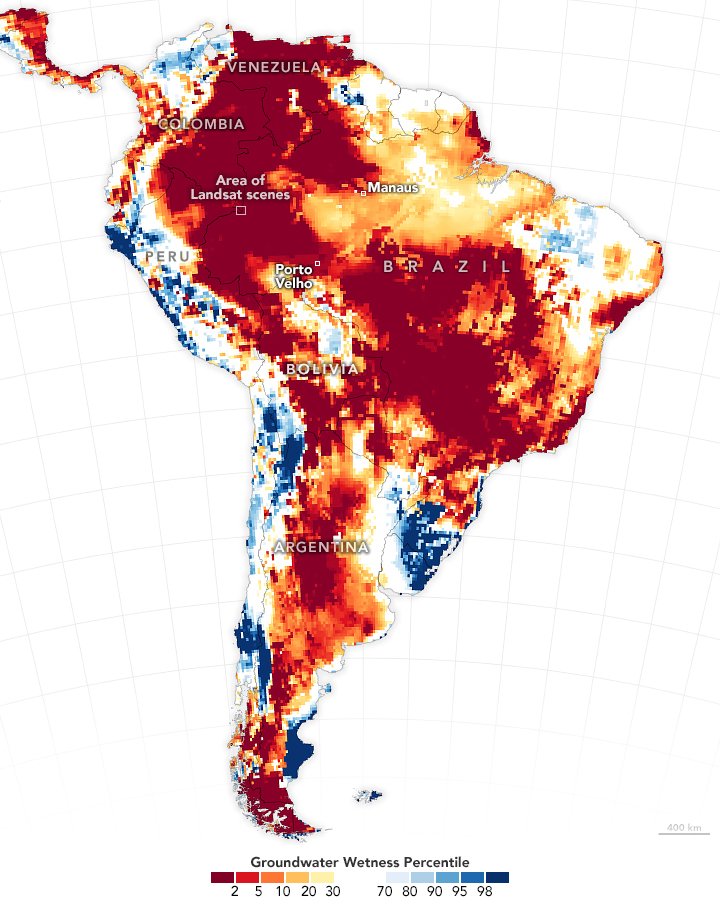
Insufficient rainfall in 2023-2024 has taken a toll on vast areas of South America. GRACE-FO data shows shallow groundwater storage for the week of Oct. 7, compared to long-term records. Blue areas have more water than usual, and orange and red areas have less.

Insufficient rainfall in 2023-2024 has taken a toll on vast areas of South America. 

GRACE-FO data shows shallow groundwater storage for the week of Oct. 7, compared to long-term records. Blue areas have more water than usual, and orange and red areas have less.
ADPC (@adpcnet) 's Twitter Profile Photo

ADPC, NASA JPL, AIT, สสน., and Kasetsart University co-organized a workshop this week on enhancing the understanding and utilization of satellite-based soil moisture data, in the context of climate, agriculture, and DRM. SERVIR Global USAID Asia NASA Marshall
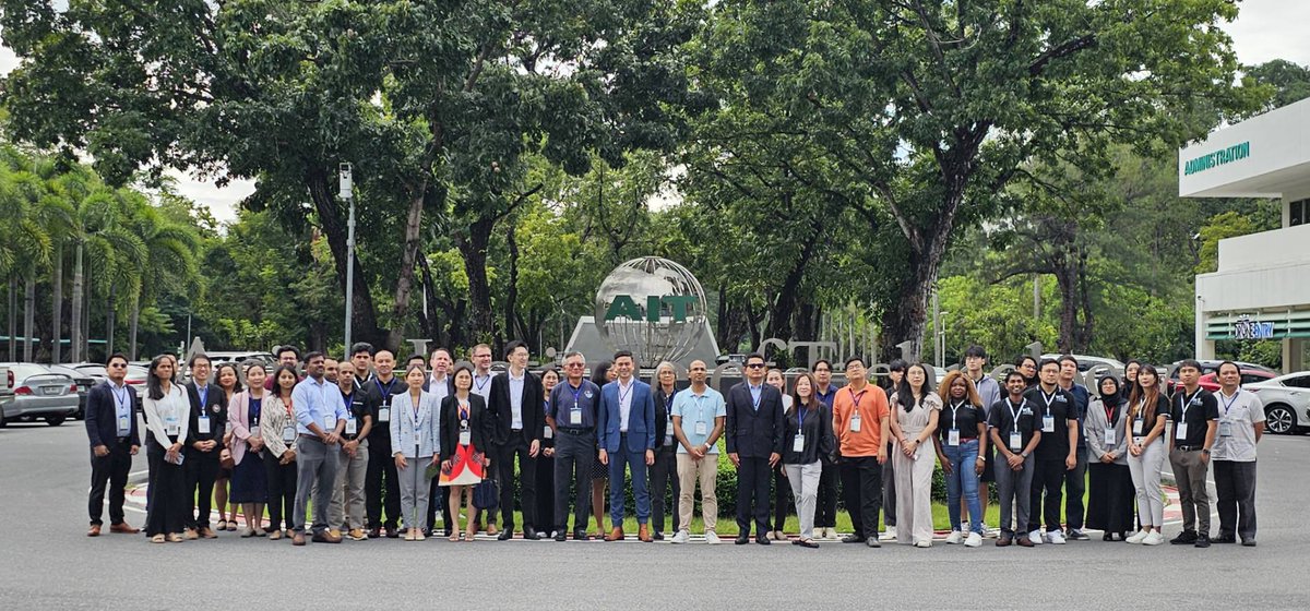
<a href="/ADPCnet/">ADPC</a>, <a href="/NASAJPL/">NASA JPL</a>, <a href="/AITAsia/">AIT</a>, <a href="/HII_ThaiWater/">สสน.</a>, and <a href="/kasetsart_ku/">Kasetsart University</a> co-organized a workshop this week on enhancing the understanding and utilization of satellite-based soil moisture data, in the context of climate, agriculture, and DRM.
<a href="/SERVIRGlobal/">SERVIR Global</a> <a href="/USAIDAsia/">USAID Asia</a> <a href="/NASA_Marshall/">NASA Marshall</a>
CATIE (@catieoficial) 's Twitter Profile Photo

🌍🚀 CATIE at the U.S. Center COP29: "SERVIR Brings Space to Village in Central America" 🌍🚀 Catch the live stream at 13:15 Azerbaijan time (04:15 Central America time)! 🎥🌐 Live-streamed on the website and at wwww.youtube.com/@US_Center.

🌍🚀 CATIE at the U.S. Center COP29: "SERVIR Brings Space to Village in Central America" 🌍🚀
Catch the live stream at 13:15 Azerbaijan time (04:15 Central America time)! 🎥🌐
Live-streamed on the website and at wwww.youtube.com/@US_Center.
NASAEarthdata (@nasaearthdata) 's Twitter Profile Photo

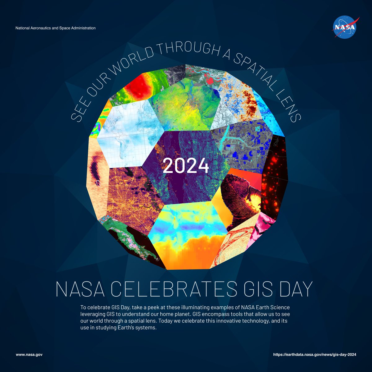
To celebrate Geographic Information Systems (GIS) Day, take a peek at these illuminating examples of NASA Earth Science data, tools, & apps leveraging #GIS to understand our home planet: go.nasa.gov/40VCtX7 #GISDay #EarthObservations #geospatial

To celebrate Geographic Information Systems (GIS) Day, take a peek at these illuminating examples of NASA Earth Science data, tools, &amp; apps leveraging #GIS to understand our home planet: go.nasa.gov/40VCtX7

#GISDay #EarthObservations #geospatial
UAH Lab for Applied Science (@uah_las) 's Twitter Profile Photo

📢LAS in the News📢 Check out this story from NASA highlighting how Aparna R. Phalke and Sarah Cox, from UAH Lab for Applied Science and SERVIR Global, are supporting improved #ag decision making in #Bhutan: go.nasa.gov/3Z1xku7 You can access the Farm Action Toolkit here: crops.servirglobal.net

📢LAS in the News📢
Check out this story from <a href="/NASA/">NASA</a> highlighting how <a href="/Aparna_RSGIS/">Aparna R. Phalke</a> and Sarah Cox, from <a href="/UAH_LAS/">UAH Lab for Applied Science</a> and <a href="/SERVIRGlobal/">SERVIR Global</a>, are supporting improved #ag decision making in #Bhutan:
go.nasa.gov/3Z1xku7 
You can access the Farm Action Toolkit here: crops.servirglobal.net
🇧🇿 Belize GEO 🛰️ (@bzgeo) 's Twitter Profile Photo

Hey #ScienceTwitter, is anyone planning on getting psyched for #AGU24 by watching the following? 😆 youtube.com/watch?v=_ZBKX-…

Dr. Daniel Swain (@weather_west) 's Twitter Profile Photo

Is there a link between #ClimateChange & increasing risk/severity of #wildfire in California--including the still-unfolding disaster? Yes. Is climate change the only factor at play? No, of course not. So what's really going on? [Thread] #CAfire #CAwx #LAfires

Zeke Hausfather (@hausfath) 's Twitter Profile Photo

Great (and scary) visualization of 2024 daily temperatures compared to prior years by the BBC today. Evocative of the iconic Joy Division album cover from 1979: bbc.com/news/articles/…

Great (and scary) visualization of 2024 daily temperatures compared to prior years by the BBC today. Evocative of the iconic Joy Division album cover from 1979: bbc.com/news/articles/…