Bill S. (@elvs71) 's Twitter Profile
Bill S.

@elvs71

#Trump Medic, Firefighter, Navy Vet, Husband. Love my country and my bourbon! #NRA #Veterans #2A Philly Sports Now in a RED State.

ID: 602920165

calendar_today08-06-2012 17:14:45

14,14K Tweet

11,11K Followers

12,12K Following

J.K. Rowling (@jk_rowling) 's Twitter Profile Photo

You appointed men to women's posts. You appointed men to women's posts. You appointed men to women's posts. You appointed men to women's posts. You appointed men to women's posts. You appointed men to women's posts. You appointed men to women's posts.

Bobby Martrich | EPAWA (@epawawx) 's Twitter Profile Photo

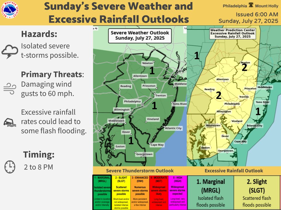
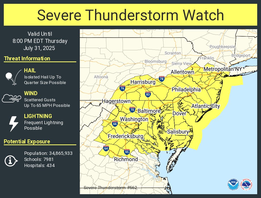
This is a little bit more expansive that I am comfortable with endorsing, but better to be safe than sorry I guess. The main threat here is straight line wind gusts and frequent lightning. Locally heavy rainfall in any storm is also possible. Not so much the hail part.

Justin Selig 🌪️⚡️ (@severeweatherpa) 's Twitter Profile Photo

A tree has fallen into the Alburtis community pool in Alburtis, Pennsylvania, Lehigh County, after severe thunderstorms passed through the area a short time ago. #pawx NWS Mount Holly Bobby Martrich | EPAWA

A tree has fallen into the Alburtis community pool in Alburtis, Pennsylvania, Lehigh County, after severe thunderstorms passed through the area a short time ago. #pawx <a href="/NWS_MountHolly/">NWS Mount Holly</a> <a href="/epawawx/">Bobby Martrich | EPAWA</a>
NWS Mount Holly (@nws_mountholly) 's Twitter Profile Photo

Saturday's Forecast: 🌡️Highs mainly in the 80s and still humid ☔Chance for showers and thunderstorms for areas mainly south and west ⛈️Isolated severe thunderstorms possible today 🌧️Heavy rain may also lead to localized flash flooding #NJwx #PAwx #MDwx #DEwx

Saturday's Forecast:

🌡️Highs mainly in the 80s and still humid
☔Chance for showers and thunderstorms for areas mainly south and west
⛈️Isolated severe thunderstorms possible today
🌧️Heavy rain may also lead to localized flash flooding

#NJwx #PAwx #MDwx #DEwx
NWS Mount Holly (@nws_mountholly) 's Twitter Profile Photo

No real changes to the severe or flash flood potential later today. Storms begin to fire in the early afternoon, capable of producing damaging wind gusts and flash flooding. Stay weather aware today and have multiple ways to receive warnings! #NJwx #PAwx #MDwx #DEwx

No real changes to the severe or flash flood potential later today. Storms begin to fire in the early afternoon, capable of producing damaging wind gusts and flash flooding. Stay weather aware today and have multiple ways to receive warnings! #NJwx #PAwx #MDwx #DEwx
NWS Mount Holly (@nws_mountholly) 's Twitter Profile Photo

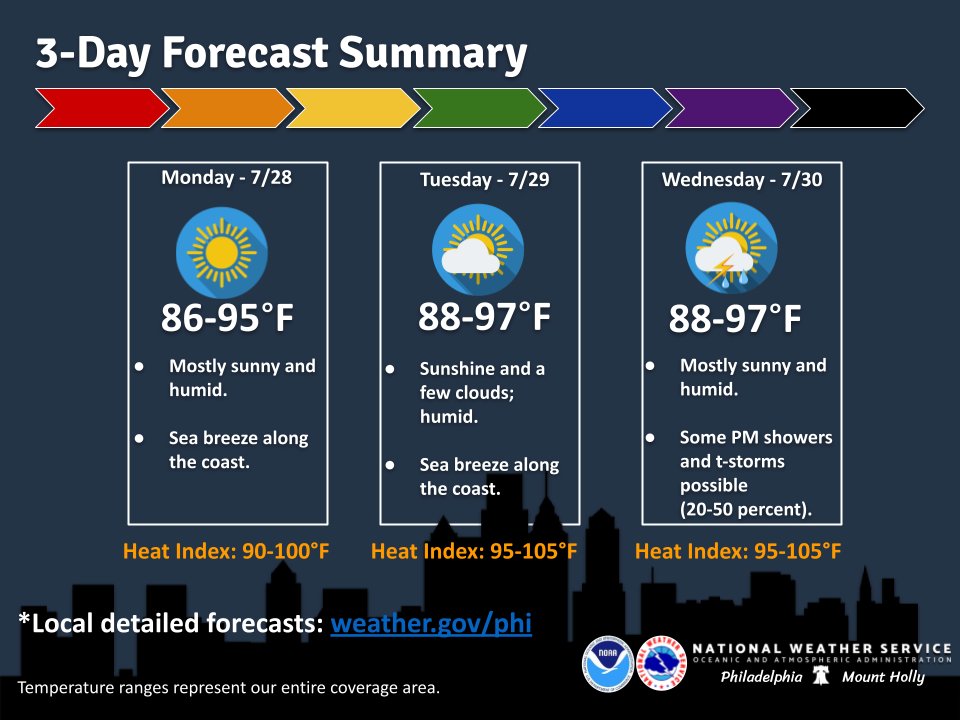
A few lingering showers/storms fade away this evening. The heat will then continue to build through midweek, although the dew points should not be as high as today. Still a hot and humid first half of the week. #pawx #njwx #dewx #mdwx

A few lingering showers/storms fade away this evening. The heat will then continue to build through midweek, although the dew points should not be as high as today. Still a hot and humid first half of the week. #pawx #njwx #dewx #mdwx
NWS Mount Holly (@nws_mountholly) 's Twitter Profile Photo

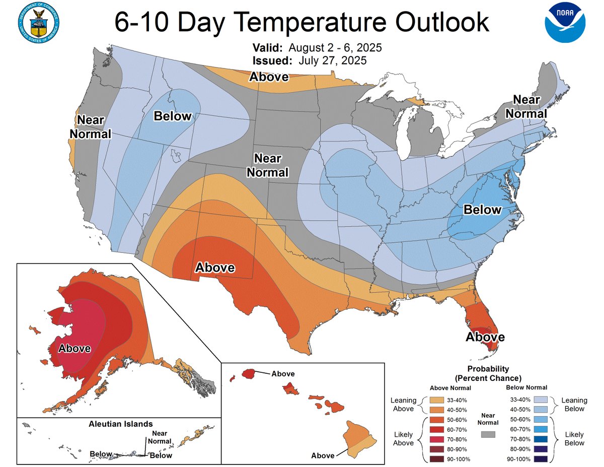
(1/2) We know. It's been a hot, humid, & miserable summer. The next several days will be no different. HOWEVER...there is a pattern change on tap, & relief is on the way for this weekend & start of next week! cpc.ncep.noaa.gov/products/predi…

(1/2) We know. It's been a hot, humid, &amp; miserable summer. The next several days will be no different. HOWEVER...there is a pattern change on tap, &amp; relief is on the way for this weekend &amp; start of next week!

cpc.ncep.noaa.gov/products/predi…
NWS Mount Holly (@nws_mountholly) 's Twitter Profile Photo

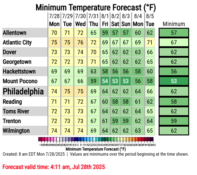
(2/2) Cold front comes through on Thurs (we'll cover potential severe weather & flash flooding later on). Then highs on the 70s/80s with lows in the 50s/60s for several days! Your latest forecast can be found at: weather.gov/phi/ #NJwx #PAwx #DEwx #MDwx

(2/2) Cold front comes through on Thurs (we'll cover potential severe weather &amp; flash flooding later on). Then highs on the 70s/80s with lows in the 50s/60s for several days!

Your latest forecast can be found at: 

weather.gov/phi/

#NJwx #PAwx #DEwx #MDwx
NWS Mount Holly (@nws_mountholly) 's Twitter Profile Photo

🔥⛈️ Similarly hot and humid conditions expected today as we experienced on Tuesday with highs in the mid to upper 90s and heat indices 100-105°. Some isolated severe thunderstorms are possible northwest of I-95 this afternoon & evening (20-30% chance). #PAwx #NJwx #DEwx #MDwx

🔥⛈️ Similarly hot and humid conditions expected today as we experienced on Tuesday with highs in the mid to upper 90s and heat indices 100-105°. Some isolated severe thunderstorms are possible northwest of I-95 this afternoon &amp; evening (20-30% chance). #PAwx #NJwx #DEwx #MDwx
NWS Mount Holly (@nws_mountholly) 's Twitter Profile Photo

⚠️⛈️ Potentially significant flash flooding is possible this afternoon into tonight. A Flood Watch is in effect for the entire area. Some isolated severe storms are possible as well. Please heed any warnings issued today. NEVER drive through flooded roads! #PAwx #NJwx #DEwx #MDwx

⚠️⛈️ Potentially significant flash flooding is possible this afternoon into tonight. A Flood Watch is in effect for the entire area. Some isolated severe storms are possible as well. Please heed any warnings issued today. NEVER drive through flooded roads! #PAwx #NJwx #DEwx #MDwx
NWS Mount Holly (@nws_mountholly) 's Twitter Profile Photo

⚠️ Numerous flash floods are forecast in our region today. Some tips to stay safe from the flooding... have a reliable source to receive any warnings that are issued, and NEVER drive through flooded roads! Most flood related fatalities occur in vehicles. #PAwx #NJwx #DEwx #MDwx

⚠️ Numerous flash floods are forecast in our region today. Some tips to stay safe from the flooding... have a reliable source to receive any warnings that are issued, and NEVER drive through flooded roads! Most flood related fatalities occur in vehicles. #PAwx #NJwx #DEwx #MDwx