Evelyn | @evelynuuemaa@fosstodon.org (@evelynuuemaa) 's Twitter Profile
Evelyn | @[email protected]

@evelynuuemaa

Geographer and Professor in Geoinformatics @unitartu, Head of the @LGeoinformatics Lab. Geospatial and open data enthusiast, foodie and coffee junkie :-)

ID: 47698876

calendar_today16-06-2009 18:22:30

1,1K Tweet

1,1K Followers

435 Following

Evelyn | @evelynuuemaa@fosstodon.org (@evelynuuemaa) 's Twitter Profile Photo

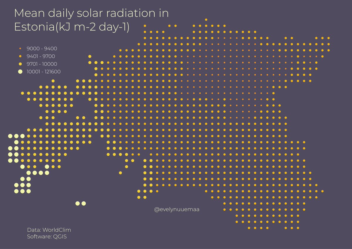
Day 1 Points: mean daily solar radiation in #Estonia. Islanders are lucky with the sun 😄🌞 Data from WorldClim - needed to prepare some data for the students in my #Spatial Data Studio course #30DayMapChallenge #QGIS

Day 1 Points: mean daily solar radiation in #Estonia. Islanders are lucky with the sun 😄🌞 Data from WorldClim - needed to prepare some data for the students in my #Spatial Data Studio course #30DayMapChallenge #QGIS
Evelyn | @evelynuuemaa@fosstodon.org (@evelynuuemaa) 's Twitter Profile Photo

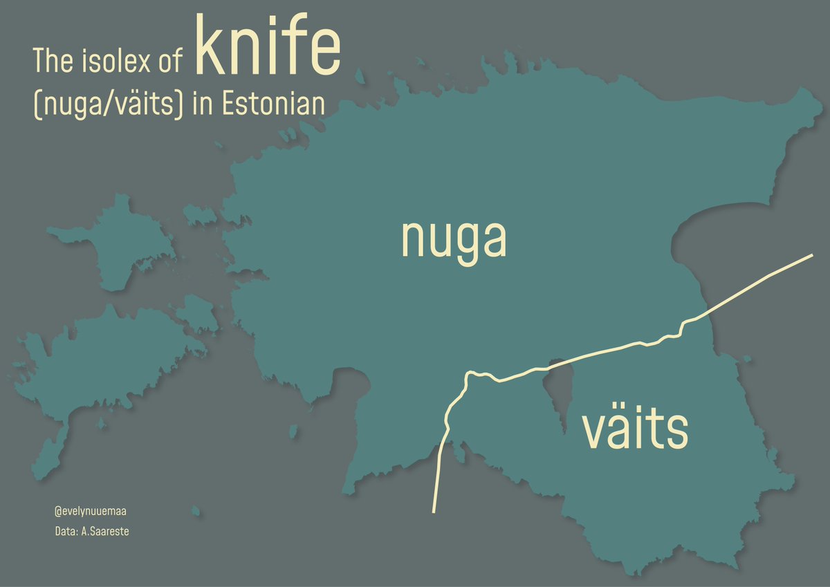
Day 2 Lines: the isolex of "knife" in Estonian language. The people from the southeastern parts use "väits" and people from northern parts use "nuga" 🔪🇪🇪#30DayMapChallenge

Day 2 Lines: the isolex of "knife" in Estonian language. The people from the southeastern parts use "väits" and people from northern parts use "nuga" 🔪🇪🇪#30DayMapChallenge
Evelyn | @evelynuuemaa@fosstodon.org (@evelynuuemaa) 's Twitter Profile Photo

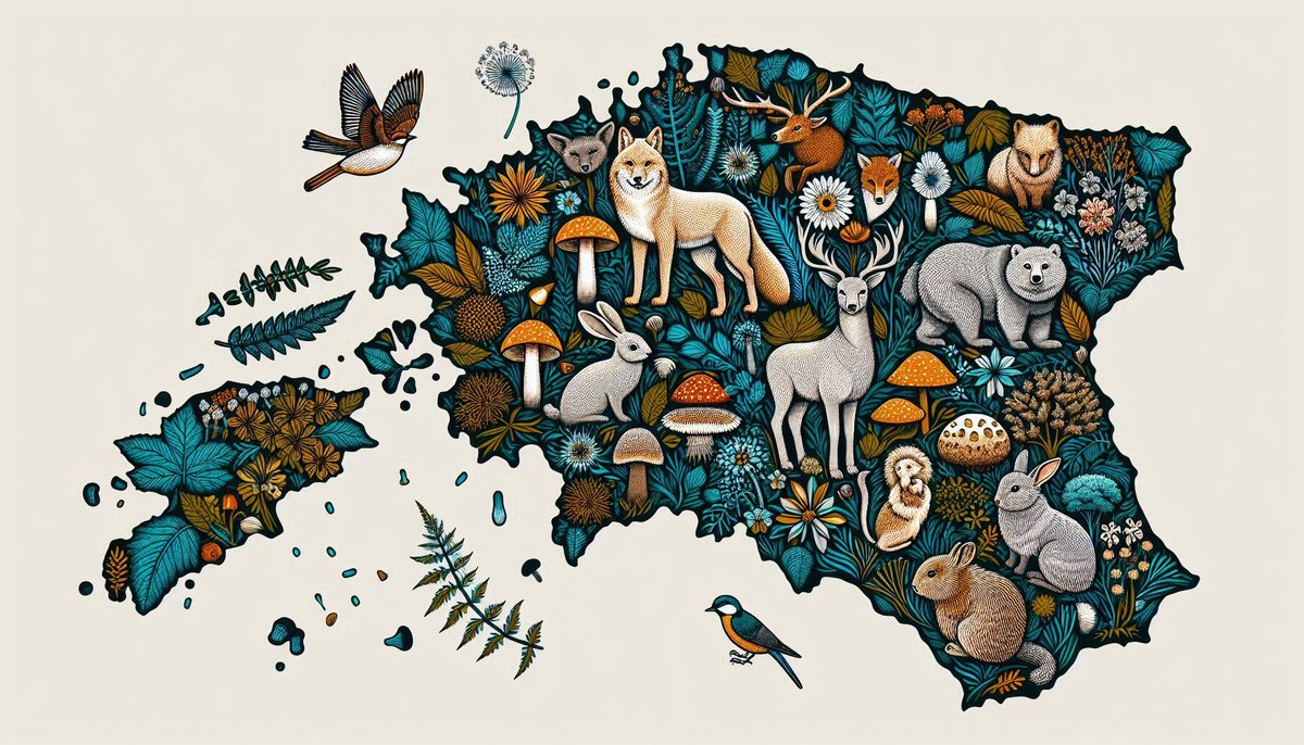
Day 3 Polygons: Islands of #Estonia 🇪🇪 There are almost 8000 islands and most of them are in the Baltic Sea but surprisingly a lot also in the rivers (more than in lakes) 🤔 #30DayMapChallenge

Day 3 Polygons: Islands of #Estonia 🇪🇪 There are almost 8000 islands and most of them are in the Baltic Sea but surprisingly a lot also in the rivers (more than in lakes) 🤔 #30DayMapChallenge
Evelyn | @evelynuuemaa@fosstodon.org (@evelynuuemaa) 's Twitter Profile Photo

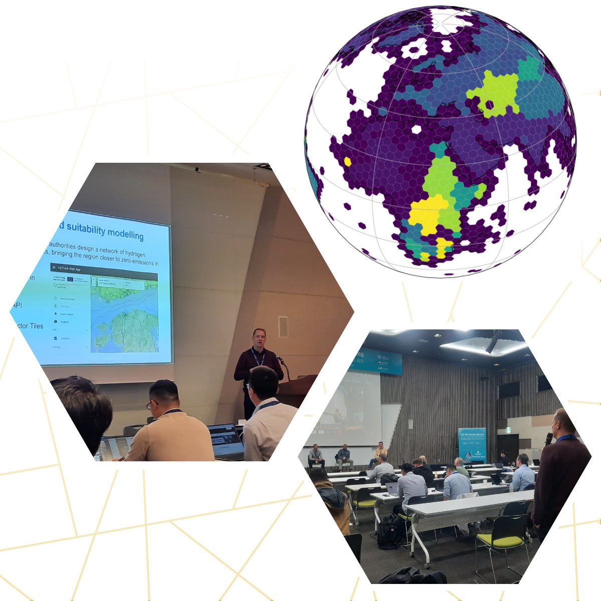
Day 4: Hexagons - sports facilities and tracks in #Estonia mapped into #DGGS 🌍🌐🏃‍♀️🤾🏊‍♀️🚴‍♀️ XDGGS ISEA7H resolution eight was used to aggregate the data. DGGS is hopefully the next revolution in #geospatial 😊🤩 #30DayMapChallenge Alexander Kmoch | @[email protected]
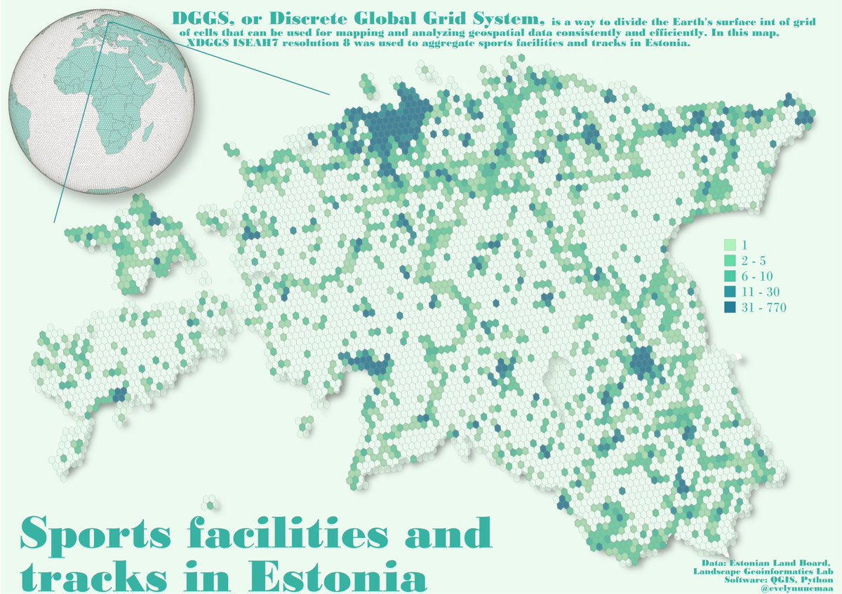
Day 4: Hexagons - sports facilities and tracks in #Estonia mapped into #DGGS 🌍🌐🏃‍♀️🤾🏊‍♀️🚴‍♀️ XDGGS ISEA7H resolution eight was used to aggregate the data. DGGS is hopefully the next revolution in #geospatial 😊🤩 #30DayMapChallenge  <a href="/allixender/">Alexander Kmoch | @allixender@fosstodon.org</a>
Evelyn | @evelynuuemaa@fosstodon.org (@evelynuuemaa) 's Twitter Profile Photo

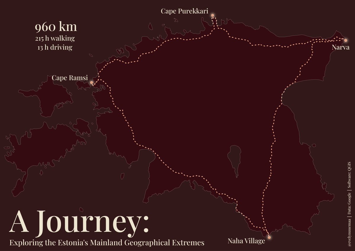
Day 5: A journey to explore #Estonia's mainland geographical extremes - north, east, south, west 🚶‍♀️🏕️🏞️🇪🇪 #30DayMapChallenge

Day 5: A journey to explore #Estonia's mainland geographical extremes - north, east, south, west 🚶‍♀️🏕️🏞️🇪🇪 #30DayMapChallenge
Evelyn | @evelynuuemaa@fosstodon.org (@evelynuuemaa) 's Twitter Profile Photo

Day 6 Raster - the seasonal dynamics of NDVI in #Estonia in 2023 based on MODIS #satellite data 🛰️🌍🌱 Big thanks to Qiusheng Wu for contributing and sharing #GEE scripts and to an excellent GEE trainer Ujaval Gandhi 🙏 #30DayMapChallenge

Evelyn | @evelynuuemaa@fosstodon.org (@evelynuuemaa) 's Twitter Profile Photo

Day 7 Vintage: Estonian national geodetic network in vintage style 📍🗺️🇪🇪 Fun Fact: Estonia started establishing geodetic points over a century ago 😏 The oldest one still in use dates back to 1891 and is located at the beautiful Kuremäe Convent #30DayMapChallenge

Day 7 Vintage: Estonian national geodetic network in vintage style 📍🗺️🇪🇪 Fun Fact: Estonia started establishing geodetic points over a century ago 😏 The oldest one still in use dates back to 1891 and is located at the beautiful Kuremäe Convent #30DayMapChallenge
Evelyn | @evelynuuemaa@fosstodon.org (@evelynuuemaa) 's Twitter Profile Photo

Day 8 HDX: population density in Estonia according to HDX data 👨‍👨‍👧‍👧The overall population spatial distribution is quite ok for a global dataset, but if I looked more in-depth into the data then some rural areas are heavily underestimated, and cities overestimated #30DayMapChallenge

Day 8 HDX: population density in Estonia according to HDX data 👨‍👨‍👧‍👧The overall population spatial distribution is quite ok for a global dataset, but if I looked more in-depth into the data then some rural areas are heavily underestimated, and cities overestimated #30DayMapChallenge
Landscape Geoinformatics (@lgeoinformatics) 's Twitter Profile Photo

We are excited to contribute to the Open Geospatial: OGC #DGGS API standard through our novel DGGS #datacube European Research Council (ERC) project #WaterSmartLand 💦🌍Interoperabitlity is crucial, and we presented our open-source DGGS server at the 130th Open Geospatial: OGC meeting in Seoul!

We are excited to contribute to the <a href="/opengeospatial/">Open Geospatial: OGC</a> #DGGS API standard through our novel DGGS #datacube <a href="/ERC_Research/">European Research Council (ERC)</a> project #WaterSmartLand 💦🌍Interoperabitlity is crucial, and  we presented  our open-source DGGS server at the 130th <a href="/opengeospatial/">Open Geospatial: OGC</a> meeting in Seoul!
Evelyn | @evelynuuemaa@fosstodon.org (@evelynuuemaa) 's Twitter Profile Photo

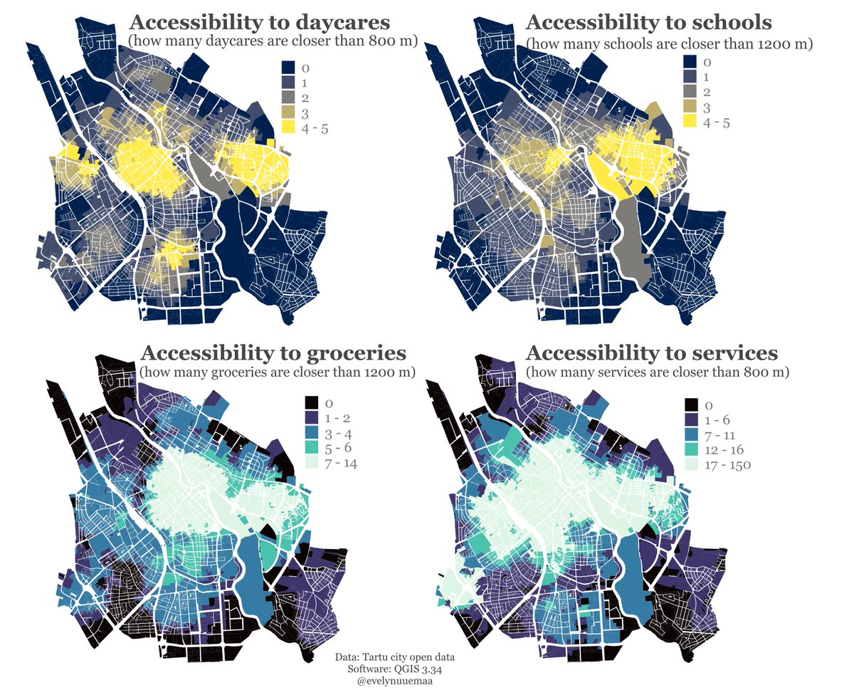
Day 16 Choroplet: accessibility to schools, daycares, groceries and services in Tartu city, #Estonia 🚶‍♀️🚶🛒🏫 #30DayMapChallenge

Day 16 Choroplet: accessibility to schools, daycares, groceries and services in Tartu city, #Estonia 🚶‍♀️🚶🛒🏫 #30DayMapChallenge
Landscape Geoinformatics (@lgeoinformatics) 's Twitter Profile Photo

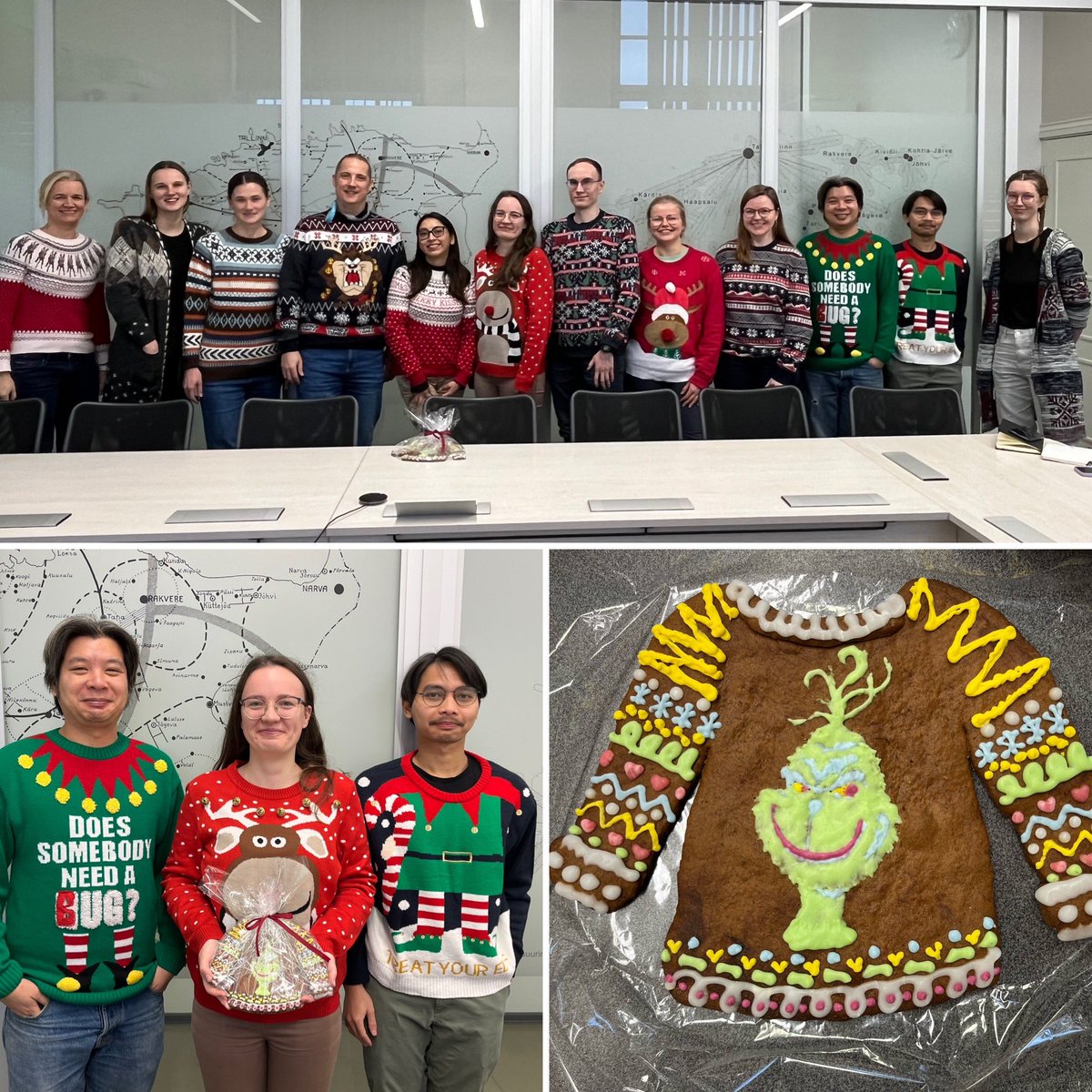
We have Christmas Sweater office day today 🤪🎄🧑‍🎄lots of cool/funny/weird sweaters and three best were awarded big Grinch Christmas sweater gingerbread 😅

We have Christmas Sweater office day today 🤪🎄🧑‍🎄lots of cool/funny/weird sweaters and three best were awarded big Grinch Christmas sweater gingerbread 😅
Landscape Geoinformatics (@lgeoinformatics) 's Twitter Profile Photo

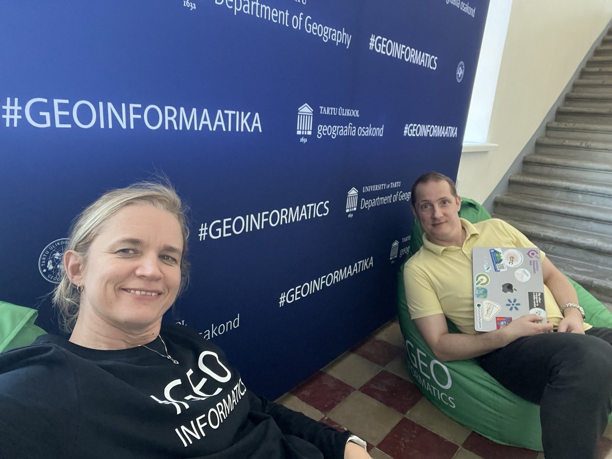
🌍 Last week, Marta Jemeljanova, Alexander Kmoch | @[email protected] & Evelyn | @[email protected] visited @AaltoGeoinfo & FGI, NLS's Geoinformatics Dept. 🤝 Excited about collaboration between Digital Waters Flagship & ERC #WaterSmartLand, and sharing insights on teaching #FOSS4G. Thanks a lot for having us! 🌊
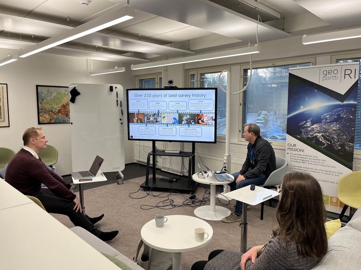
🌍 Last week, <a href="/M_Jemeljanova/">Marta Jemeljanova</a>, <a href="/allixender/">Alexander Kmoch | @allixender@fosstodon.org</a> &amp; <a href="/evelynuuemaa/">Evelyn | @evelynuuemaa@fosstodon.org</a> visited @AaltoGeoinfo &amp; <a href="/fgi_nls/">FGI, NLS</a>'s Geoinformatics Dept. 🤝

Excited about collaboration between Digital Waters Flagship &amp; ERC #WaterSmartLand, and sharing insights on teaching #FOSS4G.   

Thanks a lot for having us! 🌊
Evelyn | @evelynuuemaa@fosstodon.org (@evelynuuemaa) 's Twitter Profile Photo

🌍 We're building a #datacube Landscape Geoinformatics to integrate spatial data with varying resolutions. Resampling is key for aligning datasets with different resolutions, coordinate systems, or extents. Check out our quick cheat sheet for resampling tips! Have any suggestions?💬
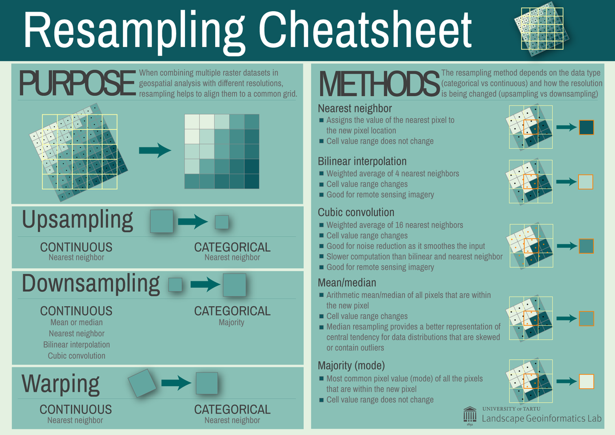
🌍 We're building a #datacube <a href="/LGeoinformatics/">Landscape Geoinformatics</a>  to integrate spatial data with varying resolutions.
Resampling is key for aligning datasets with different resolutions, coordinate systems, or extents. 
Check out our quick cheat sheet for resampling tips!
Have any suggestions?💬
Evelyn | @evelynuuemaa@fosstodon.org (@evelynuuemaa) 's Twitter Profile Photo

One of the best events of the academic year - our team’s writing retreat 🤩 spent plenty of quiet time on writing but also quality time with the team and lots of interesting discussions, good food, hiking ☺️

Evelyn | @evelynuuemaa@fosstodon.org (@evelynuuemaa) 's Twitter Profile Photo

A nee paper alert from my PhD student Pamela Guaman Pintado 🤩 a land cover and air quality relationship being analysed using #remotesensing data 🛰️ great work! 👏
Alexander Brenning (@geobrenning) 's Twitter Profile Photo

🚀Kickstart your academic career in #GIScience as a #Postdoc in my group! Looking for geospatial #machinelearning / #GeoAI for Earth surface processes & #naturalhazards. Join our team at Universität Jena & ELLIS Unit Jena. 🔍 See job ad for details: bit.ly/giscience

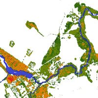
🚀Kickstart your academic career in #GIScience as a #Postdoc in my group! Looking for geospatial #machinelearning / #GeoAI for Earth surface processes &amp; #naturalhazards. Join our team  at <a href="/UniJena/">Universität Jena</a> &amp; <a href="/Ellis_Unit_Jena/">ELLIS Unit Jena</a>. 🔍 See job ad for details: bit.ly/giscience
FutureScapes (@futurescapes_ee) 's Twitter Profile Photo

Kuigi tänased õueolud on taas muutunud talviseks ❄️, õnnestus eile meie meeskonnal alustada tippkeskuse välitööde hooajaga ning seada üles esimesed püsialad uuringu läbiviimiseks!📝 Külastasime põldu, märgala ning niitu ning jätkame õige pea ka järgmiste mõõtmisaladega!

Kuigi tänased õueolud on taas muutunud talviseks ❄️, õnnestus eile meie meeskonnal alustada tippkeskuse välitööde hooajaga ning seada üles esimesed püsialad uuringu läbiviimiseks!📝

Külastasime põldu, märgala ning niitu ning jätkame õige pea ka järgmiste mõõtmisaladega!