Gary Lezak (@glezak) 's Twitter Profile
Gary Lezak

@glezak

Gary Lezak retired from a distinguished TV career to run Weather 20/20 full time! The patent-pending data is now generating millions for businesses!

ID: 176603549

linkhttp://www.weather2020.com calendar_today09-08-2010 23:50:48

19,19K Tweet

68,68K Followers

366 Following

Gary Lezak (@glezak) 's Twitter Profile Photo

The Global Predictor comes through with another accurate wedding forecast. Congratulations to Bruce & Christine on their big day on Sunday! Bruce shared with me the dry forecast 6 months ago for their wedding day in Santa Rosa Beach in the Florida Panhandle! As you can see

Gary Lezak (@glezak) 's Twitter Profile Photo

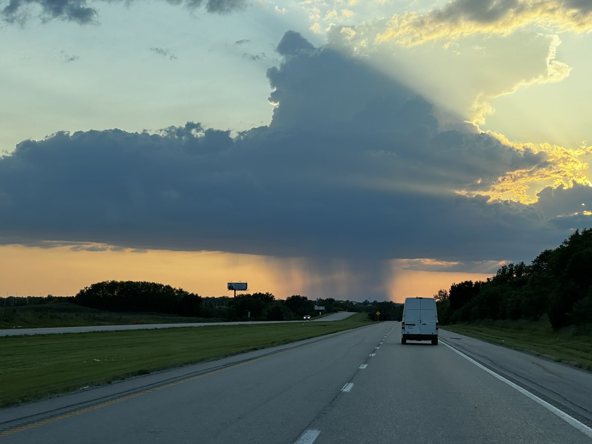
A few showers & Thunderstorms are increasing. They may hold together for a few more hours! This is a cumulonimbus cloud with a rain shaft making it to the ground as a heavy downpour!

A few showers & Thunderstorms are increasing.  They may hold together for a few more hours!  This is a cumulonimbus cloud with a rain shaft making it to the ground as a heavy downpour!
NWS Los Angeles (@nwslosangeles) 's Twitter Profile Photo

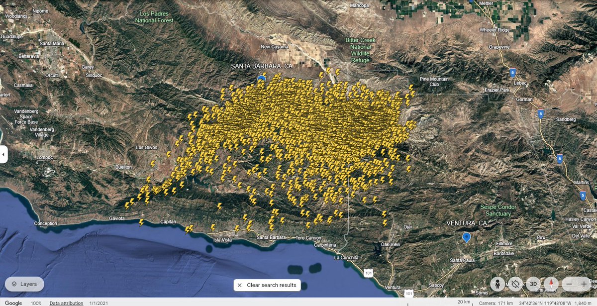
Again, it was quite the #lightning show today across Ventura and Santa Barbara counties. Here is a Google Earth image of the areal distribution of the cloud-to-ground strikes. Overall, a very impressive day. Threat of showers/thunderstorms will continue overnight. #CAwx

Again, it was quite the #lightning show today across Ventura and Santa Barbara counties. Here is a Google Earth image of the areal distribution of the cloud-to-ground strikes.

Overall, a very impressive day.

Threat of showers/thunderstorms will continue overnight. #CAwx
Gary Lezak (@glezak) 's Twitter Profile Photo

Not to put a lot of pressure on him, but if the Royals can score more than 1 run per game, this is going to be a great move. Good luck to our rookie rising!

Gary Lezak (@glezak) 's Twitter Profile Photo

Flood Watch for Kansas City Tuesday & Tuesday night. Here is the link to the Weather 2020 Youtube Channel: youtu.be/QkcTVm4eXZ0 We have 178,000 subscribers now, so subscribe today. In this video I show the set up for Tuesday, and the rainfall forecast from the European and

Gary Lezak (@glezak) 's Twitter Profile Photo

A band of thunderstorms has developed and it is heading towards KC. We are tracking this heavy thunderstorm activity on KSHB 41 News right now and through the Today Show. These have been below severe levels. A Flood Watch is in effect.

A band of thunderstorms has developed and it is heading towards KC. We are tracking this heavy thunderstorm activity on <a href="/KSHB41/">KSHB 41 News</a> right now and through the Today Show.  These have been below severe levels.  A Flood Watch is in effect.
Gary Lezak (@glezak) 's Twitter Profile Photo

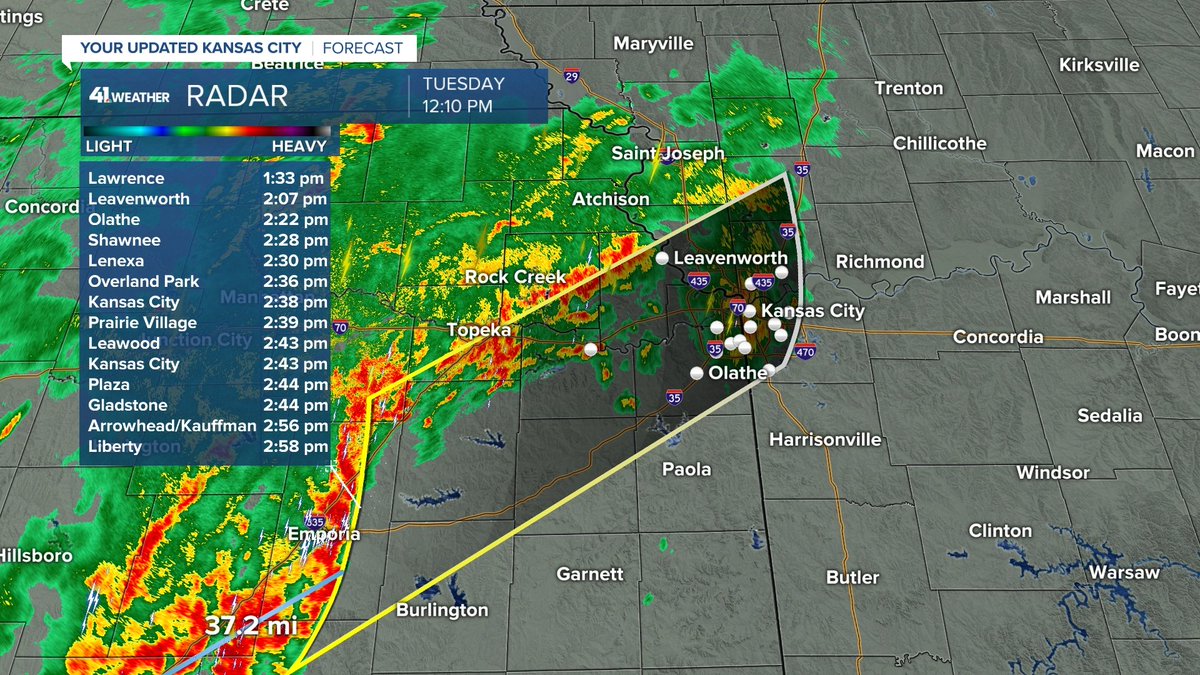
Thunderstorms are less than one hour from Kansas City. These have been below severe levels. They are producing frequent lightning, booming thunder, and very heavy rain. A Flood Watch is in effect. A second round of heavier and stronger thunderstorms is likely after 2 PM today.

Thunderstorms are less than one hour from Kansas City.  These have been below severe levels. They are producing frequent lightning, booming thunder, and very heavy rain. A Flood Watch is in effect. A second round of heavier and stronger thunderstorms is likely after 2 PM today.
Tod Palmer (@todpalmer) 's Twitter Profile Photo

According to my man, Gary Lezak, rain won’t impact St. Louis until after midnight, so Kansas City Royals slugger Jac Caglianone’s expected ML debut shouldn’t be impacted. He’ll get a chance to hit a ball over the Gateway Arch and into the Missouri River less than a year after being drafted

Gary Lezak (@glezak) 's Twitter Profile Photo

Thunderstorms are organizing southwest of Kansas City. There is a cold front slowing approaching with an upper level storm that will combine to enhance thunderstorms. Some severe weather is possible with damaging winds the main threat, and flooding is likely in a few spots as 3"

Thunderstorms are organizing southwest of Kansas City. There is a cold front slowing approaching with an upper level storm that will combine to enhance thunderstorms. Some severe weather is possible with damaging winds the main threat, and flooding is likely in a few spots as 3"