Nathan Jacobs (@jacobsn) 's Twitter Profile
Nathan Jacobs

@jacobsn

computer vision + geospatial | director of @multimodal_lab | professor @WashUengineers

ID: 14445370

linkhttp://jacobsn.github.io calendar_today19-04-2008 18:18:22

392 Tweet

912 Followers

510 Following

Nathan Jacobs (@jacobsn) 's Twitter Profile Photo

We are making another attempt to find the right postdoc for this position. Please consider applying here: apply.interfolio.com/131405.

WashU McKelvey Engineering (@washuengineers) 's Twitter Profile Photo

A team of #WashUEngineers researchers developed a visual active search framework for geospatial exploration that may combat complex problems like human trafficking and illegal poaching. Read more ⤵️ ow.ly/llz050QoRa6

Sylvain Lobry (@sylvainlobry) 's Twitter Profile Photo

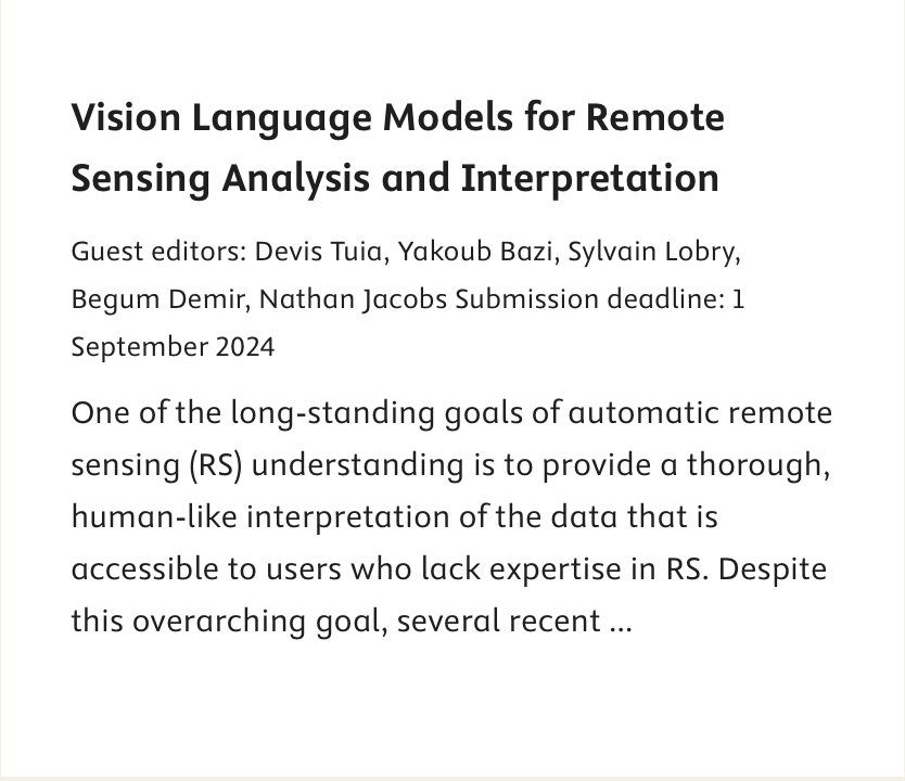
📢 #CallforPapers 📰New special issue in the ISPRS Journal of Photogrammetry and Remote Sensing on **Vision Language Models for Remote Sensing Analysis and Interpretation** 🗓️Deadline: 01/09/2024 🔗Find the call: sciencedirect.com/journal/isprs-…

📢 #CallforPapers
📰New special issue in the ISPRS Journal of Photogrammetry and Remote Sensing on
**Vision Language Models for Remote Sensing Analysis and Interpretation**
🗓️Deadline: 01/09/2024 
🔗Find the call: sciencedirect.com/journal/isprs-…
devistuia (@devistuia) 's Twitter Profile Photo

We are waiting for your papers at the interface of vision 👁 and language 👄 for satellite 🛰 image analysis! Deadline in September! With Sylvain Lobry Nathan Jacobs BigEarth and J. Bazi!


EarthVision (@earthvisionws) 's Twitter Profile Photo

The best paper award goes to Dhakal et al. for the paper "Sat2Cap: Mapping Fine-Grained Textual Descriptions from Satellite Images". Congratulations!

The best paper award goes to Dhakal et al. for the paper "Sat2Cap: Mapping Fine-Grained Textual Descriptions from Satellite Images". Congratulations!
Hannah Kerner (@hannah_kerner) 's Twitter Profile Photo

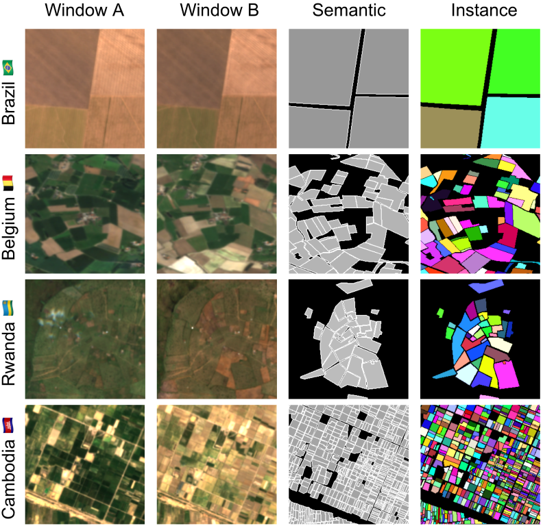
I'm so excited to finally introduce Fields of The World (FTW!) - the largest & most diverse ML dataset for field instance segmentation in satellite images. FTW has >70k samples from 24 countries (4 continents), with semantic & instance labels + Sentinel-2 RGB-NIR from 2 dates. 🧵

I'm so excited to finally introduce Fields of The World (FTW!) - the largest & most diverse ML dataset for field instance segmentation in satellite images. FTW has >70k samples from 24 countries (4 continents), with semantic & instance labels + Sentinel-2 RGB-NIR from 2 dates. 🧵
GRSS IADF (@grssiadf) 's Twitter Profile Photo

Excited to announce the continuation of the Computer Vision for Hashtag #EarthObservation (CV4EO) Workshop at WACV ! In this 2nd in a series of IEEE Geoscience and Remote Sensing Society workshops we are inviting full research and short/vision papers. geoai.ornl.gov/cv4eo-wacv/

Excited to announce the continuation of the Computer Vision for Hashtag #EarthObservation (CV4EO) Workshop at WACV ! In this 2nd in a series of <a href="/IEEE_GRSS/">IEEE Geoscience and Remote Sensing Society</a> workshops we are inviting full research and short/vision papers. geoai.ornl.gov/cv4eo-wacv/
EarthVision (@earthvisionws) 's Twitter Profile Photo

We will be at #CVPR 2025! Get ready to submit your papers by March 3! Stay tuned for more info which you can find at grss-ieee.org/events/earthvi…

We will be at #CVPR 2025! Get ready to submit your papers by March 3! Stay tuned for more info which you can find at grss-ieee.org/events/earthvi…
Nathan Jacobs (@jacobsn) 's Twitter Profile Photo

I'm excited to see these results! Very cool. Thanks for sharing! Congrats to feng qiao for the cool method and demo! See qjizhi.github.io/genstereo/ for details!

Abby Stylianou (@abby621) 's Twitter Profile Photo

I was lucky to organize this alongside my good friend and collaborator Nathan Jacobs (whose handle I failed to track down earlier 😭). Nathan has been organizing these events at different vision conferences for a while now and has the whole enterprise down to a work of art.