Jason McClellan (@jk_mcclellan) 's Twitter Profile
Jason McClellan

@jk_mcclellan

Member of the Web and Comms team at @NASAEarthData
My strange alter ego is at @acecentric

ID: 1155904965740642304

linkhttps://www.earthdata.nasa.gov/ calendar_today29-07-2019 18:16:34

566 Tweet

102 Followers

166 Following

Xebia (@xebia_global) 's Twitter Profile Photo

We're excited to announce a new partnership with Hygraph. We'll be integrating advanced #AI capabilities into the platform, helping content personalization, predictive analytics, and #automatedworkflows become the norm. news.xebia.com/xebia-hygraph-… via Xebia

We're excited to announce a new partnership with
<a href="/hygraph/">Hygraph</a>.

We'll be integrating advanced #AI capabilities into the platform, helping content personalization, predictive analytics, and #automatedworkflows become the norm.

news.xebia.com/xebia-hygraph-… via <a href="/Xebia/">Xebia</a>
Xebia (@xebia_global) 's Twitter Profile Photo

Check out the latest release of xef_ai! Version 0.0.4 adds MLFlow gateway models and more to simplify adding AI to your projects. xebia.com/blog/mlflow-ga… #AI #GenAI #LLMs

NASAEarthdata (@nasaearthdata) 's Twitter Profile Photo

New to remote sensing? 🛰️ NASA's Applied Remote Sensing Training Program (ARSET) offers a free online training course titled "Fundamentals of Remote Sensing." Learn more at earthdata.nasa.gov/news/learn-fun… NASAARSET 🛰🌎 #RemoteSensing #EarthData

New to remote sensing? 🛰️

NASA's Applied Remote Sensing Training Program (ARSET) offers a free online training course titled "Fundamentals of Remote Sensing."

Learn more at earthdata.nasa.gov/news/learn-fun…

<a href="/NASAARSET/">NASAARSET 🛰🌎</a> #RemoteSensing #EarthData
NASAEarthdata (@nasaearthdata) 's Twitter Profile Photo

A new version of NASA's Making Earth System Data Records for Use in Research Environments (MEaSUREs) Global Precipitation Climatology Project (GPCP) daily and monthly precipitation products is available at NASA's #GESDISC. Learn more at go.nasa.gov/4c0JfhU #Precipitation

A new version of NASA's Making Earth System Data Records for Use in Research Environments (MEaSUREs) Global Precipitation Climatology Project (GPCP) daily and monthly precipitation products is available at NASA's #GESDISC.   Learn more at go.nasa.gov/4c0JfhU

#Precipitation
Jason McClellan (@jk_mcclellan) 's Twitter Profile Photo

If you're not familiar with NASA Worldview, it's an incredibly powerful (and free) tool that puts a massive amount of Earth data at your fingertips. Check out this free webinar to learn how to harness its power. 🛰️

NASAEarthdata (@nasaearthdata) 's Twitter Profile Photo

New Data Alert! 🛰️ VIIRS BRDF/Albedo Version 2 Products are now available in the Application for Extracting and Exploring Analysis Ready Samples #AppEEARS. Visit the Data Alert released by NASA’s #LPDAAC to learn more: earthdata.nasa.gov/data/alerts-ou…

New Data Alert! 🛰️
VIIRS BRDF/Albedo Version 2 Products are now available in the Application for Extracting and Exploring Analysis Ready Samples #AppEEARS. 

Visit the Data Alert released by NASA’s #LPDAAC to learn more: earthdata.nasa.gov/data/alerts-ou…
NASAEarthdata (@nasaearthdata) 's Twitter Profile Photo

Would you like to learn how to use NASA’s Worldview satellite imagery mapping tool to support your scientific work through an easy-to-access satellite imagery archive? Join us Wed., April 16, at 2 p.m. EDT (-04:00 UTC) to learn how. Get more info and register at

Would you like to learn how to use NASA’s Worldview satellite imagery mapping tool to support your scientific work through an easy-to-access satellite imagery archive? Join us Wed., April 16, at 2 p.m. EDT (-04:00 UTC) to learn how.   

Get more info and register at
NASAEarthdata (@nasaearthdata) 's Twitter Profile Photo

NASA's #LAADSDAAC continues to provide critical Level-1 data from NOAA-21 VIIRS. Check out the latest updates to NOAA-21 VIIRS Level-1 geolocation and calibrated radiance data products. go.nasa.gov/4ieS0Gu

NASA's #LAADSDAAC continues to provide critical Level-1 data from NOAA-21 VIIRS. Check out the latest updates to NOAA-21 VIIRS Level-1 geolocation and calibrated radiance data products. go.nasa.gov/4ieS0Gu
NASAEarthdata (@nasaearthdata) 's Twitter Profile Photo

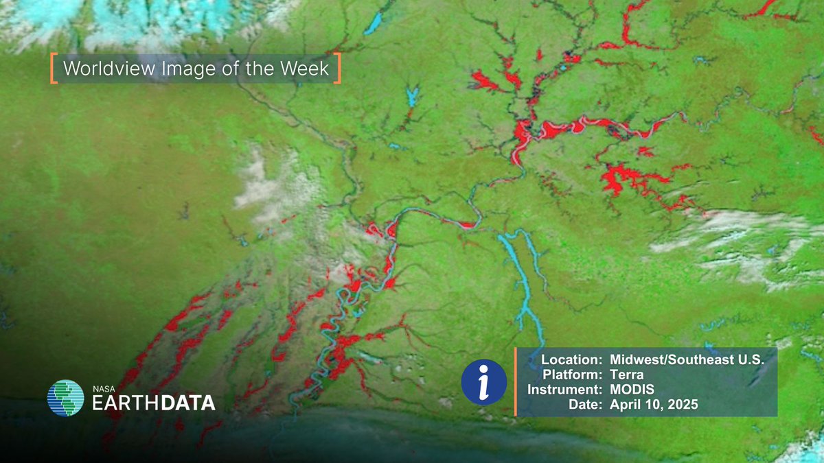
🌎 Worldview Image of the Week 🌎 Flooded rivers and landscapes across the Midwest and Southeastern U.S. captured by the MODIS instrument aboard the Terra platform. Get more details and interact with this week's image at earthdata.nasa.gov/news/worldview… #flooding #EarthScience

🌎 Worldview Image of the Week 🌎
Flooded rivers and landscapes across the Midwest and Southeastern U.S. captured by the MODIS instrument aboard the Terra platform.

Get more details and interact with this week's image at earthdata.nasa.gov/news/worldview…
#flooding #EarthScience
NASAEarthdata (@nasaearthdata) 's Twitter Profile Photo

The GLIMS Glacier Database offers detailed satellite data on 200,000+ glaciers, providing key insights into global and regional climate trends, hazard risk detection, sea level rise, freshwater resources, and ecosystem health and stability. Learn more at earthdata.nasa.gov/news/feature-a…

The GLIMS Glacier Database offers detailed satellite data on 200,000+ glaciers, providing key insights into global and regional climate trends, hazard risk detection, sea level rise, freshwater resources, and ecosystem health and stability.

Learn more at earthdata.nasa.gov/news/feature-a…
NASAEarthdata (@nasaearthdata) 's Twitter Profile Photo

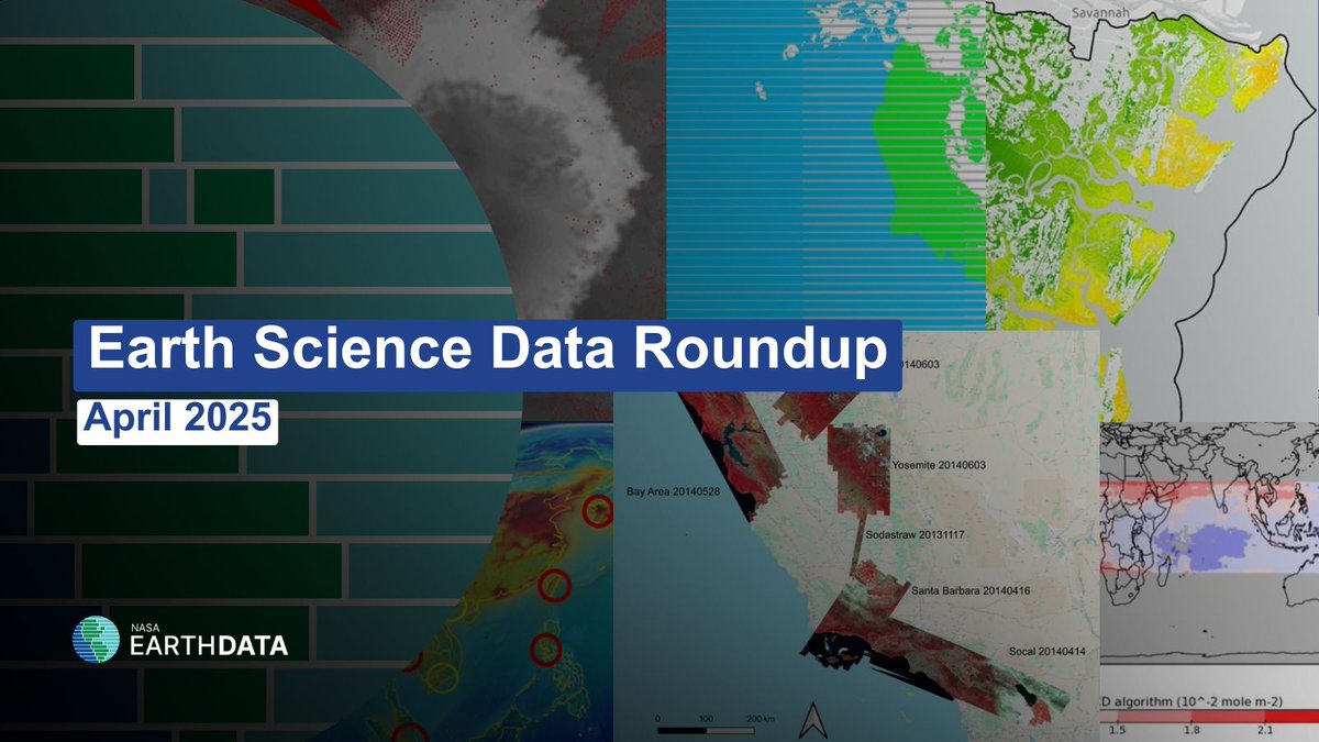
🌎Earth Science Data Roundup🌎 Catch up on the datasets, products, and resources released by NASA’s Distributed Active Archive Centers last month. earthdata.nasa.gov/news/earth-sci… #EarthScience #NASA #Data

🌎Earth Science Data Roundup🌎
Catch up on the datasets, products, and resources released by NASA’s Distributed Active Archive Centers last month.
earthdata.nasa.gov/news/earth-sci…
#EarthScience #NASA #Data
NASAEarthdata (@nasaearthdata) 's Twitter Profile Photo

🌎 Worldview Image of the Week 📸 The VIIRS instrument aboard the Suomi NPP platform captured this image, which shows heavy rains and snow over Central Europe. See more and interact with the image at earthdata.nasa.gov/news/worldview…

🌎 Worldview Image of the Week 📸

The VIIRS instrument aboard the Suomi NPP platform captured this image, which shows heavy rains and snow over Central Europe. See more and interact with the image at earthdata.nasa.gov/news/worldview…
NASAEarthdata (@nasaearthdata) 's Twitter Profile Photo

Looking to stay up to date with the latest NASA Earth science data news, products, webinars, and more? If you're not already, consider subscribing to our free monthly newsletter - earthdata.nasa.gov/subscribe

Looking to stay up to date with the latest NASA Earth science data news, products, webinars, and more? If you're not already, consider subscribing to our free monthly newsletter - earthdata.nasa.gov/subscribe
NASAEarthdata (@nasaearthdata) 's Twitter Profile Photo

If you want to access all of NASA's Earth science data, your first step is to obtain an Earthdata login. Watch this video to learn how easy it is to get started. youtu.be/8Ji1XfKZ78c?si…

NASAEarthdata (@nasaearthdata) 's Twitter Profile Photo

NASA’s new ICESat-2 bathymetric dataset uses laser altimetry to map shallow coastal zones—previously data-sparse regions. Learn more at earthdata.nasa.gov/news/new-globa…

NASA’s new ICESat-2 bathymetric dataset uses laser altimetry to map shallow coastal zones—previously data-sparse regions.

Learn more at earthdata.nasa.gov/news/new-globa…
NASAEarthdata (@nasaearthdata) 's Twitter Profile Photo

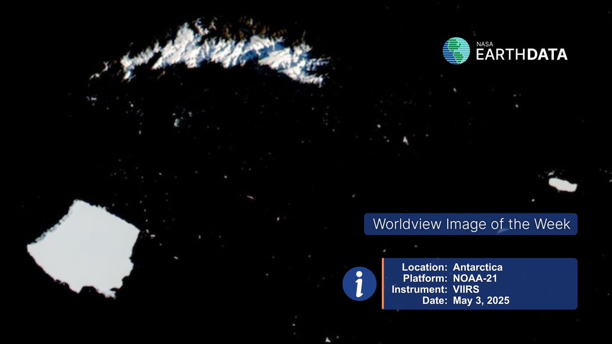
🌏 Worldview Image of the Week 🌍 The VIIRS instrument captured Icebergs A23A and A23C below South Georgia Island, Antarctica, on May 3. View before-and-after imagery to see A23C break from A23A at earthdata.nasa.gov/news/worldview…

🌏 Worldview Image of the Week 🌍
The VIIRS instrument captured Icebergs A23A and A23C below South Georgia Island, Antarctica, on May 3. View before-and-after imagery to see A23C break from A23A at earthdata.nasa.gov/news/worldview…
NASAEarthdata (@nasaearthdata) 's Twitter Profile Photo

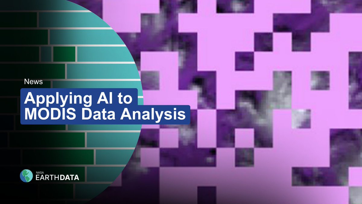
🛰️ MODIS has collected decades of data. 🤖 AI is enabling smarter, faster analysis of this Earth observation data. Learn how: earthdata.nasa.gov/news/feature-a… #AI #NASA #RemoteSensing

🛰️ MODIS has collected decades of data.
🤖 AI is enabling smarter, faster analysis of this Earth observation data.
Learn how: earthdata.nasa.gov/news/feature-a…
#AI #NASA #RemoteSensing
NASAEarthdata (@nasaearthdata) 's Twitter Profile Photo

New data release! 🛰️ April 2025 global surface air temp & precipitation data is available. Learn more about this monthly assessment of anomalies and extremes: earthdata.nasa.gov/data/alerts-ou… #EarthData #precipitation #NASA
New data release!
🛰️ April 2025 global surface air temp &amp; precipitation data is available.
Learn more about this monthly assessment of anomalies and extremes: earthdata.nasa.gov/data/alerts-ou…
#EarthData #precipitation #NASA
NASAEarthdata (@nasaearthdata) 's Twitter Profile Photo

On Rachel Carson Day, we honor a legacy of environmental awareness and science-driven action. Dive into how NASA continues that work by tracking the health of rivers and streams from space. earthdata.nasa.gov/topics/terrest… #RachelCarsonDay #EarthScience #Environment

ISS Research (@iss_research) 's Twitter Profile Photo

Working with Level-1 and atmospheric datasets? Join our webinar on Thursday, Jul. 31, and learn how to subset and create analysis-ready data faster using Harmony services in NASA's Earthdata Search: go.nasa.gov/4m2Ke4X #EarthData #RemoteSensing #OpenData